Aunt Betty has asked me for a family portrait. We don’t have anything current, so Marie and I scouted a location for making one. This is one possibility.

Aunt Betty has asked me for a family portrait. We don’t have anything current, so Marie and I scouted a location for making one. This is one possibility.
Four of us, Marilyn, Linda, Bob, and I skipped the scheduled Fitness Hike at McDowell Mountain Park this week. Instead, we met at Linda’s house and hiked up to the top of Little Granite Mountain!
The goal was get to the peak of this mountain:

A view from early in the hike when we were on good trails:

There are a lot of trails in this area, nearly all of which were made by motorcycles and quads. This area is now part of the Preserve; Linda tells me that there is almost no motorcycle traffic there now. We did, however, see some recent tracks on one of the trails that we hiked.
It’s difficult to know which trails to hike; we basically just guessed until we got to a point where I thought we might be able to begin our ascent. We bushwhacked for only a short ways before finding an established trail. We found numerous trails on our way up. Unfortunately, there’s a lot of growth and rocks. We’d often lose the trail for a time only to find it, or some other trail, again later on.
Here is a photo Linda making her way up one of these marginal trails:

The route we ascended was in the shade and was quite cold even though we were expending a lot of energy. Bob forged ahead and waited for the rest of us in the sun. That’s still not the top though, just one of the lower peaks.

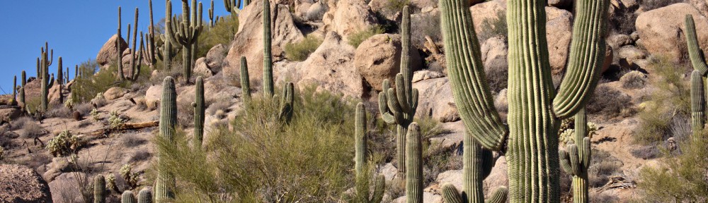
A view of Troon to the left and Pinnacle Peak to the right. We were surprised at the high density of saguaros in the area.
More saguaros!

Another view of Pinnacle Peak from even higher up. This photo helps to convey just how steep this area is.

Linda took this photo of me on top of the peak:

Linda also took these photos of me and Marilyn:


We were definitely not the first ones up there. The US Coast and Geodetic Survey placed this marker on the top in 1946.

A view from the top. Bartlett Dam is just visible at the far right of the photo.

Four Peaks with a small bank of clouds for a cap:

Another view from somewhere near the top. We wandered around for a long while trying to decide on the best way down. I had seen some cairns that looked promising, but somehow we missed them during the initial part of our descent. I backtracked and found them only to find that they lead back to where the rest of the group was patiently waiting.

We ended up taking a different route on our descent. We somehow made our way down through that mass of rock and vegetation in the photo below.

Linda, Bob, and Marilyn hiking back on easier trails:

Looking up at a large saguaro. I thought about editing the airplane out of the picture, but decided to leave it in.

Linda took this photograph of the same saguaro. I’m in the process of framing the shot above. The NEX-7’s viewscreen does tilt, but not quite enough for me to see what’s at the top of the frame. It took several tries before I was satisfied with the composition.

We ended up hiking 6.2 miles with over 1500 feet of total ascent.
Hi Kevin:
Just wanted to say hi.
Darrick
I hiked up to Tom’s Thumb on Wednesday. I started at the Tom’s Thumb Trailhead and hiked a short ways on the Tom’s Thumb Trail until I reached the climber’s access trail to Fort McDowell, Lost Wall, and Half-and-Half Wall. This trail starts out fairly flat; the first part is pretty easy. But then it gets steeper and steeper still as you go up. After passing Fort McDowell, the trail is loose and crumbly with unsure footing. I would have had difficulty making it to the top without my hiking stick. But I enjoy this kind of thing and found it fun.
When I got to the ridge line, the hiking became easier again and I set up my tripod to take a few pictures – they were all hand-held shots up to that point. At this point I was to the Northwest of Tom’s Thumb and I was able to get some rarely seen shots of this rock formation. The trail got more difficult as I got nearer to Tom’s Thumb. I had to do a lot of scrambling to get to the other side so that I could rejoin the other (shorter and easier) access trail to Tom’s Thumb. Even non-climbers take this (shorter and easier) trail to see Tom’s Thumb.
This is a view of Tom’s Thumb, Gardener’s Wall, and Glass Dome from the climber’s access trail. I think the other prominent rock formation in the immediate foreground is the Half-and-Half Wall.

I think this is the East End. A small portion of Morrell’s Wall is visible at the far left. Four Peaks is on the horizon off to the left too.

A view of Troon Mountain and Pinnacle Peak (and lots of houses).

Another view of Tom’s Thumb from the northwest. The rock formation in front of and to the right of Tom’s Thumb is called The Rist. The top of Gardener’s Wall is visible at the far left. Glass Dome is the smaller rock formation about a third of the way over from the left edge of the picture. Weaver’s Needle in the Superstition Mountains is barely visible in the distance.

Looking to the southwest into Scottsdale:

Another view of Tom’s Thumb from a spot near the top of Gardener’s Wall. (Another climber’s access trail leads from the Tom’s Thumb Access Trail over to the top of Gardener’s Wall.)

Another view of Glass Dome. Weaver’s Needle is still barely visible in the distance.

Looking back towards Troon:

I saw this rock while descending the Tom’s Thumb Trail:

Another view while descending the Tom’s Thumb Trail:

The back sides of Sven Towers I and II with Rio Verde and Tonto Verde off in the distance:

Near or shortly after sunset:

The sky changed very rapidly. I got this shot just a few minutes later:

A tree. It looks better in silhouette than it does in the daylight.

This is another shot from the Fountain Hills Lake Overlook Trail. The sun had set about half an hour earlier; I was waiting for the fountain to rise again at 6pm. Sony NEX-7 w/ LA-EA2 and Zeiss 24mm lens at f/9, 4 sec, ISO 100.

Nick, Bob, Joe, Marilyn, and I hiked the Barnhardt Trail on Sunday.
These icicles near the small cactus were a harbinger of things to come.

A view of one of the mountains in the area.

A small cactus coexisting with an agave:

A trickle of water near the waterfall:

A somewhat more impressive waterfall:

We had forgotten our hiking poles, so Joe fashioned us some poles using tree branches and agave stalks. Marilyn fell down twice despite having two walking sticks. Nick fell too and nearly went over the edge!

Joe, Nick, Bob, and Marilyn pose for a photo.

Icicles alongside the trail:

A view from the trail as we were heading back. It took us longer to descend the portions of the trail covered with snow and ice than it did when we were going up.

A small pinnacle that I noticed while heading down the trail:

The trail went past and slightly above the tree at the upper right. What I found fascinating about this spot is the large number of cacti growing out of the cliff wall.

This, in the photo below, is the same tree in the photo above, but from the other side of the tree.

Some of the other vegetation that I saw near the tree. The cacti, agave, etc, were so dense in this area, that I had to carefully pick my way through them as I climbed back up to the trail.

The trail goes across this rock slide. (You can’t see the trail in this photo as I’m pointing the camera up.)

A view of the Rim country off in the distance.

Marilyn took the rest of the photos, below.
Kevin, Bob, Joe, and Nick hike across the rock slide.

The four of us hiking, near the bottom left help to give a sense of the size of Barnhardt Canyon.


The snow covered trail:

Kevin sets up his tripod:

Icicles at one of the waterfalls.

Nick contemplates the view of the rim. 
Nick examines icicles:

Joe with Molly:

Marie looks at one of her Christmas gifts:

This photo was taken from the hillside trail overlooking the Fountain Park. It was a single exposure at f/2, 123 seconds, ISO 100, with a focal length of 24mm, but the RAW file was processed twice in order to get the nice orange glow just above the horizon. This area was blown out otherwise. I also masked portions of that darker layer to darken other areas of the foreground making the saguaro more prominent. The white “dashes” in the sky are the beginnings of star trails. I’m a little surprised that they are visible through the clouds.

Friday’s Hike wasn’t an official Fitness Hike scheduled at McDowell Mountain Park, but five of us met at the Tom’s Thumb Trailhead just off of 128th Street. Bob, Bob’s dog Sarge, Linda, Nick, and I hiked the Marcus Landslide Trail, including the short loop at the end. After hiking the loop on the Marcus Landslide Trail, we backtracked to the intersection with the Boulder Trail and took Boulder down to the Pemberton. From there, we hiked over to Coachwhip and turned off on the Windmill Trail. We took the East End Trail up to the Tom’s Thumb Trail, which took us most of the way back to the parking lot. We made a slight diversion near the end in order to make our hike just slightly longer than twelve miles.
A pair of rocks near the Sven Slab climbing area:

A saguaro on the Marcus Landslide Trail:

Another view from the Marcus Landslide Trail:

A broken mushroom rock leaning against another rock. I managed to avoid getting the sign in the photo by standing right behind the sign while taking this photo. (I took another photo of this rock formation on a hike back in November. On that occasion, I had Nancy stand in front of the sign.)

Another mushroom shaped rock:

Bob’s dog, Sarge:

Submarine Rock:

Beneath Submarine Rock:

Bob, Sarge, Linda, and Nick on the Coachwhip Trail:

Looking up at a few of the many switchbacks on the East End Trail:

Views from the East End Trail:


Linda, Nick, and Bob near the top of the East End Trail:

Linda takes a break while Nick explores the nearby cave / shelter:

The cave / shelter:

Below are some signs on the Tom’s Thumb Trail. Joe and I climbed at Fort McDowell one time, but I haven’t been any further on this trail. Back in the ’90s, Marilyn and I tried to find the other climbing areas, but there weren’t decent trails to these areas back then. (None that I could find, anyway.) According to the map, this trail should lead all the way to Tom’s Thumb. I think it’d be fun to try to get to Tom’s Thumb via the Fort McDowell / Lost Wall / Half and Half Wall access trail.