
Month: April 2013 (page 1 of 2)
Friday’s hike took us out to the Dixie Mine, past the nearby petroglyphs, and then past even more petroglyphs where we got to scramble up a section of smooth stone in the wash.
Seven of us were on Friday’s hike. From left to right are Bill, Amy, Linda, Marilyn, Doug, and Jane. Marilyn and Jane were visiting from Mesa.

Prickly pear blossom:

Some of the saguaros are starting to bloom!

The rest of the group got ahead of me a few times as I practiced photography:

These small reddish-orange berries are wolfberries. I haven’t tried any, but I’m told that they’re edible and sort of taste like a tomato.

The brittlebush is starting to wilt, but the many of the ocotillo now have blossoms.

The top of Thompson Peak is framed by the blooming creosote bush.

Ranger Amy tells us the story of the Swiss construction company who ended up constructing three roads, each successively less steep up to the top of Thompson Peak. I have hiked up the current road once. I shudder to think of what it would’ve been like to go up either of the earlier two attempts as the present road is still very steep! Scars of the earlier road attempts are still visible on Thompson Peak.

This is the main petroglyph panel near the mine. There are a few more petroglyphs scattered above, below, and to the sides of this panel.

Doug and Bill wait for the rest of us to examine the petroglyphs:

A cropped version of the above photo:

We passed this area on our way to the next petroglyph panel:

The petroglyphs at the next area are scattered about. Patience and a willingness to examine the rock closely is required for finding some of them. Here, Amy has made her way past some waist-high brush to get a better look at some of them:

It appears that the Hohokam drew a lizard here. I have no idea what the other marking might mean.

A section of smooth, water polished rock adds a challenge to the hike:


It takes some looking, but there are at least four areas of petoglyphs on this wall. There’s a wiggly line that might represent a snake towards the upper right of the photo. They’re difficult to see, but when I zoomed in on the unscaled version, I saw smaller wiggly lines below the larger one – perhaps these represent baby snakes?

There appears to be a drawing of someone falling head-first in this photo. Perhaps it’s a warning to not go too high? (It would’ve taken some additional scrambling to get up above the drawing.)

Amy poses for a photo at the top of the “waterfall” area. (I’m not sure that it’s really a waterfall…)

A look at what’s ahead of us:

Amy takes a photo looking down and past the area we just scrambled up:

The canyon was still scenic as we continued on:

We had returned to the Dixie Mine Trail when I took this photo:

California Buckwheat:

Purple-flowered Rhatany growing amidst a Christmas Cholla. Amy told us that it can be a kind of parasite, though I saw some growing by itself today when I rode my bike.

Marie performed with the 8th grade band at the Arts in the Courtyard event at the Fountain Hills Middle School. There were also exhibits showing some of her artwork and that of your classmates as well.
Marie studies some work done by one of her classmates.

This is Marie’s perspective drawing from that area:

A cropped version showing just the drawing:

Marilyn and Marie together:

This cartoon tells the story of how we came to have cats:

Marie also took a 3D art course. Here are four of her projects:


The eighth grade band played at the end of the evening. Below are two photos of Marie playing clarinet.


I took this photo in November, 2012 when we hiked Siphon Draw to the Flatiron.
I took this one near the end of the hike. I looked at it when I was processing the other photos from that hike, back in November, but it kind of looked blah to me then, so I didn’t do anything with it. I’ve been experimenting a bit more with setting the color temperature to match certain parts of the scene. This is what I came up with.

Friday’s Hike was outside the park, starting at the Tom’s Thumb Trailhead, though part of the group may have set foot inside McDowell Mountain Park at some point. Eight of us started on the Tom’s Thumb Trail; we all turned left onto the Mesquite Canyon Trail after a short ways. We parted ways shortly after turning east on the Feldspar Trail. Linda, Janet, Bob, and I continued up Mesquite Canyon while Amy, Bill, Doug, and Michael continued on the Feldspar Trail on their way to hike the Marcus Landslide Trail.
This is a photo of the group at the start of the hike. From left to right are Bill, Janet, Linda, Bob, Doug, Amy, and Michael.

Here is an uncropped version which shows Morrell’s Wall above.

Linda, Janet, Bob, and I split off just after passing this large boulder near the intersection of the Mesquite Canyon Trail with the Feldspar Trail. Amy is posing beside it in this photo.

A view of Morrell’s Wall from further up Mesquite Canyon:

Looking back at Troon, off in the distance, as we climb out of Mesquite Canyon; the rock formation with the three large boulders on top is the Morell’s Wall Parking Lot Area. (There’s no longer a parking lot nearby, but there was at one time.) Marilyn and I used to climb there a lot. There is a 5.7 route that tops out just left of those boulders called Seven Up.

There is a prominent pinnacle halfway across the photo which I call the Thumbnail Pinnacle. (There’s a climb on it called The Thumbnail.) That pinnacle and the walls just below it form a climbing area known as Hog Heaven. Over the course of the next hour or so after taking this photo, we made our way slightly past and then above Hog Heaven. When Bob and I hiked this trail back in January, we had an easy time seeing it. It was more difficult on Friday since the trail was obscured by vegetation that had grown since then.

I don’t remember what Linda and Janet were looking at, but apparently they found it entertaining:

Red Mountain is visible off in the distance through a gap in the boulders:

A good view of Weaver’s Needle and the Flatiron off in the distance:

Taking a break beside one of the many small hills along the way:

A somewhat closer view of the Thumbnail Pinnacle and the walls of Hog Heaven, off to the left, below it:

New Mexico Thistle:

There were sections where we gained more feet vertically than we did horizontally. There were also some fairly high steps from time to time.

A view of the Marcus Landslide Trail Loop. The Boulder Trail and part of the Pemberton Trail can even be seen in this photo. I thought we might see Amy’s group on the trail below, but I think they were probably done hiking it by the time we got to this point. Submarine Rock can be seen about a third of the way from the right and a third of the way from the bottom.

Bob, with Hog Heaven’s “Main Wall” behind him:

Bob, Linda, and Janet, just below the Thumbnail Pinnacle!

Bob took this photo of me photographing the Thumbnail Pinnacle. Unfortunately, my footing atop that boulder was just precarious enough that I had trouble getting a good shot. I have a photo of Bob, Linda, and Janet beside the pinnacle on that side, but it’s out of focus.

Linda’s photo of me on that rock:

Thompson Peak is to the left with numerous antennae. Scottsdale is in the background.

Another view of the Thumbnail Pinnacle from somewhat higher up; it has a distinctive shape that can be seen from the park and even some parts of Fountain Hills, but it looks totally different from this vantage point.

We passed this small rock outcropping as we continued up to the ridge which would eventually lead us to the highest point of the McDowell’s:

We eventually lost sight of the Thumbnail Pinnacle as we continued up the ridge. The place where I stood to take this photo was close to the last such vantage point.

The ridge still had a lot of boulders to negotiate, sometimes around and sometimes over.

Bob, Linda, and Janet just after crossing to the southwest side of the ridge:

We started seeing a lot of these black and yellow caterpillars; I think it might be a Striped Garden Caterpillar (Trichordestra legitima).

A view looking back along the ridge we had just traversed. We started on the northeast side to the left and eventually crossed over to the southwest side to the right. Weaver’s Needle, The Flatiron, Red Mountain, and even the Fountain Hill’s fountain lake can also be seen in this photo.

Linda is sitting on the East End summit boulder, the highest point in the McDowells.

Linda took this photo of me showing where I stood while taking her photo…

There is a cave, of sorts, underneath another large boulder that’s near the summit boulder. Linda took this photo of me in that cave:

The cave had a sort of window…

A reddish-orange Mariposa Lily with Tom’s Thumb in the background. (Thanks to Bill Craig for the correct identification! I had originally identified this as a poppy.)

Tom’s Thumb, The Rist, Glass Dome, and Gardner’s Wall. It’s possible that some of the other rock formations have names too, but I don’t know what they are. Tom’s Thumb is the largest pinnacle situated near the upper-right rules of thirds point. Gardener’s Wall is below and slightly to the right of Tom’s Thumb in this photo. (If you view it from the trailhead, however, Gardener’s Wall will be below and to the left of Tom’s Thumb.) The Rist is the smaller cluster of rocks to the right of Tom’s Thumb. Glass Dome is near the left edge of this photo, protruding somewhat above the ridge line.

Once we got back to the Tom’s Thumb trail, we hiked up towards Tom’s Thumb. No of us were eager to go to the Thumb that day, so we took a look at a nearby cave / shelter instead. Instead of taking the main Tom’s Trail, we chose a more interesting route along the Gardener’s Wall access trail:


Bob and I had both noticed this boulder with a saguaro beside it in the past; I think I may even have posted a photo of it at some point. I think this photo turned out well, despite the sun being high in the sky – it was almost noon when I took this photo. Troon and Pinnacle Peak are both visible in the background.

Globe mallow flowers:

Prickly Pear Blossoms:

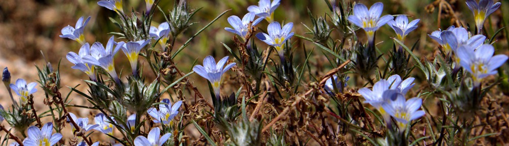
I think this is Miniature Woolystar (Eriastrum diffusum):

When we got back to the intersection of the Feldspar and Tom’s Thumb trails, we hadn’t even gone four miles! We decided to add in some easy mileage by hiking the Feldspar over to the Marcus Landslide Trail providing a circuitous route back to the trailhead. Despite that added distance, we had only hiked about 5.3 miles when we finished. But we had over 1700 feet of elevation gain! I took this photo, below, from the Marcus Landslide Trail. The Thumbnail Pinnacle can be seen about a third of the way over from the left side of the photo.

Playing around with some new equipment…


Friday’s hike started at the Wagner Trailhead. We hiked the Wagner Trail to the Granite Trail. At that point, Amy and her group turned left, while Bob, Sarge, Janet, and I turned right. This is a photo of the group just prior to splitting up:

Bob, Sarge, Janet, and I hiked out to the Delsie Trail, at which point we noticed that it now has a sign!

A view of Rock Knob that’s a bit different from what we normally see:

We came across some rock formations that we hadn’t noticed before:


Globemallows with Weaver’s Needle in the distance:

We hiked over ten miles. Bob had to stop to give Sarge water several times.

A saguaro at the top of a flower covered bank of a wash:

A view of the McDowells from a hilltop on the Granite Trail:

Hedgehog blossoms:

I have not been able to identify these flowers. Anyone know what they are?
[Update: Amy tells me that these flowers are California buckwheat (Eriogonum fasciculatum). She says that she likes to call them the “hangover plant” because tea brewed from dried flowers has been used as a headache remedy from drinking too much.]

This is a view of the entire bush. It’s the only one of it’s type that we noticed during our 10+ mile hike.
