Month: June 2013 (page 1 of 3)
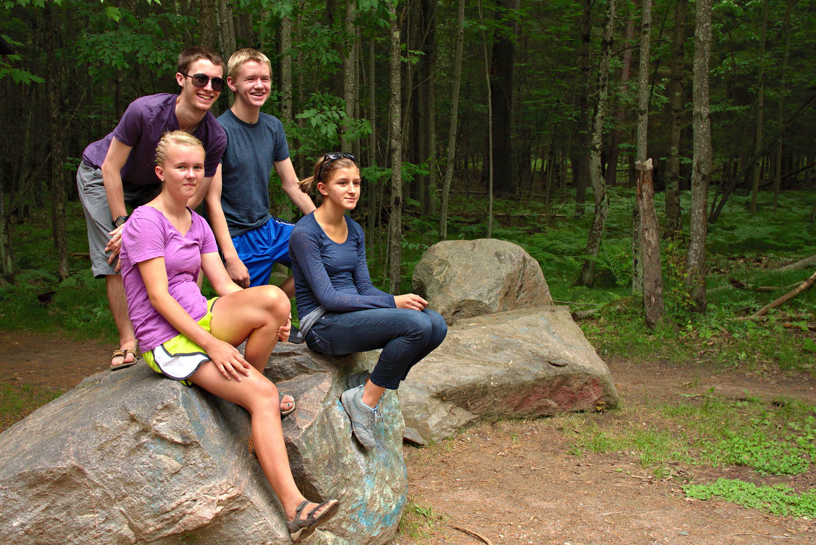
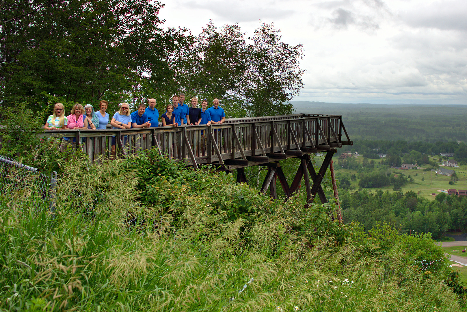
Anna, Pat, Greg, and Marie sit on a rock at the Piers Gorge trailhead.
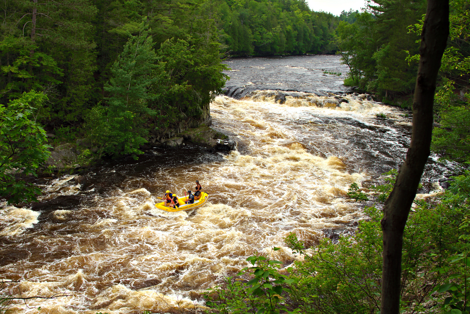
Turbulent waters of the Menominee River: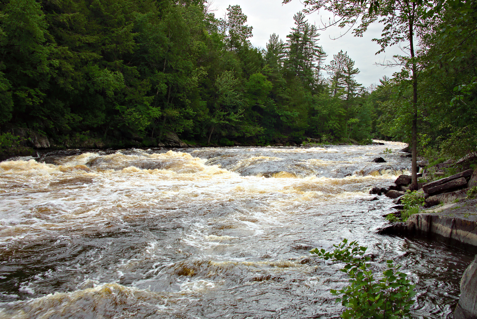
Rafters going through the rapids:
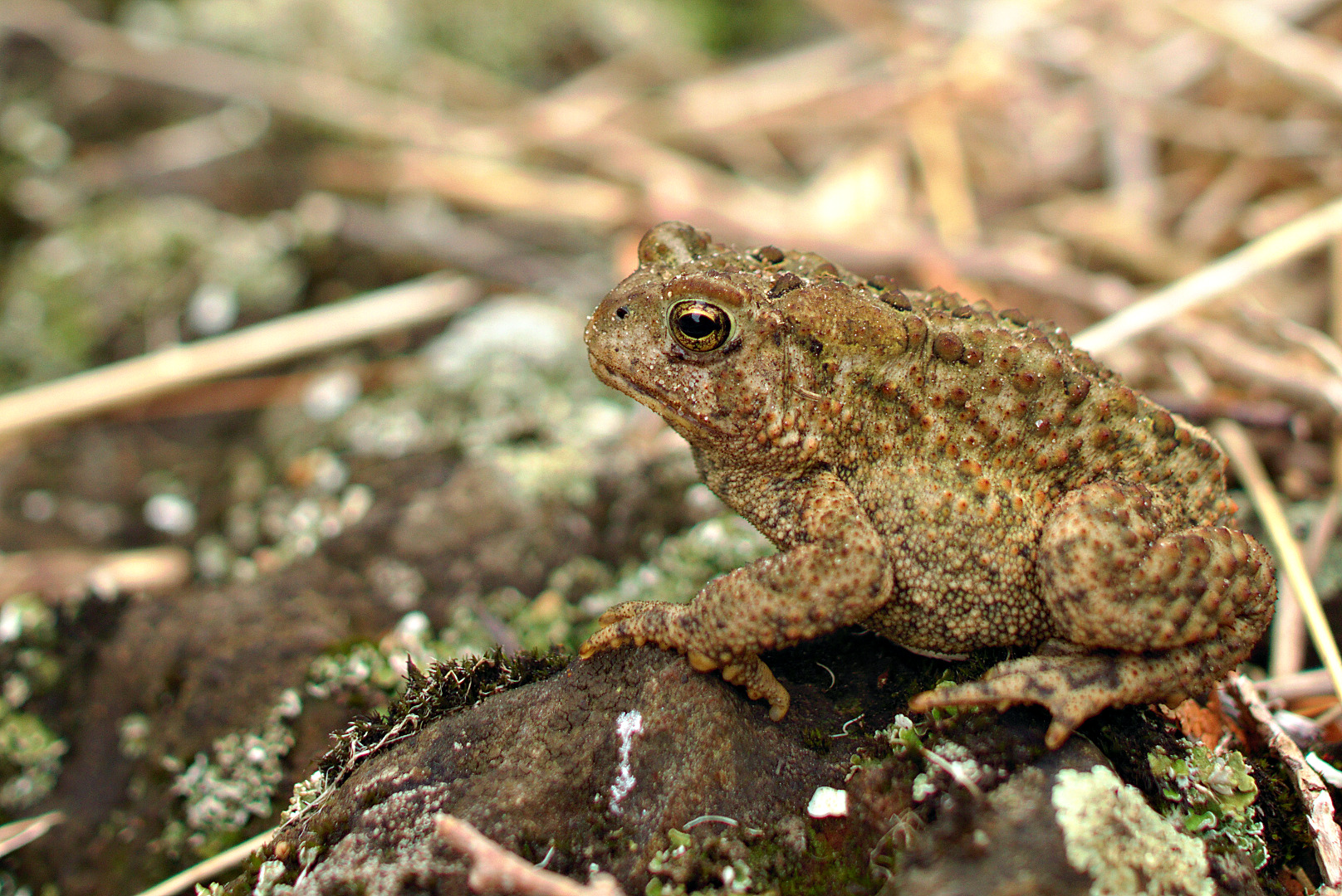
We saw this toad on the way back.


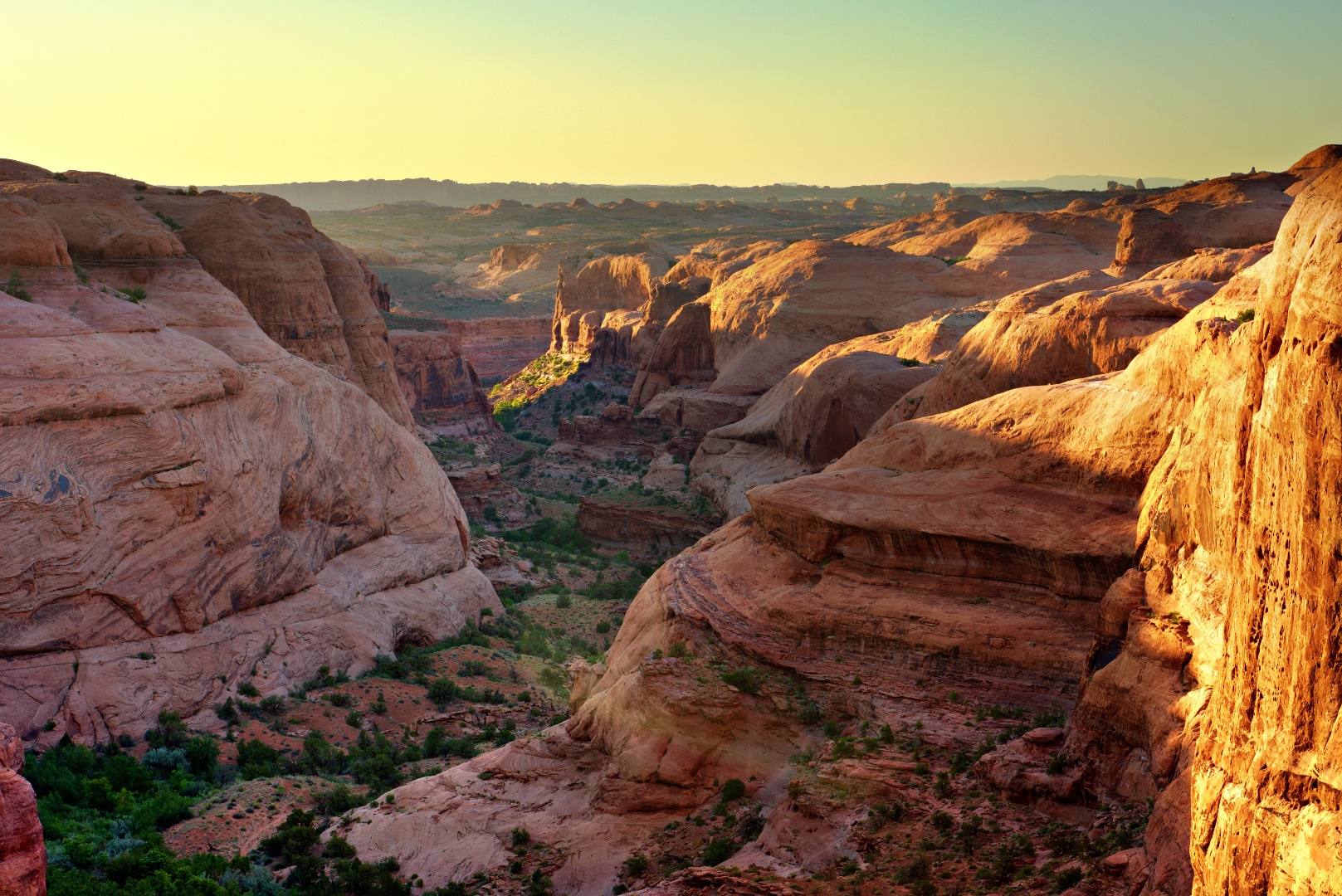
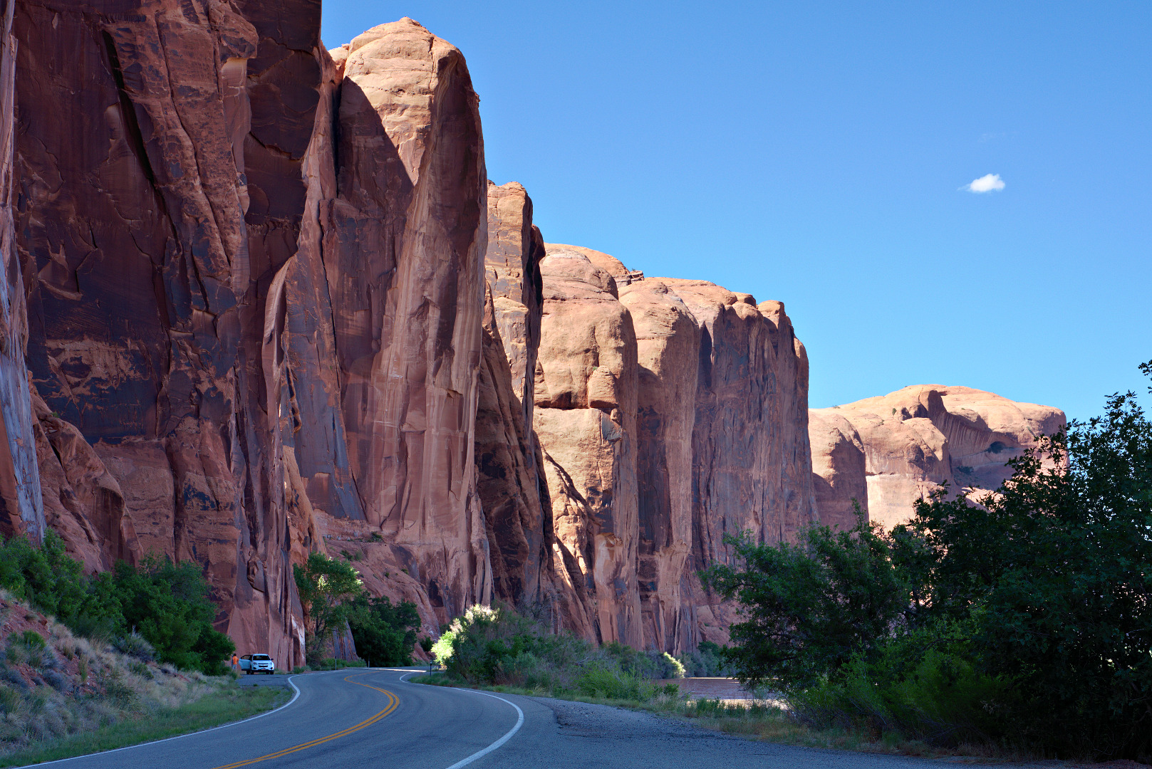
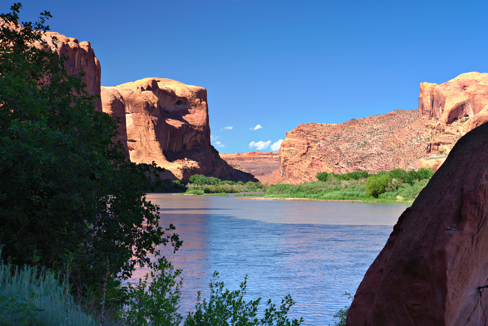
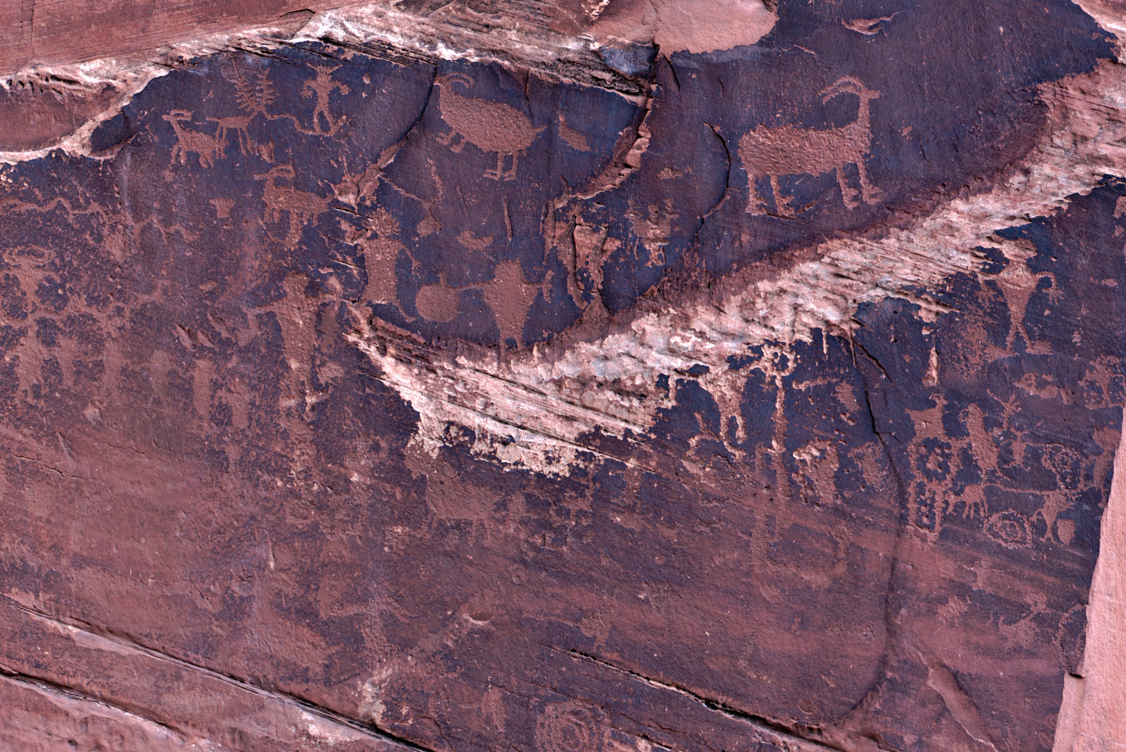
Utah State Route 279 snakes along the north bank of the Colorado river. In many places, not more than a few feet from the road are tall, nearly vertical cliffs. About 5 miles from the intersection with US 191 is a rock art site created by ancient native Americans.
This photo looks back along 279. The rock art is not visible in this photo – it’s on the walls to the left and even behind the camera.
 Here is a view looking up and across the river. If you look closely, you can see part of the Moab Rim Trail on the other side of the river.
 This is the sign discussing the rock art at one of the pull outs.
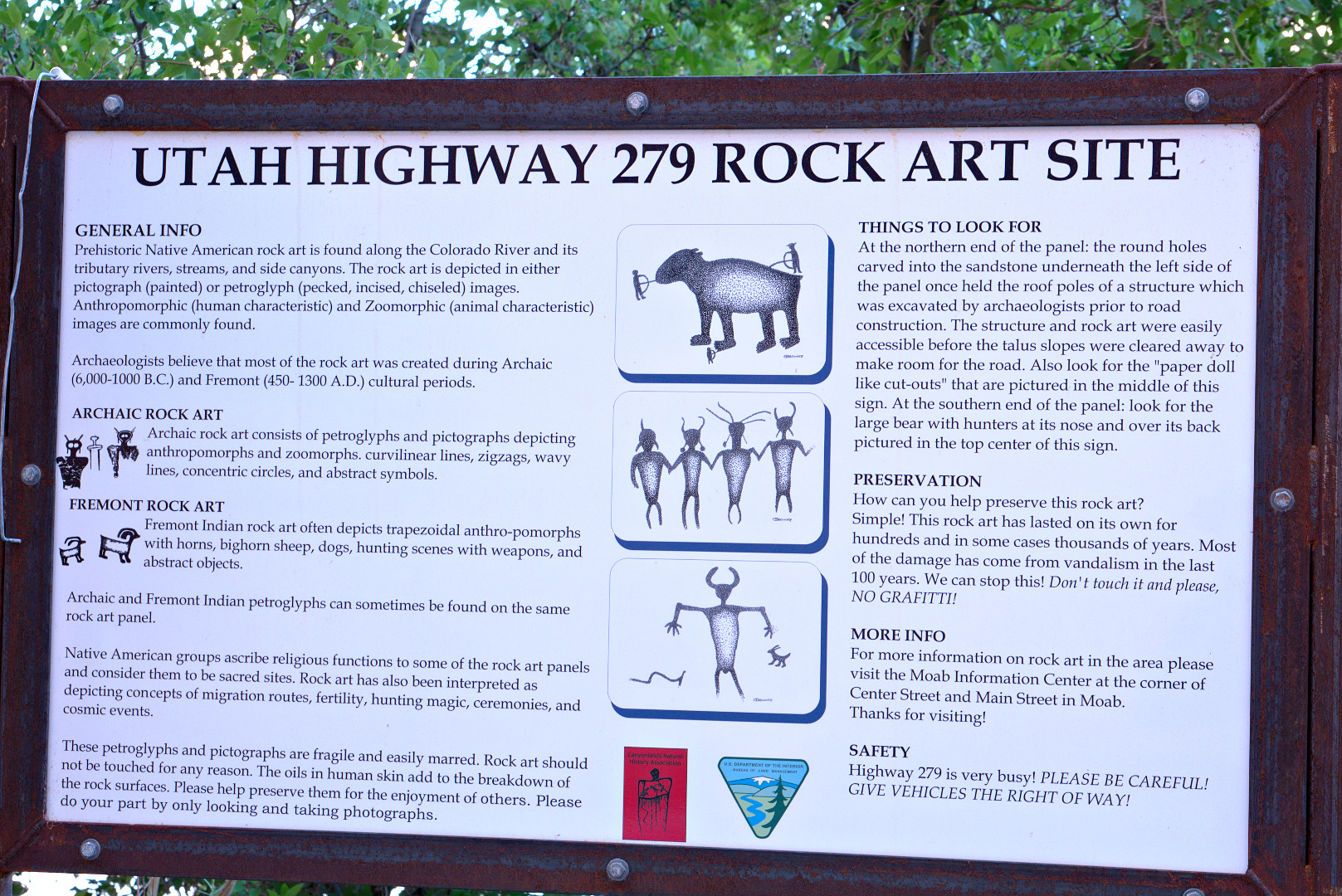
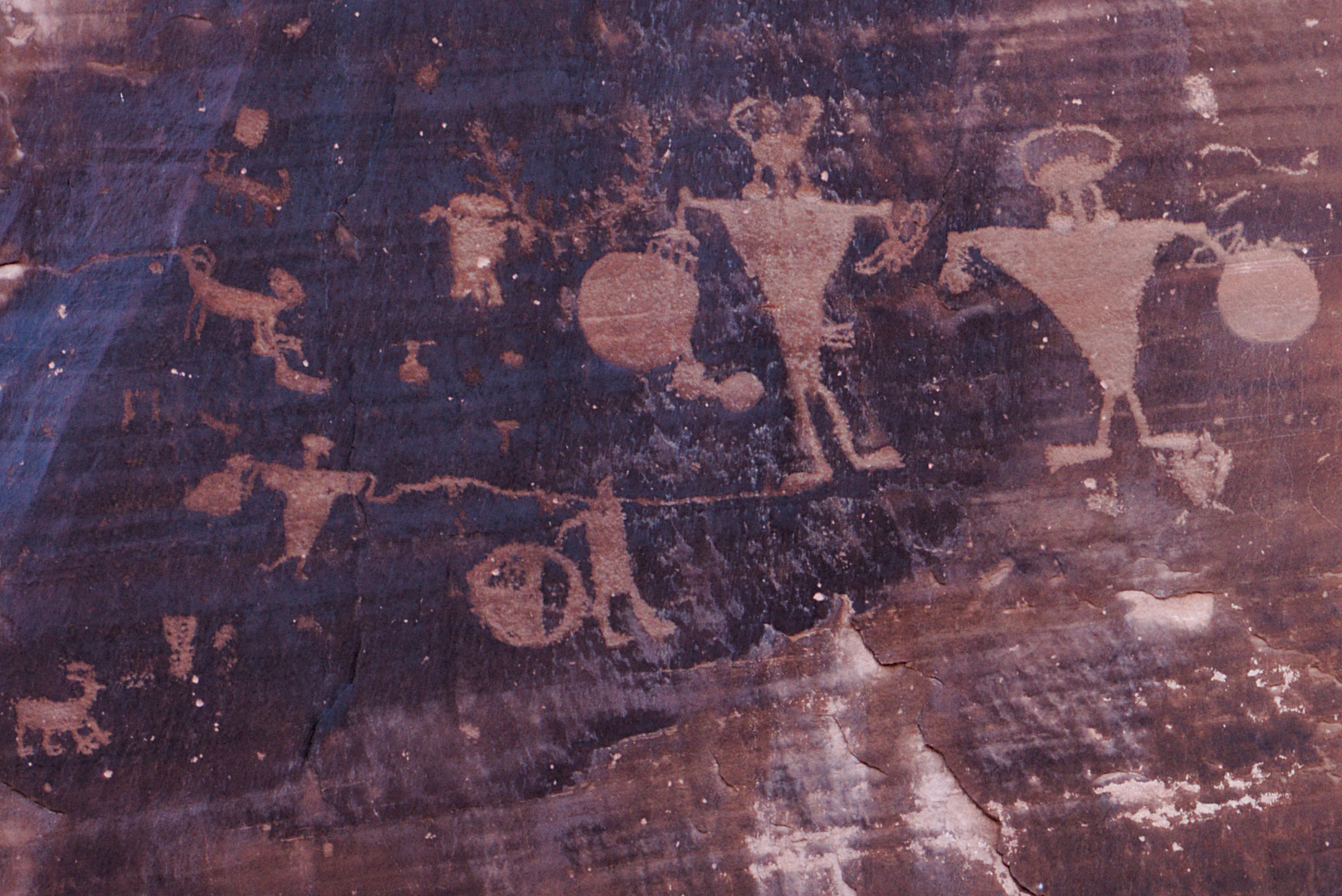
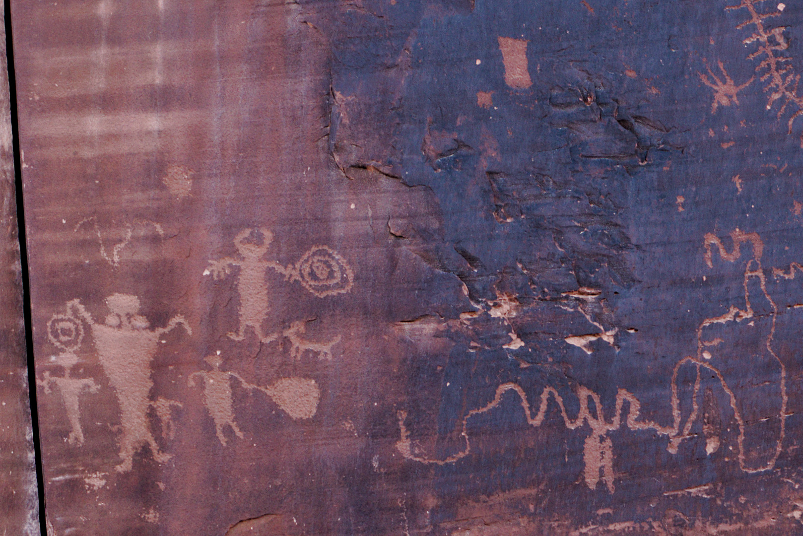
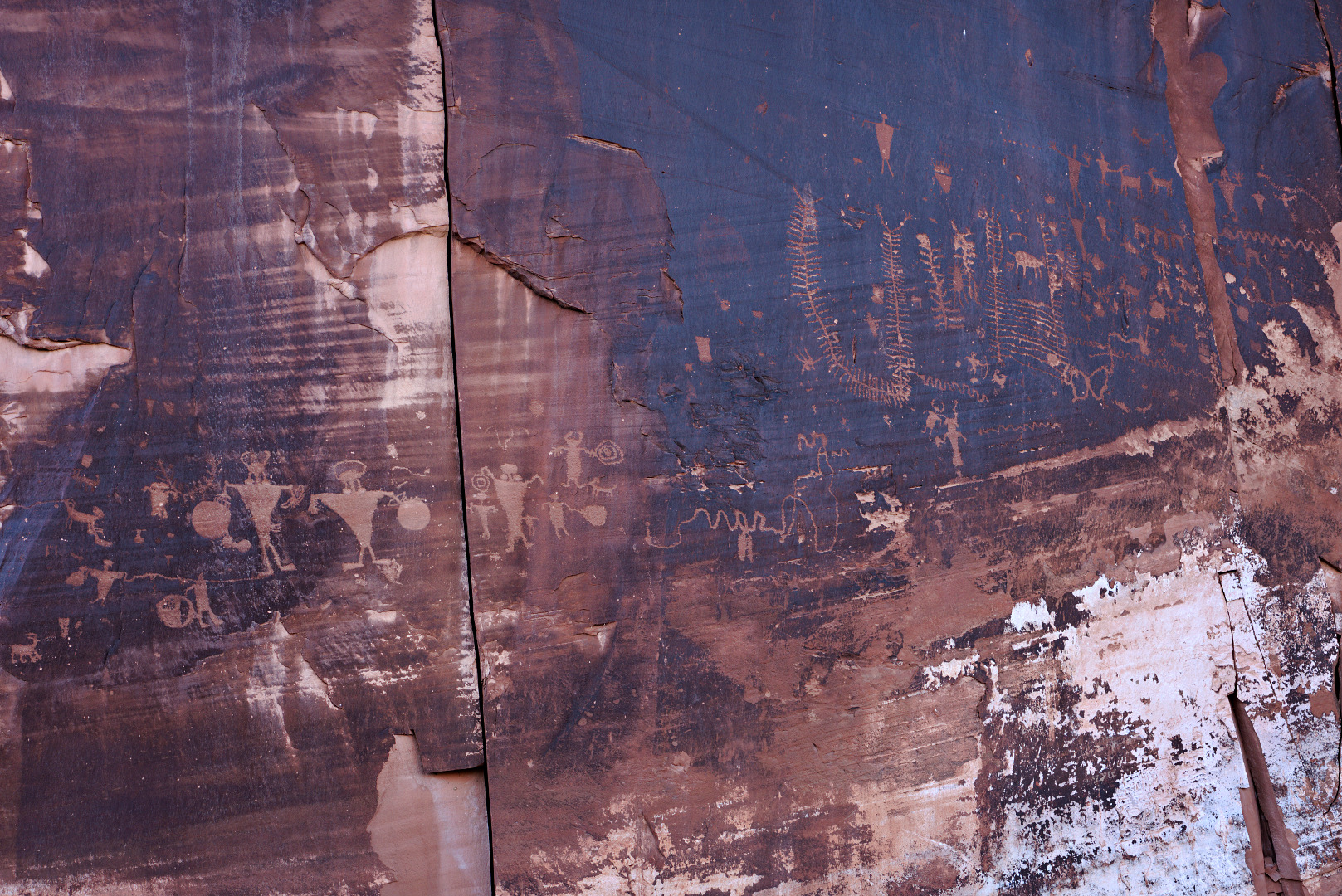
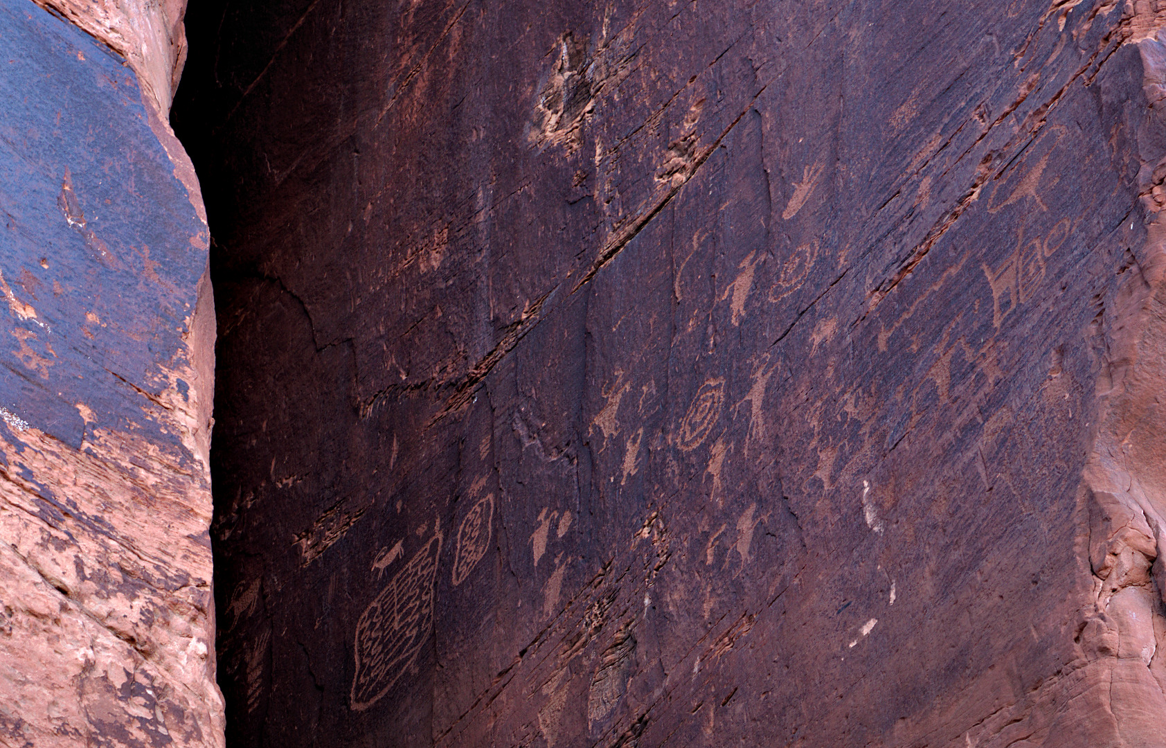
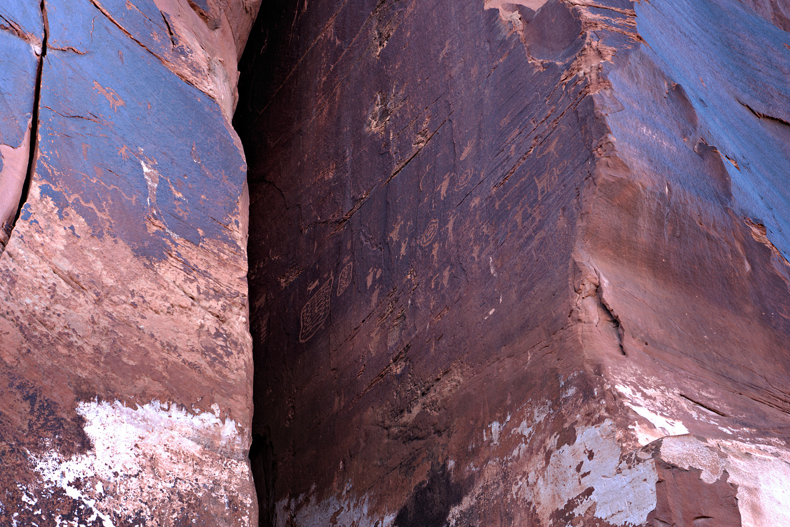
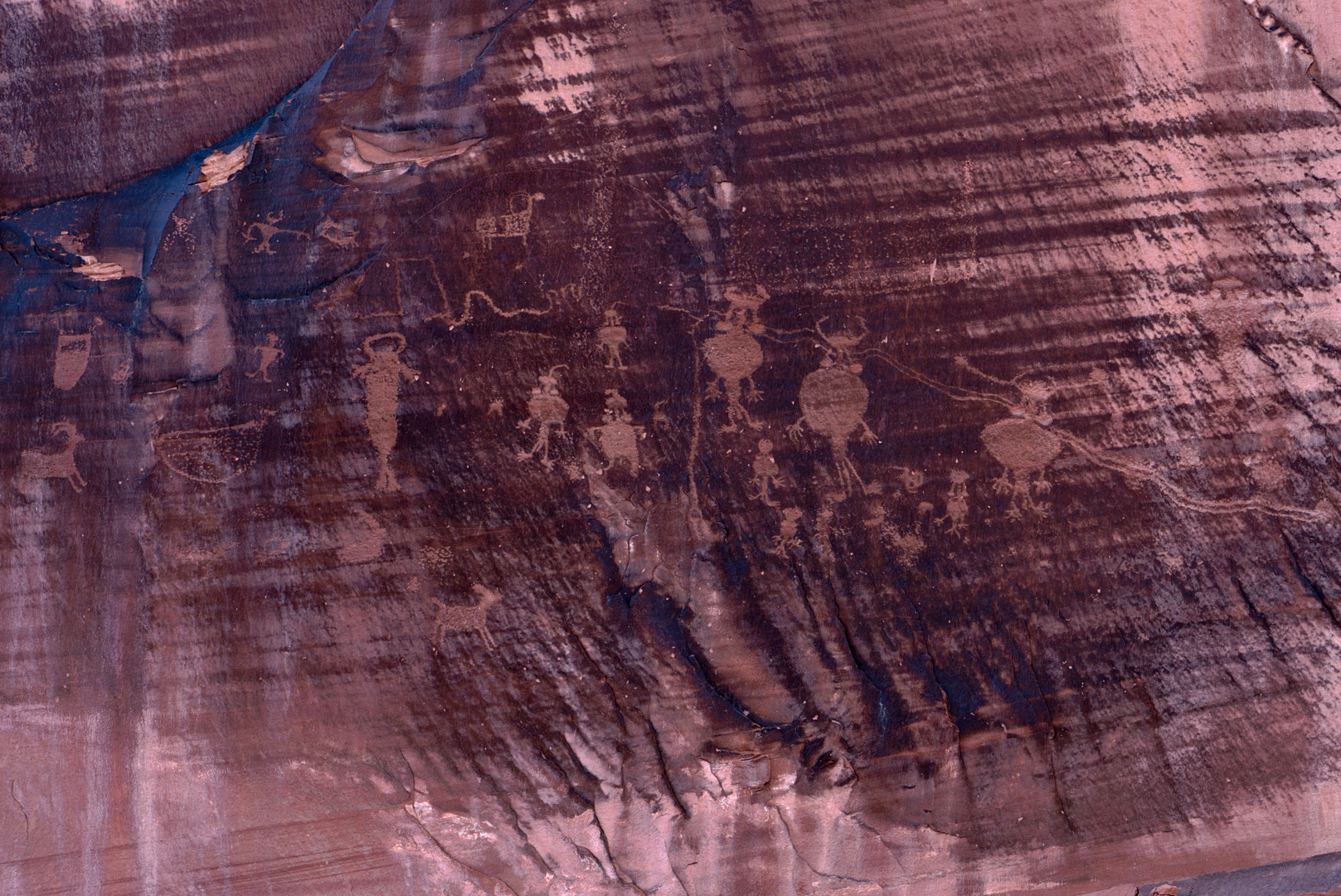
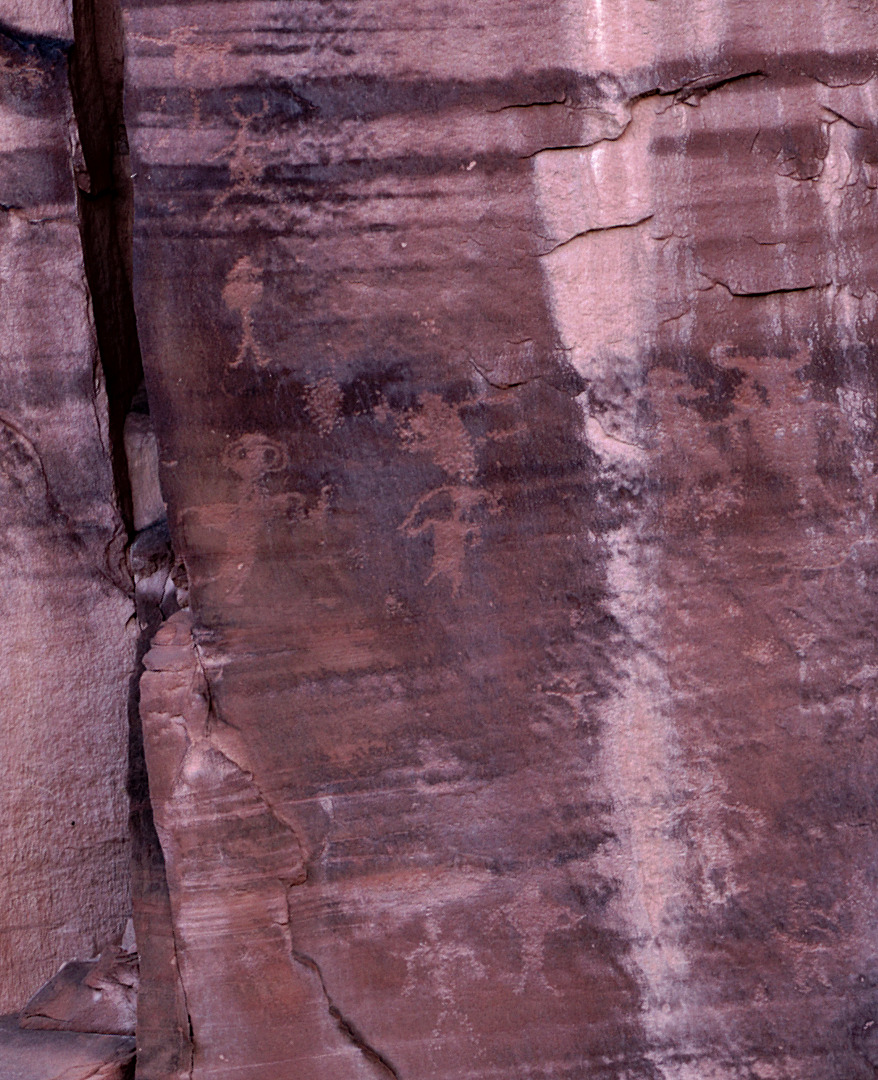
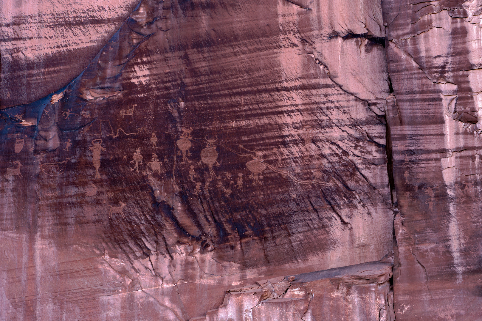
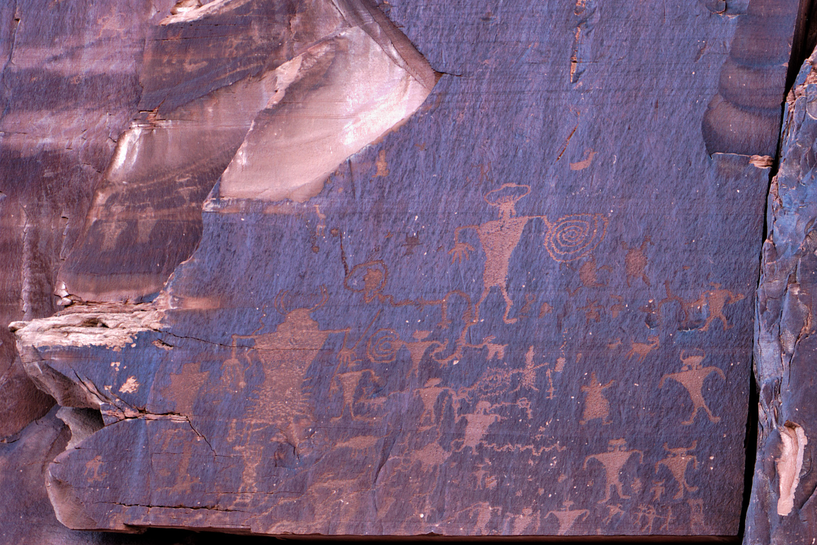
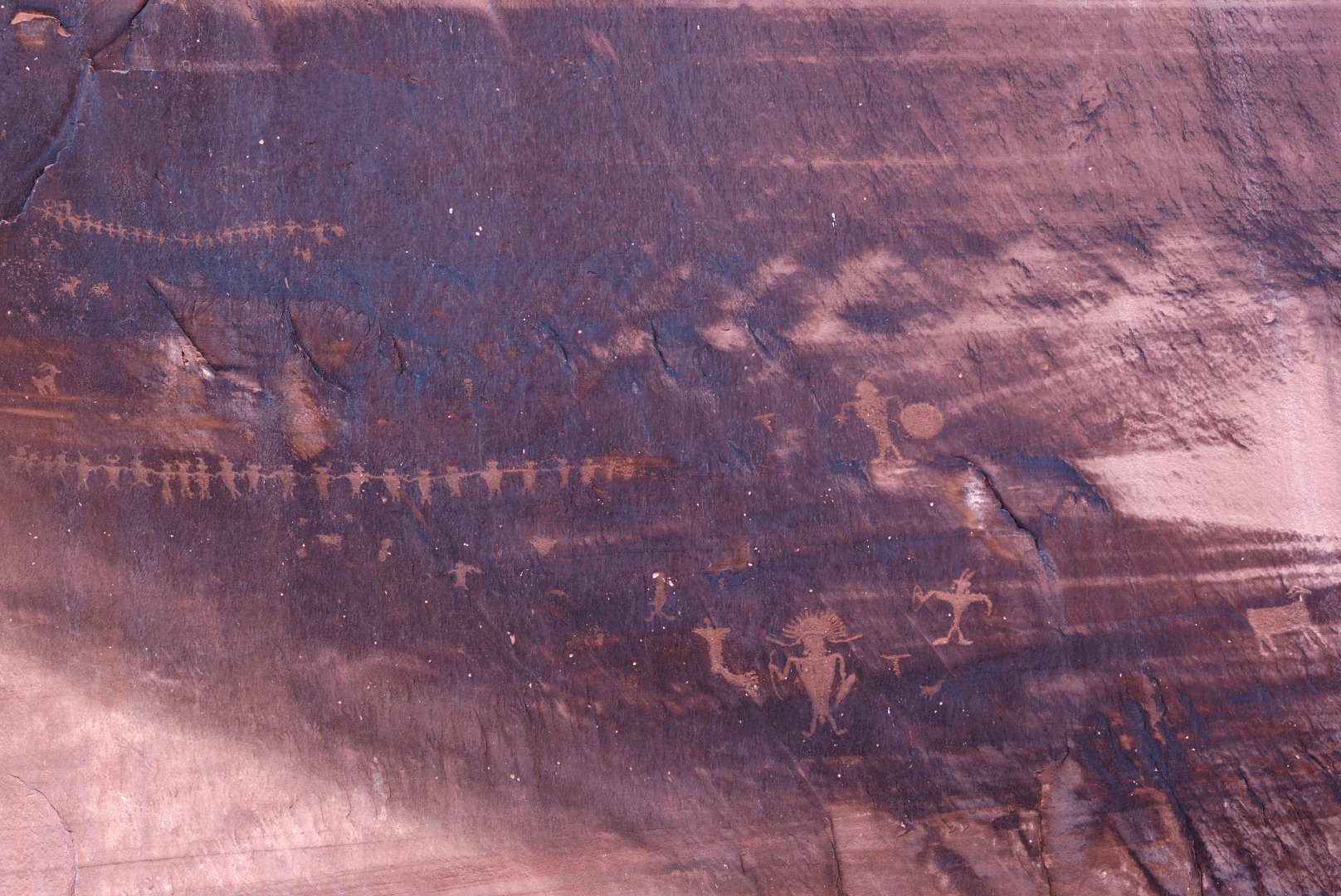
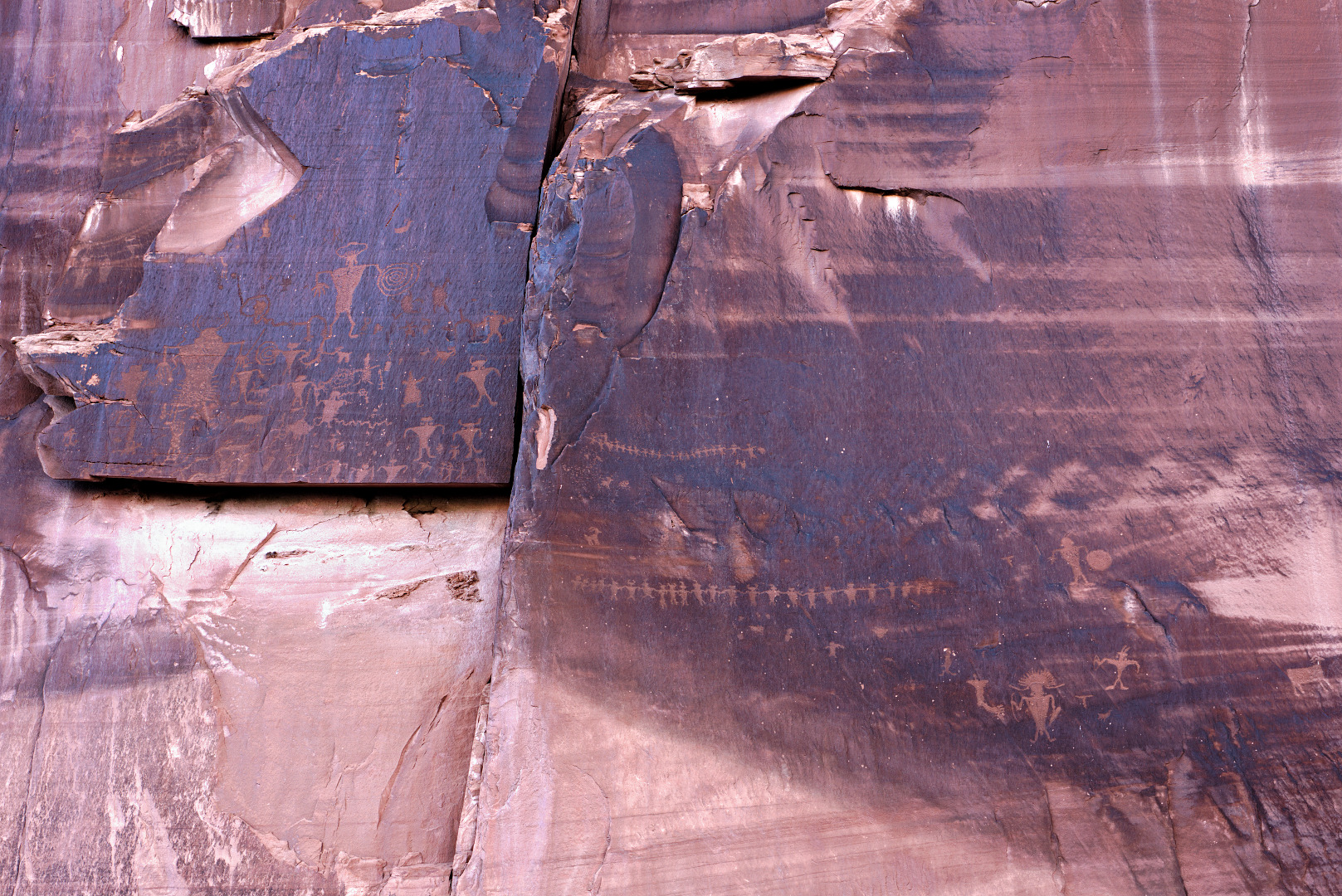
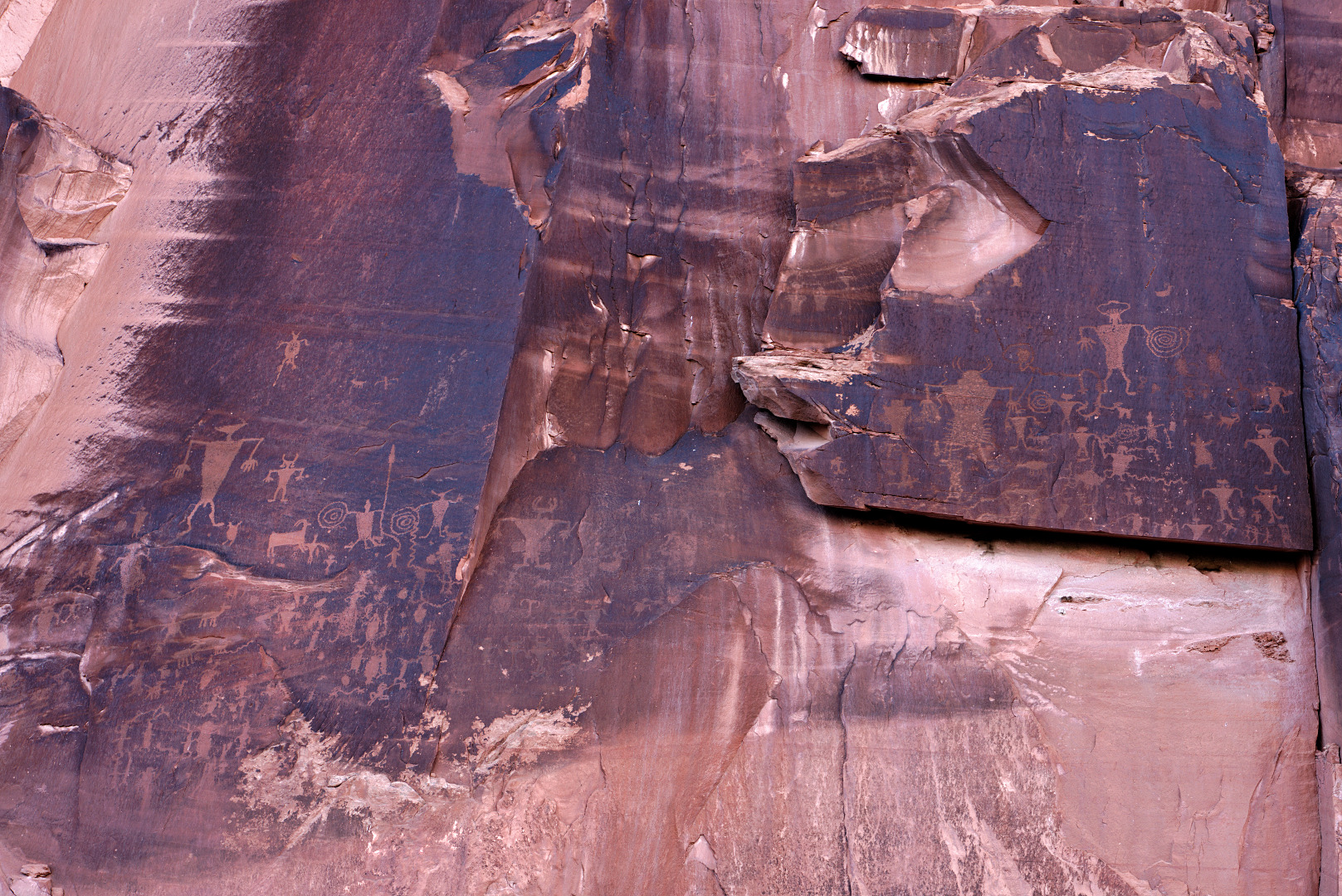
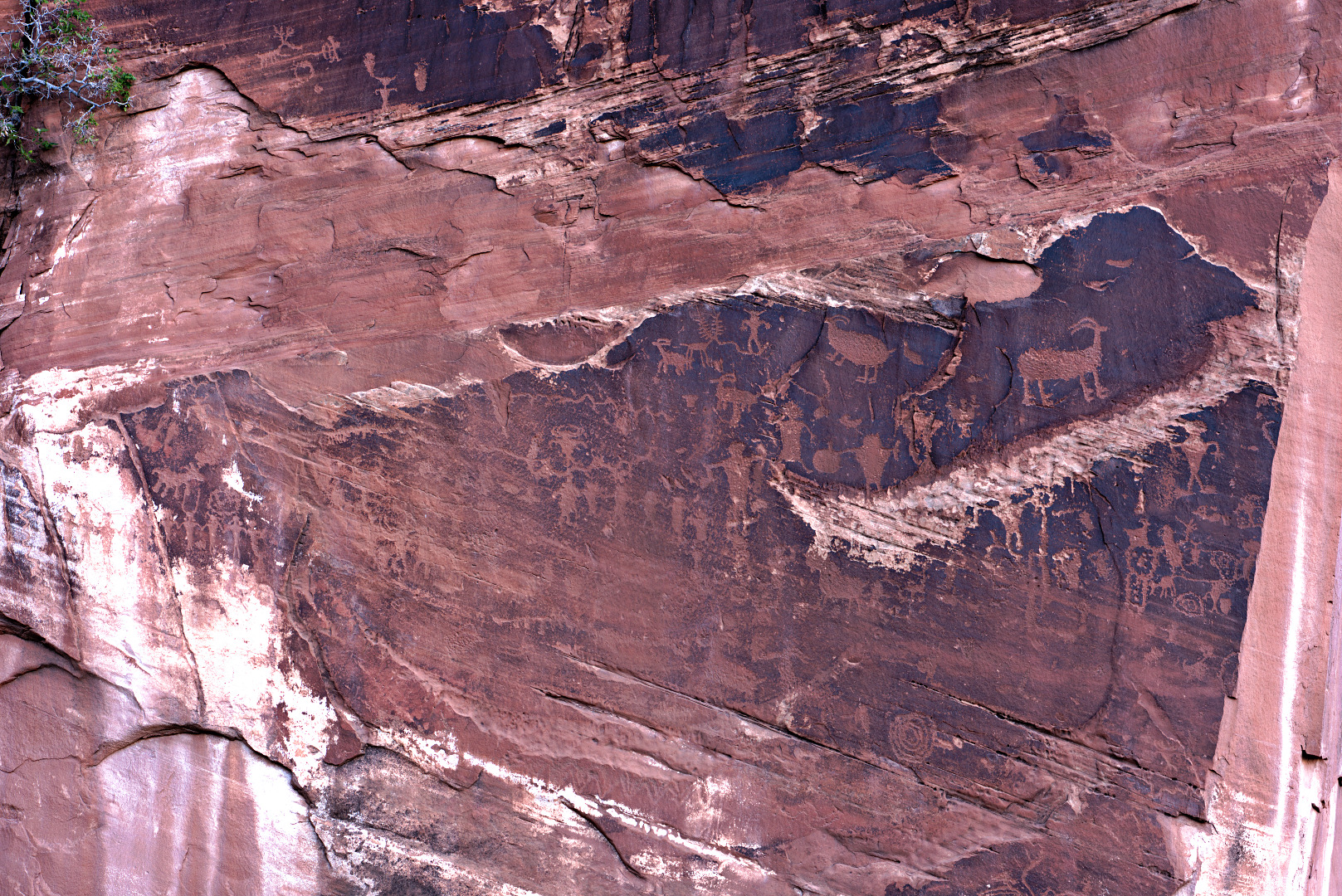
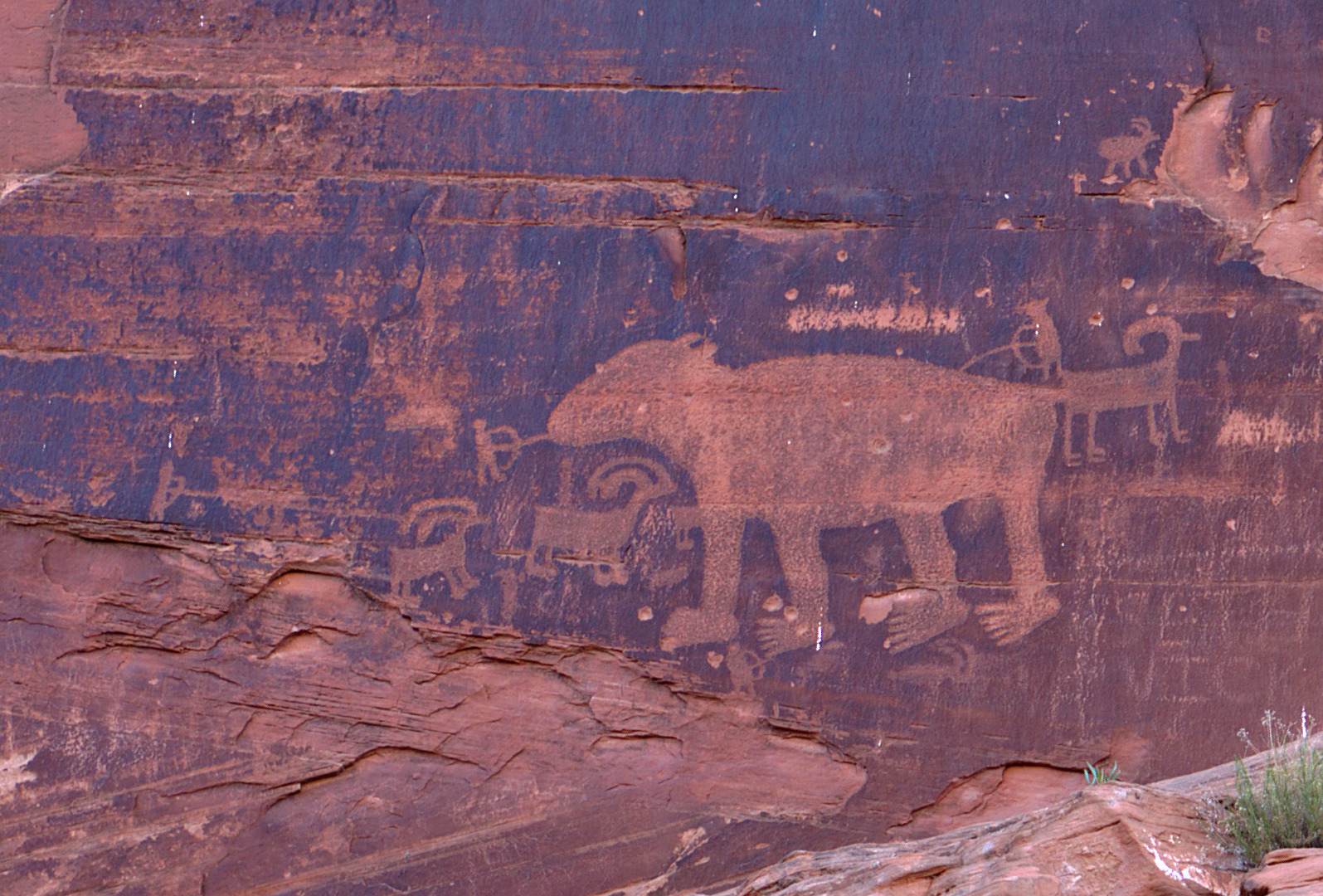
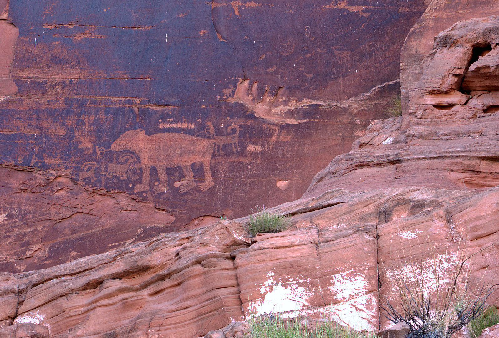
Much of the rock art is faded and difficult to see, especially when viewed in bright sunlight. It is better to visit during the afternoon when the area is in the shade. Even so, it often takes some looking to see these petroglyphs. I’ve added a lot of contrast in the photos below to make them easier to see.
Group 1:
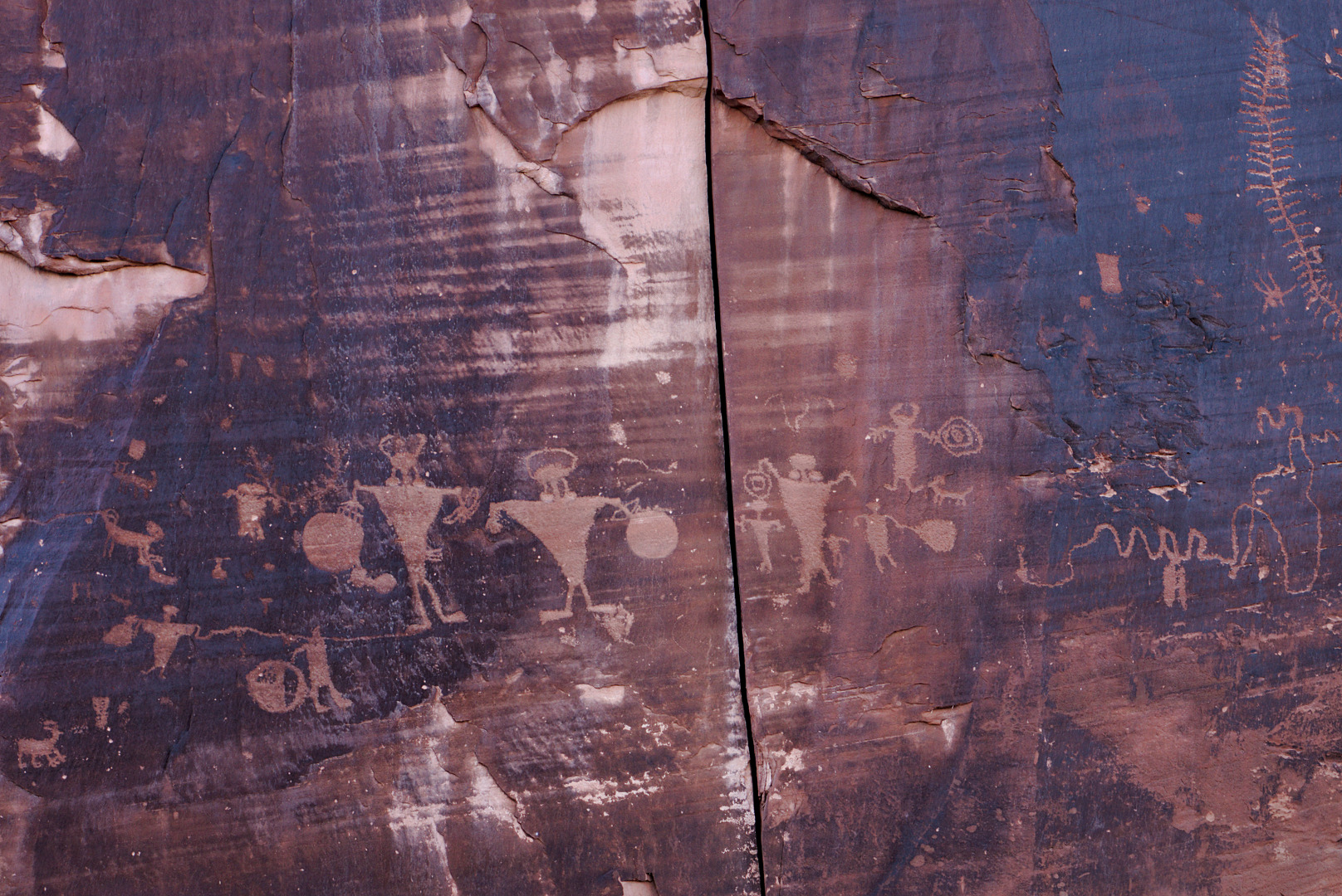
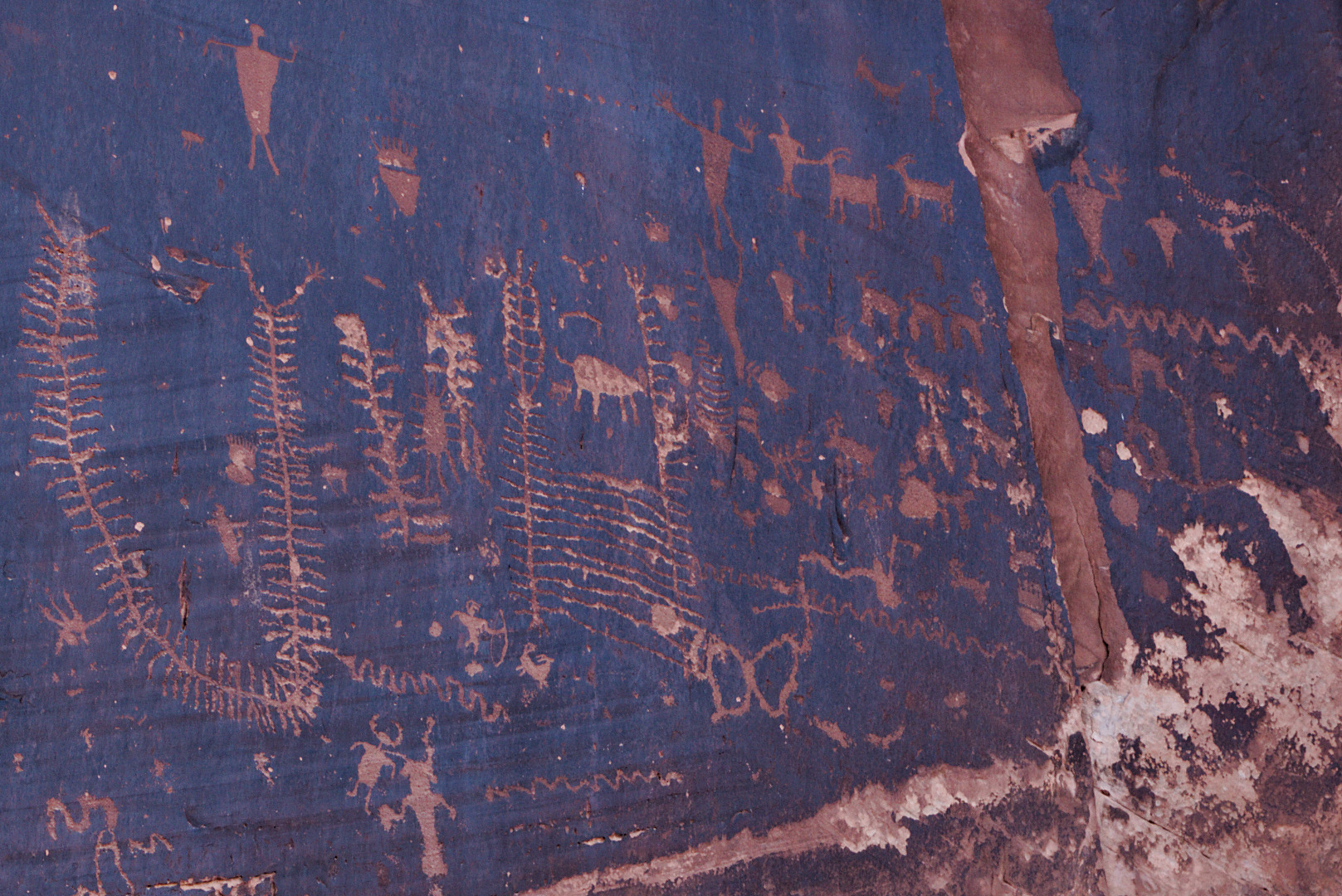
Group 2:
Group 3:
Group 4:
Group 5:
Group 6:
Group 7 – sadly, there was a lot of modern day graffiti in this area. I’ve cropped some of it away, but there’s some which is still visible.
I found it interesting that the artist depicted the bear’s feet as having numerous long toes.
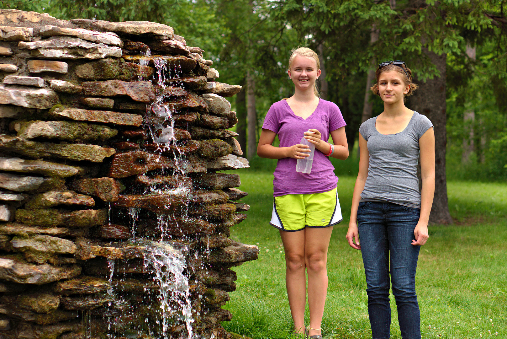
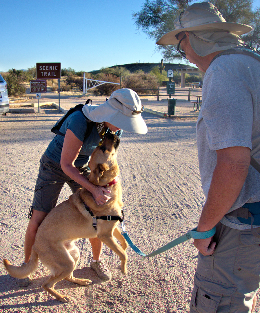
We hiked the Scenic Trail during last Friday’s Fitness Hike. We had a fairly large group for a hike in June. Often, it ends up just being the regulars who show up for hikes during the summer months.
I didn’t take many pictures. The desert is very brown right now; plus I have more than a few photos of this area. See this post from several months ago for other Scenic Trail photos.
Sarge greets Heather as Bob looks on:
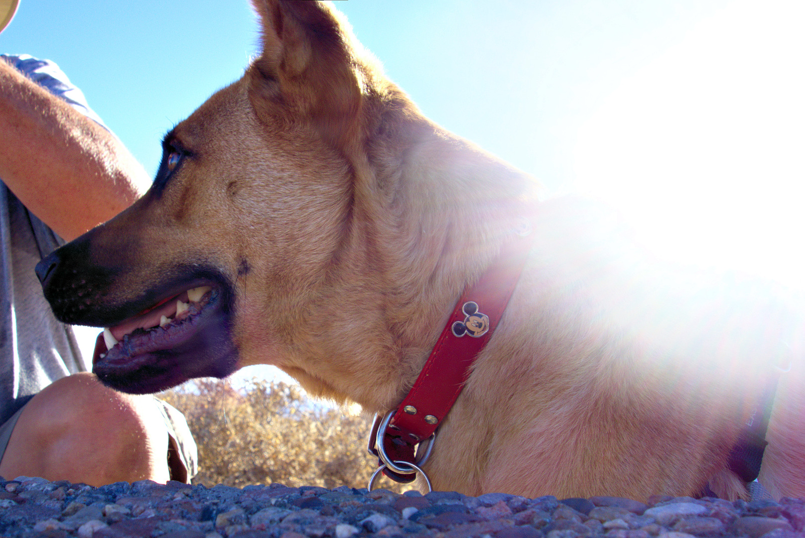
Sarge waits for water at the top of the hill on the Scenic Trail.
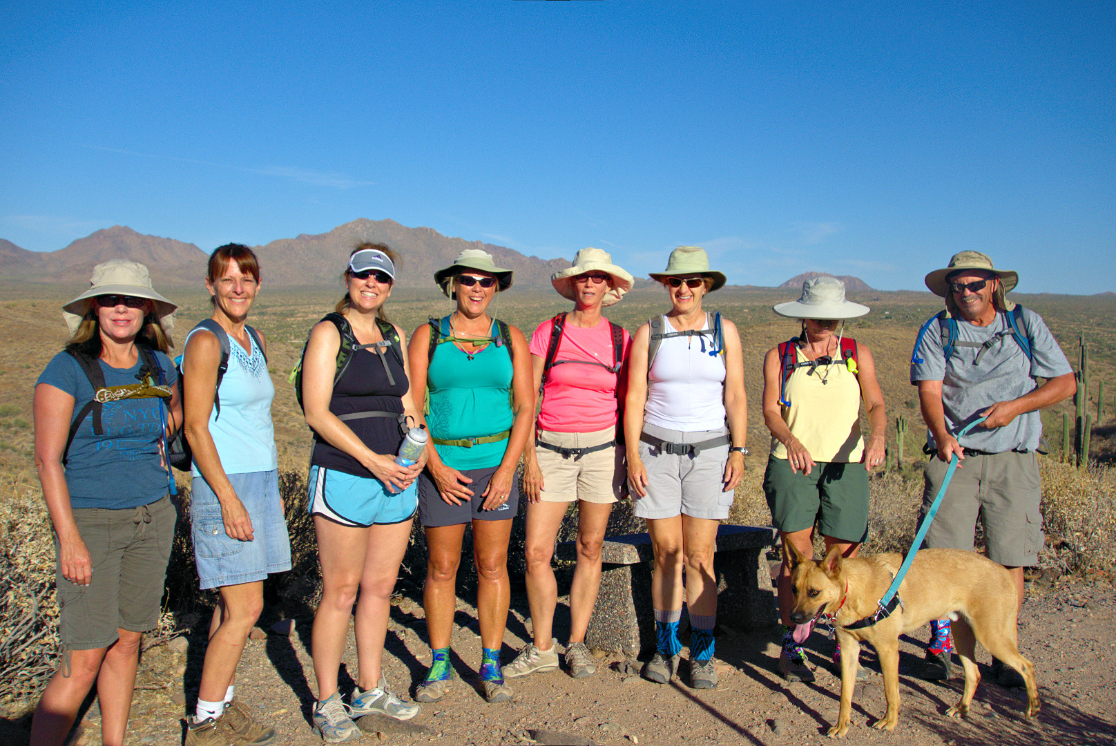
From left to right are Heather, Teresa, Mary, Janet, Mary, Marilyn, Linda, and Bob, with Sarge in front.
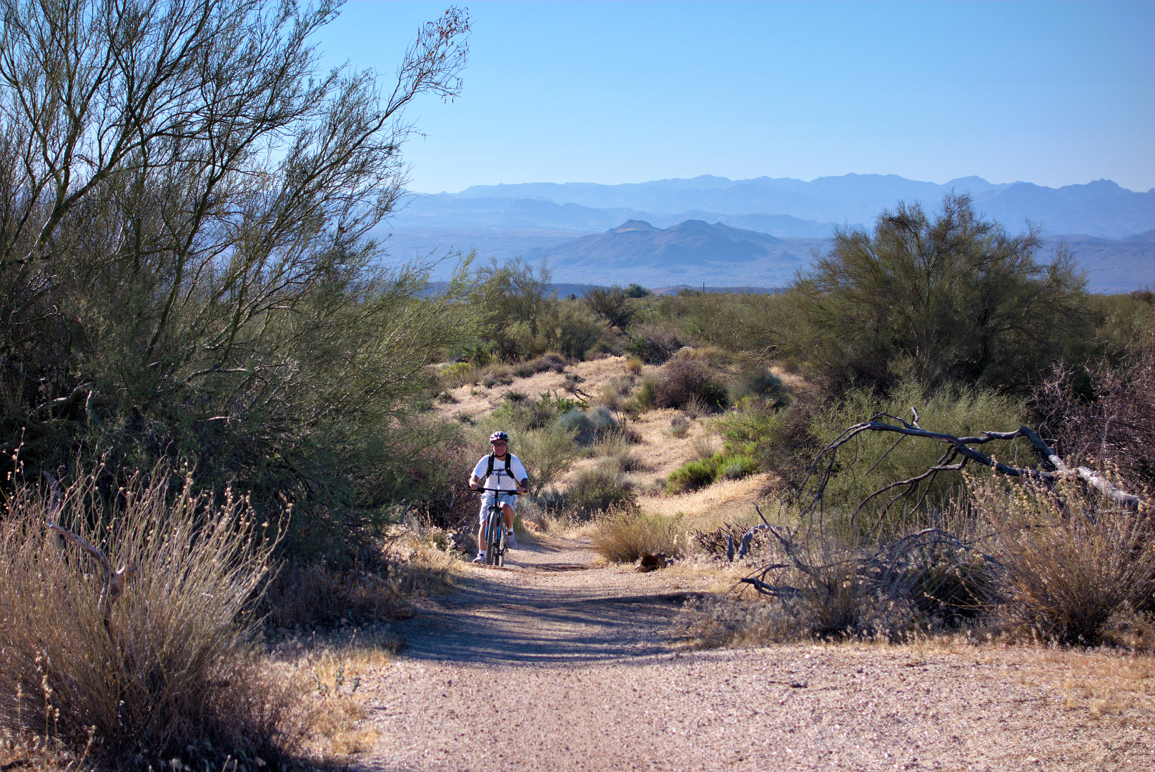
Bonus photo! This is Mary’s husband, Clayton, riding the Pemberton Trail on Sunday:
I took this during an early morning bike ride.
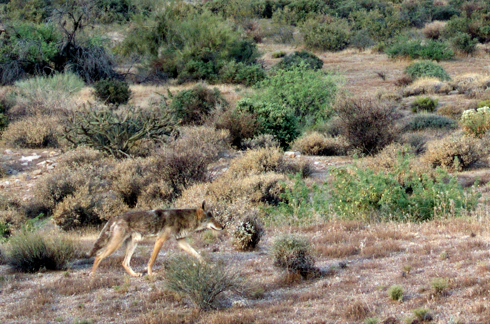
Later on, I saw this coyote:
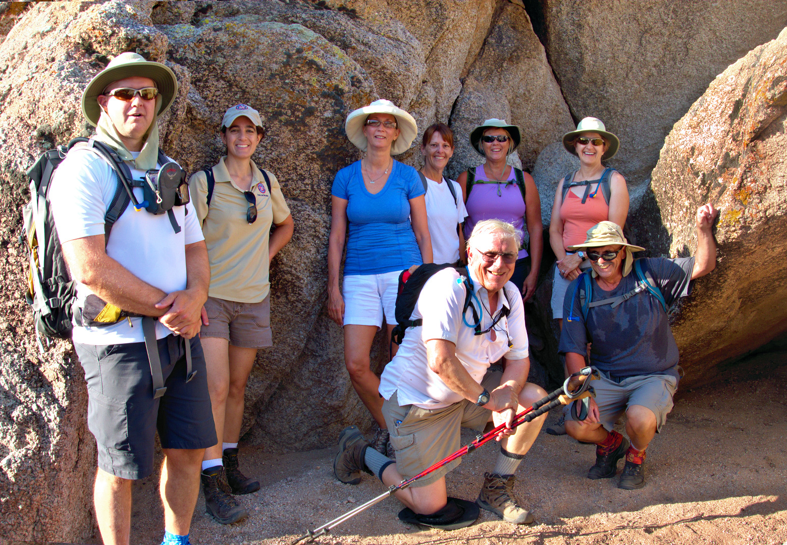
Today’s hike started at the Wagner Trailhead. We hiked the Wagner Trail, turned right onto the Granite Trail and hiked past Stoneman Wash, stopping when we got to another wash which feeds into Stoneman Wash. We hiked a short ways up the wash where Amy and I took the group photo shown below. From there, the group split up with Amy leading Doug and Mary back to the Trailhead via the Bluff Trail.
Bob, Teresa, Janet, Marilyn, and I hiked continued up over the rocks and followed the wash up to the Pemberton Trail. We turned left on Pemberton and returned via the Bluff Trail.
From left to right (and back to front) in the photo below are Kevin, Amy, Mary, Teresa, Janet, Marilyn, Doug, and Bob. I took one exposure. Amy took another. I combined them in post processing so we could all be in the photo together.
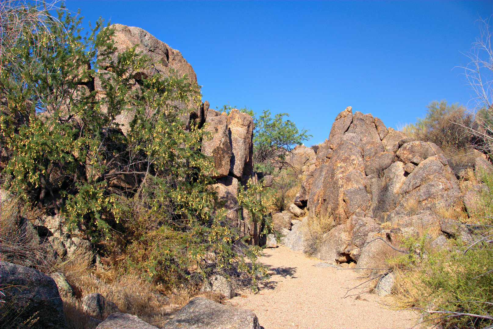
 This photo was taken from the wash after the group split up. (I didn’t take many photos today. I still have a lot of photos from the Moab area to process.)
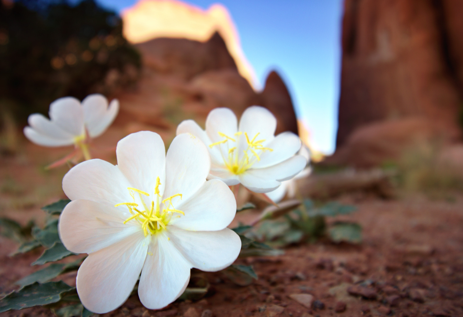
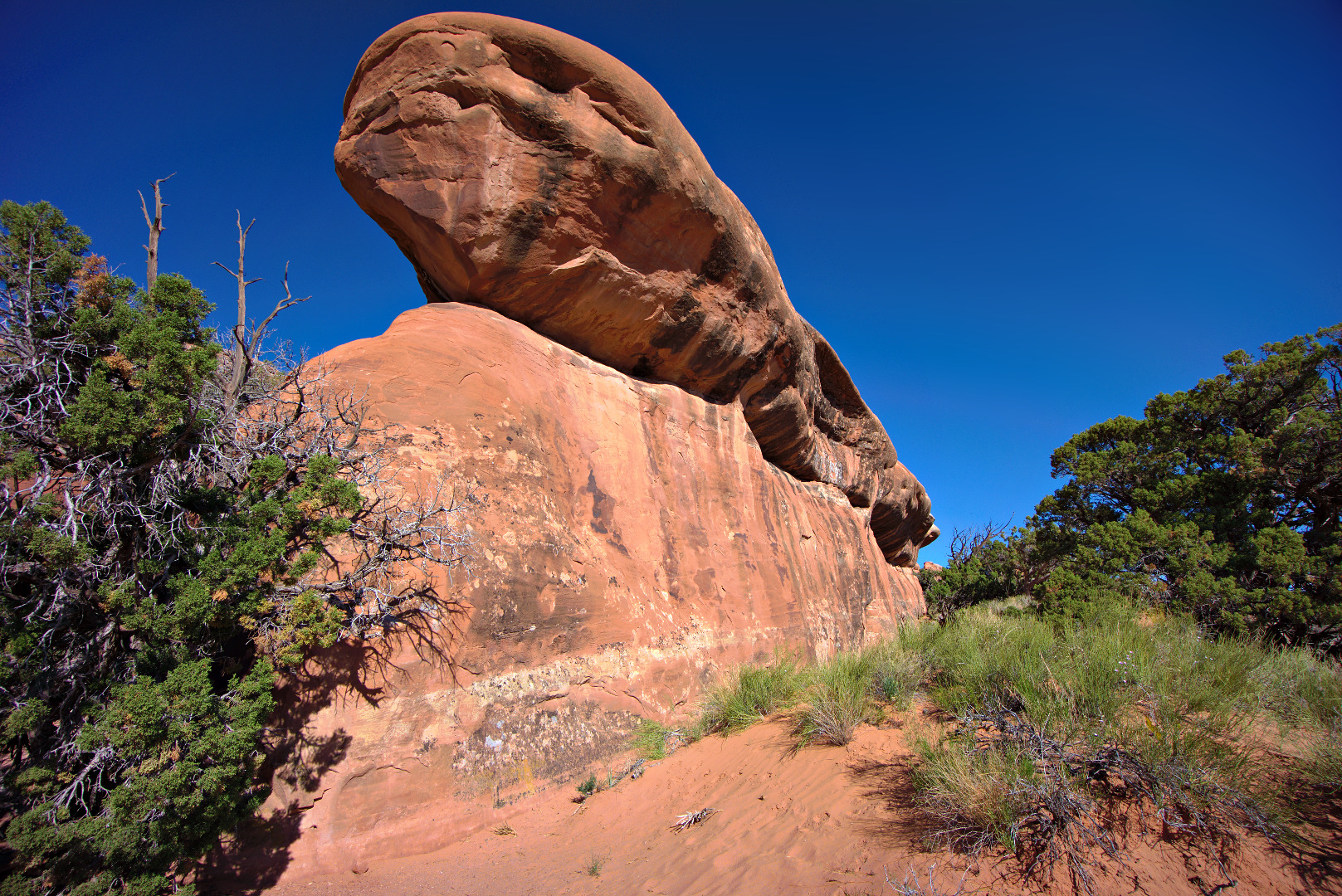
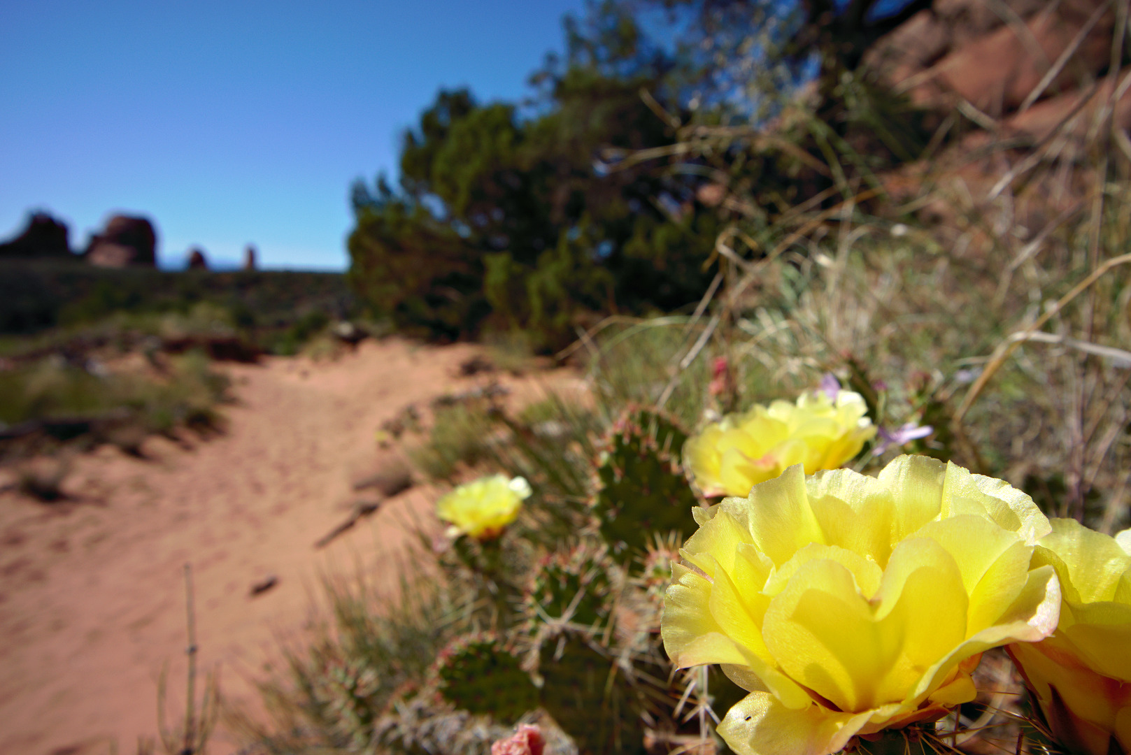
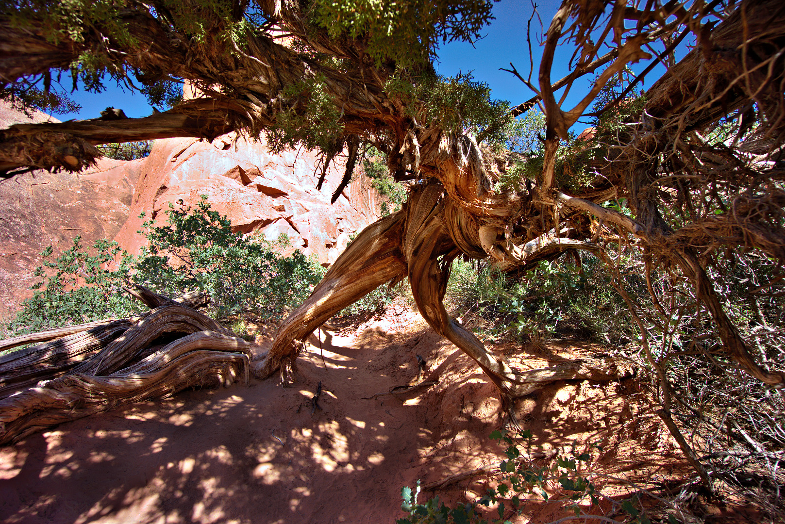
These are photos from my hike with Marilyn through the Devil’s Garden at Arches National Park.
We saw these white flowers near the trailhead.
 A sandstone fin, one of many in the area:
 These are prickly pear flowers. The prickly pear plants that we saw appeared to be smaller than the ones that we’re accustomed to seeing in Arizona.
The trail passes under (or by) this interesting Juniper tree. The wide angle lens that I used for some of these shots really helped to capture the scope of the tree.
Another fin. The trail follows a sandy course between the fin in the middle and the one to the right. It then climbs the fin, forcing the hiker to make a traverse that’s kind of high up on sloping sandstone. This is probably the most difficult section of the hike.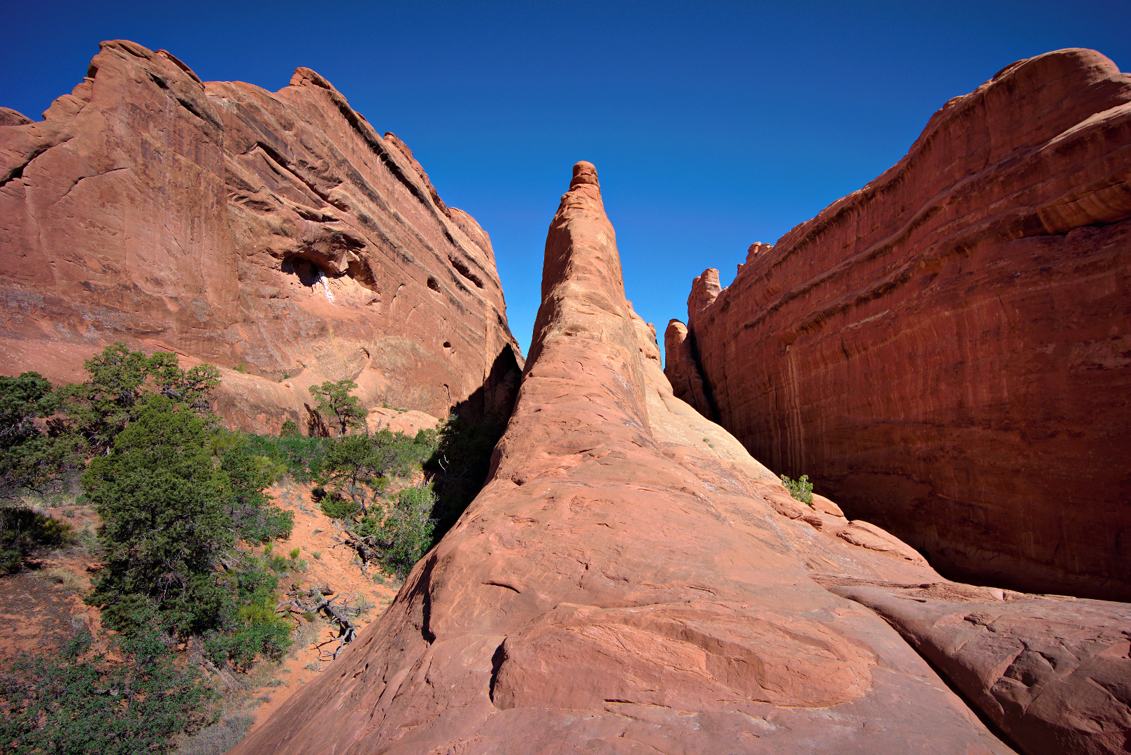
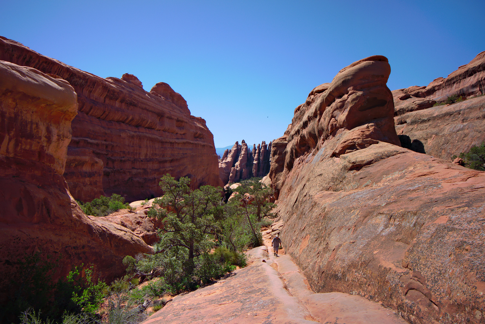
More fins. We chatted with the guy walking up alongside the fin for a while. He’s an ex-NYPD officer who’s now living in Florida.
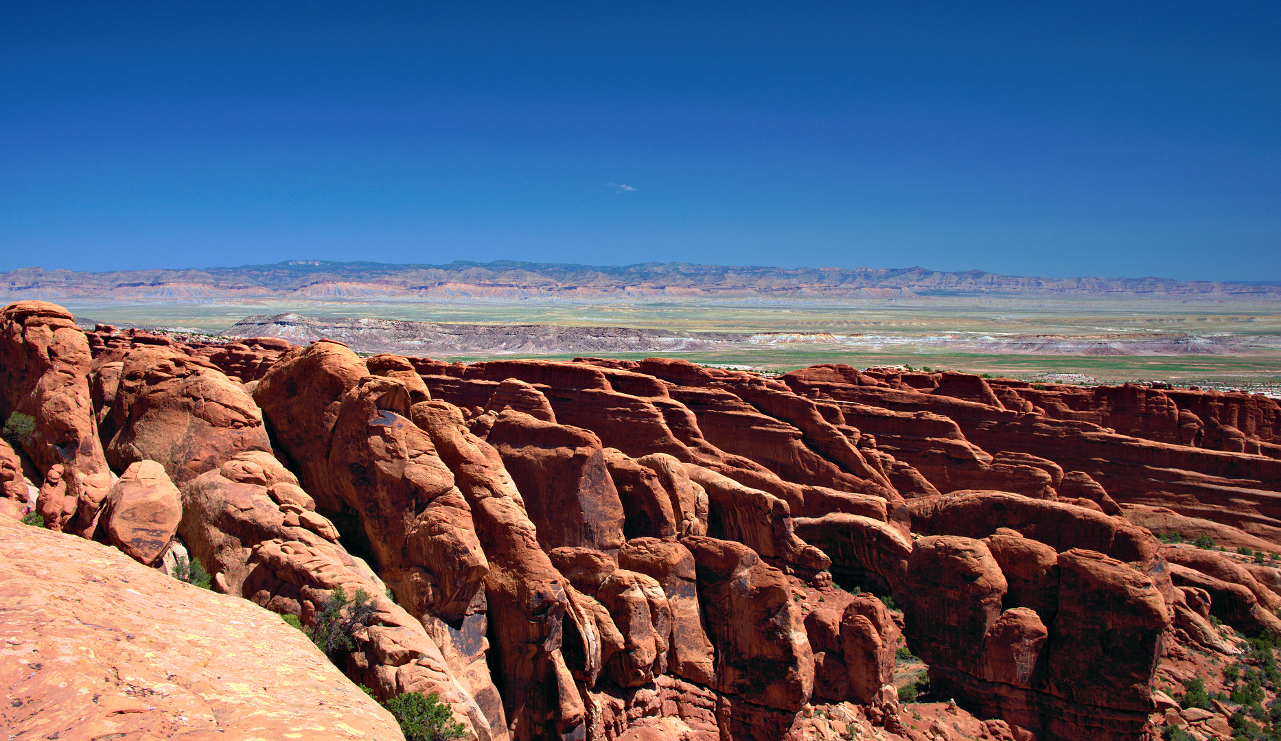
A view of some of the fins that are past the Double-O Arch. I have some Double-O Arch photos, but I won’t post them because Marilyn has some which are better. I’ll post at least one of hers once I get around to processing them.
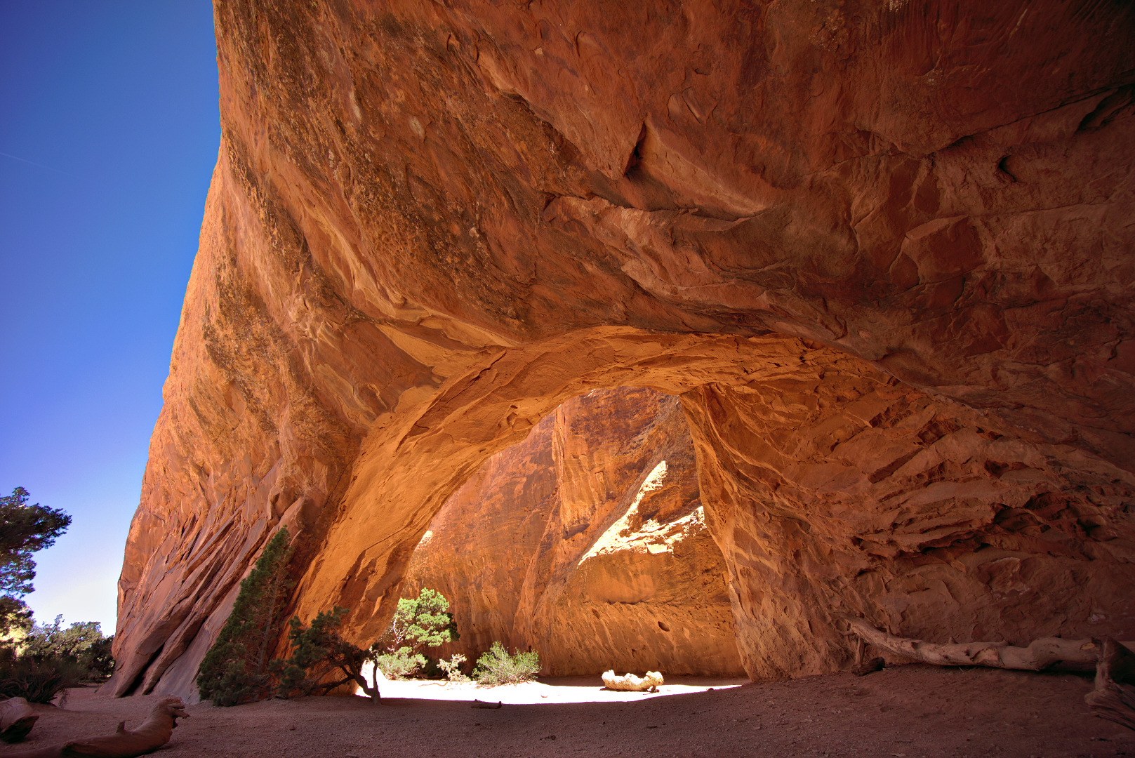
This is Navajo Arch:
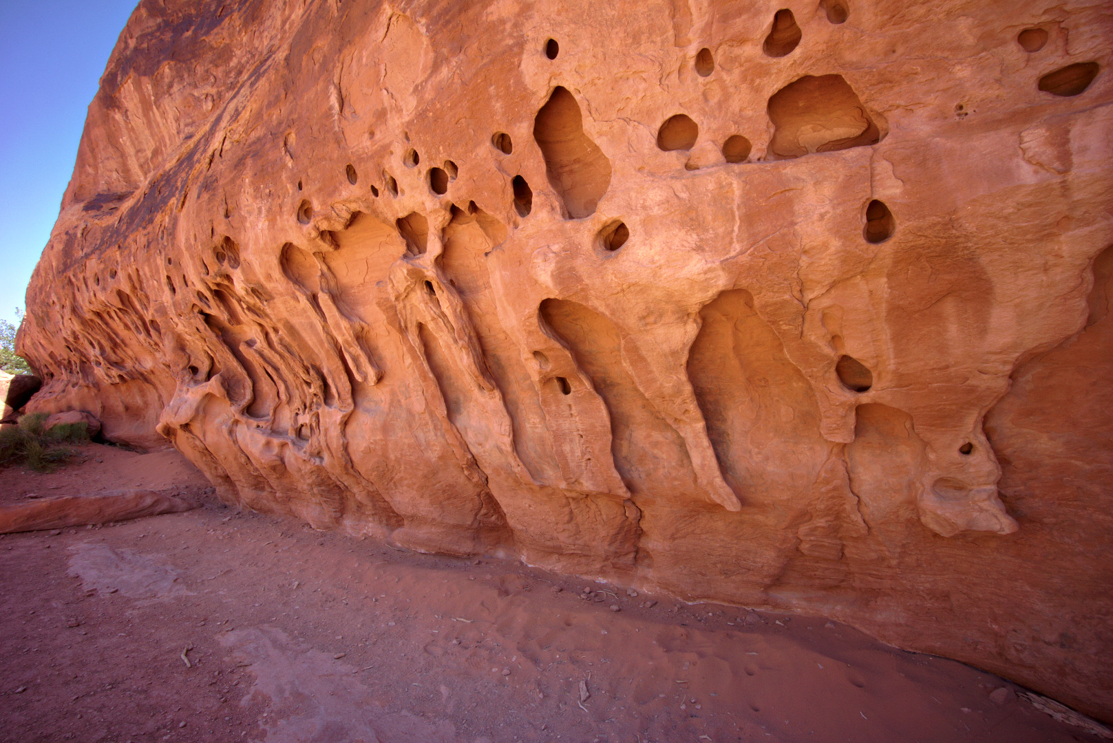
 This is a wall that you pass on the way to and from Navajo Arch:
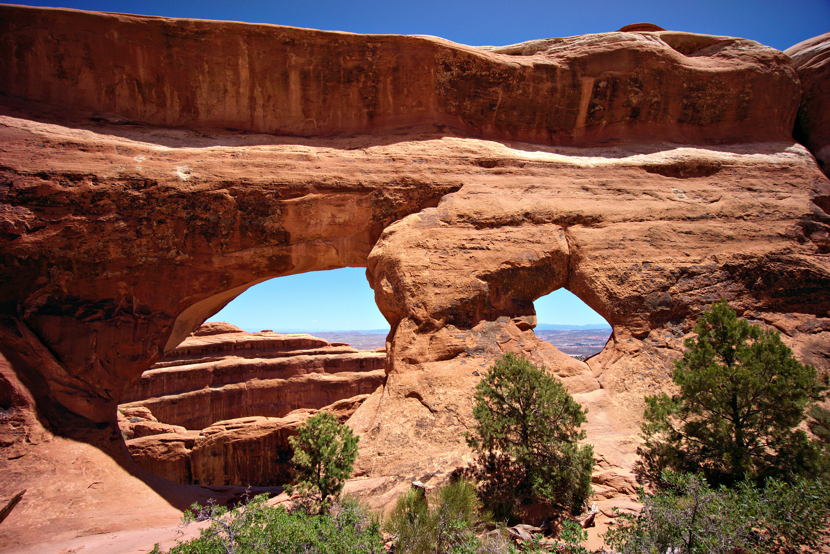
 Partition Arch:
This is a view from the large sloping ledge on the other side of Partition Arch.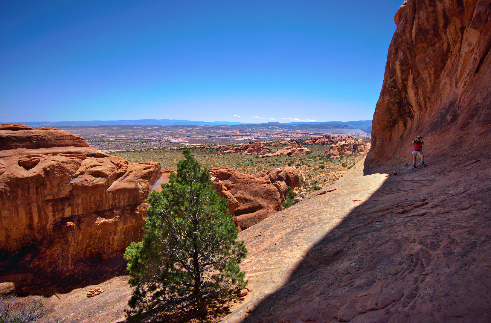
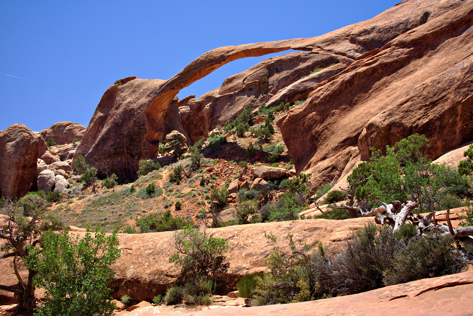
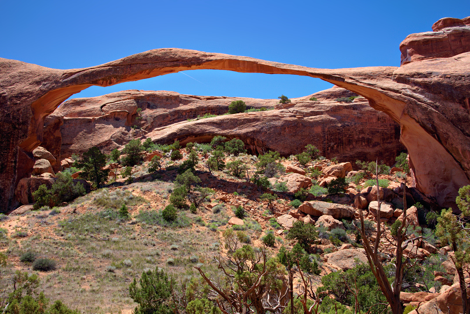
Two views of Landscape Arch:
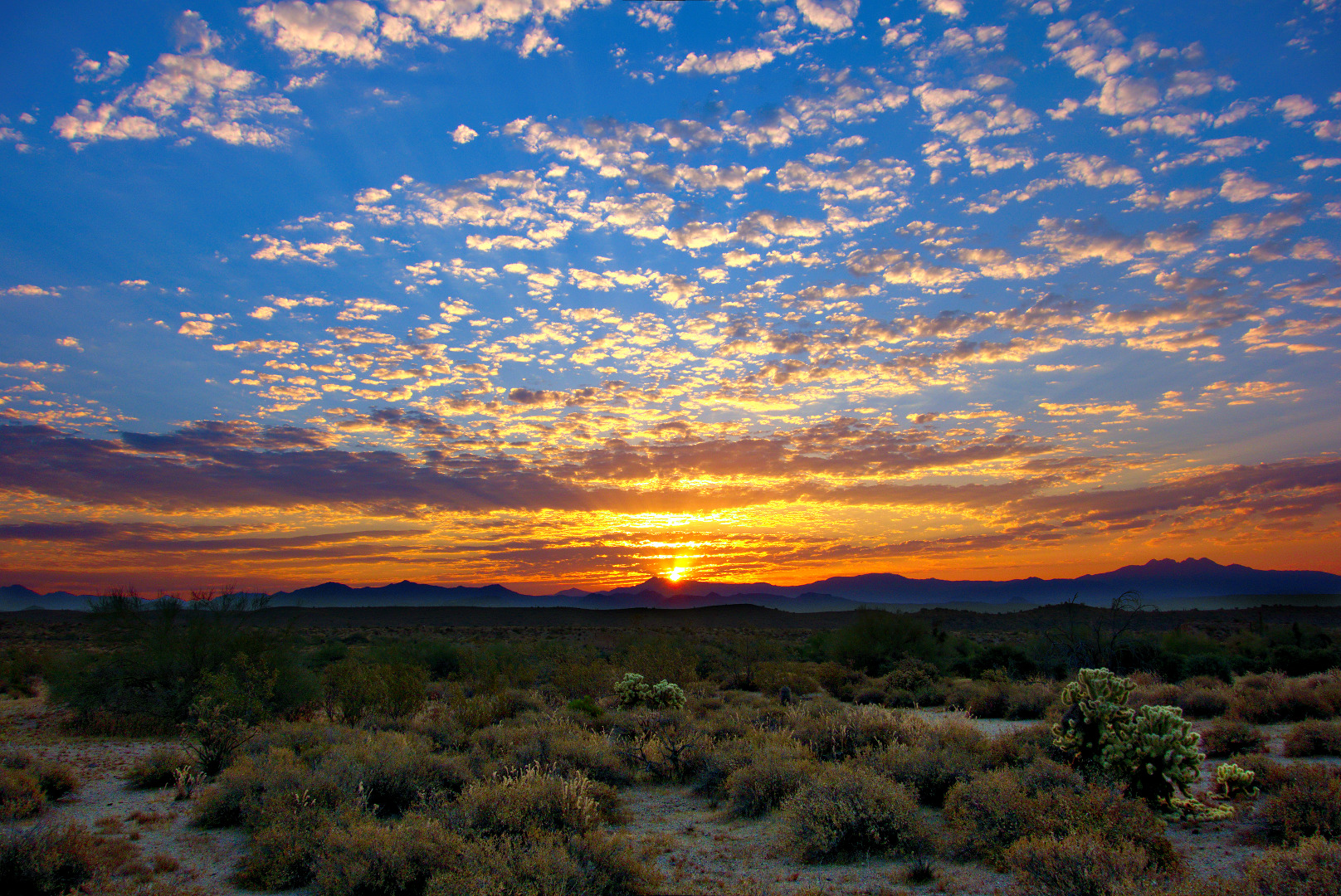
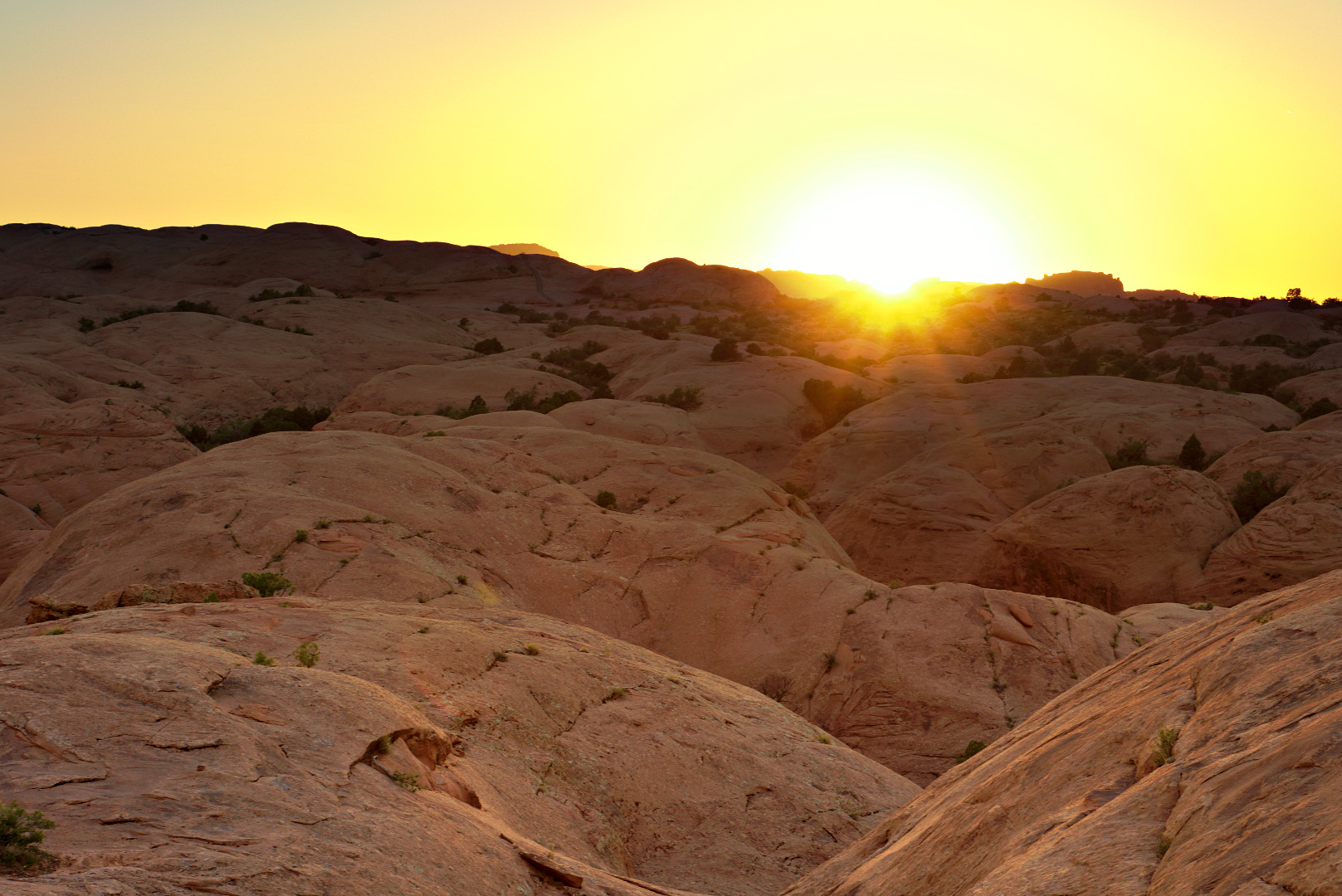
Not an awesome shot, but this is where I happened to be when the sun set.
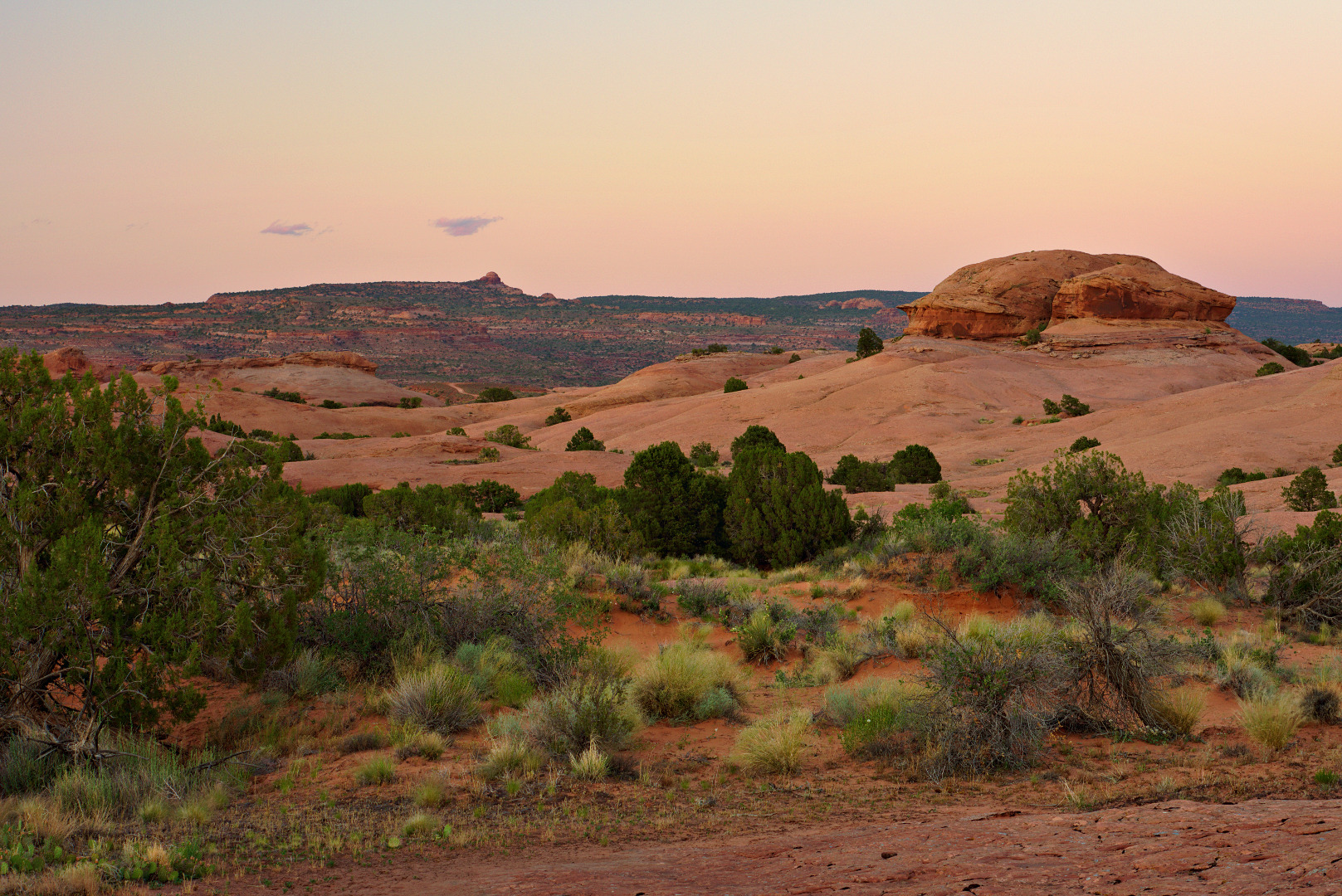
 I got this shot after sunset:
I hiked the Slickrock Bike Trail Practice Loop on Saturday evening and took this photo of one of the canyons there. The canyon was very dark; I can see substantially more detail in this photo (which was composed from three exposures) than I could when I was there.