Sculptor Kendra Fleischman created this work, titled Truth. It was donated in 2005 by The Fountain Hills Civic Association and Jackie & Jerry Miles.
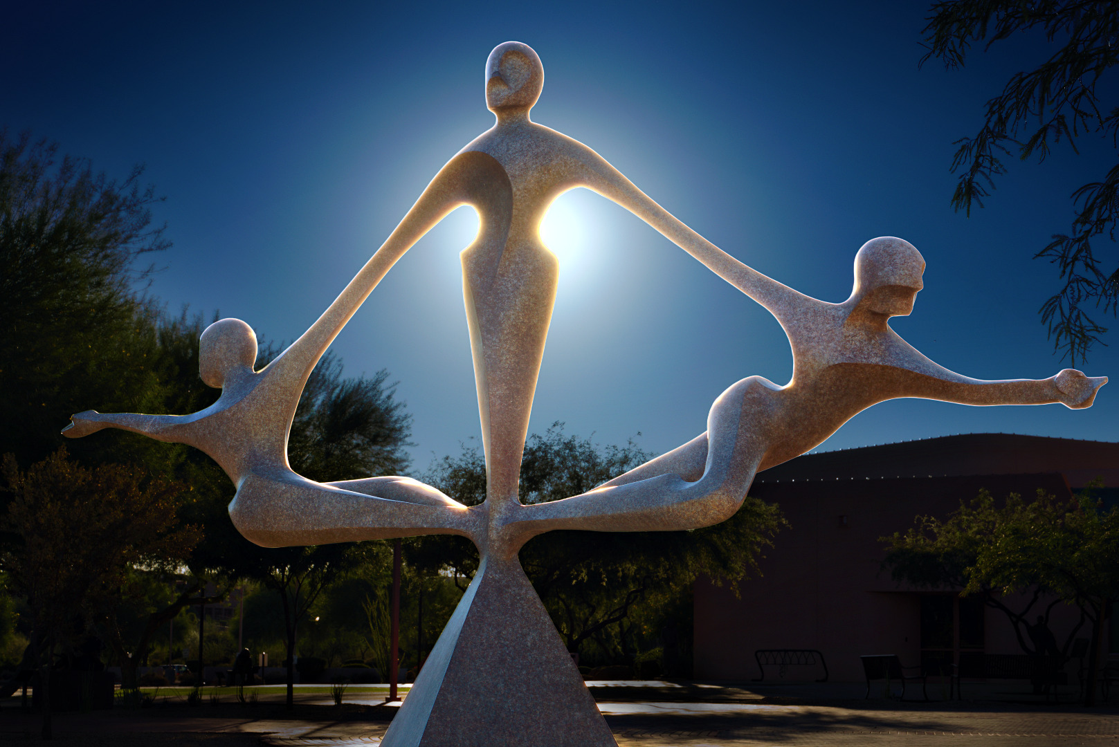
Sculptor Kendra Fleischman created this work, titled Truth. It was donated in 2005 by The Fountain Hills Civic Association and Jackie & Jerry Miles.
Embrace was created by sculptor David Hiles. It was donated by The Fountain Hills Civic Association, The Sunridge Foundation, and many others – see photo of plaque below for complete list. (Note: The plaque is in poor condition; I had to do a significant amount of touch-up to make it look presentable.)

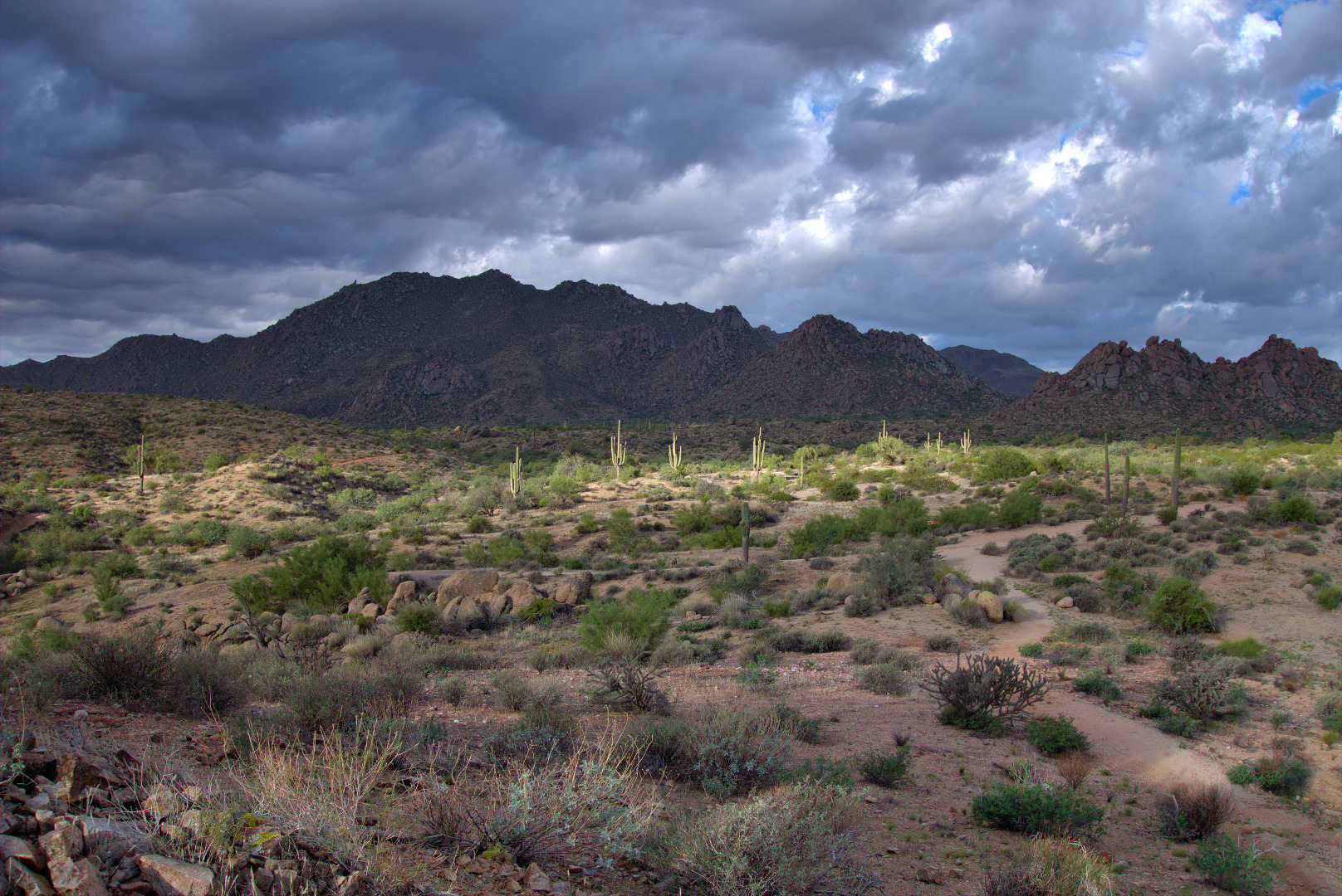
Friday’s hike started from the Tom’s Thumb Trailhead. Ranger Amy lead four others (including Bill and Kathy from last week’s hike) on a hike of the Marcus Landslide Trail.
Bob, Linda, and I hiked less than a half a mile with Amy and her group. We parted ways when we got to the Feldspar Trail. I had hoped to hike to the top of Morrell’s Wall. We made it as far as the base of the wall, but seeing no easy way to the top, we made our way over to Mesquite Canyon instead. From there we followed the trail leading to Hog Heaven. We hiked up past Hog Heaven to the Thumbnail Pinnacle and continued on to the East End, which is the highest point in the McDowells. We finished our hike by taking the Tom’s Thumb Trail back to the trailhead. We hiked only about five and a half miles but had well over 2,000 feet of total ascent for the day.
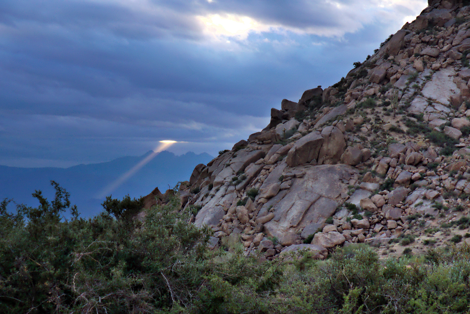
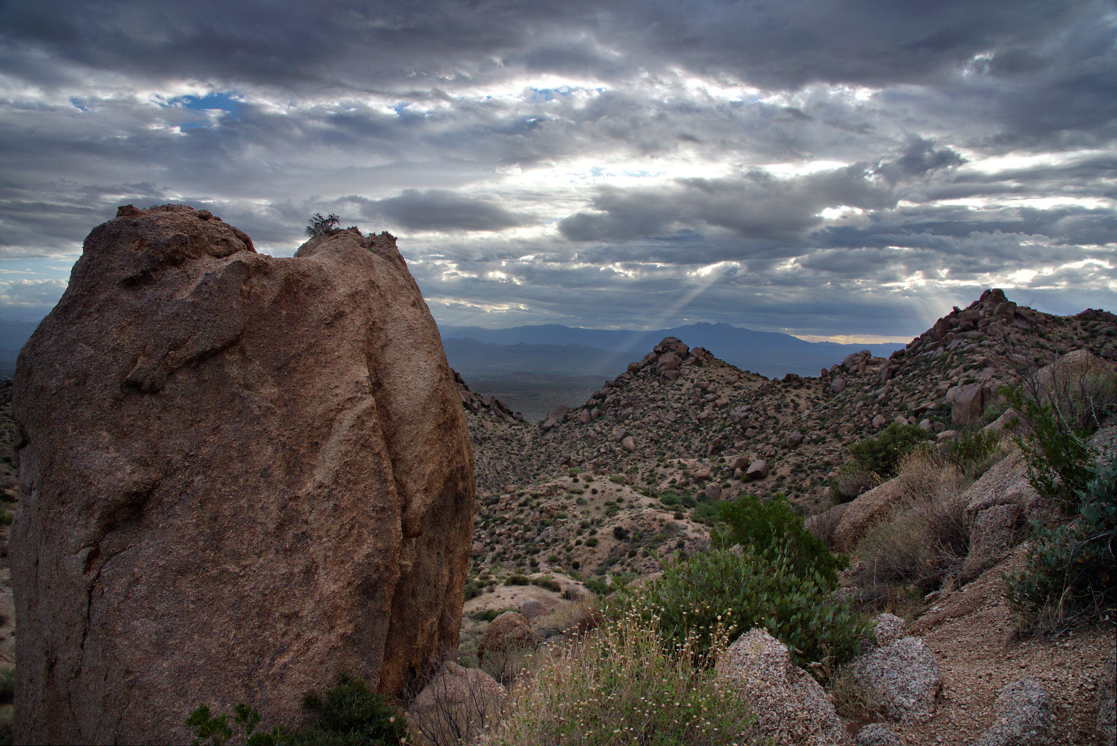
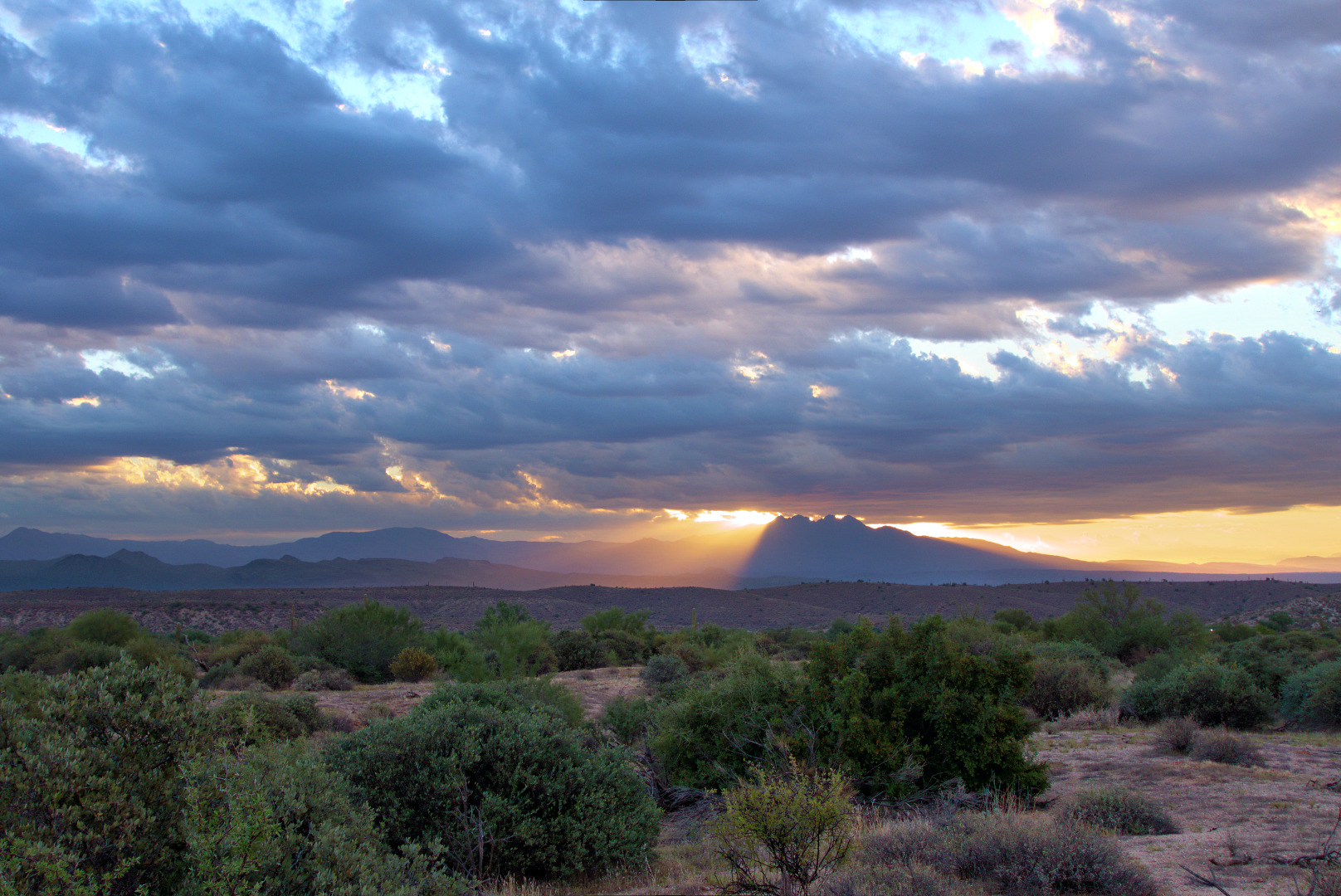
The day started out cool and cloudy. We saw this beam of light shining through the early morning clouds.
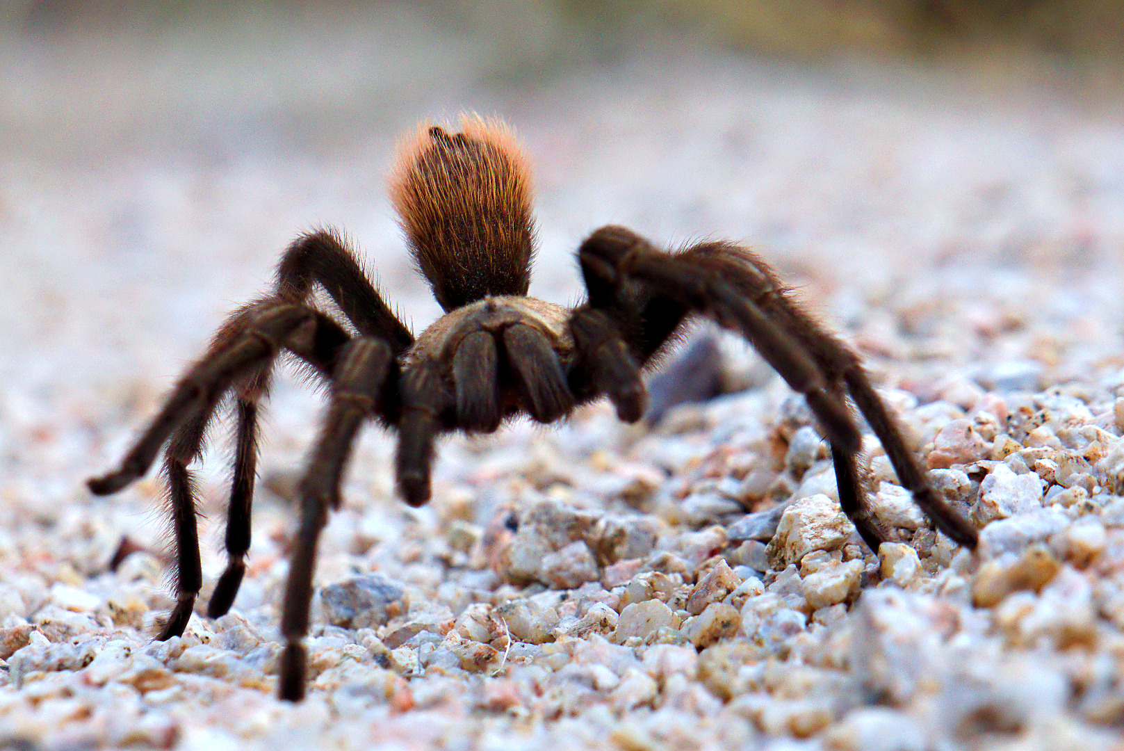
 Shortly after we got on the Feldspar Trail, we saw this tarantula. I took lots of pictures, but am only including three of them here.
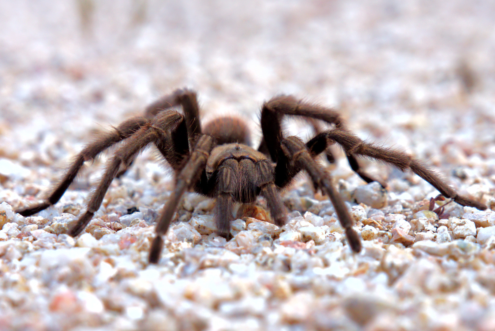
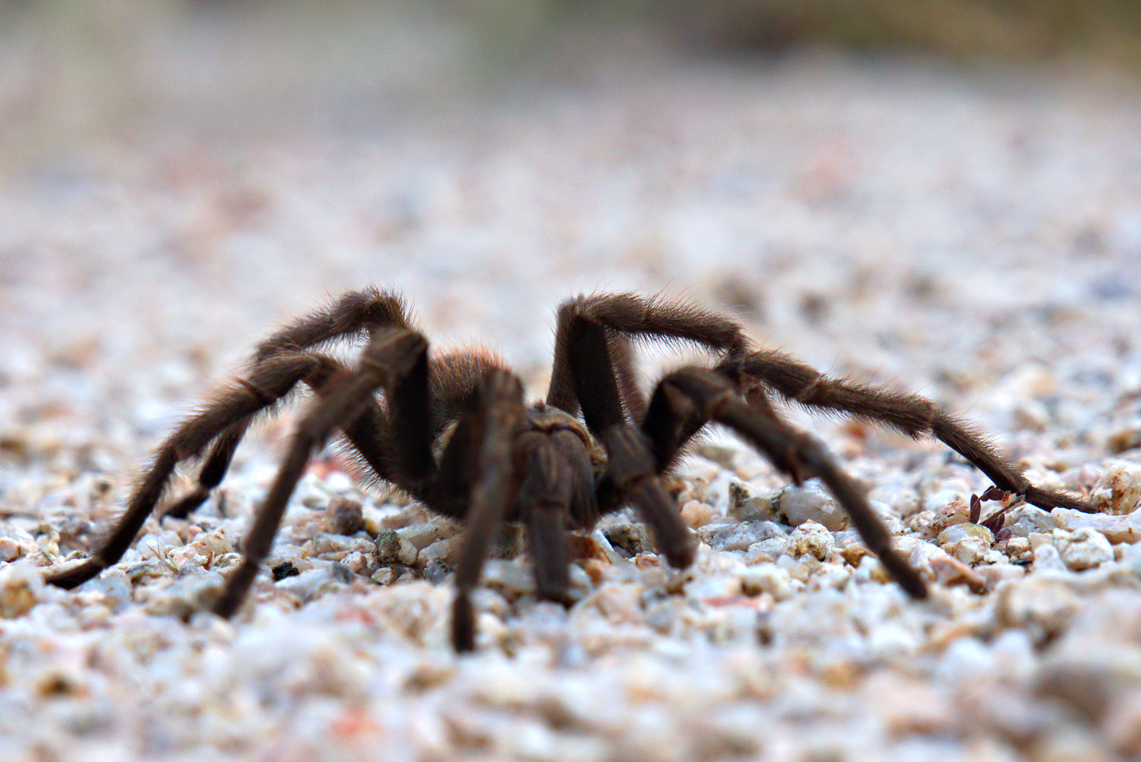
In this shot, it had woken up and was starting to crawl towards me.
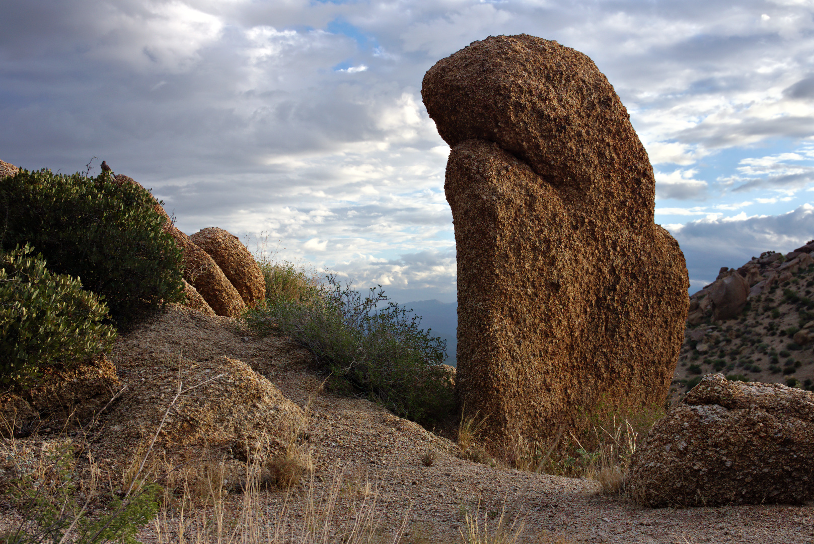
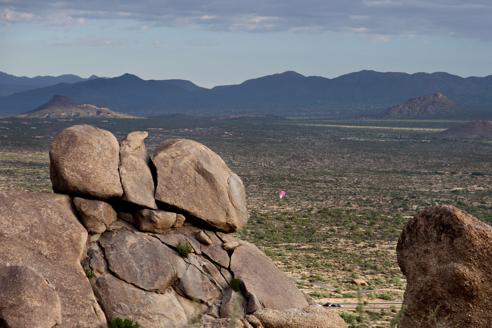
 We passed this boulder on our way up to Morrell’s Wall.
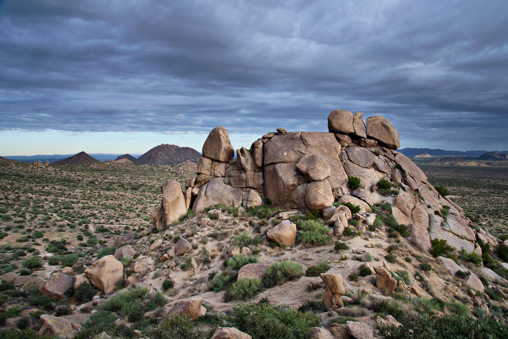
 This rock pile is part of the Morrell’s Wall Parking Lot Area. There is no longer a nearby parking lot, but there was a nearby temporary parking area constructed for Tom’s Thumb Trail not long ago. The area had been named well before that however. In the past, a narrow jeep road lead to the rock pile with a turnaround / pullout that could accommodate two or maybe three vehicles.
 We saw a paramotorist (powered paraglider) just after takeoff as we rested on our way up to Morrell’s Wall. We also saw some hot air balloons far off in the distance. I took some photos, but the balloons were too far away to see clearly.
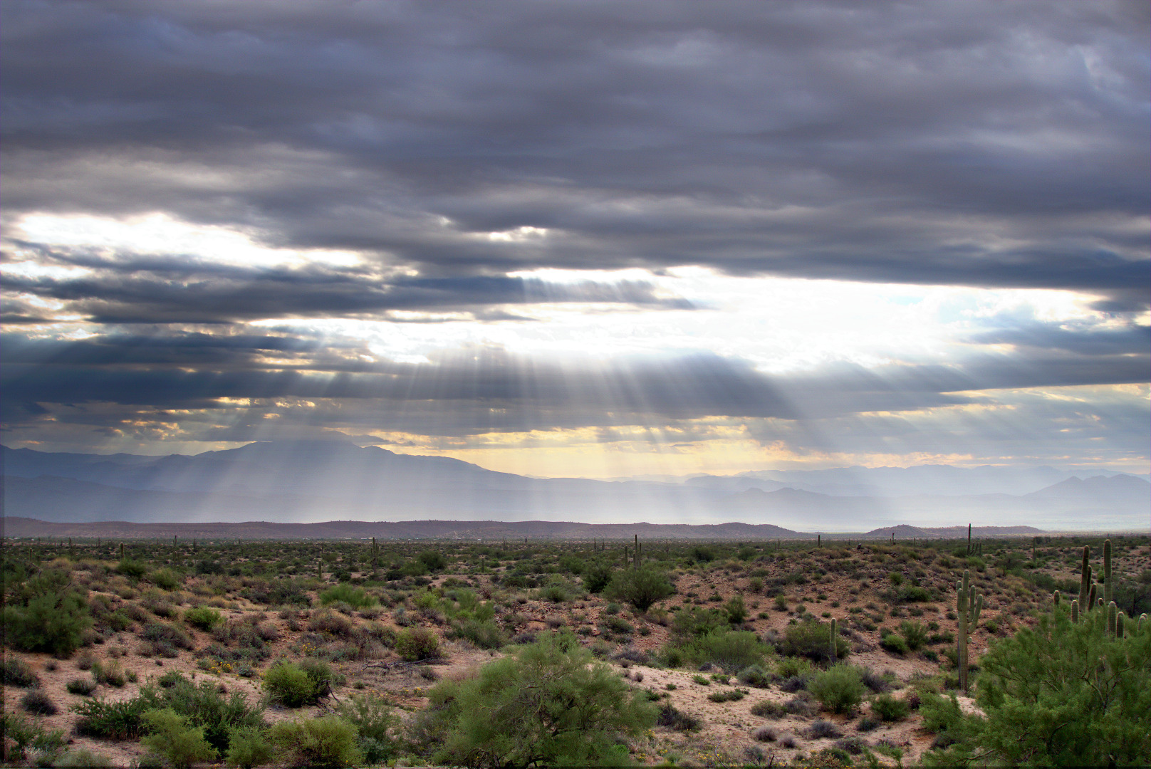
More interesting clouds…

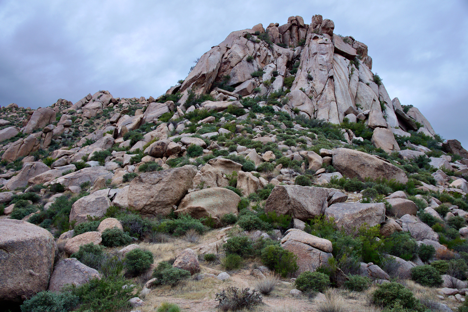
In this photo, below, of Morrell’s Wall, it looks like it should be possible to get to the top by going left, but once we got there, our way was blocked by large boulders and unforgiving vegetation.
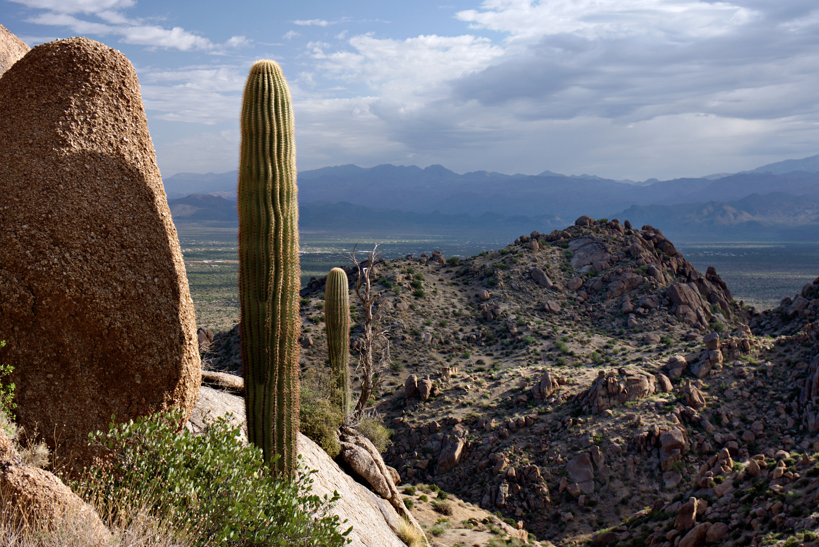
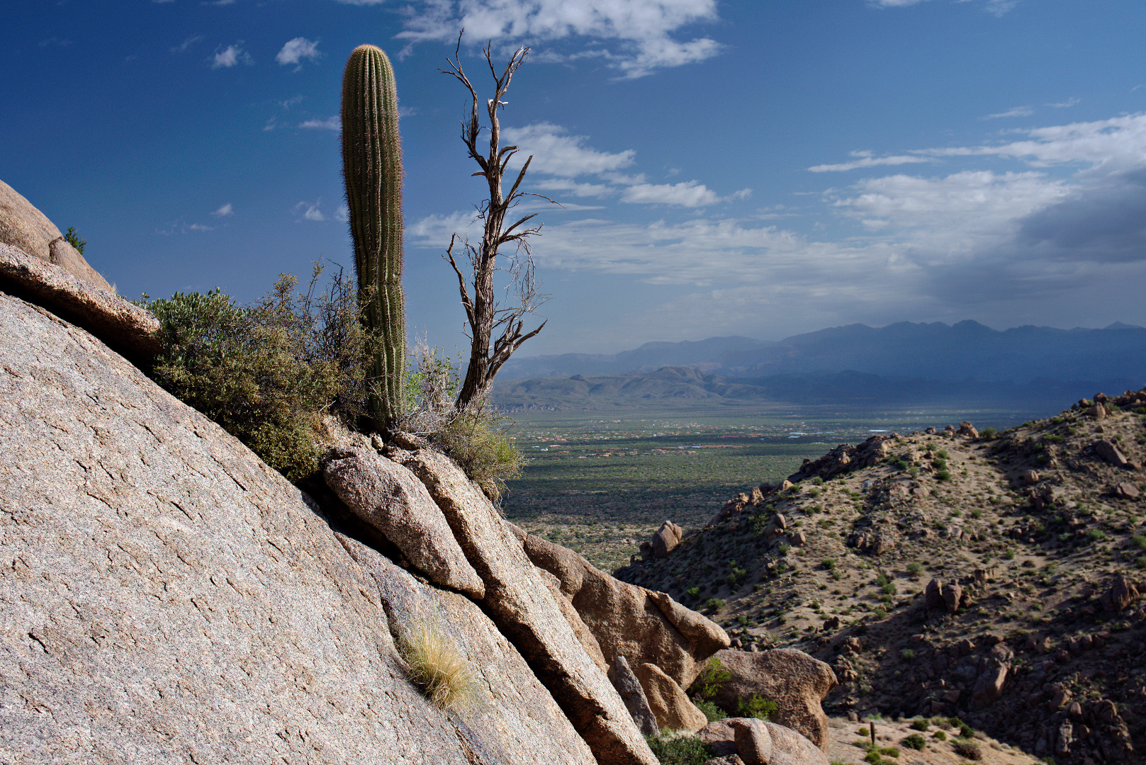
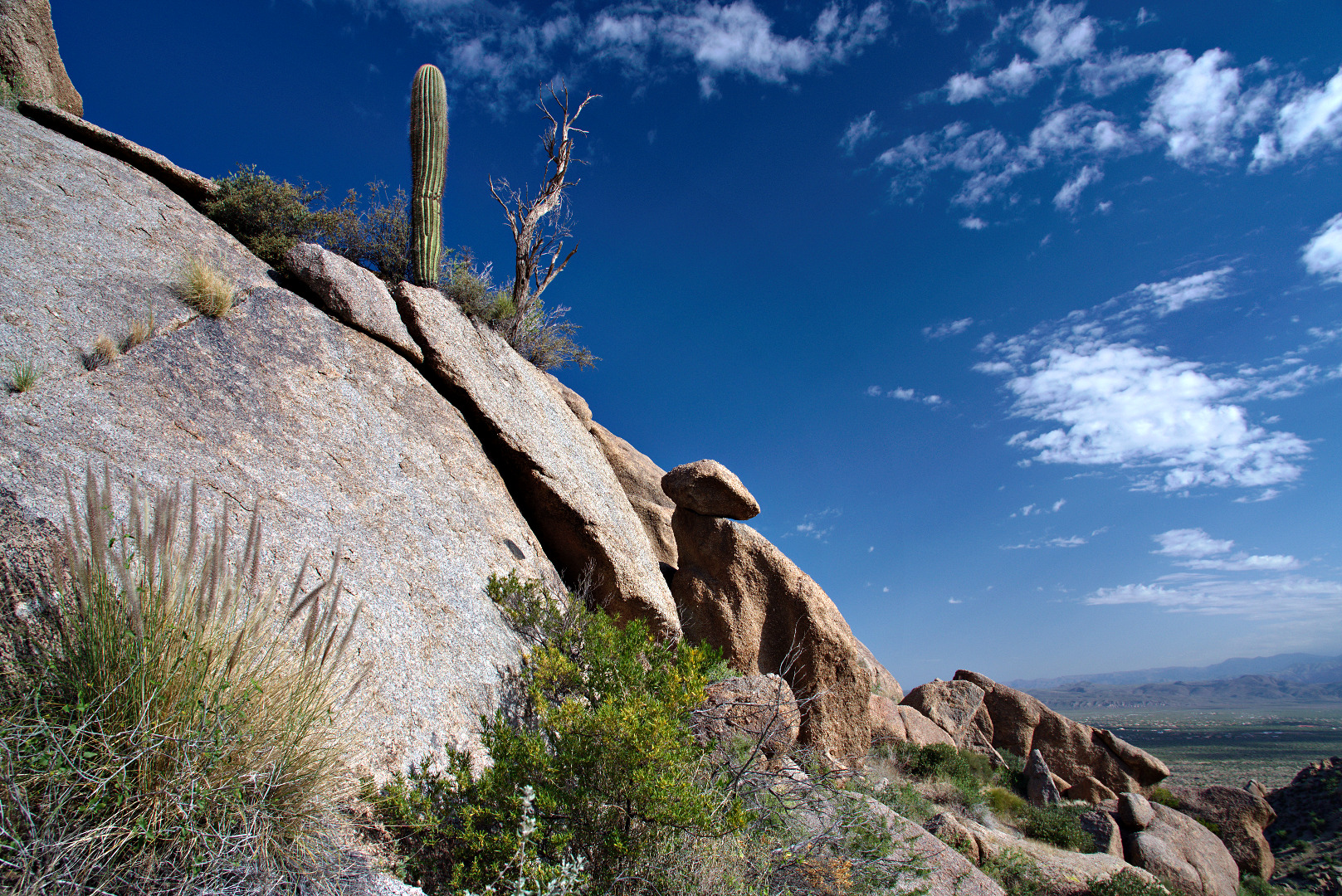
I liked this view of two saguaros with a dead tree up on a rock wall. I took several photos from different angles.
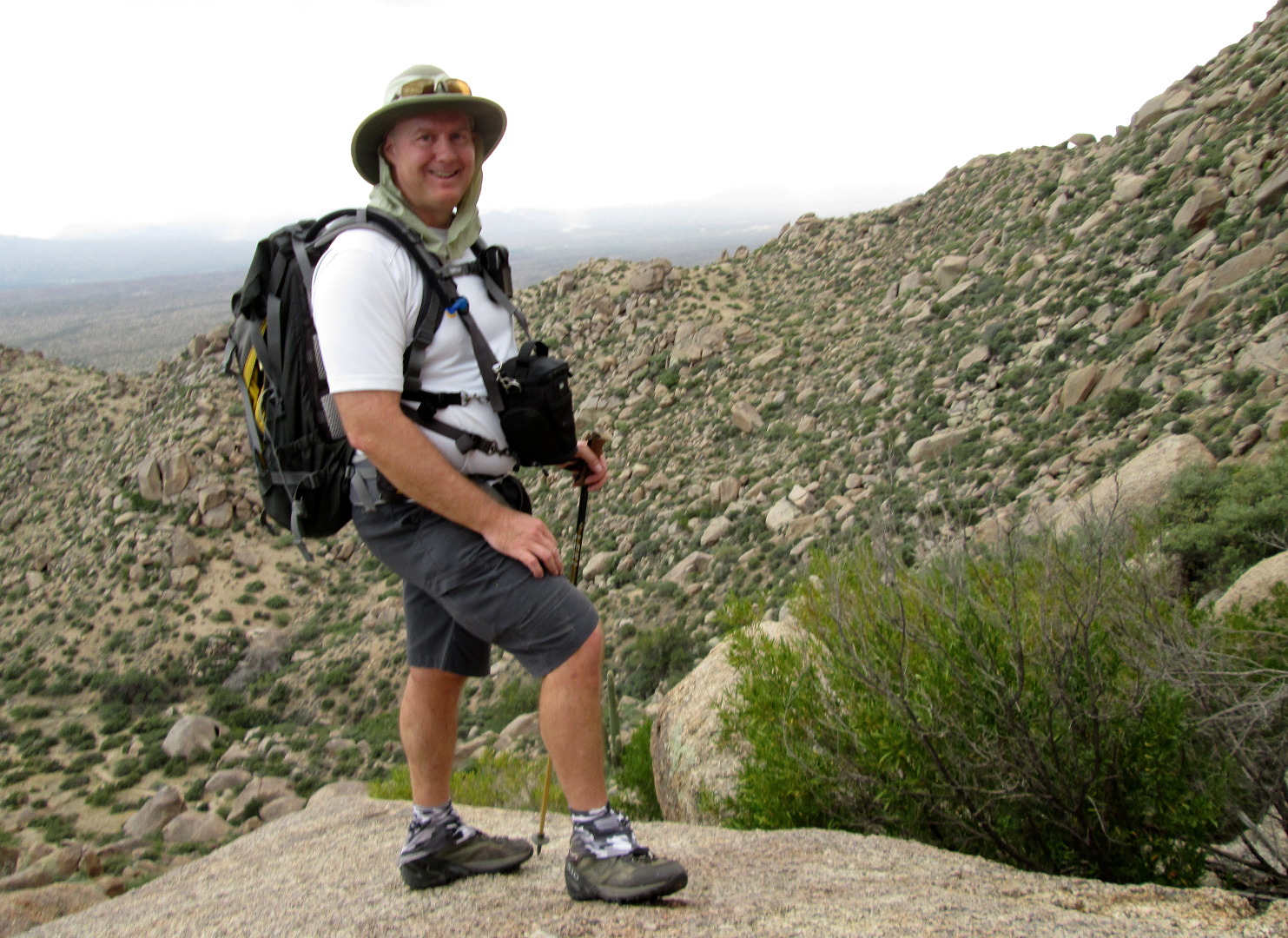
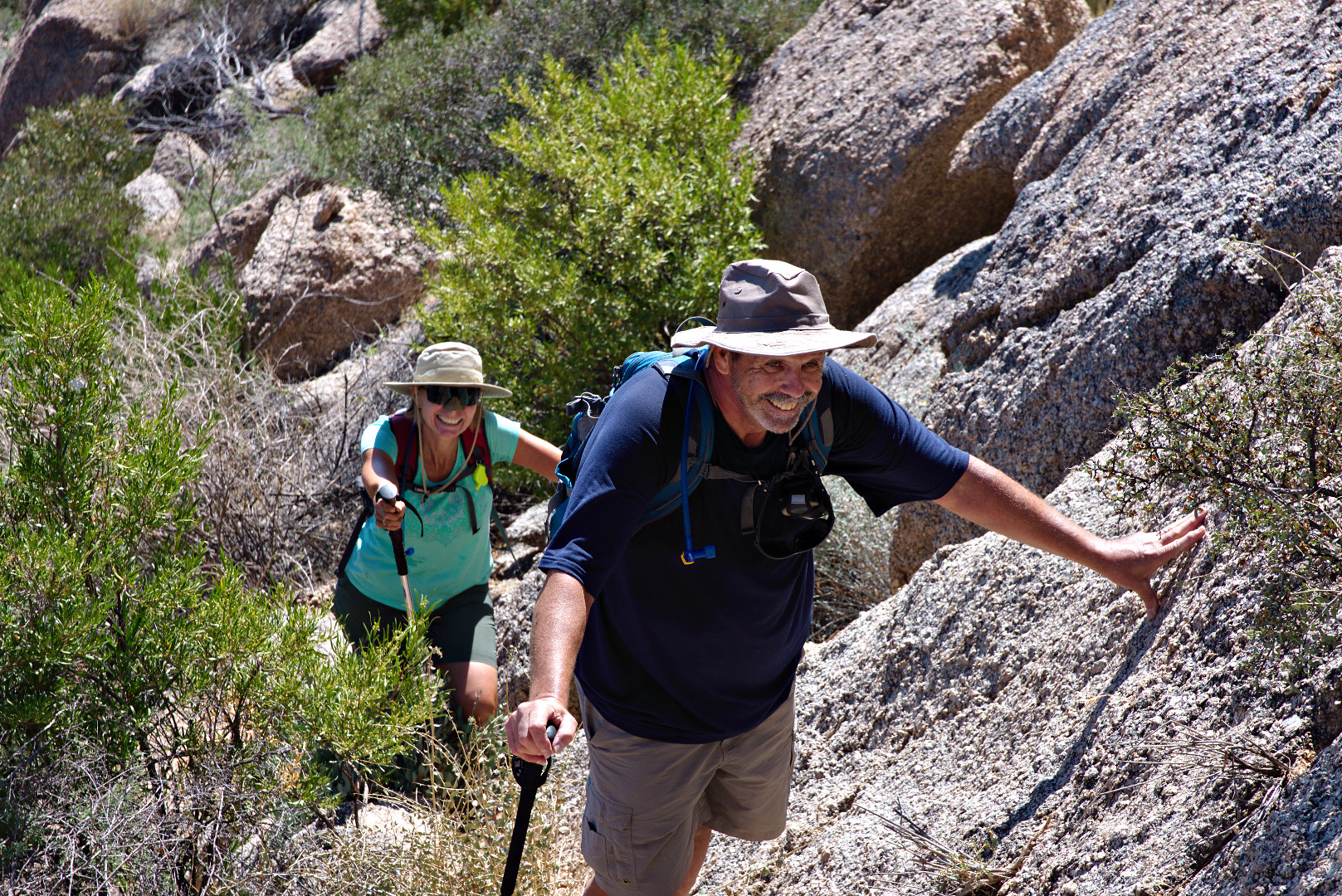
 Linda took this photo of me as we were hiking up to Hog Heaven.
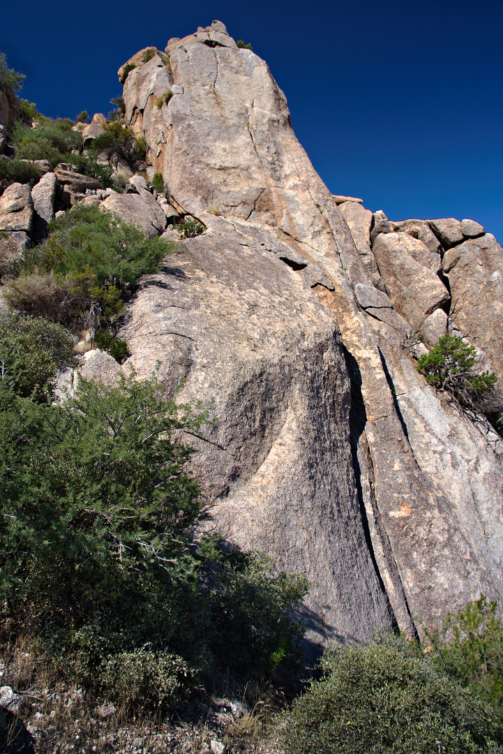
This is the Main Wall at Hog Heaven.
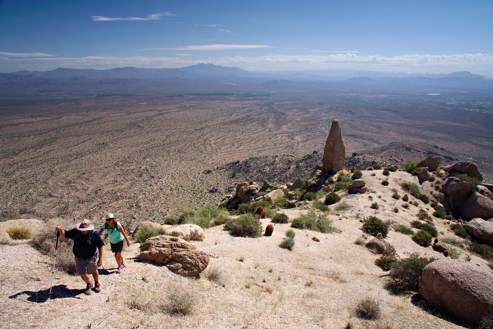
Bob and Linda make their way up the trail past Hog Heaven.
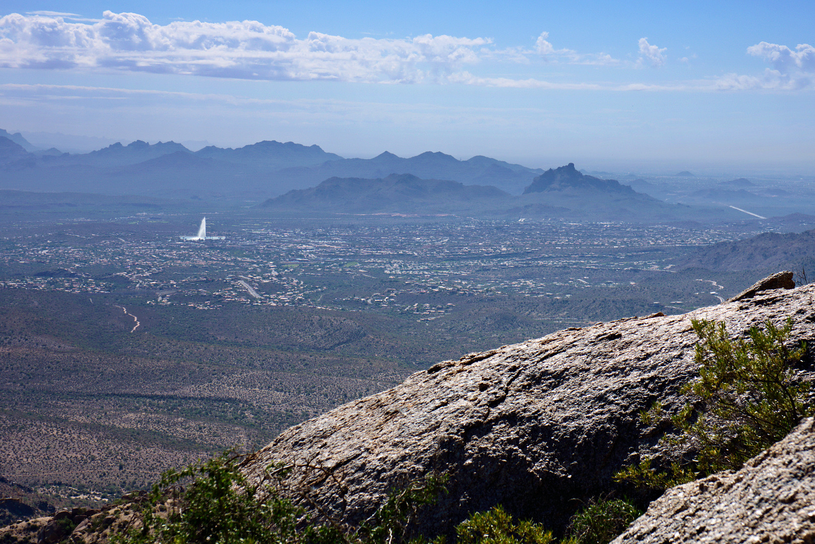
A wide-angle view from partway up the ascent adjacent to Hog Heaven. The wall is quite tall – it took us a while to get above it. The Fountain (in Fountain Hills) can be seen in the right hand corner of this photo.
Another view of the Fountain. Red Mountain can be seen in this photo too.
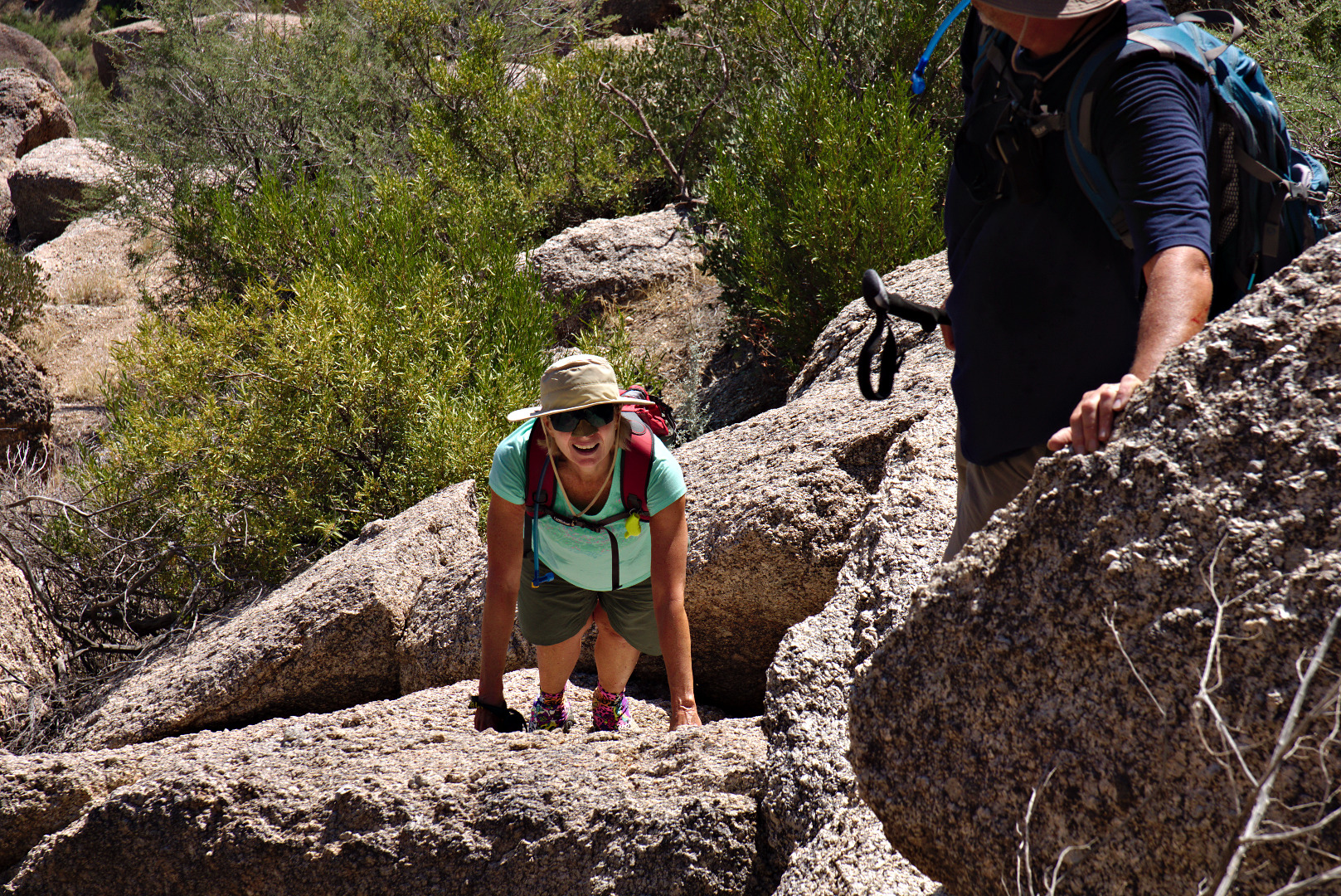
Linda scrambles up some more rocks.
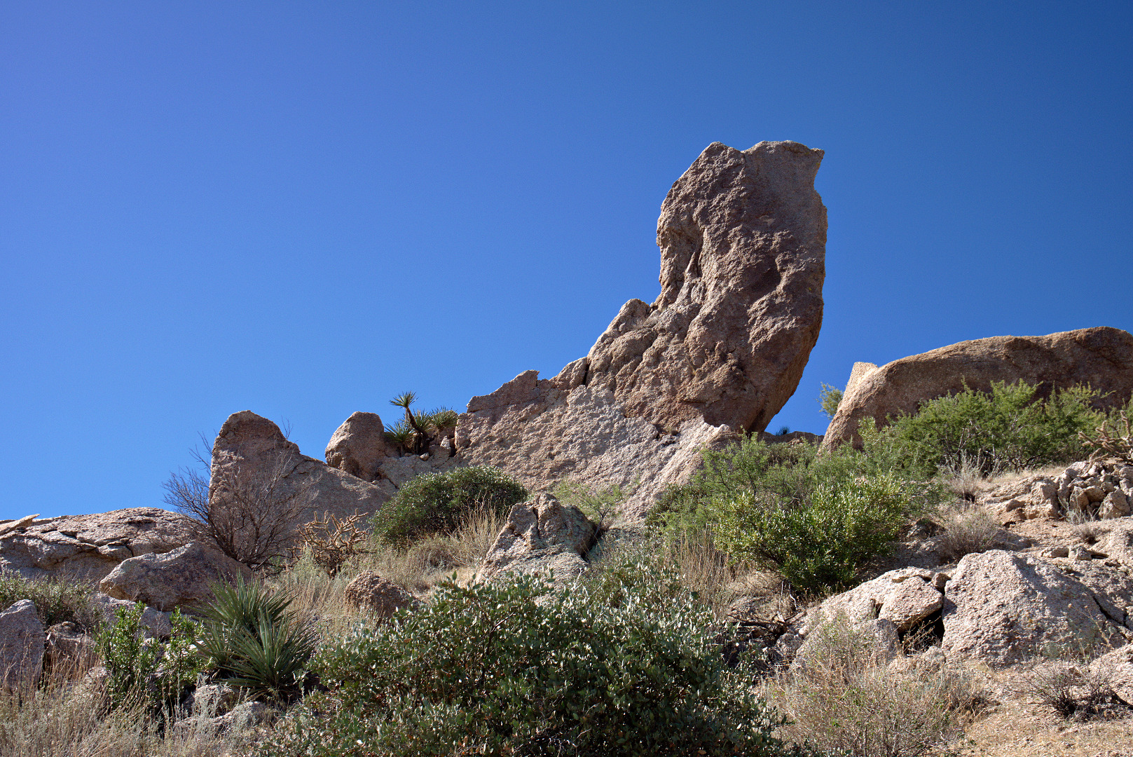
 A view of the Thumbnail Pinnacle from below.
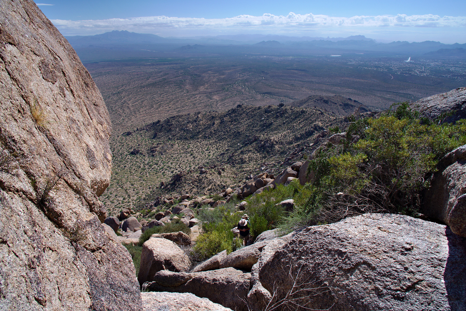
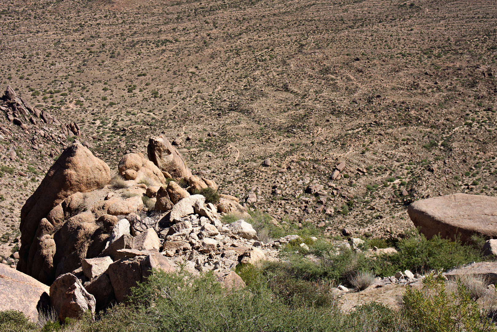
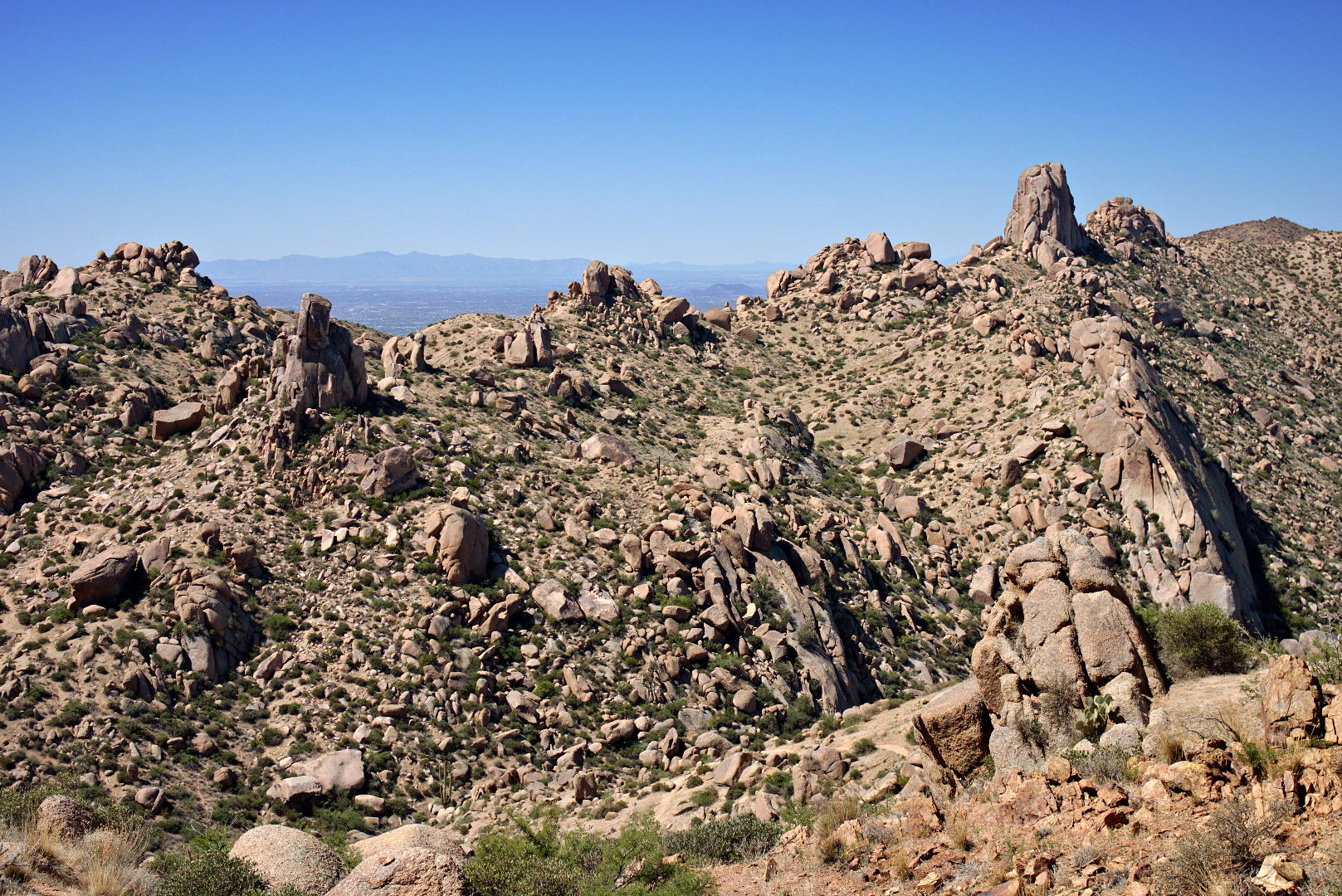
 A view looking down at the top of Hog Heaven. Further below, part the Marcus Landslide slide mass, is a large boulder known as Submarine Rock.
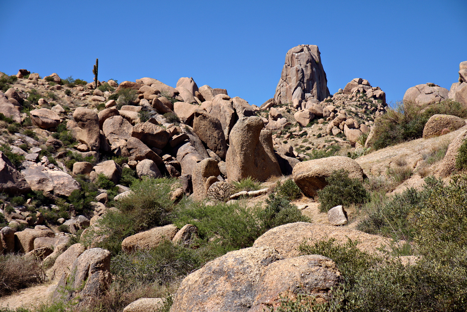
 A view looking up at the Thumbnail Pinnacle. I happened to be there at just the right time of day so that I could get the upper part of the pinnacle to partially block the sun.
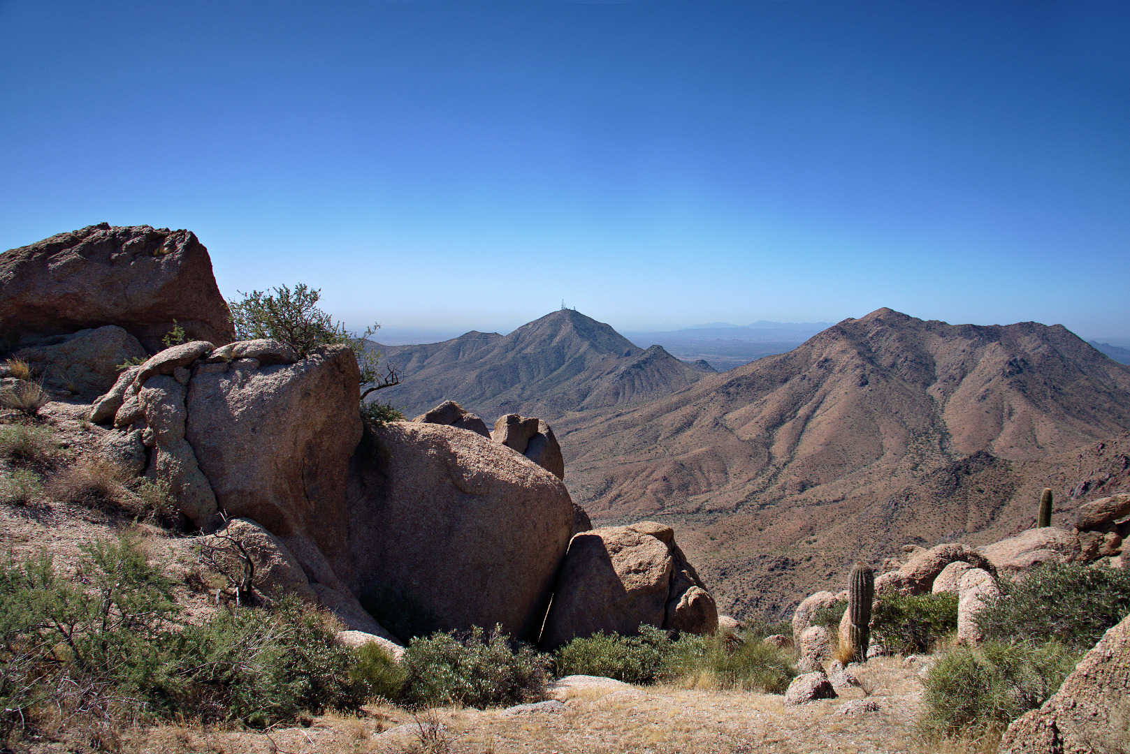
 Once we got to the Thumbnail Pinnacle we were afforded new views to the east. Thompson’s Peak (with the antenna towers) is visible in the photo below.
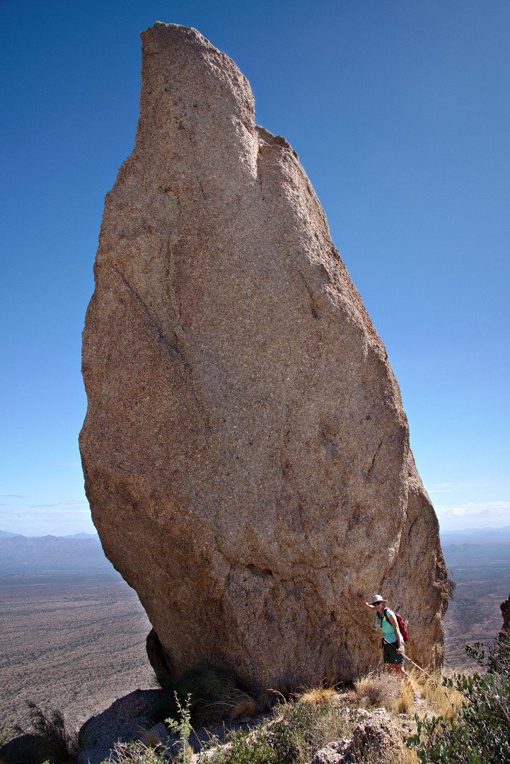
 Linda, standing next to the Thumbnail Pinnacle. It’s surprising how different it looks depending upon from where it’s being viewed.
 Getting to the Thumbnail Pinnacle was a goal, but there was more uphill ahead of us. This photo below, looks back at the Thumbnail Pinnacle, before we went over the ridge blocking our view of it.
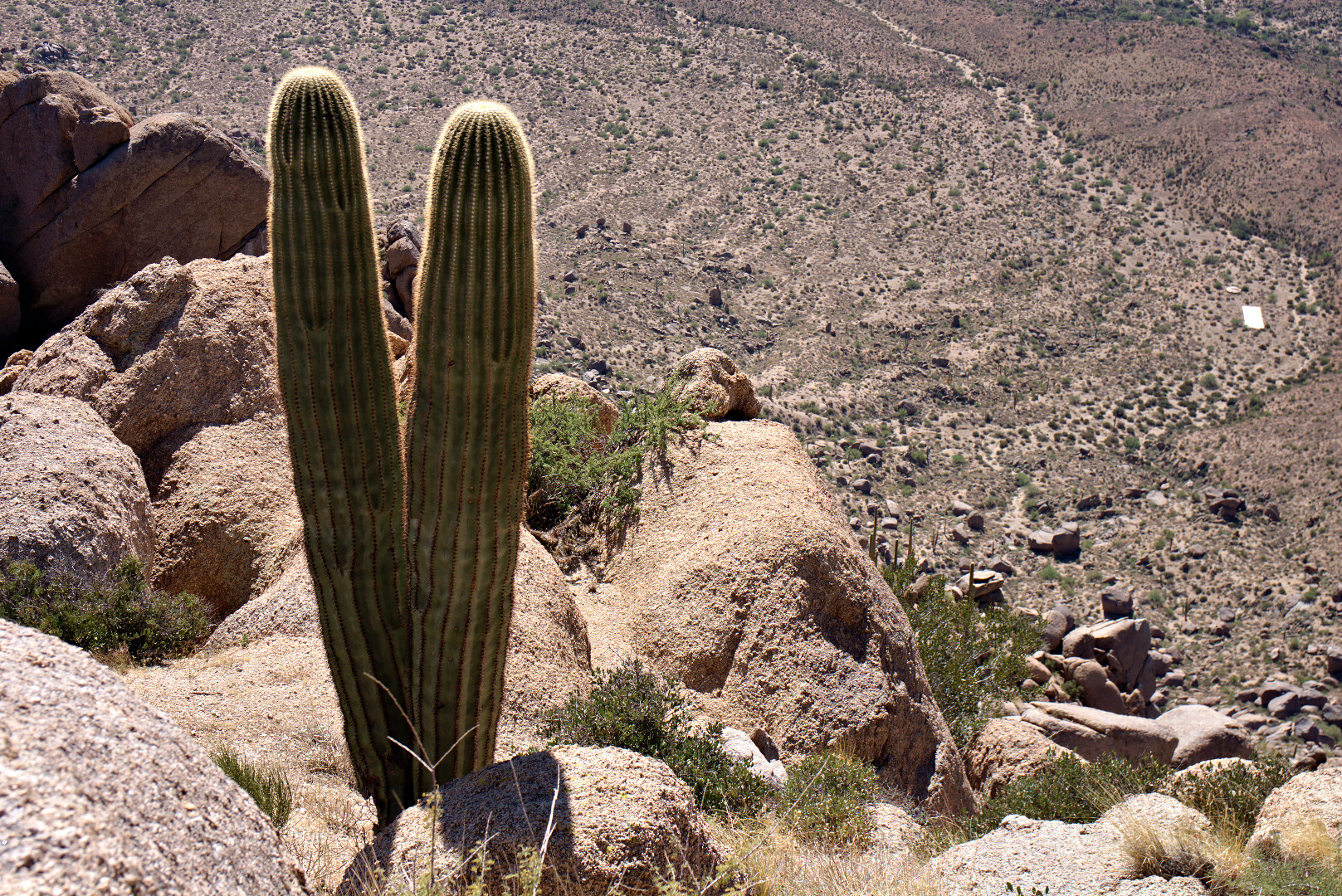
 A double saguaro! And… it’s a long way down!
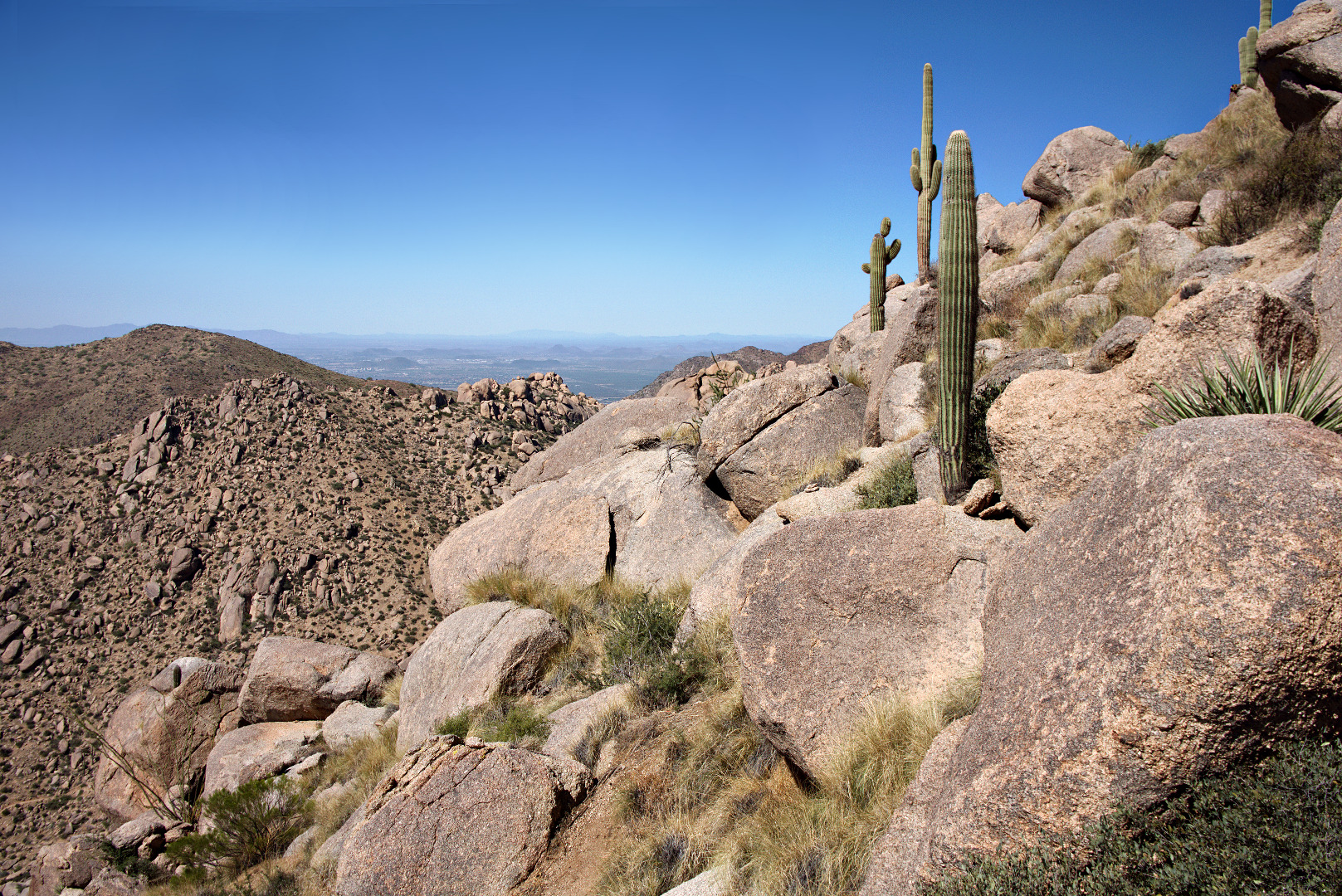
 More saguaros upon the boulder encrusted ridge. The trail lead over and around some of these boulders.
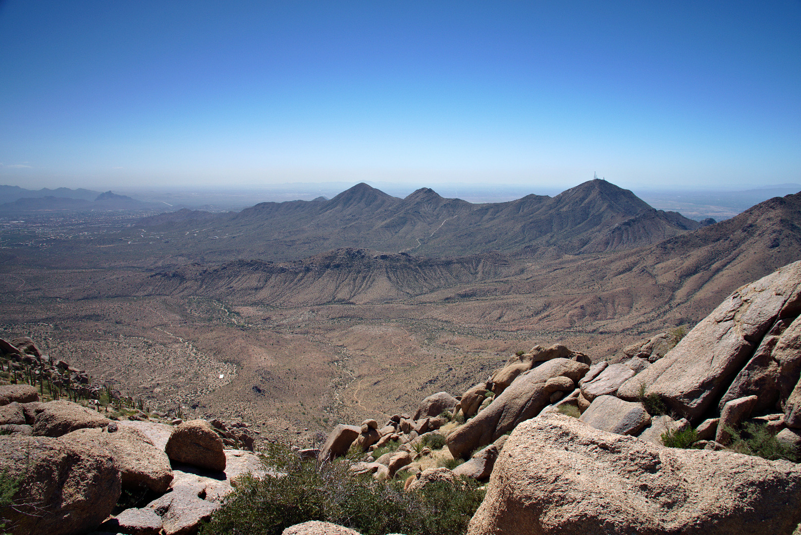
Looking back towards Thompson Peak. The East End Trail can be seen far below.
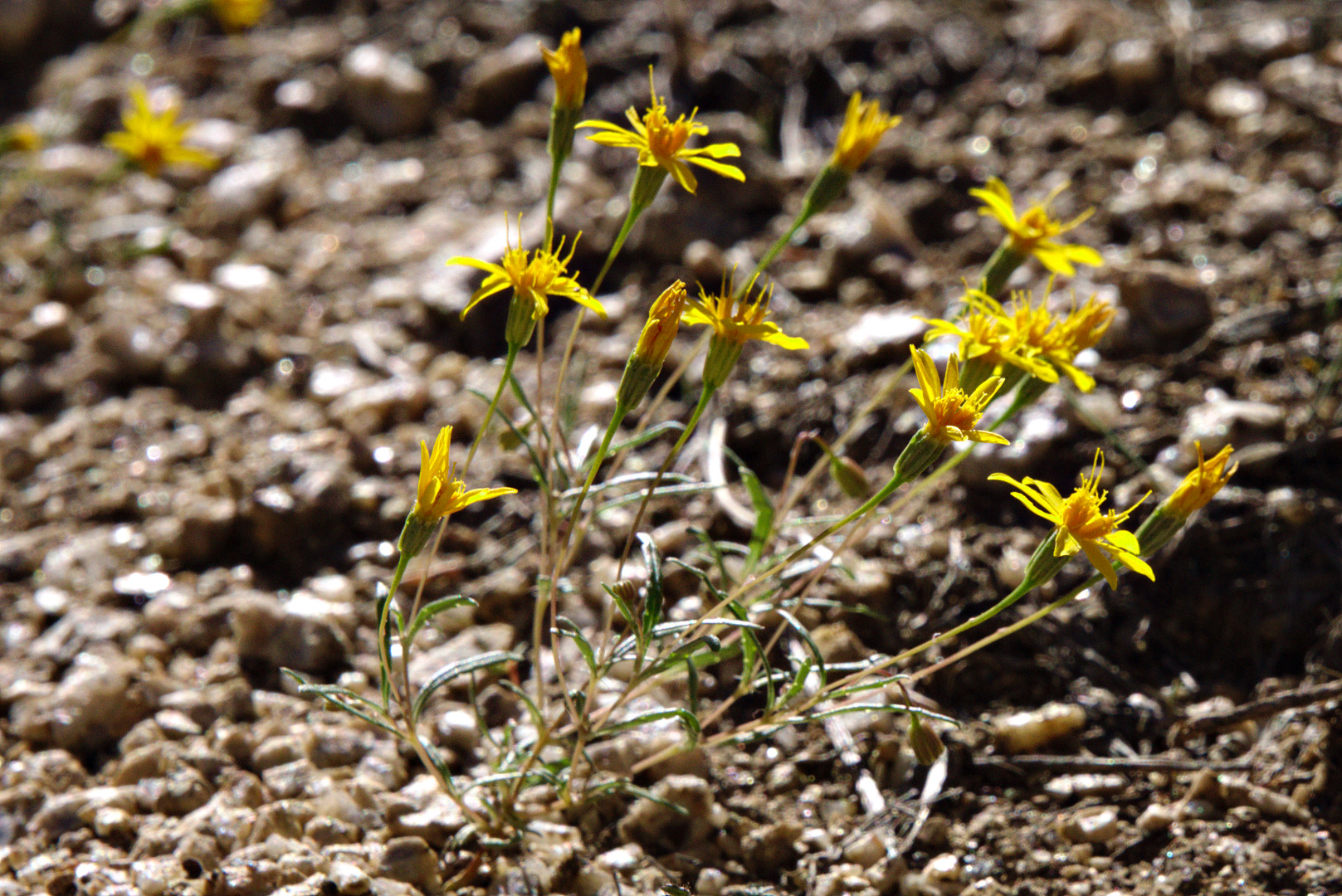
We saw some very tiny yellow flowers. Each flower was smaller than my pinkie fingernail.
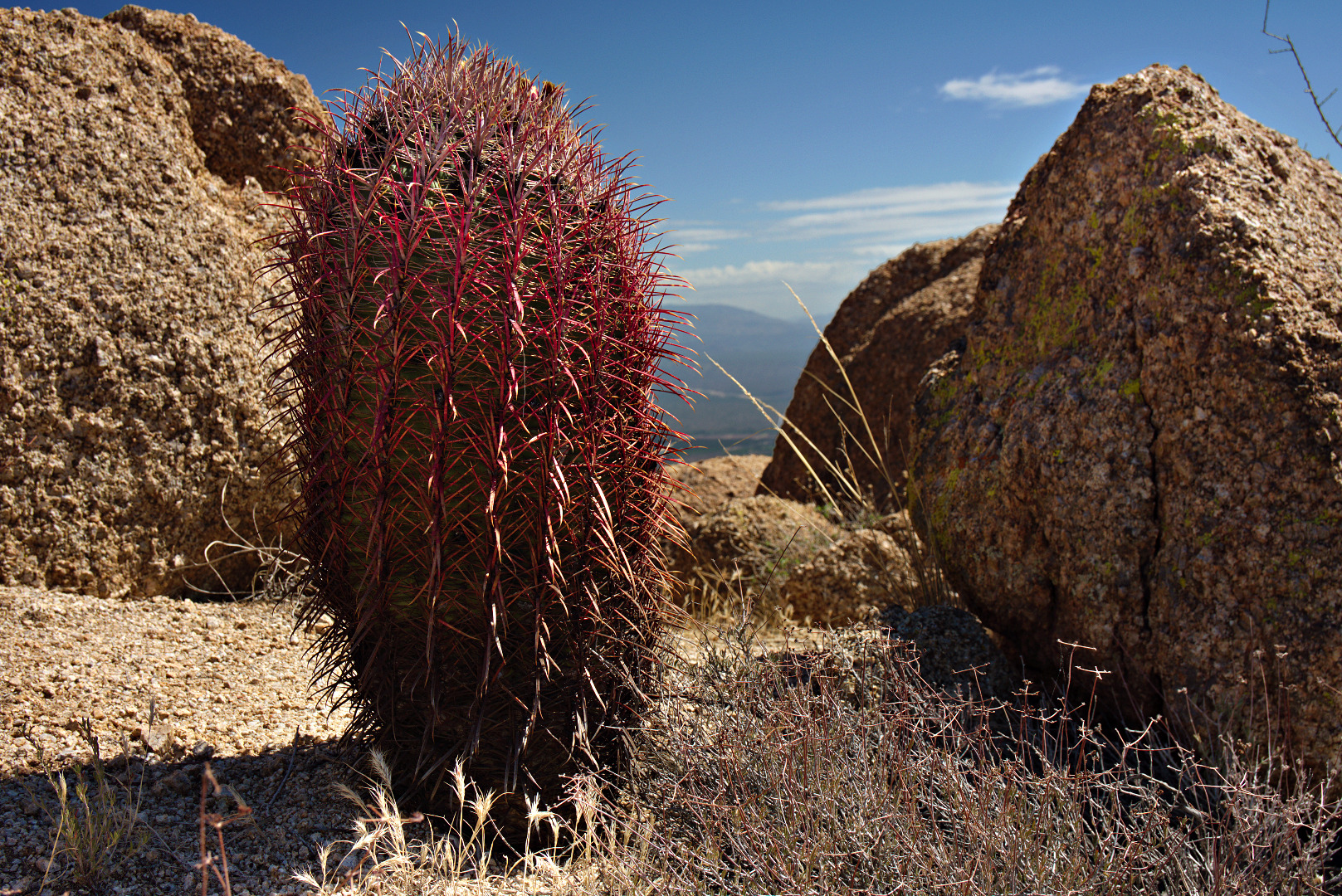
A barrel cactus with extraordinarily red needles.
Yet another view to the southeast.
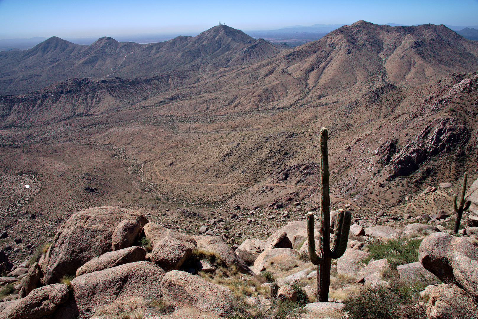
 At this point, but behind the camera, we’re approaching the East End, which is the highest point in the McDowells. This photo, below, looks back at the boulder encrusted ridge that we hiked to get over to this point. The Thumbnail Pinnacle is not visible from here. It is below at the left end of this ridge.
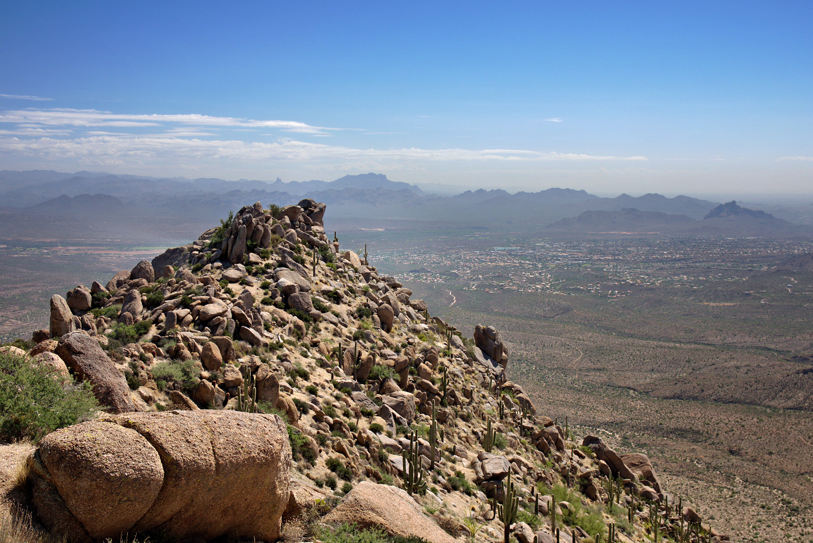 A view of Glass Dome, on the left, and Tom’s Thumb on the right. Gardener’s Wall is below and slightly to the right of Tom’s Thumb in this photo.
We saw a larger yellow flower as we were descending.
 A view of Tom’s Thumb from the Tom’s Thumb Trail.
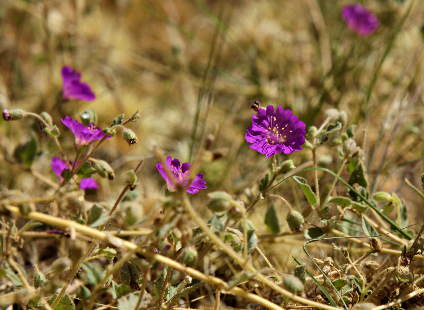
 We saw some purple flowers too.
 On the way down, we saw climbers on Gardener’s Wall. There are two climber’s at the belay station midway up the wall. A third and maybe even a fourth climber are at the bottom waiting to make their ascent. As we watched, we saw the third climber start on the first pitch of Hanging Gardens (5.5).
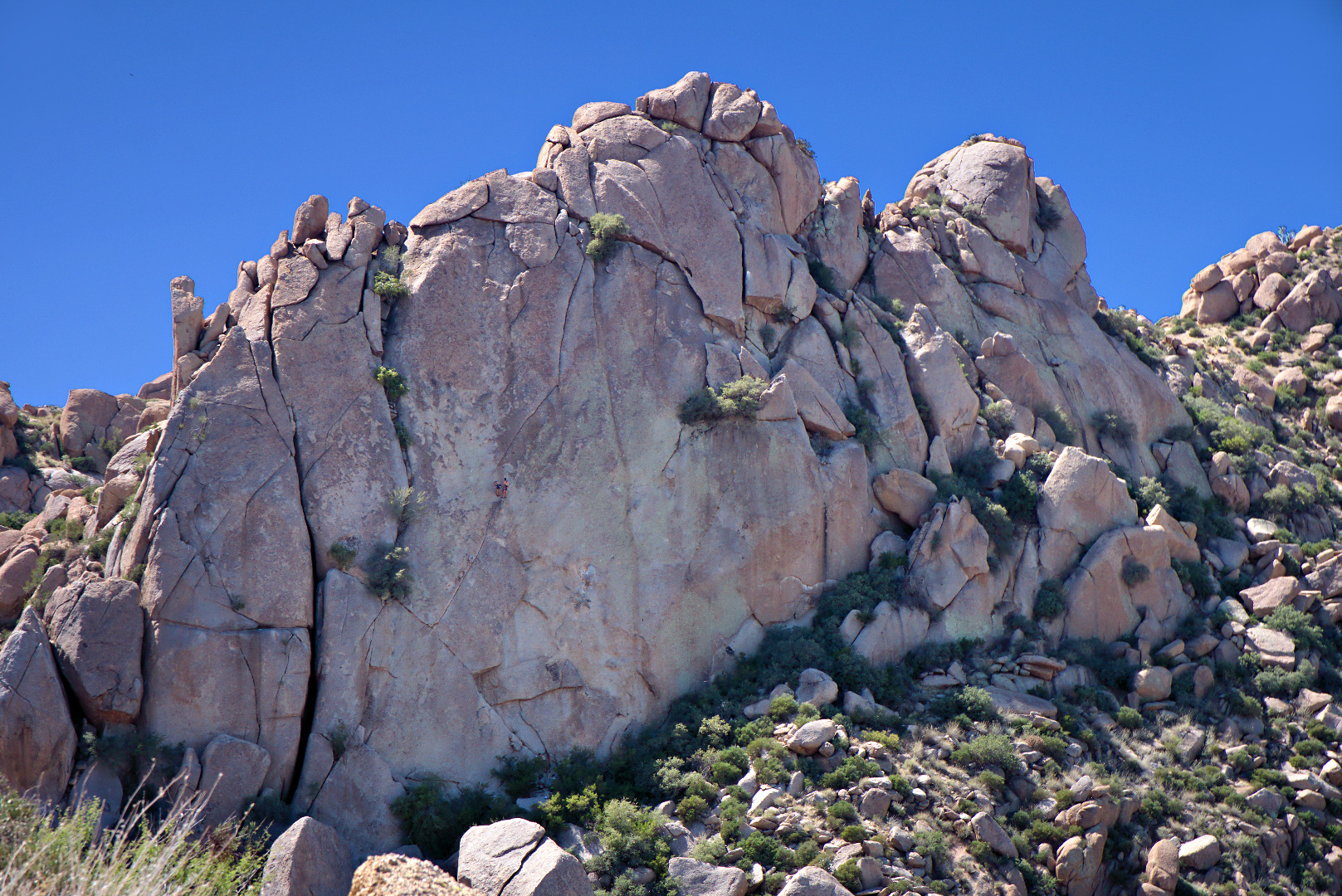 Here is a crop of the above photo showing the climbers. From the bottom, the climb follows crack system that leads up and left, where it intersects another crack leading up and right. Past the belay station, there are a few face moves that lead to another crack leading up and to the right. My recollection is that you have to work your way left again once you get close to the top.
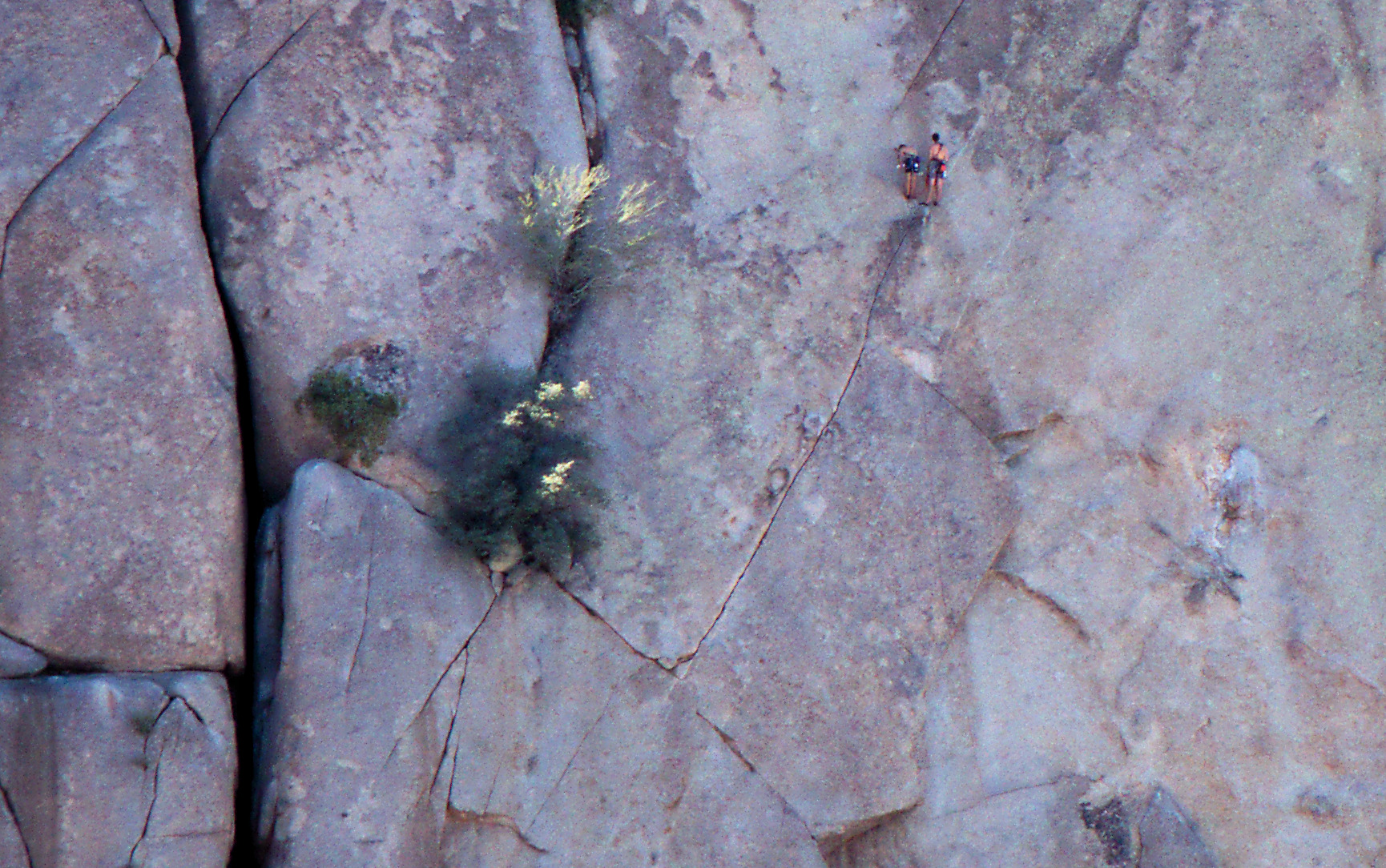
Marie suggest this shot. I noticed that we could see Four Peaks in the right-most windows, so adjusted the tripod’s height and location to see as much of the that reflection as possible.
It was an interesting exercise to account for the white balance in the shade of the patio in contrast with the sunny area on the grass. I had Marie hold up a gray card in both locations and then blended separately processed layers for each area. I processed each exposure a second time to show patio detail and darken the sky. So, in summary, I used two exposures, processing each one twice to compose this photo.
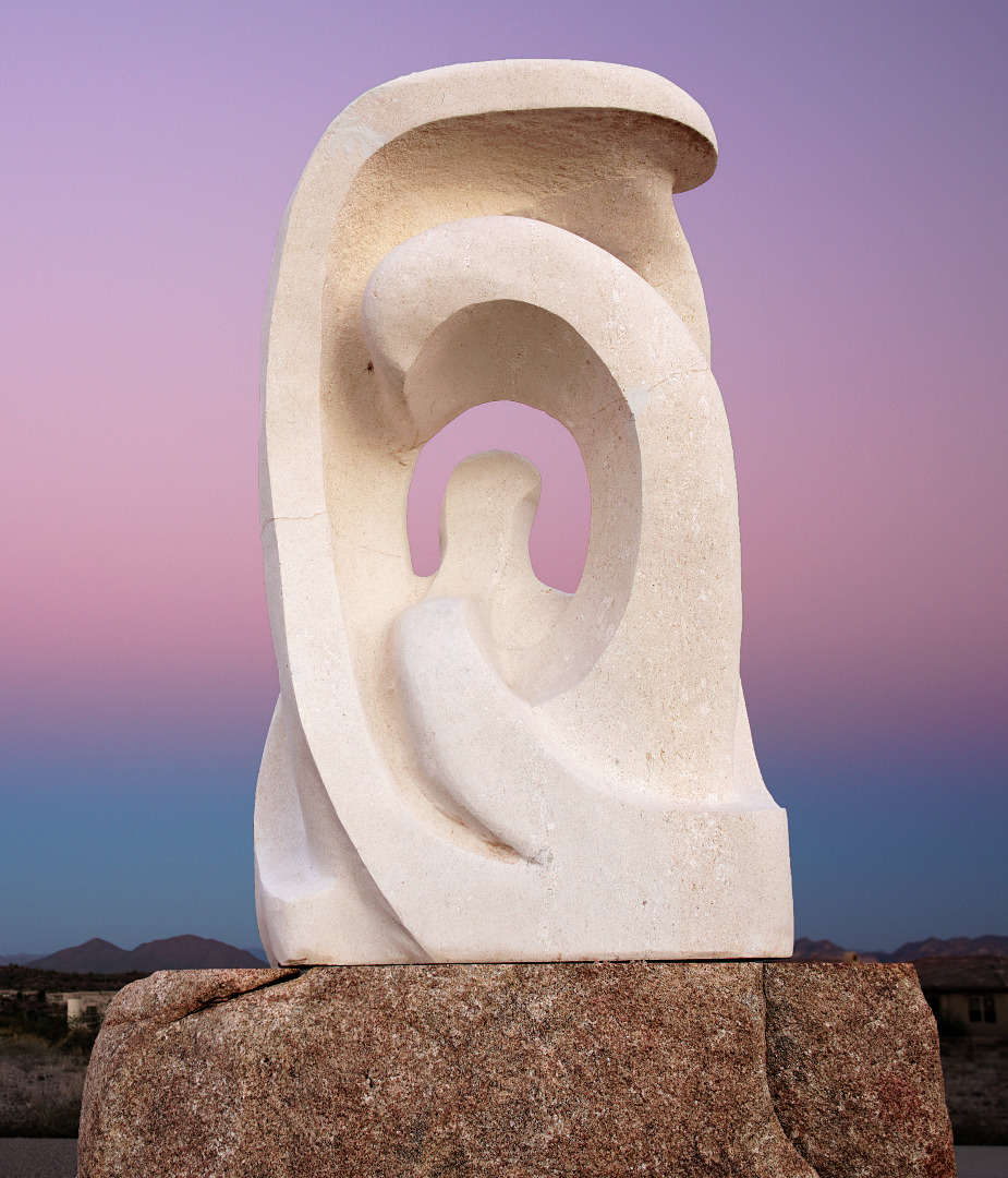
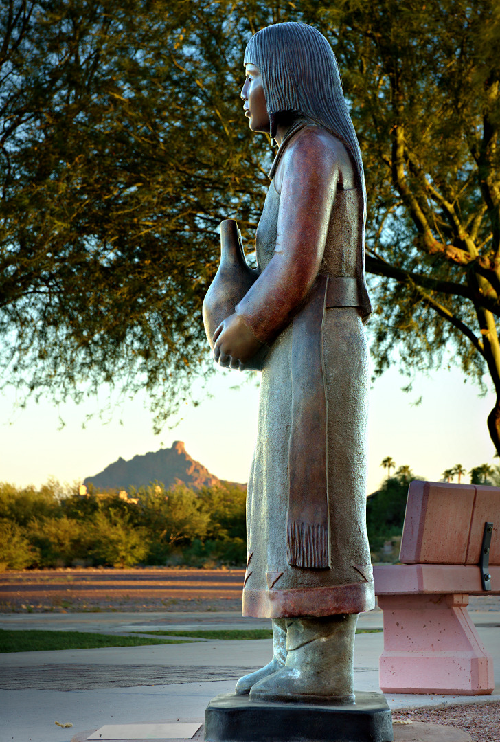
This work, created by sculptor Doug Hyde, is titled Santa Clara Wedding Vase Gift. It was donated in 2007 by Jean and Rolland Lorenz to celebrate their 50th wedding anniversary.
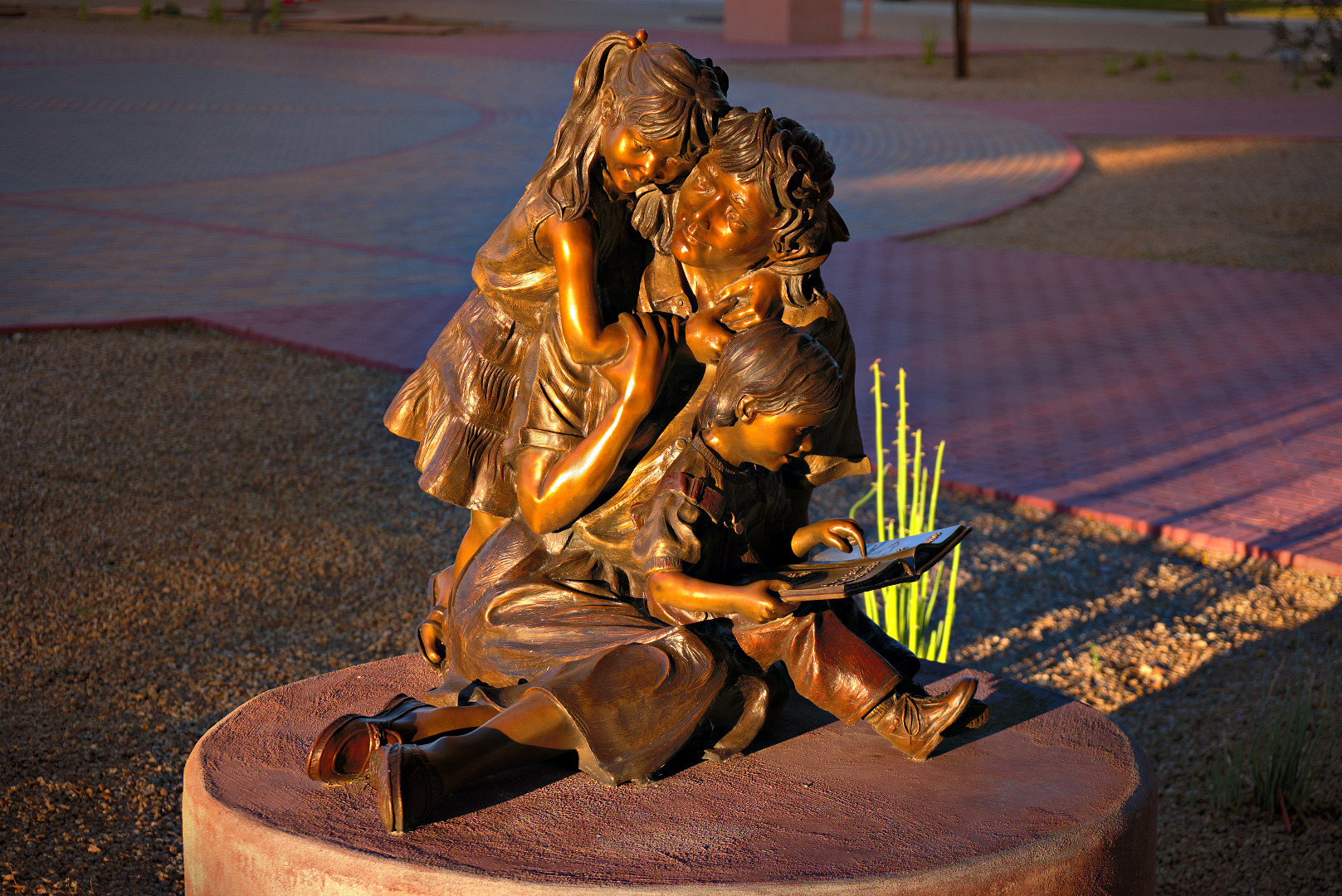
More Than Words was created by sculptor Greg Todd. It was donated in 2013 by Neil E. (Tony) Atchinson and Sally Ballee’ Atchinson.
This sculpture titled, Where Have All the Mammoths Gone?, was created by Martha Pettigrew. It was donated in 2008 by Jackie & Jerry Miles and the Fountain Hills Cultural & Civic Association.
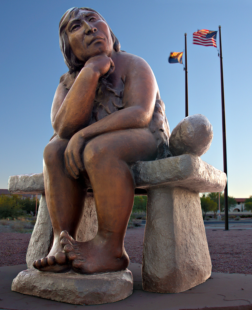 I had considered cloning the flags away, but Marie told me the sculpture has more impact, especially considering its title, with flags and other evidence of modern civilization in the photo.
I took these photos Sunday morning during our bike ride. There were a lot of clouds with a chance or rain.
I think these are the first photos that I’ve posted which were taken with the RX100M2. It’s a pocket sized camera from Sony. The cool thing about it is that it has a multi-interface hot shoe. This not only allows you to attach standard flashes, but also Sony-specific accessories as well. I’ve equipped mine with an electronic viewfinder. A viewfinder is really nice for taking photo outdoors in bright conditions, though it’s quite a lot bigger with the viewfinder attached.
Sunrise as seen from the Wagner Trailhead. Four Peaks is partially obscured by rays of sun bursting out of the clouds.
 I think this photo was taken from near the bench at the top of the Bluff Trail.
 A view of the McDowells from the top of the Bluff Trail.
 This photo was taken near the Sven’s Slab climbing area. Tom’s Thumb can be seen in the distance.
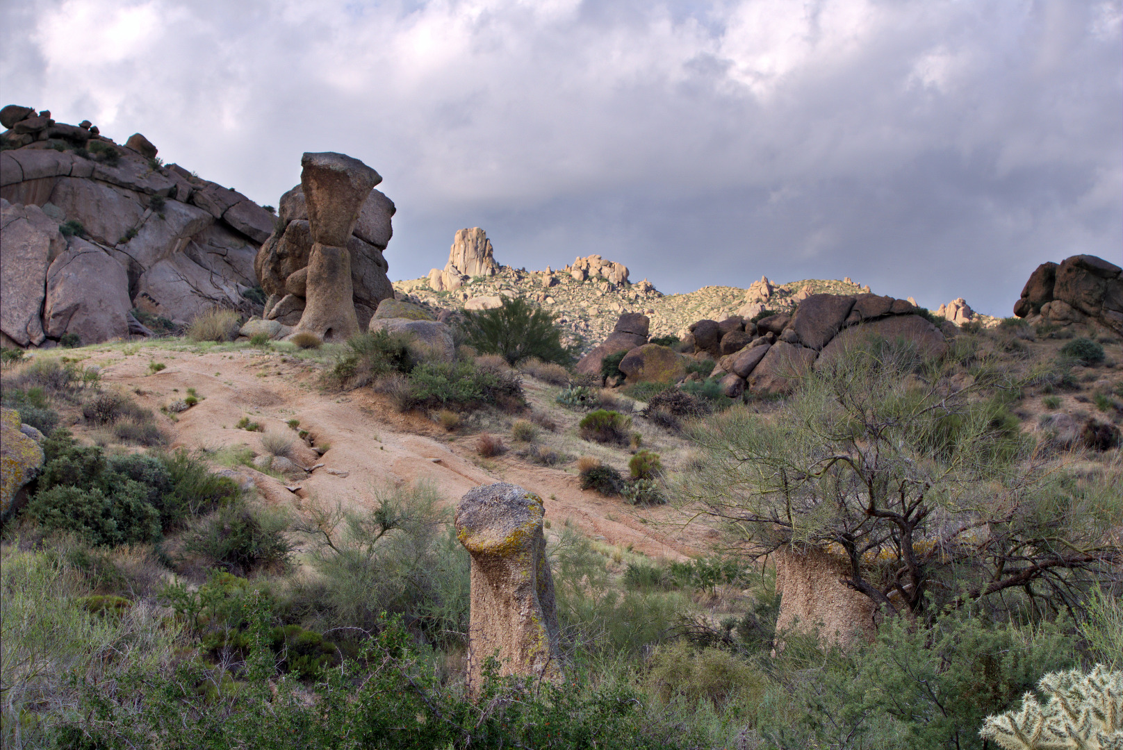
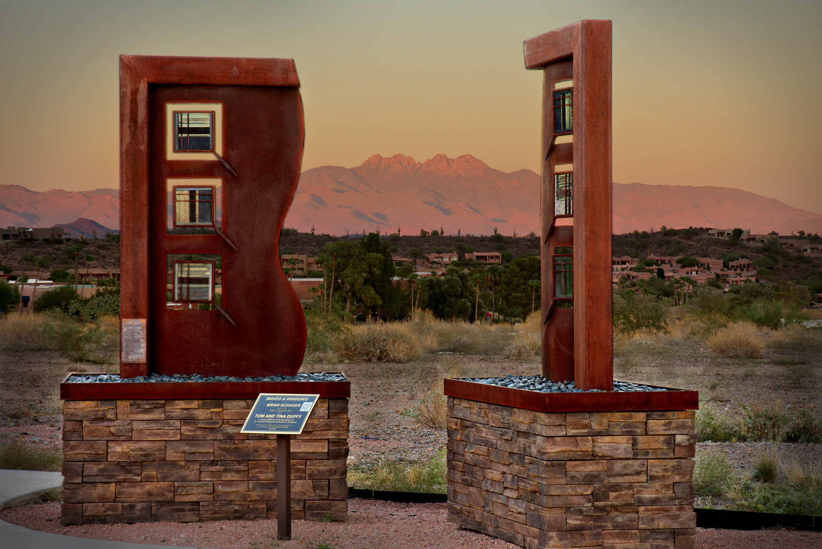
This sculpture, by Brian Schader, is called Waves & Windows. It was donated by Tom and Tina Duffy. (See photo below of entire plaque.)
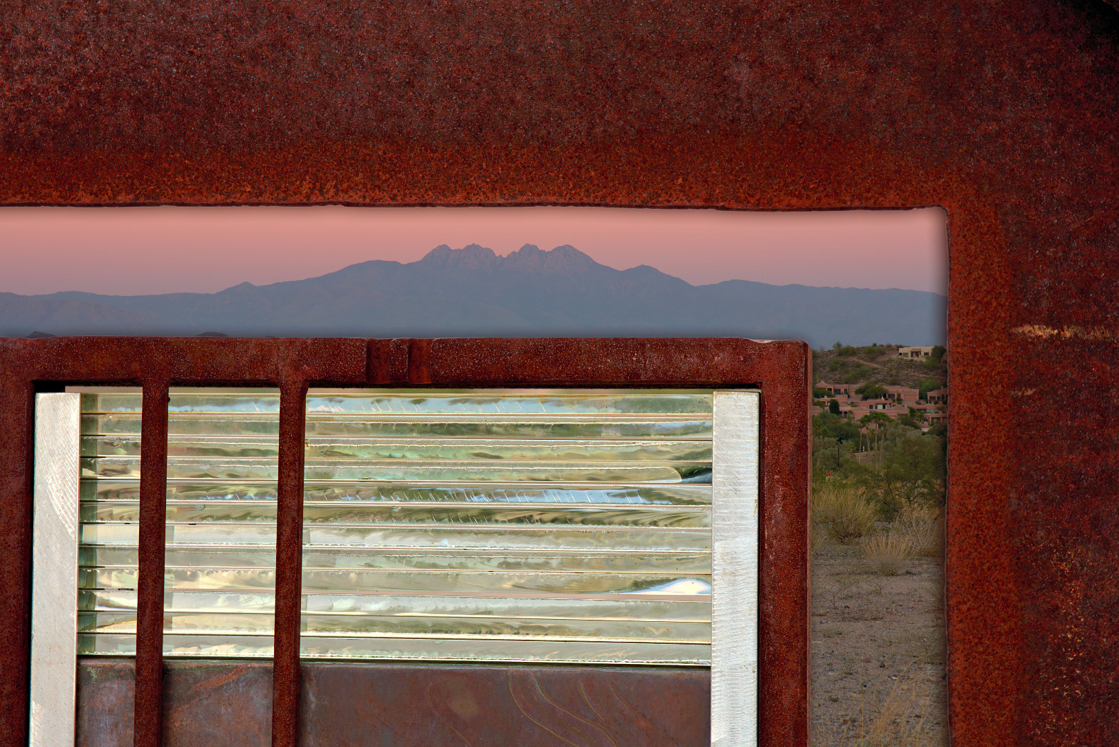
A close-up, looking through a part of one of the windows. This photo was taken a few minutes after the first photo. The sky had turned a nice rosy pink.
 The plaque:

This sculpture, by Doug Hyde, is called The Corn Dancer. It was donated in 2011 by Jean and Rolland Lorenz in memory of their son David.
