Month: February 2013 (page 1 of 2)

Friday Fitness Hike

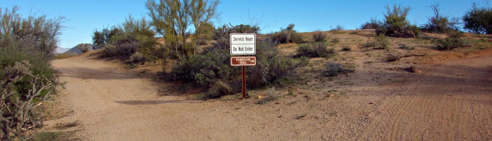
Friday’s hike took us out to the Dixie Mine (on the Dixie Mine Trail).  We went on to look at the petroglyphs and then hiked further up the canyon past the waterfall to the Prospector Trail.  We hiked the short section of Prospector that took us back to the road and then hiked down the road back to the Dixie Mine Trail.  Total distance was six miles exactly.

Recent rain has made the desert very green:

Group photo – there were too many new faces for me to remember everyone’s name.

Jill and George:

A rocky section along the Dixie Mine Trail:

Petroglyphs; these are a short way past the mine.

George, taking photos of the petroglyphs:

Another view of the petroglyphs:

A view from further up the canyon.

This is one of a number of holes dug into the canyon walls.  I think prospectors started digging at these sites to see if they could find anything of value.

Richard, standing at a plateau in the waterfall area.  Several of our party decided to turn around at this point.  The six of us who went on found the waterfall to be slippery.

A view from the very top of the waterfall:

Janet, beside a moss and lichen covered rock:

Another view from the wash / canyon.  Richard found a trail that lead us up out of the wash for a short ways, presenting some views that I hadn’t seen before.

Three views from the Dixie Mine Trail as we headed back.  Snow can be seen in the mountains in the distance.


Callisto

I took this photo of Callisto while testing the SEL24F18Z (24mm f/1.8 e-mount Zeiss lens). It was taken at f/1.8, 1/60 sec, ISO 640, with no image stabilization.


Snow!

It rained here today, but the precipitation came down as snow at only slightly higher elevations.  I took this photo from my balcony late in the day.

Little Mount Ord

Marilyn and I hiked to the top of Little Mount Ord yesterday.  We parked at the junction of forest service roads #626 and #1688.  We hiked #1688 until we got to a trail leading to the top of Little Mount Ord.  The latter trail was easy to follow in the beginning, but it had a lot of brush.  We alternated between bushwhacking and hiking what appeared to be infrequently used trails between the brush.  We found an area where cattle had congregated at one time; it’s possible that we were following cow trails during some of our ascent of Little Mound Ord.

FS #1688 had a mix of mud and snow, though most of it was reasonably dry and in good condition.  There were several spots that would’ve been challenging for me in our truck, but it would be no trouble at all for someone familiar with OHV travel.

A view of Mount Ord.  There is a lookout tower and a bunch of antennae on top.  Little Mount ord is off to the right, but is not visible in the photo below.

The moon, seen through the branches of a pine tree:

Marilyn, hiking FS #1688:

A view looking towards the Phoenix Metro area.  There was so much haze that we had trouble seeing Red Mountain.  (Red Mountain can be see slightly below the horizon, one third of the way over from the left edge of the photo.)  SR 87, also known as Beeline Highway, can be seen in this photo.

A view as we were hiking up Little Mount Ord.  The Mogollon Rim can be seen between gaps in the vegetation.

Four Peaks had snow on at least three of its peaks.  FS #1688 can be seen cutting across the hillside in the foreground.  If you were to follow that hillside leftward to the top, you’d end up at the summit of Mount Ord.  (There are easier ways to get there though.)

After we descended Little Mount Ord, we hiked a ways further on FS #1688 where I got this picture of a peak in the Mazatzals.  A portion of Little Mount Ord can be seen in the foreground.

I stopped partway down FS #626 on the way back, got out of the truck, and took a few more photos.  This one is looking across Beeline Highway into the Mazatzals.

The loading chute of a corral just off of FS #626:

Another View of the Mazatzals:

Sport / Tech Loops

Marilyn and I rode a couple of laps at the competitive tracks of McDowell Mountain park in the late afternoon.

Marilyn on the Tech Loop:

A view from the Tech Loop:

Marilyn on the Sport Loop:

A view near the “Clay Pit” area on the Sport Loop:

Friday Fitness Hike

Friday’s hike this week started at the Trailhead Staging Area.  A few of us met early to show Jim Burns, a bird photographer, the approximate location where we had seen the long-eared owl in early January.

We hiked out Pemberton towards Tonto Tank in the dark.   The sky became colorful somewhat before sunrise.

We hiked a bit further and saw the sunrise:

This is where we stopped to let Jim continue on his own to look for the owl:

Jim, with his camera and tripod.  He has a 600mm f/4 lens on his Canon camera.  He says it weighs around 20lbs.

On the way back to the Trailhead Staging Area, we saw this raven on a saguaro:

Nancy, Linda, and I joined several others for a hike on the Scenic Trail.  From left to right are Richard, Larry, George, Jill, Bill, Linda, and Nancy.  Amy had started the hike with us but went back for some other hikers who showed up late.

Linda, Nancy, and I split off to explore the trail between the Scenic Trail and the Horse Staging area.  The rest of the group continued on the Scenic Trail.  Below is a photo of them hiking up the first hill encountered when hiking the Scenic Trail in a counterclockwise direction:

Nancy and Linda:

A skull, which we think once belonged to a Javelina:

A view from the Pemberton.  Parts of the scenic trail snake along the high ridge line in the foreground.  In the far distance, the Flat Iron in the Superstitions can be seen.

When we got back to the parking area, we were just shy of twelve miles.  I walked over to and part way up the Hilltop Trail and then back to my truck to put me at twelve miles exactly.  Below is a view of Red Mountain from the Hilltop Trail.

Elephant Mountain

Marilyn and I hiked at the Spur Cross Ranch Recreation Area on Sunday.

We hiked the Spur Cross Trail to Tortuga, at which point we continued straight on Tortuga.  Tortuga branches off to the left, but we continued going straight which is the Elephant Mountain Trail at that point.  The Elephant Mountain Trail descends into a wash, follows the wash for a time and then gradually ascends to a pass which separates the main bulk of Elephant Mountain from a  lower peak to the East.  This lower peak is the site of an old Native American fortress, complete with walls somewhat below the relatively flat top of the peak.  We continued on Elephant Mountain Trail until it met up with the Spur Cross Trail, which we followed back to the parking area.

A view of Elephant Mountain from either the Tortuga Trail or near the beginning of the Elephant Mountain trail from where it connects to the Tortuga Trail.  The fortress peak with the shear sides is in front of the main bulk of Elephant Mountain.

In the photo below, we were on the Elephant Mountain Trail, beginning our descent into the wash.


A view of the Elephant Mountain fortress peak from where the Elephant Mountain Trail dips into a wash:

I think this might be Sugarloaf Mountain with Skull Mesa to the right.  (I’m not certain though.)

Another view of the Elephant Mountain fortress rock:

Great views…

A wall of ridged rock on Elephant Mountain:

One of the views as we were making our way back to the Spur Cross Trail:

Another look at one of the rock walls on Elephant Mountain:

Marilyn amidst some very tall saguaros:

A mountain biker descending the Spur Cross Trail:

Marilyn on the Spur Cross Trail:

Saguaros on the Spur Cross Trail:

White stone and brown rocks along the Spur Cross Trail:

The sun came out shortly before setting, bathing the trail in an orange glow:

Marilyn, waiting for me as I take lots of “golden hour” photos:

More views near sunset…

I noticed these ruins near the parking area just prior to leaving.  I’m puzzled about the wood beam though.  It doesn’t look weathered enough to be original.

Two Burros

Marilyn and I visited the Spur Cross Ranch Conservation Area on Sunday.  We saw two burros in the parking lot.  They’re obviously very well fed; we suspect they wandered over from a nearby ranch.


Friday Fitness Hike

Today’s hike started at the Wagner Trailhead.  Fourteen of us hiked out Wagner to the Granite and then to the Delsie Trail.  At Delsie, we split up; Amy’s group finished up by hiking up to Bluff and then back on Granite to Wagner.

Nancy, Janet, Linda, Bob, Sarge, and I hiked up Delsie to the Granite Tank on Pemberton. From there, we hiked the new Pemberton re-route to Lariat which we took back to Granite where we retraced our steps back to our cars.  Total distance was 9.75 miles.

Recent rain has made the trails very green.  We even noticed a bit of green in the McDowells.


Linda, Janet, and Nancy on the Delsie Trail:

Bob and Sarge:

A view of the McDowells and saguaros in the foreground midway up the Delsie Trail.  Tom’s Thumb can be seen a third of the way from the right hand side of the photo.  The Thumbnail Pinnacle can be seen at the far left of the photo.

This photo was taken near the Granite Tank.  The Tank is not visible in this photo, but is off to the left.  The road to the left used to be the Pemberton Trail.  Pemberton has been rerouted to the right.

The new Pemberton reroute has lots of twists and turns and is very scenic.  The desert vegetation is very dense in places and, much to our surprise, we saw large boulders along the way.

A closer view of one of the large boulders in the above photo.

I found a way to climb to the top of that boulder.  Linda took this photo of me on the top:

Janet standing next to a somewhat smaller boulder a little ways further down the trail:

A healthy saguaro.  I think this was still on the Pemberton Trail.

A view from the Lariat Trail as we were headed back:

Sleepy Freckles

Okay, maybe she’s not tremendously sleepy in this photo, but she was prior to me getting out my camera and crawling towards her on the floor.  Her brother, Tiger, is creeping up on her from behind.