Tag: McDowell Mountain Park (page 40 of 46)

Friday Fitness Hike

We hiked the Scenic Trail during last Friday’s Fitness Hike.  We had a fairly large group for a hike in June.  Often, it ends up just being the regulars who show up for hikes during the summer months.

I didn’t take many pictures.  The desert is very brown right now; plus I have more than a few photos of this area.  See this post from several months ago for other Scenic Trail photos.

Sarge greets Heather as Bob looks on:

2013-06-21-DSC03434-medium

Sarge waits for water at the top of the hill on the Scenic Trail.

2013-06-21-DSC03442-medium


From left to right are Heather, Teresa, Mary, Janet, Mary, Marilyn, Linda, and Bob, with Sarge in front.

2013-06-21-DSC03449-medium


Bonus photo!  This is Mary’s husband, Clayton, riding the Pemberton Trail on Sunday:

2013-06-23-DSC03500-medium

Sunrise on the Pemberton

I took this during an early morning bike ride.

2013-06-15-DSC03317-medium

Later on, I saw this coyote:

2013-06-15-DSC03378


Friday Fitness Hike

Today’s hike started at the Wagner Trailhead.  We hiked the Wagner Trail, turned right onto the Granite Trail and hiked past Stoneman Wash, stopping when we got to another wash which feeds into Stoneman Wash.  We hiked a short ways up the wash where Amy and I took the group photo shown below.  From there, the group split up with Amy leading Doug and Mary back to the Trailhead via the Bluff Trail.

Bob, Teresa, Janet, Marilyn, and I hiked continued up over the rocks and followed the wash up to the Pemberton Trail.  We turned left on Pemberton and returned via the Bluff Trail.

From left to right (and back to front) in the photo below are Kevin, Amy, Mary, Teresa, Janet, Marilyn, Doug, and Bob.  I took one exposure.  Amy took another.  I combined them in post processing so we could all be in the photo together.

2013-06-14-DSC03250-mediumThis photo was taken from the wash after the group split up.  (I didn’t take many photos today. I still have a lot of photos from the Moab area to process.)

2013-06-14-DSC03272-medium


Friday Hike – Scenic Trail

Bob, Sarge, Linda, Janet, Marilyn, and I hiked the Scenic Trail today.  We all noticed that the desert has gotten brown again…

2013-05-31-DSC09928-medium


Linda, Janet, and Marilyn nearing the top of the ridge on the Scenic Trail:

2013-05-31-DSC09933-mediumSarge!

2013-05-31-DSC09942-medium


We noticed a lot of haze off in the distance today.  I think the hills near the water tower are known as Asher Hills.2013-05-31-DSC09949-medium


Saguaro Blossoms on the Boulder Trail


This is one of the saguaros I saw today while riding the Boulder Trail to the Marcus Landslide Trail.
2013-05-26-DSC09904-mediumBelow is a 1:1 crop of the flowers from the above photo.  I used my Sony RX100 for these photos.  ISO 125, f/9, 1/250 sec with a (35mm) equivalent focal length of 100mm.  (Camera focal length was 37mm.)

2013-05-26-DSC09904-cropped


Friday Hike – Sonoran Trail

Nick, Bob, Doug, Janet, Linda, and I met at the Eagle’s Nest trailhead.  We hiked nearly ten miles and had nearly 2000 feet of total ascent on our hike utilizing the Dixie Mine, Sonoran, Promenade, and Western Loop Trails.

A view of a water tower from the Sonoran Trail:

We were resting part way up the Western Loop Trail when I took this photo of the portion of the McDowells comprising the East End and Tom’s Thumb.  You can just make out Tom’s Thumb perhaps a quarter of the way over from the right edge of the photo.

Linda, Janet, Bob, and Nick taking a break.

Nearing the high point of the Western Loop Trail…

A view of Red Mountain from the top of the Western Loop Trail.  There is a trail which leads to an overlook.  We spent very little time there because there were quite a lot of insects at the overlook.

Linda took this photo of Janet, Bob, me, and Nick at the overlook:

A view of Sunrise Peak where we hiked last week:

We’re on the Promenade Trail in the photo below.  It’s an old jeep road.

On the way back, I took a photo of the entrance to the Western Loop Trail.  We hiked that segment earlier in the hike.

A section of the Sonoran Trail has a short stretch of slippery rock.  The trail builders decided to put in a chain handrail at this point.

There are long uphill stretches on the way out and on the way back.  The photo below shows Nick, Janet, Bob, and Linda near the bottom of the most sustained uphill segment on the way back.

Linda took this photo of a blossoming barrel cactus plant:

A Wolfberry bush…

A view of Four Peaks:


Snakes on the Pemberton!

I saw two snakes while riding earlier today.  These snakes were perhaps 400 yards apart, on the eastern end of the new stretch of the Pemberton.  The first snake I saw was a rattlesnake, probably a Western Diamondback.  Another rider told me that the second snake is a bullsnake.  Amy Burnett, the ranger at McDowell Mountain Park, told me that it’s a sub-species of bullsnake called a Sonoran Gopher Snake.

Both snakes were lying across the trail sunning themselves to get warm.  I had trouble getting the rattler to move.   I nudged it’s tail twice with my foot before it finally deigned to raise its head.  Only after nudging its tail again with a stick did it decide to take a defensive posture.  Even though I was walking all around it taking photos, it stayed in the middle of the trail where it could’ve gotten run over by a bike.  It moved off into the grass only after I spewed a mouthful of water at it.

This is a crop (close-up) of the above photo:

This next photo shows a better view of the rattler’s tail.  Unfortunately, the head is not quite in focus.

Another crop…

I came across the Sonoran gopher snake only a short while later, probably not even a quarter of a mile from the Western Diamondback.  It, too, was lying across the trail, but became quite curious about my camera!  It started slithering towards me as I was frantically taking photos of it.   I eventually had to move out of its way!

It was perhaps two feet away for this shot.  It looks closer because I cropped away the bottom part of the image.

An even tighter crop:

Bike Ride on the Pemberton

Marilyn and I rode the Pemberton Trail at McDowell Mountain Park this morning.  Conditions were awesome when we started, but got quite windy near the end.  We probably should have started half an hour earlier.

These first three photos are views from the Boulder Trail as I approached the Marcus Landslide Trail.  (I left the Pemberton for a while to ride up in the McDowell Sonoran Preserve.)

The photo, below, shows a few of the many boulders along the Boulder Trail.

This photo, below, looks across the slide area of the Marcus Landslide.

This is the same boulder in the first photo, but with Rock Knob in the background to the right of the boulder.  My ride took me down the Rock Knob Trail where I got to ride past that formation.

A view of the Palo Verde tree and bench (and my bike) at the top of the Bluff Trail.  I only rode perhaps a hundred yards of the Bluff Trail – just enough to get up to that tree on top of a small hill which affords a great view of the area.

The newly constructed section of the Pemberton Trail has some interesting rock formations along the trail.  I rode ahead of Marilyn, so that I could get set up to take these two photos of her riding through that area.

Marilyn, on the Pemberton

Friday Fitness Hike

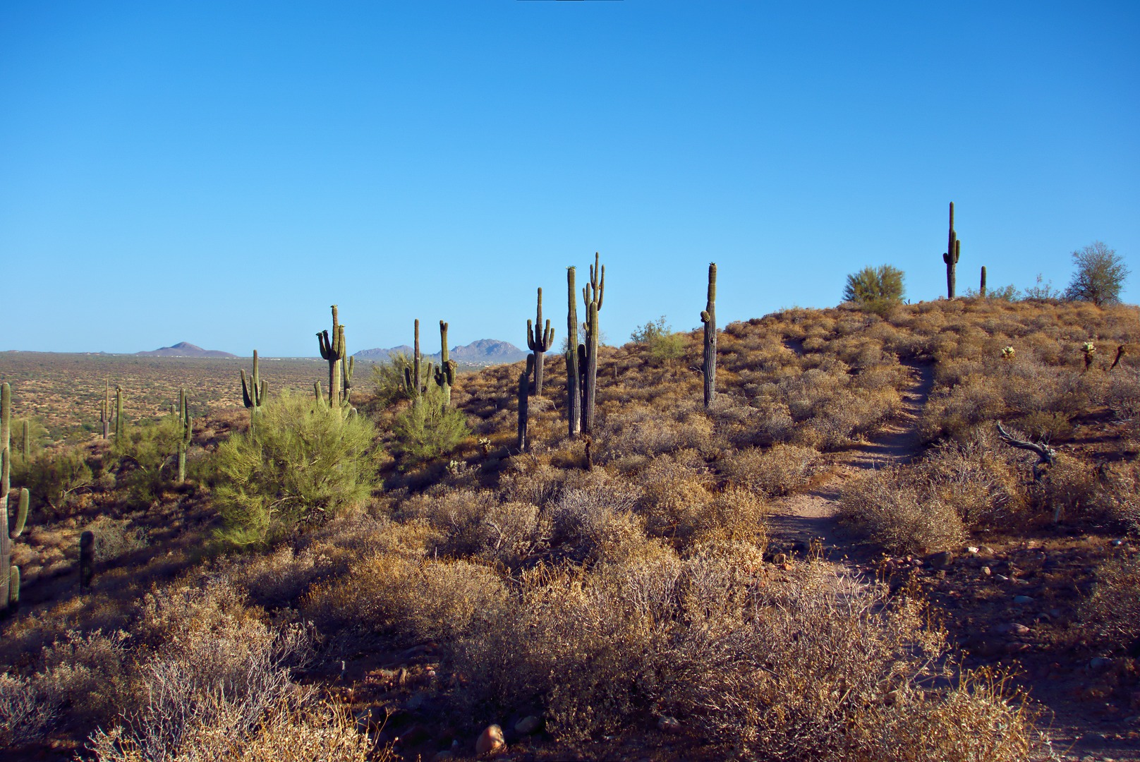
Friday’s hike took us out to the Dixie Mine, past the nearby petroglyphs, and then past even more petroglyphs where we got to scramble up a section of smooth stone in the wash.

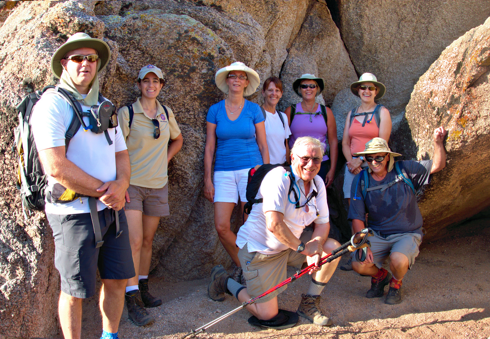
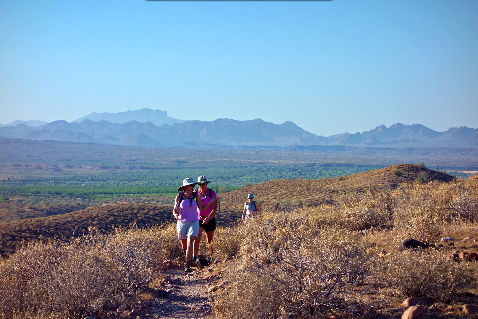
Seven of us were on Friday’s hike.  From left to right are Bill, Amy, Linda, Marilyn, Doug, and Jane.  Marilyn and Jane were visiting from Mesa.

Prickly pear blossom:

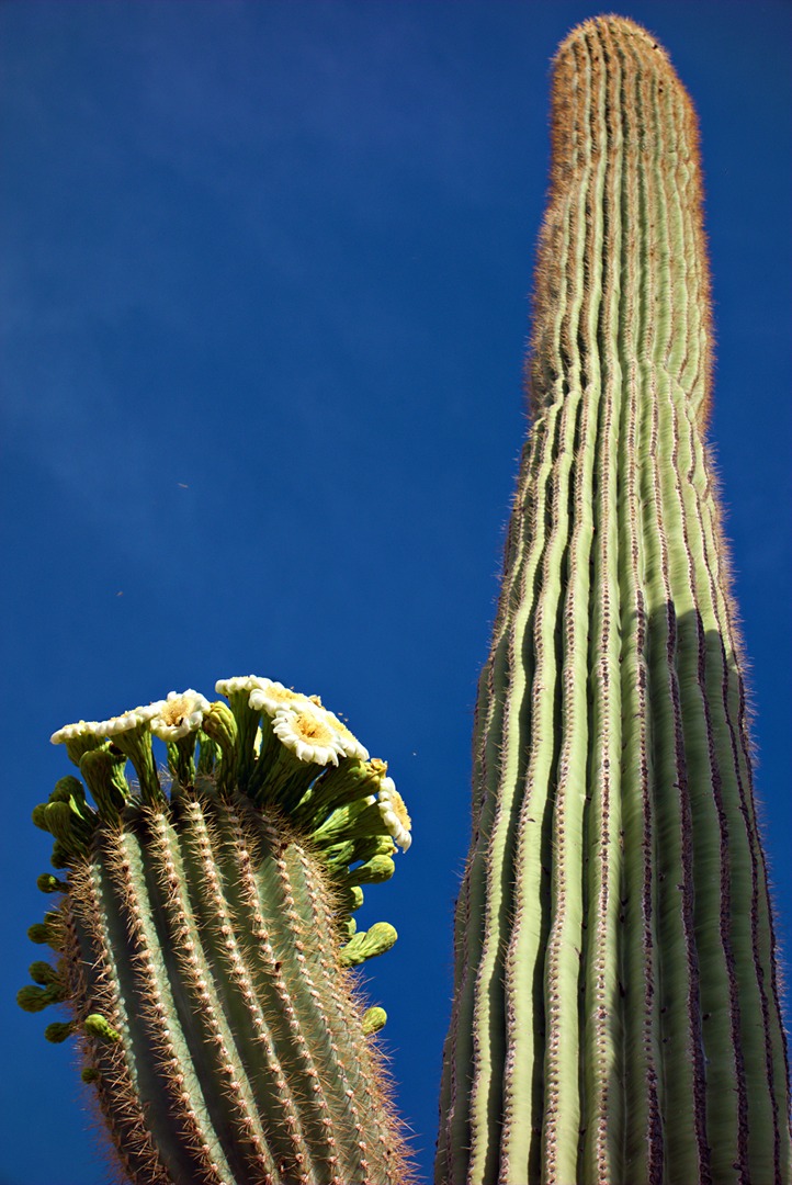
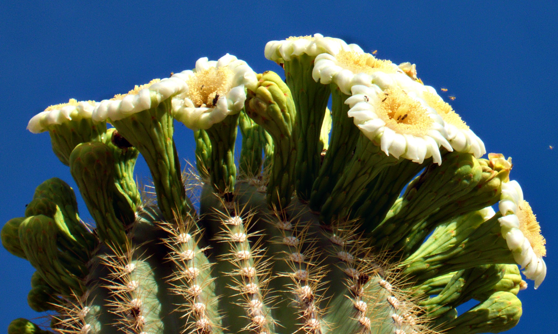
Some of the saguaros are starting to bloom!

The rest of the group got ahead of me a few times as I practiced photography:

These small reddish-orange berries are wolfberries.  I haven’t tried any, but I’m told that they’re edible and sort of taste like a tomato.

The brittlebush is starting to wilt, but the many of the ocotillo now have blossoms.

The top of Thompson Peak is framed by the blooming creosote bush.

Ranger Amy tells us the story of the Swiss construction company who ended up constructing three roads, each successively less steep up to the top of Thompson Peak.  I have hiked up the current road once.  I shudder to think of what it would’ve been like to go up either of the earlier two attempts as the present road is still very steep!  Scars of the earlier road attempts are still visible on Thompson Peak.

This is the main petroglyph panel near the mine.  There are a few more petroglyphs scattered above, below, and to the sides of this panel.

Doug and Bill wait for the rest of us to examine the petroglyphs:

A cropped version of the above photo:

We passed this area on our way to the next petroglyph panel:

The petroglyphs at the next area are scattered about.  Patience and a willingness to examine the rock closely is required for finding some of them.  Here, Amy has made her way past some waist-high brush to get a better look at some of them:

It appears that the Hohokam drew a lizard here.  I have no idea what the other marking might mean.

A section of smooth, water polished rock adds a challenge to the hike:

It takes some looking, but there are at least four areas of petoglyphs on this wall.  There’s a wiggly line that might represent a snake towards the upper right of the photo.  They’re difficult to see, but when I zoomed in on the unscaled version, I saw smaller wiggly lines below the larger one – perhaps these represent baby snakes?

There appears to be a drawing of someone falling head-first in this photo.  Perhaps it’s a warning to not go too high?  (It would’ve taken some additional scrambling to get up above the drawing.)

Amy poses for a photo at the top of the “waterfall” area.  (I’m not sure that it’s really a waterfall…)

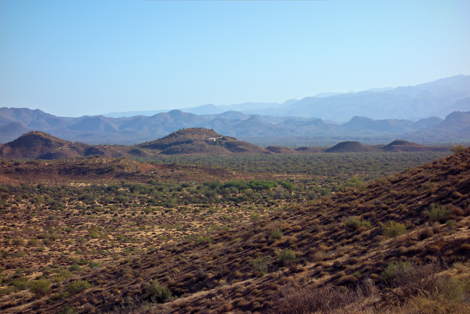
A look at what’s ahead of us:

Amy takes a photo looking down and past the area we just scrambled up:

The canyon was still scenic as we continued on:

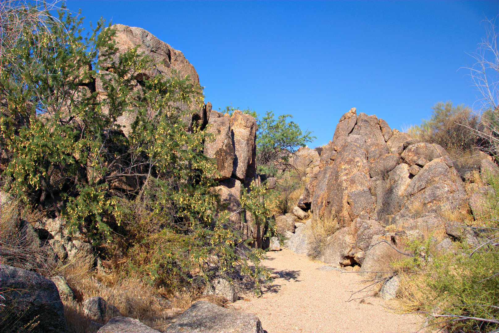
We had returned to the Dixie Mine Trail when I took this photo:

California Buckwheat:

Purple-flowered Rhatany growing amidst a Christmas Cholla.  Amy told us that it can be a kind of parasite, though I saw some growing by itself today when I rode my bike.