Category: Uncategorized (page 6 of 6)

The Friday Fitness Hikes at McDowell Mountain Park have been suspended for a month so that Amy can lead wildflower hikes instead. I and several other Fitness Hike regulars are taking the opportunity to visit other areas.
This week, we hiked half of the Pine Creek Loop to the Ballantine Trail. There is another trail that crosses the Ballantine Trail at the Boulder Flat area. We took that trail left, up to the top of the ridgeline to the north of the Ballantine Trail and then down the other side to an old cabin built out of galvanized corrugated sheet metal.
Below is the track we took. We started out on the red track at the west (left) side of the map.
View hike-130301-Ballantine_Cabin.kml in a larger map
The area is incredibly rocky. These are some of the rock formations (and vegetation) that we saw shortly after turning off the Pine Creek Loop onto the Ballantine Trail.

Nancy and Linda on the Ballantine:

Saguaros and rocks on the Ballantine:

A view looking back to the northwest. If you look closely, you can see Beeline Highway (State Route 87) in this photo.

This monolith can be see on the south side of the trail at just over two miles into the hike.

Linda climbed up on the big flat boulder next to the monolith for this photo:

The monolith looks quite different when looking back at it from a short ways further along the trail:

We heard water flowing down Camp Creek during sections of hike along the Ballantine Trail. From where we stood up on the ridge though, we had to look very closely to see any water.

Another view looking back to the west. Linda and Nancy can be seen hiking the Ballantine in the upper right of this photo:

Nancy, standing by a one-time gate atop the ridge to the north of the Ballantine Trail. Red Mountain can be see in the far distance at the upper left in this photo.

I had visited the north side of this ridgeline only once or twice before and had forgotten what it looked like on the other side. This is a view looking to the northwest.

This is the view to the northeast. If you look closely, you can just make out the cabin which was our eventual destination. If you refer back to the map, the cabin is located slightly south of the little “Y” at the northwest end of the tracks. (I explored a short ways beyond the cabin prior to returning.)

We were surprised to see a few patches of snow as we made our way down to the cabin:

Nancy and Linda standing in the cabin’s doorways:

We thought the skull hanging on the wall was a nice touch:

An even closer look at the skull:

When we got inside the cabin, we saw a cot. The mattress and bedding had been balled up and suspended from the ceiling to keep it dry and to keep critters out. (I didn’t take a photo of this.) Some supplies, mugs, and a small pot could be see along the west wall. I found it interesting that brake fluid had been positioned next to the cooking oil.

We saw a stove and more supplies along the north wall. There was also a storage bin, half of which can be seen at the far left in this photo, which contained plates and eating utensils.

This is the view out of the east window:

The photo below shows Linda and Nancy taking a break near the cabin. When I had last visited the area, perhaps eleven or twelve years ago, I saw an enclosed corral near the cabin. Up high, stretched between two poles was the skin of a medium sized animal. If you look behind where Linda is standing, you can see, lying on the ground, an animal skin which I believe to be the same skin that I saw those many years ago.

This gate, below, leads to the Pipeline Trail. I explored a short ways to the north along the Pipeline Trail, but also to the east along another trail that was, I think, once the main Ballantine Trail.
Back when I first started hiking in this area, I noticed that the track on my GPS map went to the north, the way that the three of us took on Friday to go to Ballantine Cabin. The trail then continued to the east and eventually went up to the same corral that the present day Ballantine trail goes through further to the east. Back in 2001, this trail was very difficult to follow as a lot of brush had grown up over the trail. I remember crawling on my hands and knees under some of the brush and climbing up and down boulders in other sections to get past it. The section that I hiked on Friday, present day, was amazingly clear and easy to follow.

I saw this granite boulder with an arch in it as I was hiking out along that section of trail leading east from Ballantine Cabin.

I went a short ways further along the trail leading east before returning to explore a small section of the Pipeline Trail heading north. The trail crosses a creek, probably Pine Creek:

I saw another corral as I hiked out along the Pipeline Trail. There is a sort of corridor or chute constructed with metal pipe, shown towards the left edge of the photo. Note that the near end of it narrows down so that a cow (or bull or steer) driven down the chute won’t be able to go any further. I think this mechanism serves the same purpose as the head gate that we used to use on the farm. The animal would be driven down the chute and would get jammed up at the narrow end of the chute at which point the ranch hand could possibly employ some other kind of restraint for working on the animal – vaccinations, branding, etc. Once the animal was processed, that narrow end of the chute would be opened up to let the animal out.

Another view of the corral looking east:

A view looking southwest from the top of the ridge as we were heading back to the Ballantine Trail:

Another look at the very textured rock formation to the southwest from lower down:

Nancy and Linda on their way back to the Ballantine Trail.

A rock formation near the intersection of the trail leading over to the cabin and the present day Ballantine Trail. (I think the section of trail that we hiked also used to be the Ballantine Trail. But perhaps now, it’s a continuation of the Pipeline Trail?)

One of the views as we were hiking back on the Ballantine:

And another:

Nancy and Linda descending a section of the Ballantine. It’s largely uphill on the way out and mostly downhill on the way back. We had over 2100 feet of total ascent for the day.

The trail goes right under the arm of the large saguaro:

We saw poppies alongside the trail on the way back:

We saw this saguaro as we were nearing the end of our hike on the other half of the Pine Creek Loop. The hike was only a little over nine miles, including the exploration that I did beyond the cabin.

On Sunday, Marilyn, Joe, Nick, and I hiked out near Saguaro Lake. We did the Goldfield High Country via Gateway Canyon hike. This hike is supposed to be only eight miles in length and, if you manage to do it efficiently without any wrong turns or detours, it might actually turn out to be that long. We, however, ended up hiking 9.72 miles with 1,219 feet of total ascent.
There is a maze of trails in the area. If you are thinking about doing this hike, I strongly recommend downloading one of the GPS tracks from the page describing this hike at hikearizona.com. I downloaded johnr1’s Official Route to my GPS. We probably would not have found our way had we not had these GPS tracks. There are so many trails in the area that it is easy to make a wrong turn or miss a turn. There were several instances where we got off route even with the track. Yours truly even hiked a bit over a quarter mile on what seemed to be a good track certain that it would eventually turn and go the right way. It was, in fact, going almost exactly the wrong way from where we wanted to go.
We started out in the early afternoon on Sunday, but it got dark on the way back. We all ended up strapping on our headlamps so that we could see the trail during the last couple of miles.
The hike parallels the river for the first couple of miles. At times, the river is in sight; at other times it’s far enough way that it can’t be seen. We felt like we were zigzagging our way along this entire stretch. One of the most difficult parts for me was the sections of river rock. I don’t move well through this type of terrain due to old injuries.

We eventually entered a wash with steep walls. I found the hiking to be much easier here. The sand underfoot was firm and even. No more ducking under low hanging limbs through the maze of small trees or hiking on ankle-turning river rock.

Marilyn stops to take her own photos in this wash:

A view of the canyon where the majority of the elevation gain occurs. There is a trail (not visible in the photo below) along the left canyon wall leading up to the top. On the way up, we made the constant mistake of following right offshoots of the trail. We’d proceed for a ways on what appeared to be a trail only to have it peter out. We would then notice a good trail 10 or so feet higher up to our left.

We saw several caves in the canyon walls on the way up.

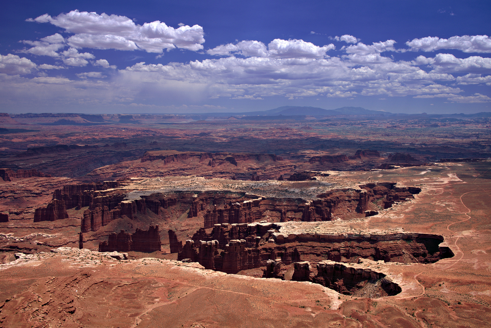
This fin on the canyon wall reminded us of some of the canyon country in Utah:

Joe pauses so that I can get a photo on the way up:

It was a cloudy day on Sunday. The sun barely manages to peek through the clouds behind another wall that we saw after we emerged from the canyon.

There appeared to be a trail to the southwest, but the GPS track lead us in the opposite direction. We didn’t understand the point of the path until we hit the end of the track where we saw this small arch. Red Mountain is visible through this arch.

The arch isn’t very big. In this photo, below, Nick pretends to sit on it. It’s a fairly sheer drop on the other side of the arch; Nick didn’t trust it to hold his weight. He didn’t want to damage it either.

A view of some mountains in the distance as we were hiking down the canyon:

Looking up one of the canyon walls:

A look back at where we had been:

A 1:1 crop of the above image. If you look carefully, you can see the small arch near the bottom right of the photo. (You may need to zoom the photo on your viewing device.)

Clouds in the late afternoon. It started raining a short time before we reached the car. It started raining hard just as we were getting in the car.

Another late afternoon shot.

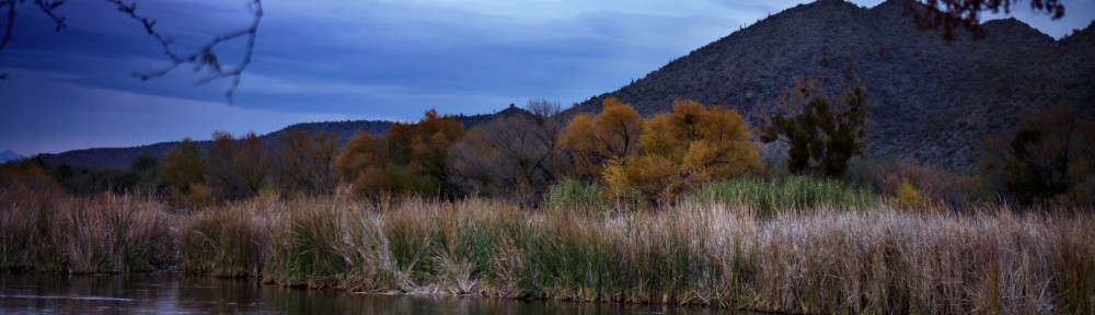
I got this photo of the river shortly after sunset. It was getting fairly dark when I took this photo.

Hi Kevin:
Just wanted to say hi.
Darrick
It rained for a while this afternoon, leaving behind a partial, but quite wide and brilliant rainbow. I did boost the saturation of the sky in the RAW file conversion. That was a lot quicker, easier, and more effective than my earlier attempt at photographing a rainbow.

One of Marilyn’s photos…
