Tag: Moab2012 (page 3 of 3)

Porcupine Rim Trail / Kokopelli Trail / Castle Valley

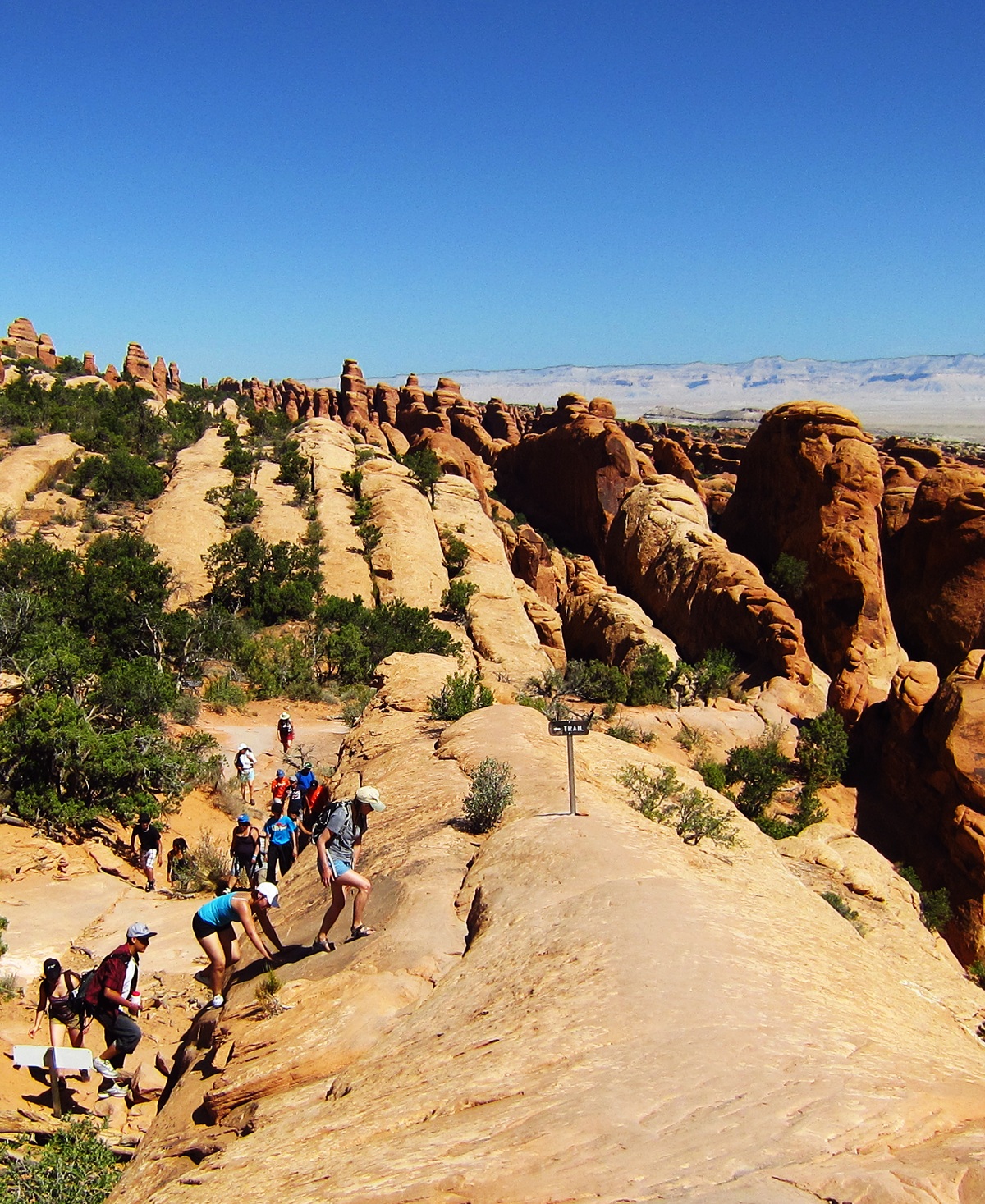
On Saturday, the last full day of our stay in Moab, we headed out to the Sand Flats Recreation Area.  We started out hiking Fins & Things, a 4×4 jeep trail.  Unfortunately, I took a wrong turn along the way and we ended up taking a tour of the various campsites through which Fins & Things passes on its way back to the main road.  It was very disappointing.  I did, however, get this photo of a cool looking snake:

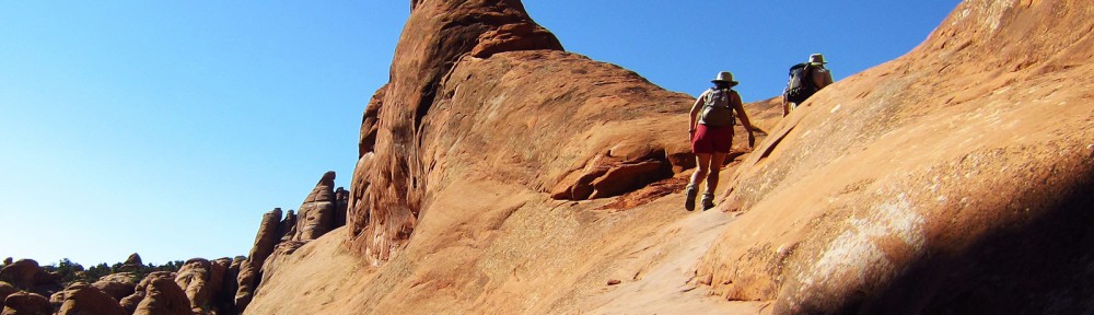
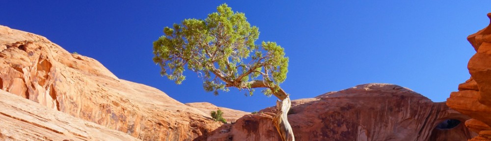
Once back at our truck after our unsuccessful attempt at hiking Fins & Things, we drove down the road to the trailhead for the Porcupine Rim Trail.  We all started hiking it, but Marilyn and Marie decided to wait for me, resting under this broad tree:

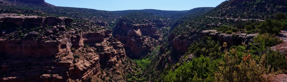
Seeing more than a glimpse of the canyon below was difficult due to all of foliage growing on the side of the trail.  But, every now and then, a small clearing appeared from which I could take a photo.  This is one of the better ones.

 I came to a point where the trail split.  I followed the path that would lead me to higher ground, thinking that the views would be better.  The path I chose ended up taking me to the Kokopelli Trail.  The small section of the Kokopelli Trail that I saw was navigable by passenger car, whereas the Porcupine Rim Trail definitely was not.  There were indeed some interesting views from that vantage point.

Here is another view from the Kokopelli Trail.  You can see some of the Trail (road) itself in this photo.

I turned around and started retracing my steps down the Porcupine Rim Trail.  As I was coming back, I got a call from Marilyn who informed me that I would soon be seeing racers running the Desert R.A.T.S. (Race Across The Sand) race.  This is a seven day event in which racers run/walk the 148-mile long Kokopelli Trail from Grand Junction, Colorado to Moab, Utah.  Distances covered each day range from between nine and fifty miles.   Here is a photo of the front runners:

I saw perhaps a dozen other racers on the way back down.  When I got back to the trailhead, an aid / support station for the race had been set up and there were several more vehicles at the trailhead.  It seems likely that some of the passenger cars that I saw driving down the Kokopelli Trail earlier in the day were support vehicles for the race.

Later in the day, after food and a siesta, and well after that final stage of the race had been concluded, Marilyn and I drove the truck back up the Kokopelli Trail to the Castle Valley Overlook.  It turns out that, had I continued hiking up the Porcupine Rim Trail earlier in the day, I would’ve eventually ended up at the overlook.

Three mountain bikers, emerging from their ride up the Porcupine Rim Trail, got to the overlook slightly ahead of us.  One of them climbed a rock for a better view:

The view of Castle Valley, just before sunset, was spectacular.

Windows Area, Arches National Park

On Tuesday of our week in Moab, we visited Arches National Park in the late afternoon.  We visited Park Avenue first and then drove to the Windows Area where we stayed until somewhat after sunset.

We stopped at a pullout just before getting to the Windows Area, where I took this photo of Turret Arch with the La Sals in the background:

Here is a view of the North and South Window, together known as The Spectacles as viewed from atop a rock just off the trail leading over to Turret Arch.

A view of Turret Arch from on or near that same rock that I got the photo above:

Shortly after climbing down off the rock from where I took these photos, I was walking around the rock when I noticed that it had four people on it.  I quickly took the photo, below.  This is perhaps my favorite photo from this visit to the area.

I took this photo from near the South Window:

As the sun got lower in the sky, I took another photo of Turret Arch.  I like the way that the smaller hole on the left glows like an eye of a Jack-O-Lantern.

The North Window, just before sunset:

Sunset, or perhaps slightly after:


The Portal Overlook Trail

On our second full day in Moab in 2012, I hiked the Portal Overlook Trail while Marilyn and Marie went rafting.  Back when I had first started mountain biking, I had read about the Portal Trail in Lee Bridger’s book, Mountain Biking Moab.  It sounded like a truly harrowing ride, one that I would never do.  This year, while thumbing through one of the many books we have on the Moab area, I came across the Portal Trail again, but it was described as a hike and not a ride.  Ah, that I can do!

The Portal Overlook Trail starts in JayCee Park off of Utah 279.  Even if you have no interest in hiking the Portal Overlook Trail, it’s well worth it to drive Utah 279.  The road snakes along one bank of the Colorado River and is very scenic.  There is native American rock art on portions of the wall to the right as you drive out on Utah 279 from US 191.  And just before coming to the petroglyphs is “Wall Street”, a climbing area just off the road.  You can literally park, walk a few feet, and start climbing.

But, on the morning that I hiked the Portal Overlook Trail, I didn’t see any of that because JayCee park is encountered before you get to “Wall Street” or the rock art.  I’m not including photos here of the early part of the hike.  It started off kind of flat and I hiked through trees for a time.  Then I came to slickrock and it got steep, steep enough at times for me to welcome the excuse to stop and take a few photos.

When I got to the overlook section, I noticed that I could see Arches National Park from the trail.   I had the lens fully zoomed – at 200mm – for this photo, plus I cropped it a lot on my computer, providing for a sort of digital zoom too:

Anyway, that’s balanced rock – and other nearby rock formations – in the photo above.  I took a lot of photos of that skyline, but they all had that kind of bluish cast, perhaps from haze, or perhaps from just being too far away.

I continued hiking up the trail and ended up on top of Poison Spider Mesa.  Here is a view of and from the mesa:

I hiked some of the four-wheel drive trail on top of the mesa.  It was tempting to go further, but I reminded myself that I still had to return.  Plus, I got myself a little bit lost on all of the slickrock out there.  It’s easy to do.

Once I made it back to the edge of the mesa, I found the Portal Overlook Trail again.   Not too far down, I saw this sign:

Here is a view of the trail only a short ways beyond:

And, after some more hiking, I saw this sign.  It’s easily readable if you click on the photo and make it bigger.  It says, “Warning! Three Bicyclists have died here.  Dismount Now and walk.”

Here is a wider angle view putting it into context:

A view of what looks like the tricky bit:

Yet another view.  On the way up, I hiked over that rock near the top right in the picture.  On the way back down, I actually walked on the path just left of the rock.  I imagine it’s quite exhilarating for the cyclists who actually ride it.  The road seen far below is Utah 279, with the Colorado River next to it.  The water was very low this year.  The girls mentioned that this was the case after they finished their rafting trip too.

A view looking back up the trail.  One of the things that I noticed on the way up was that it was sometimes difficult to see where the trail went, looking only twenty or thirty yards ahead.  But, even so, once you went just a bit further, the path was obvious and easy to follow.

A view of the trail with perhaps a little under a mile left until I’m back at my truck.  Again, you can see the road, Utah 279, and the river just next to it.

Devil’s Garden, through the Lens of Marie’s Camera

Me:

Mom and Dad:

I thought this photo below would make a nice shot. First of all, the tree looked fantastic in real life. It was wonderfully gnarly and twisted, just like trees in Tim Burton films.I’ll admit that the color has been boosted a little bit here, but it helps convey what it really looked like when I was there. Here, I was aiming to “frame” the photo with the tree and its shadows in the foreground, directing attention to the rosy rock fins.

My father taking a picture:

My parents atop a fin:

This was taken while I was going up one of the fins, near the end of the hike. Mom and Dad are in this one, and were wondering where I went.  It was a great opportunity to take a photo of them in this beautiful landscape. The view of the Double-O Arch (I think that’s what this is) in the background was very nice, too.

One of the fins that must be climbed on the way back from Double-O Arch:


Devil’s Garden

One of our favorite hikes in the Moab area, and one we do on almost every visit to the area, is Devil’s Garden Primitive Loop.  Located at the very end of the main road in Arches National Park, this loop includes the main trail out to Double O Arch and another section that’s only somewhat more difficult than the main trail.

Near the start of our hike on this most recent trip, I noticed a sort of “V” in between two rock formations through which I could see another interesting formation beyond:


Here’s is a view looking back up the trail not long after starting out.  If you look very closely, perhaps in an enlarged version of the photo, you can see some people hiking along the trail.

[groups_member group=”Registered”]

Here, Marilyn is taking her own photo of Landscape Arch.  This shot was taken just before starting the slog through the sand on on the “primitive” trail leading off the mail trail.

[/groups_member]

Devil’s Garden has many fins.  If the fins erode away enough, sometimes a series of small towers is formed:

Here, [groups_member group=”Registered”]Marilyn and Marie[/groups_member][groups_non_member group=”Registered”]my wife and daughter[/groups_non_member] look at a collection of fins:

I really like this shot.  Here, [groups_member group=”Registered”]Marilyn[/groups_member][groups_non_member group=”Registered”]my wife[/groups_non_member] is photographing that same set of fins shown in the above photo:

[groups_member group=”Registered”]At a spot shaded by some fins, I got this shot of Marilyn and Marie:

[/groups_member]

Below is Double O Arch taken from the “primitive” trail somewhat before it rejoins the main trail.  (The main trail starts at the parking area and terminates at Double O Arch.)  If you look closely, you can see four people standing on the top.  When we first saw the arch, one of this group, probably the one on the far right, was gingerly making his way out onto the arch.  He eventually convinced his companions to come join him for a photo.

Here is another view of Double O Arch.  In this photo, you can see why it got it’s name.  There is a large “O” shaped arch on the top and another “O” shaped arch at the bottom.  A clear view of the arch at the bottom is obscured somewhat by some vegetation in this photo.  If you look closely you can see someone standing on the other side of that lower, smaller arch.

As I was ascending the fin looking over Double O Arch, I saw a woman in a very bright shirt posing for a photo.  I think it’s interesting that there are muted versions of some of the same colors in her shirt in the rock face just over her right shoulder – that’s left in this photo:

Here is a view of Double O Arch from that sandstone fin, not far away from where I saw the woman with the multicolored shirt.  You get an unobscured view of the lower arch, but it’s very dark – it looks like it could almost be a cave in this photo:

A view of fins and even an another arch (whose name I do not know) from high atop one of the fins that is part of the main trail back from Double O Arch:

Here, a pair of sightseers stand atop a fin for a better view:

[groups_member group=”Registered”]Marie[/groups_member][groups_non_member group=”Registered”]My daughter[/groups_non_member] descends a steep fin on her way down to Landscape Arch.  Even though it’s steep, so long as you’re wearing appropriate footwear, the traction is very good.

Landscape Arch is the longest known arch in the world.  Pieces of it fall off from time to time.  There once was a trail which lead under the arch, but is is closed now due to safety concerns.  Up the trail a short ways from Landscape Arch, there used to be another arch, now collapsed, that I once visited with my sister back in the 90s.

[groups_member group=”Registered”]A shady spot where Marilyn and Marie wait for me to finish taking pictures of Landscape Arch and Partition Arch.

[/groups_member]

Here is Partition Arch as seen from the trail just in front of Landscape Arch.  There is also a spur trail, which we did not take this year, which leads to Navajo Arch and Partition Arch.

[groups_member group=”Registered”]Marilyn and Marie nearing the end of the hike:

[/groups_member]

Corona Arch / Bowtie Arch / Jug Handle Arch

On our recent visit to the Moab area, we hiked out to Corona Arch.  We had never seen Corona Arch before; it was a new experience for us.

The early morning sun cast long shadows of me and my daughter:

We saw some interesting rock formations along the way:

My daughter stopped many times to take some pictures:

At one point along the route out to Corona Arch, we had to ascend a small ladder.  The stunted tree made for a convenient landmark for finding our way back down!

My wife, too, took many photos along the way:

One of our first views of Corona Arch!

Bowtie Arch can be seen shortly before arriving at Corona Arch.  I actually took this photo much later in the day.  My wife and I did the hike twice that day, once in the morning and once in the late afternoon.

After arriving at and then walking through Corona Arch, I noticed two large holes in the rock wall adjacent to the arch.  The early morning sun cast a shadow off of some other feature creating a “nose” for the two “eyes” in the wall.

Here is my daughter standing below Corona Arch.  Apparently, it is large enough to fly a small airplane through the arch.  I saw a framed photo of just such an event at one of Moab’s eating establishments.

On the way back, I took this photo of one of the cairns that had been carefully built in the shape of an arch:

The trail out to Corona Arch passes over a railway track used for transporting potash.  Below is a photo of one of the passes through which the trains travel.

After our hike, we drove a few more miles down the road and took a look at Jug Handle Arch: