Month: October 2012 (page 2 of 3)

Little Saddle Mountain Trail, after the Fire

Back in mid-May, Joe, Bob, Nancy, and I hiked the Little Saddle Mountain Trail.  On that very same morning, a man from Mesa shot an incendiary shotgun round into some brush probably not more than a mile from where we were hiking.  This turned into a massive fire, known as the Sunflower Fire, that would eventually burn 17,446 acres in the area.

Joe, Marilyn, and I attempted to hike some of the Little Saddle Mountain Trail on Sunday afternoon.

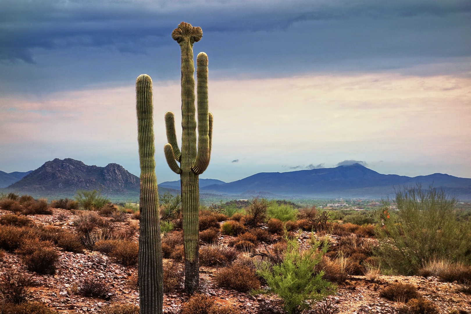
We could see that some of the hills had been burned from where we parked, but the initial quarter mile or so of trail hasn’t been much affected.

I saw a bee pollinating some flowers…

…and some more flowers growing amidst some prickly pear:

Marilyn took this picture of an Agave.  You can see some burned trees on the hillside to the right.

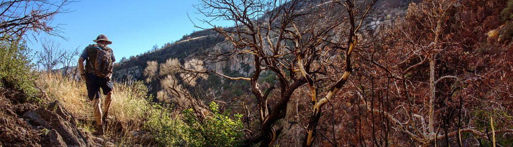
Marilyn also took this photo of me and Joe hiking past some burned trees.  There’s some new growth in the middle of the remnants of the shrub on the far left – I think it might be a Manzanita plant that had burned there.  My guess is that the new growth is Manzanita too.

Burned trees:

More burned trees:

We encountered a blooming Agave or Century Plant:

Here’s a close-up shot of the blooms…

…and another crop showing the very top of the plant.  I don’t think I had ever seen one in bloom before.  As I was editing it, I noticed some bees on these blooms.

The creek had only a little bit of water in it.  We ended up hiking in the creek for a while because the trail became very difficult to find and follow.  Either new growth has sprouted up where the trail is or rain has washed parts of it away.  This is not uncommon in areas that have been ravaged by fires.  We made it just slightly less than two miles along the trail before turning back.  We could have gone further, but I was outvoted.

A roll of rusty barbed wire hung up on a burned out tree.  I think I noticed this wire on a previous hike, but of course, the tree wasn’t burned then.

A view as we were hiking back through the creek:

A ridged and pocked rock perched on the bank of the creek near some burned trees.  Their proximity to the creek did not protect these trees.

Joe, hiking up a hill on the way back:

Another interesting looking boulder:

Fallen Prickly Pear fruit below a ridge line of burned trees.  Most of the Prickly Pear that we saw looked to be in reasonable condition.  Most of the Barrel Cacti that we saw though seemed to have been burned on the inside leaving only a yellow husk.


Friday Fitness Hike

Bob, Linda, Janet, Amy, and I started our Friday hike at the Wagner Trailhead.  We hiked a 9.35 mile route utilizing the Wagner, Granite, Delsie, Pemberton, and Stoneman Wash trails.

It had rained Thursday night into Friday Morning.  The trails were damp, but no rain fell on us during the hike.  The sky was full of interesting clouds and I think those clouds made for some interesting photos.

Amy is holding the rib of a dead saguaro in both of the group pictures.  The McDowells are visible behind us.

Below, Amy is taking her own photo of the McDowells and the highly textured clouds above.  Red Mountain is visible off in the distance.

Textured clouds:

The edges of the two cloud layers direct the viewer’s attention to the McDowells in this photo.

A pair of saguaros.

A view from the Pemberton.  This shot was taken near the Granite Tank as we were ascending the nearby hill.  At the top of the hill is a crested saguaro off to the right.  (It’s not shown in this photo.)

The damp conditions made sand in the washes firmer than usual.  I noticed, however, that the Wagner and Granite Trails felt somewhat soft and squishy when we first started hiking.  It’s interesting that the rain can make a normally firm trail soft and a normally soft trail firm.

We saw this tree just as we entered Stoneman Wash.

Boulders in Stoneman Wash:

A large multi-armed saguaro visible from Stoneman Wash:

Another edit of the above photo.  The sky has somewhat less contrast in this one.  Marie likes this one better, but Joe likes the original edit, above, better.

Yellow flowers.  Anyone know what kind of plant this is?

We heard helicopters flying overhead around the time when I was trying to photograph the yellow flowers.  (My camera didn’t want to focus for close-up shots.)

I’m hoping that Amy will be able to tell me the name of this reddish plant.  There’s a lot of it growing in the washes.  Several weeks ago, we saw similar plants that were light pink in color at the bottom of the Tonto Tank Trail.


Views from the Pine Creek Loop

Marilyn and I hiked the Pine Creek Loop late on Sunday.  It’s a three mile loop that starts from a parking area just off the Beeline Highway.  It connects with the Ballantine Trail about half way around, though we did not hike the Ballantine Trail on Sunday.

The trail starts off steep; elevation is gained quickly.  This is a view from perhaps half way up.

A view looking off to the west.  Beeline Highway (AZ 87) is visible in this photo as is Red Mountain.

We had descended from the top of the hill and were making our way around the loop here.  The terrain is very hilly here.

The trail is cut into the hill forming a steep bank and this location.  The sun had not quite set yet and was peeking through a bush.  I thought it made for an interesting shot.  I was shooting in RAW mode with exposure bracketing.  I used the brightest and darkest exposures (which are a stop and third apart) along with a bit of tone mapping to create the image below.

We’re perhaps half a mile away from the parking area in this photo.

Bob’s Siphon Draw / Flat Iron Photos

Bob hiked up Siphon Draw to the Flat Iron on Saturday.  He sent me these pictures…


Electric Blue Clouds over the Hilltop Trail in Mid-July

A big storm hit central Arizona back in mid-July.  Once the storm had passed, as dusk was approaching, we noticed that the sky was filled with electric blue textured clouds.  Marilyn and I hiked up the Hilltop Trail in McDowell Mountain Park where we took this photo and many others too.

2011 Arches National Park Photos

Below are a few photos from our 2011 trip to Arches National Park.

Joe points the way to Delicate Arch:

A family photo in front of Delicate Arch.  Karl took this photo.

A roadside view in Arches National Park.

A view from Devil’s Garden, in Arches National Park.

Palm Tree at Sundown

We had a nice pink sky after sunset earlier this evening.  This is a photo of the palm tree in our front yard.

Taken with my NEX-7 at ISO 1600, f/7.1, 1/100s, -0.7 EV, w/ a focal length of 200mm (fully zoomed).  There’s more noise than I would like in the fronds of the tree; this is partly due to the high ISO and partly due to the fact that I tone mapped it for more color and definition in the tree.  The tone layer is largely masked out with only a 30% opacity for portions of the tree and other foliage.

I used exposure bracketing on my NEX-7.  I might get better results if I use the +0.7 EV exposure for the tree and other foliage.

Kittens, by the Water Bowls

I got this photo today of all three kittens lazing by the water dispensers.

Marie’s Contest Poster

Dad took a photo of my art class homework / contest poster this morning…

Minstrel’s Kittens

Neither Minstrel or her kittens came by yesterday.  We think they were frightened off by the Javelina that had visited the night before.  But, for a time this morning, both the mamma and daddy cat were here along with three kittens.

The daddy cat is quite tolerant of the kittens.  He doesn’t like it when Callisto – who is probably his offspring too – comes outside.  She used to try to go up and greet him, but he growls and she backs off.

The gray kitten with white markings has very big ears!

The one remaining ginger kitten.  We had seen a second one when Minstrel starting bringing them by, but it disappeared soon thereafter.

Here are the two grays playing with each other: