This is near the top of the steps leading up to the Ski Jump in Iron Mountain, Michigan. I am told that several years ago the steps were in an extreme state of disrepair. They were refurbished with money from step sponsors.
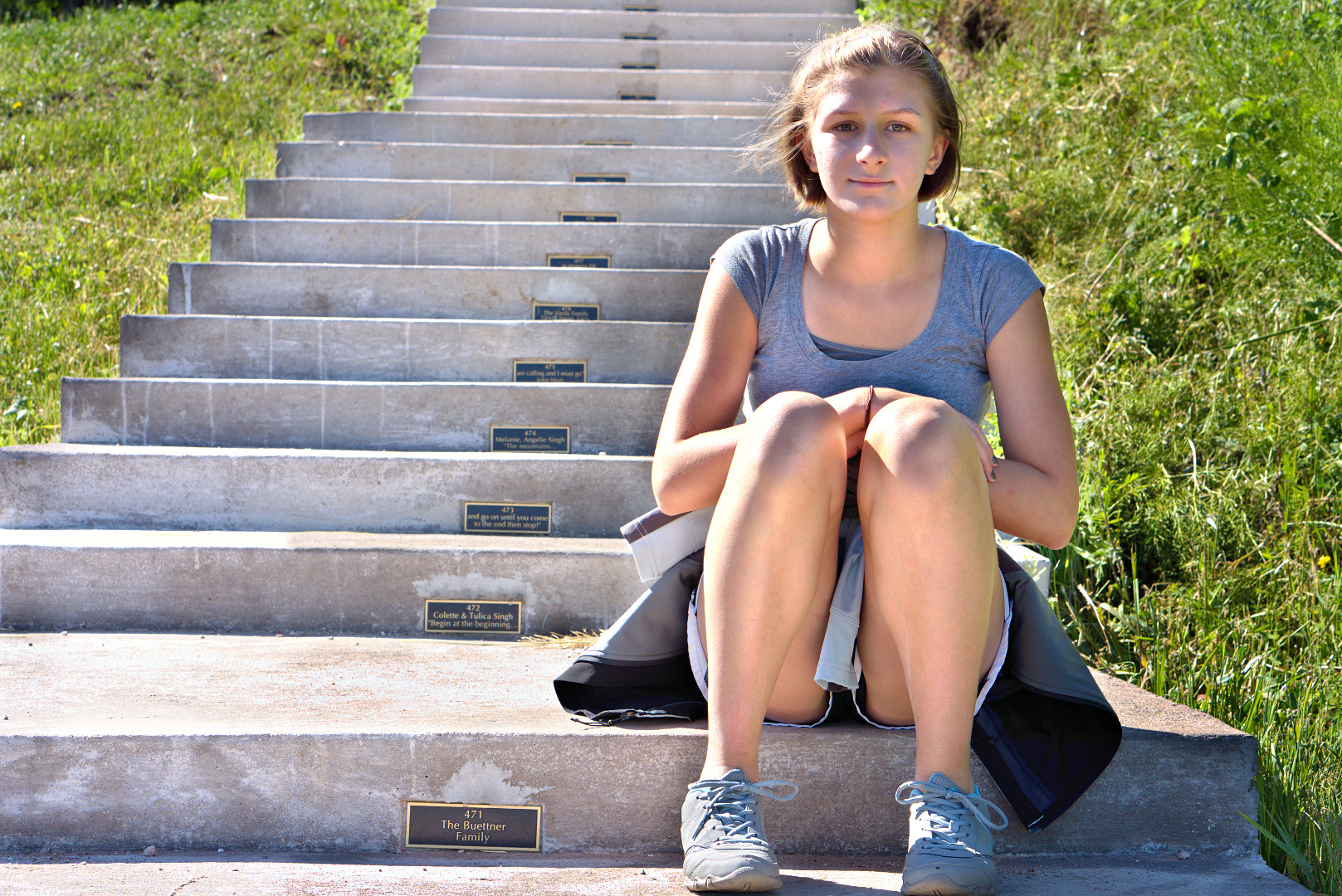
This is near the top of the steps leading up to the Ski Jump in Iron Mountain, Michigan. I am told that several years ago the steps were in an extreme state of disrepair. They were refurbished with money from step sponsors.
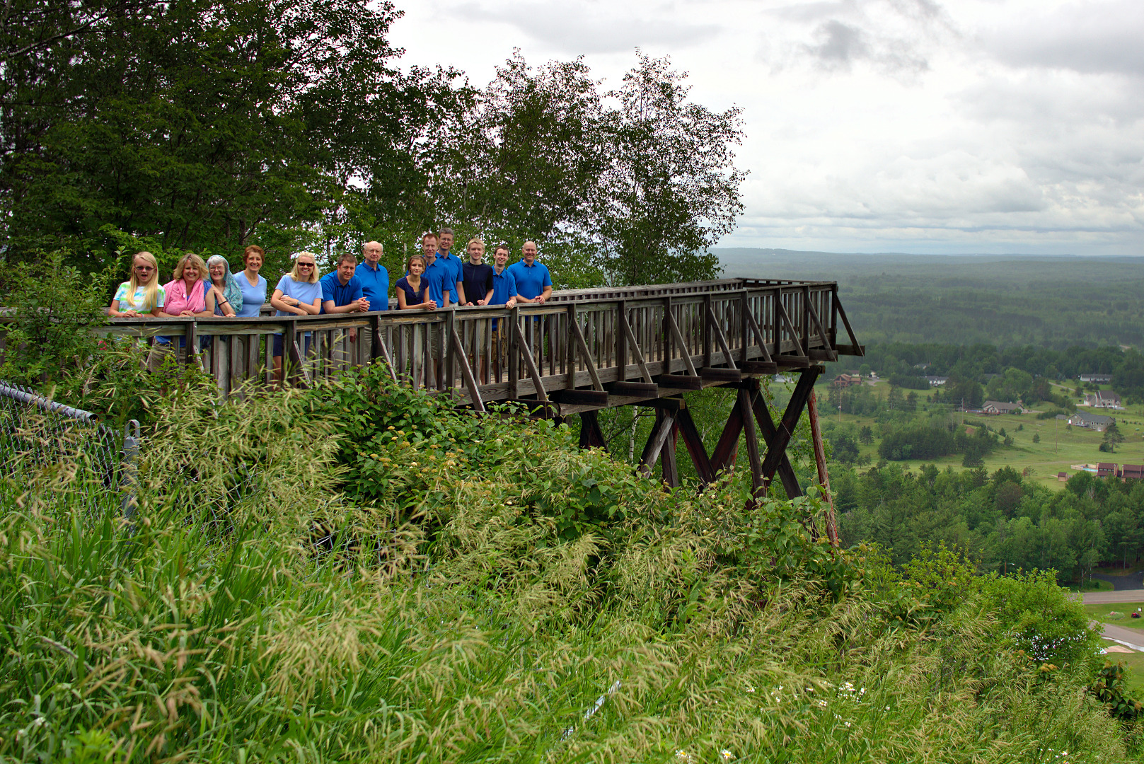
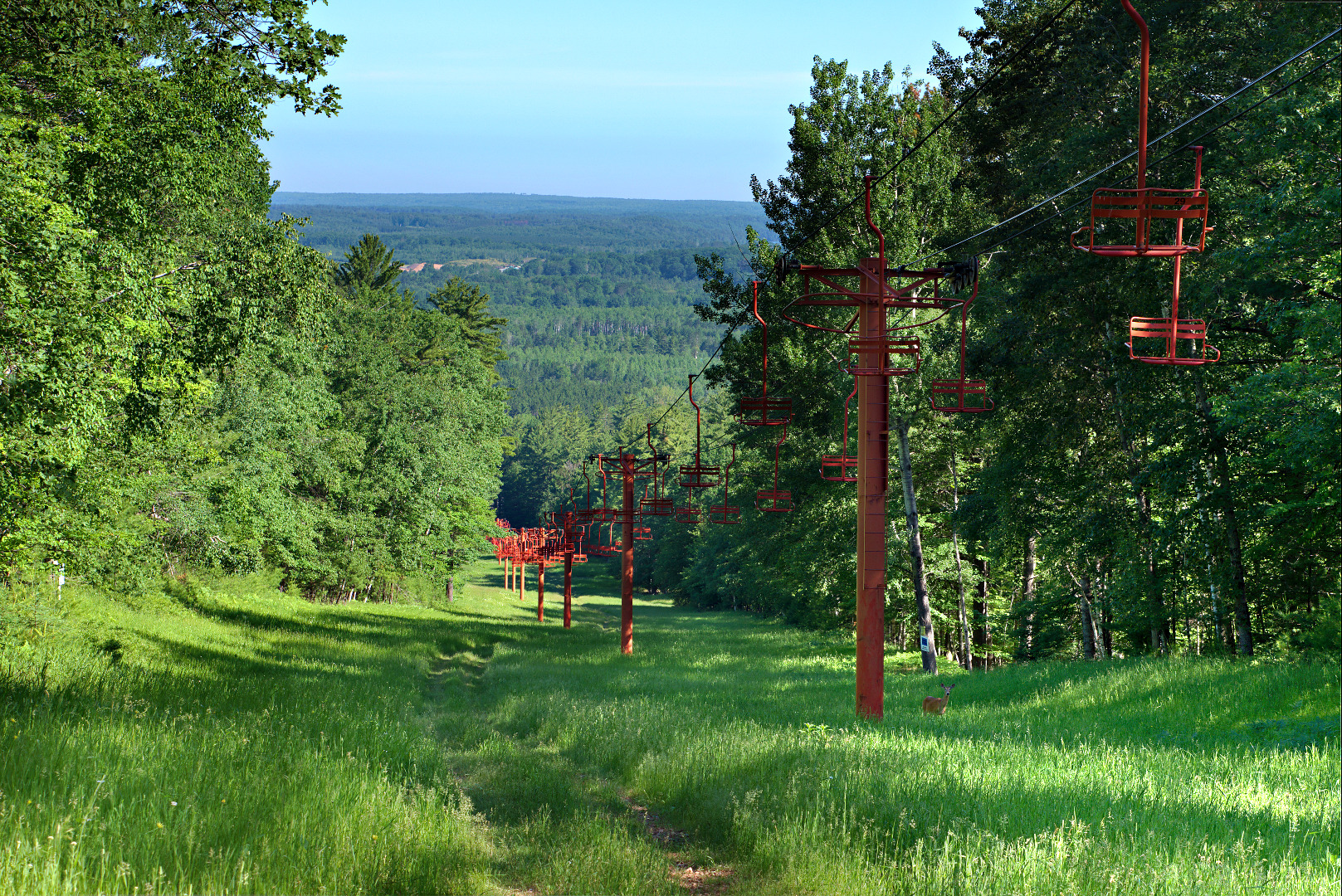
…in Iron Mountain, Michigan:
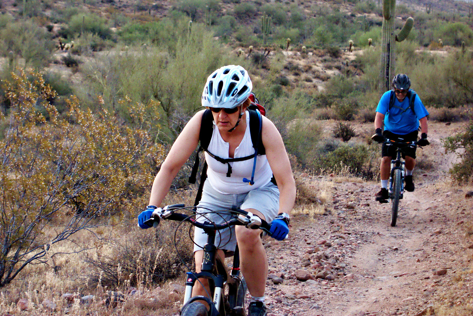
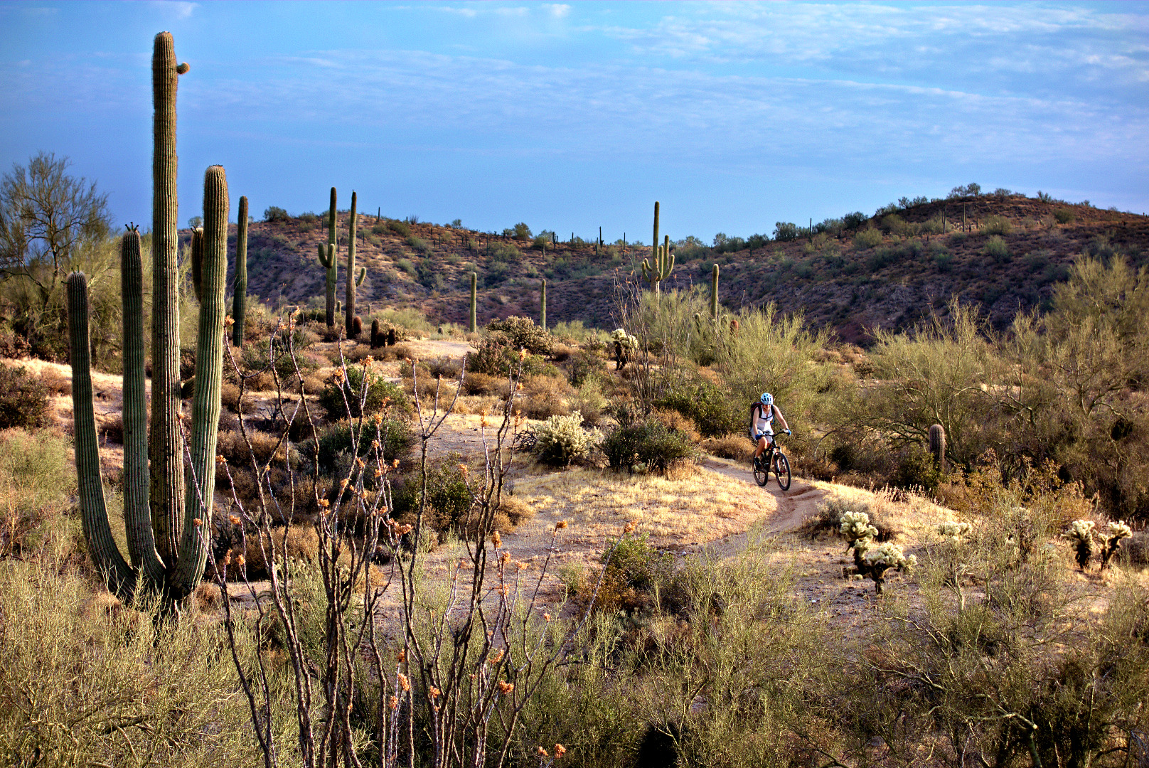
Bob, Marilyn, and I went out early to ride the Competitive Tracks at McDowell Mountain Park.
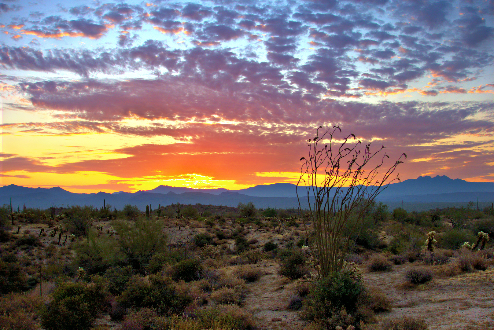
Just before sunrise:
 Marilyn and Bob ride to the top of the first big hill on the Sport Loop:
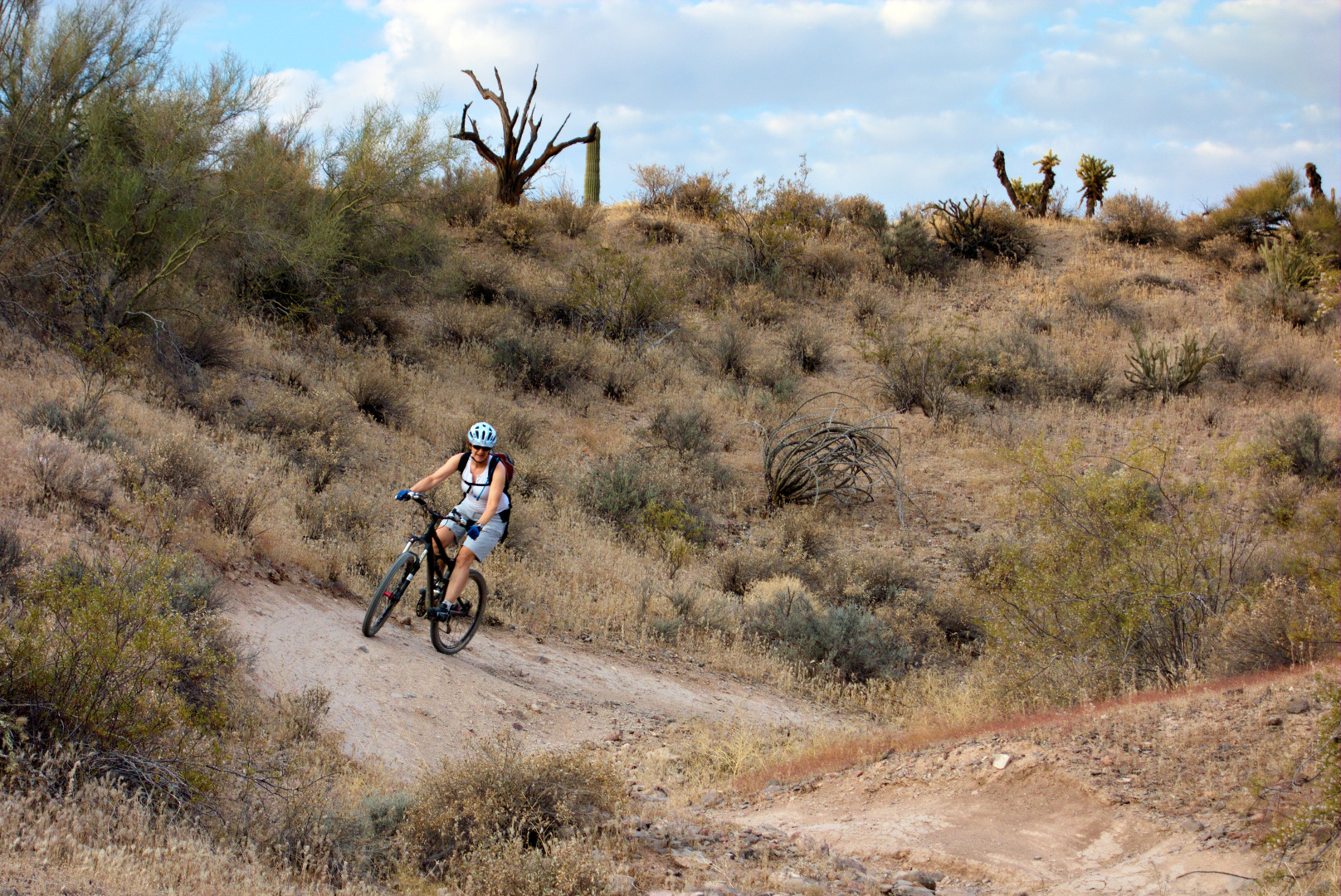
 Negotiating some S-curves:
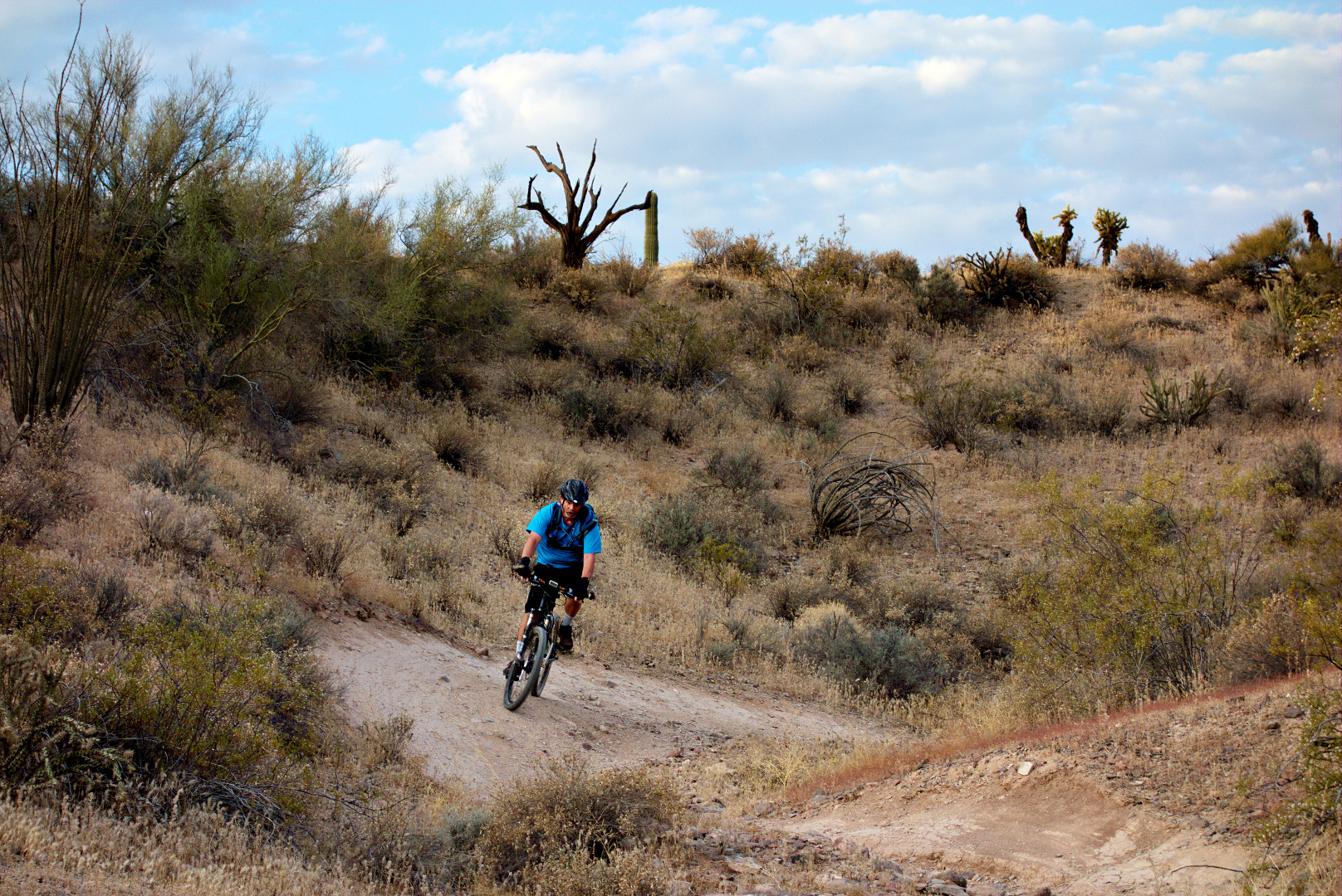
Bob, near the end of the Sport Loop:
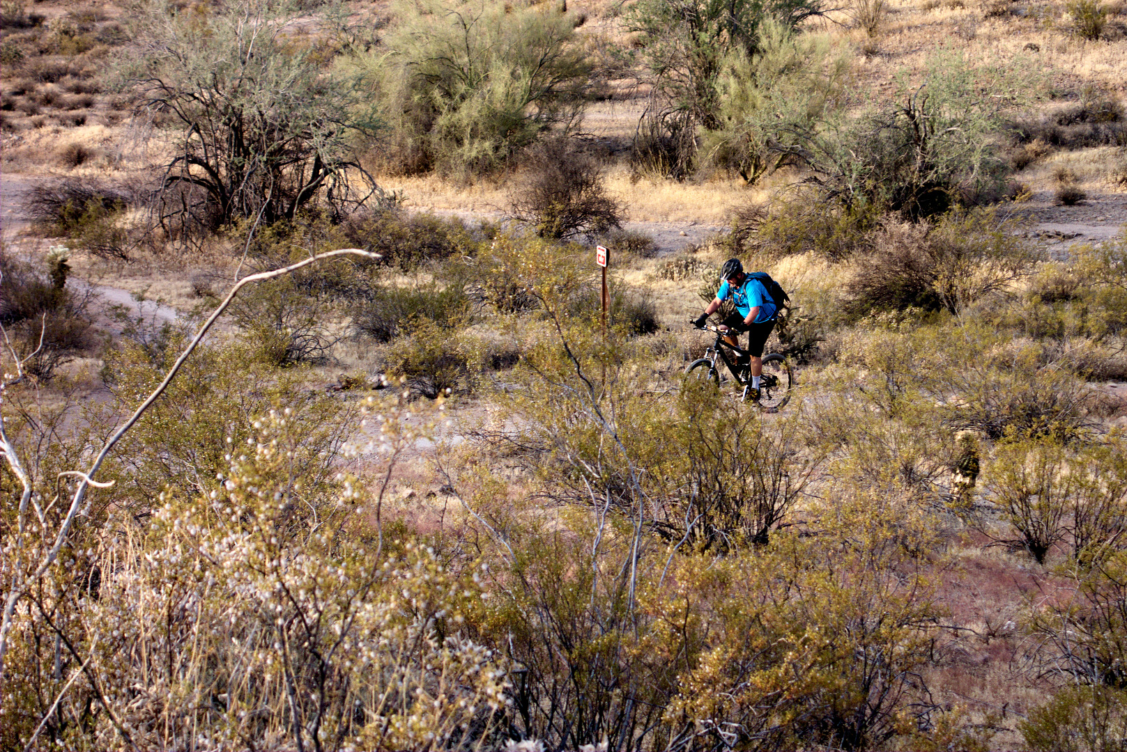
Marilyn, on the Technical Loop:
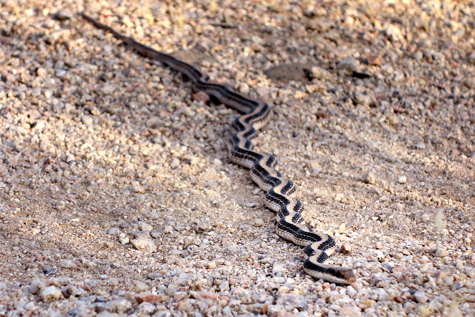
 This snake was lying across the trail on the technical loop. I got three shots of it prior to turning around and slithering off.
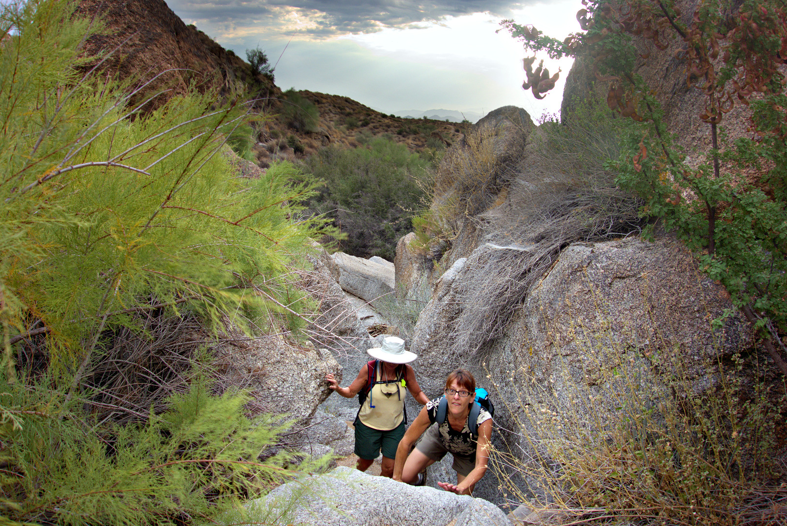
Friday’s hike started at the Wagner Trailhead. Bob, Teresa, Linda, Janet, and I hiked 7.25 miles. The highlight of the hike was the wash paralleling the Bluff Trail. Most of the photos below are from that area.
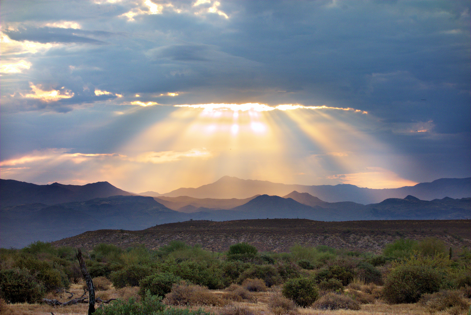
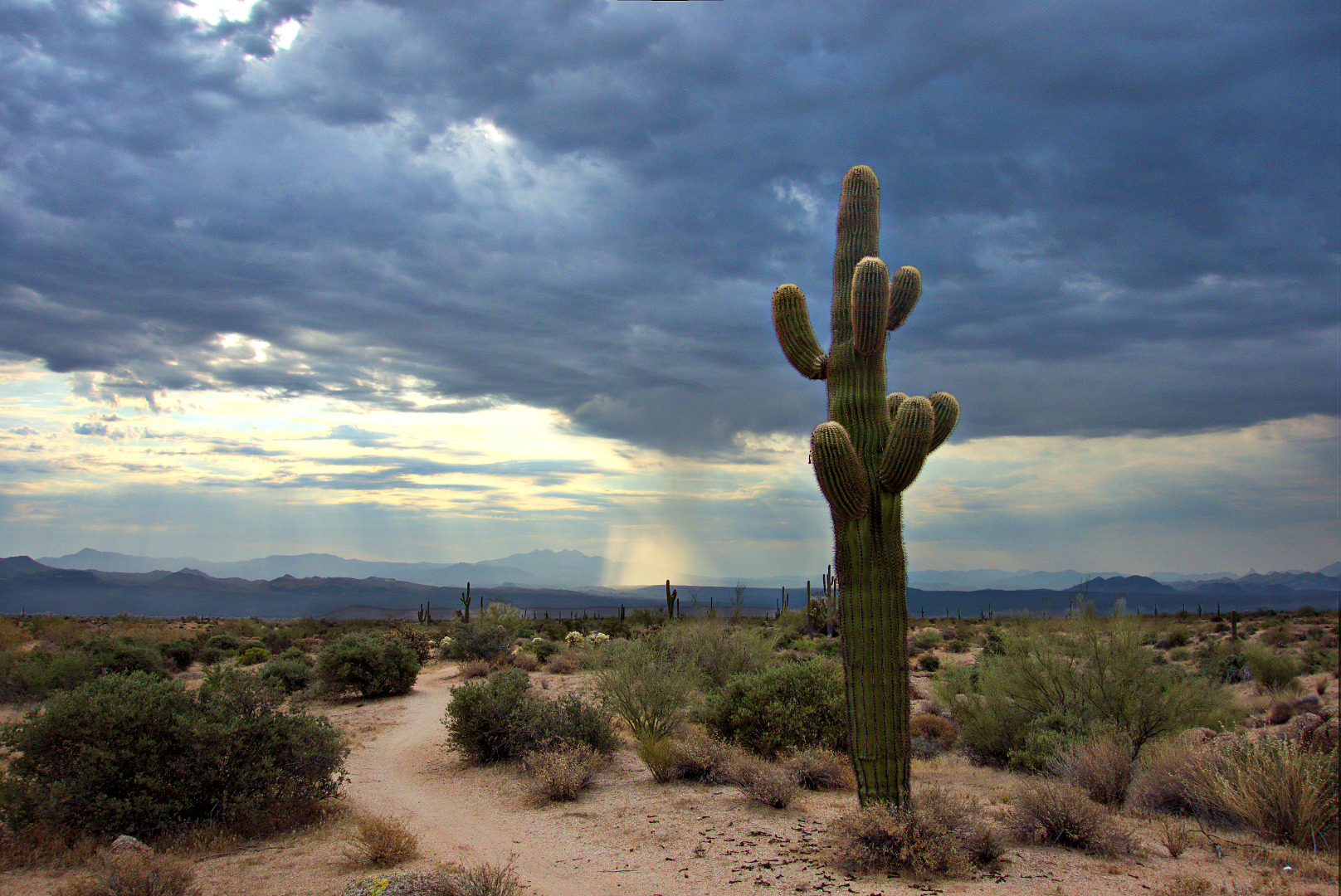
The morning was cloudy, which is kind of unusual for Arizona, though not too unusual for hikes in July and August. We heard thunder off in the distance and were able to see rain in the distance too. Occasional gaps in the clouds allowed the sun to light up mountains in the distance.
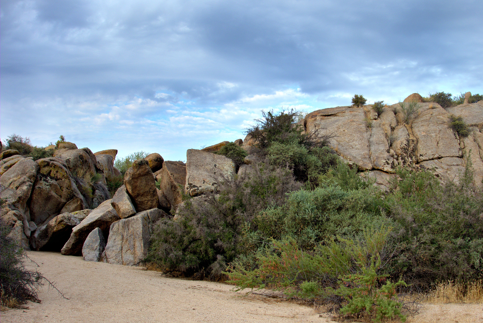
This is a view of the wash, just after leaving the Granite Trail. We climb the boulders near the left edge of the photo in order to continue on up the wash.
Teresa and Linda make their way up the rocky part of the wash.
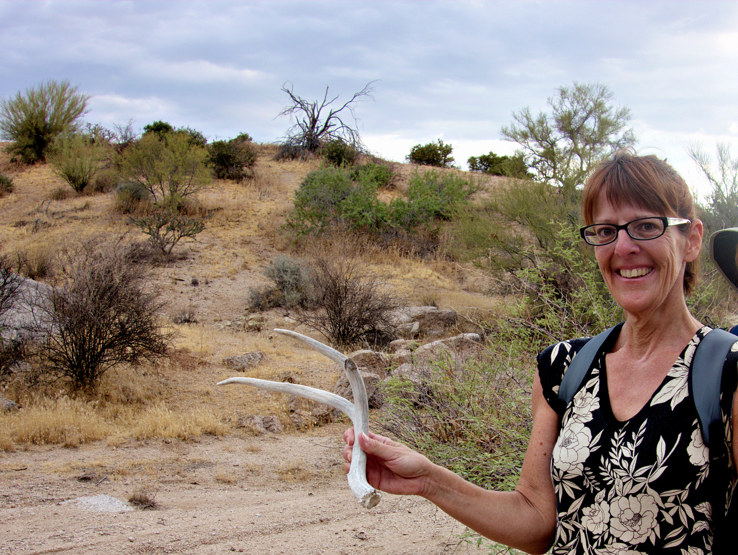
Teresa found this antler in the wash.
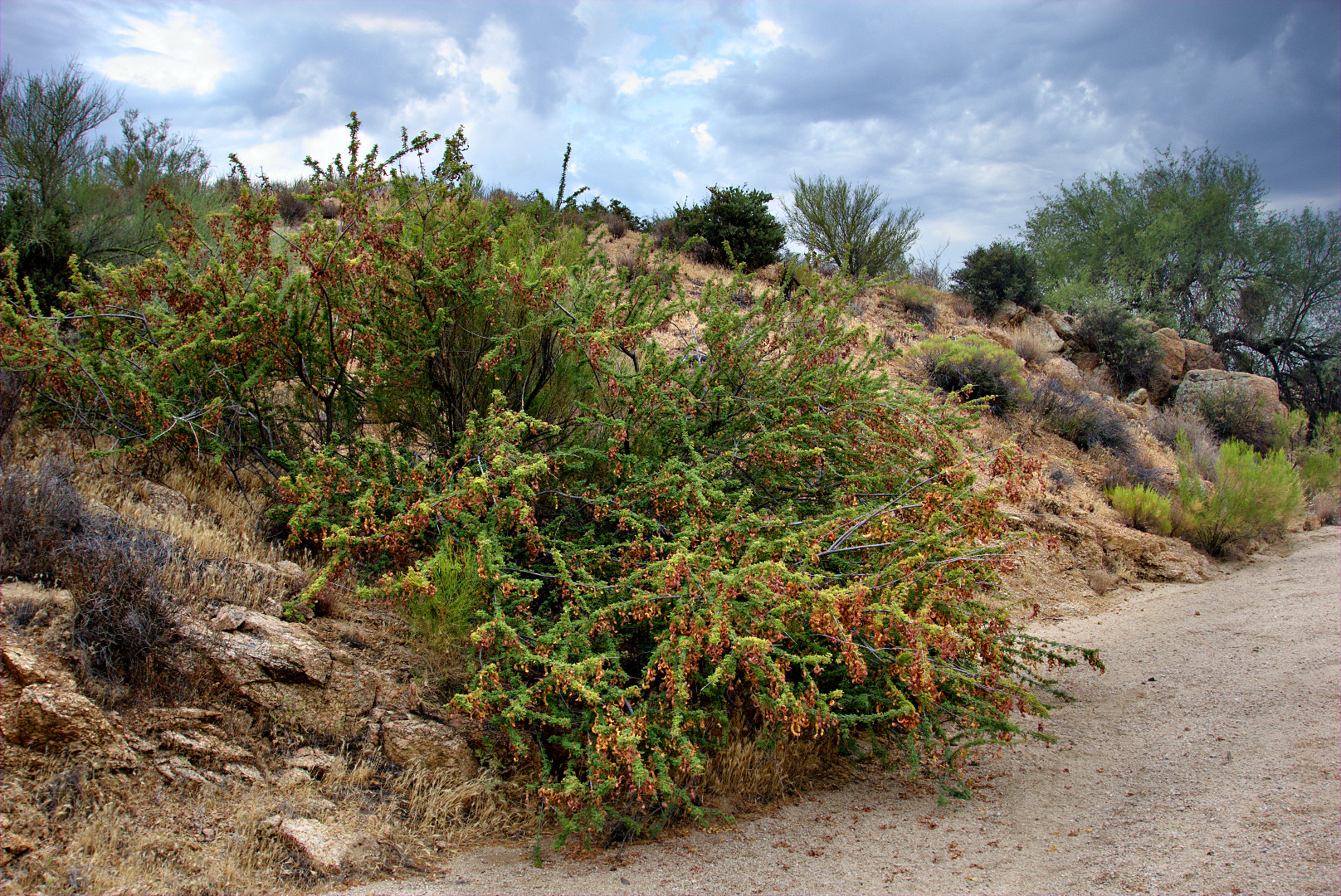
Anyone know what kind of plant this is?
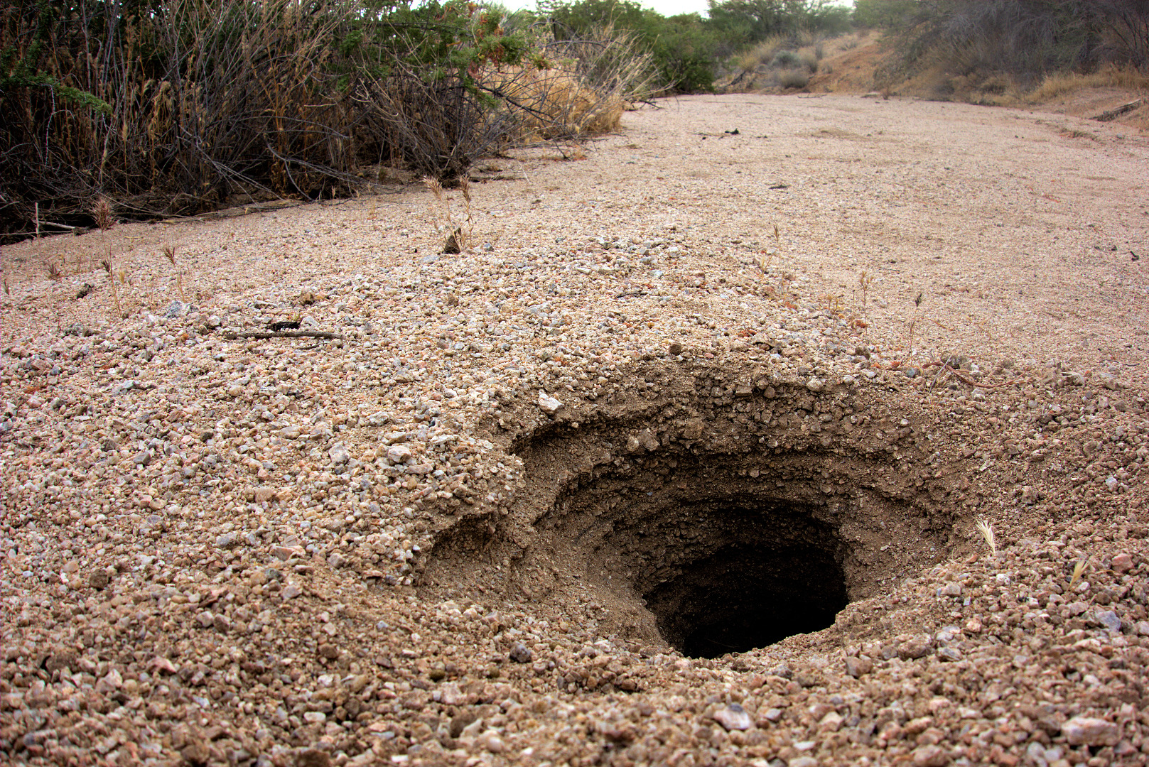
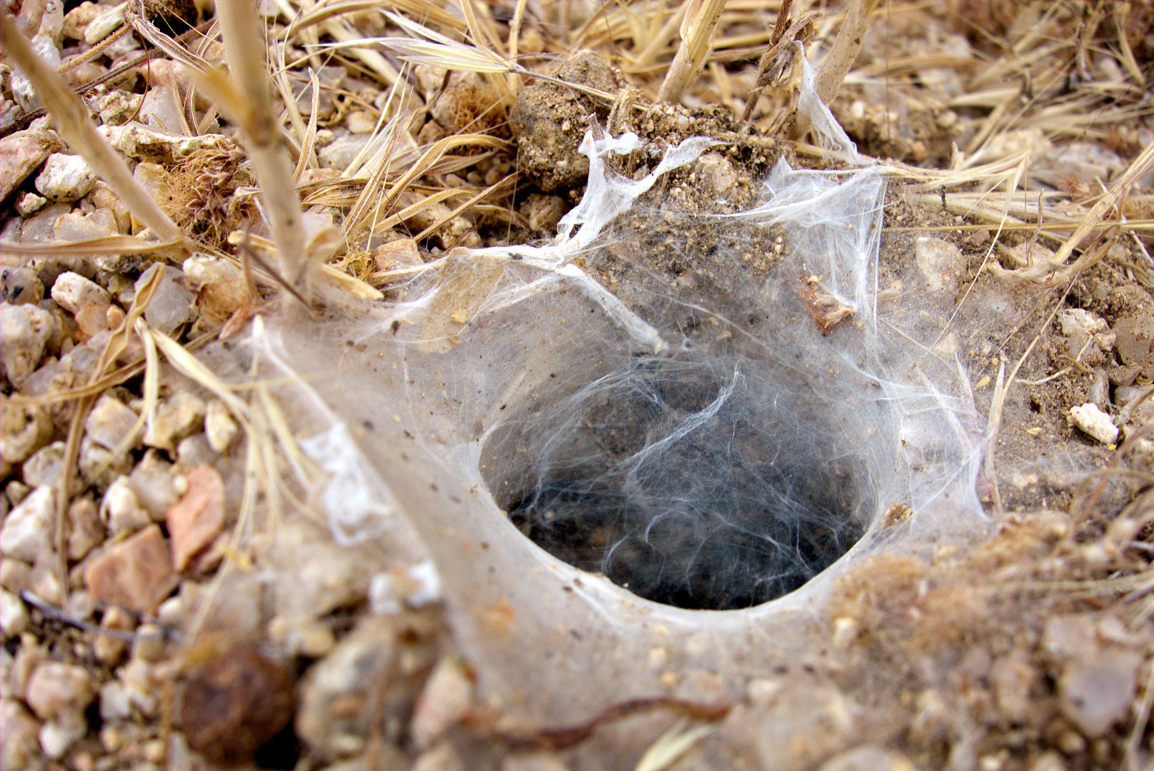
We saw many holes as we hiked up the wash. This one was quite large, but shallow. We were able to easily see the bottom of the hole. We wondered what kind of animal made this hole.
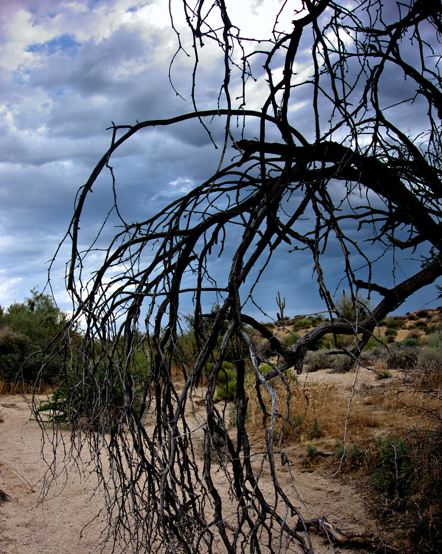
Spooky looking tree branches:
Here’s a spider hole. But what kind of spider lives here?
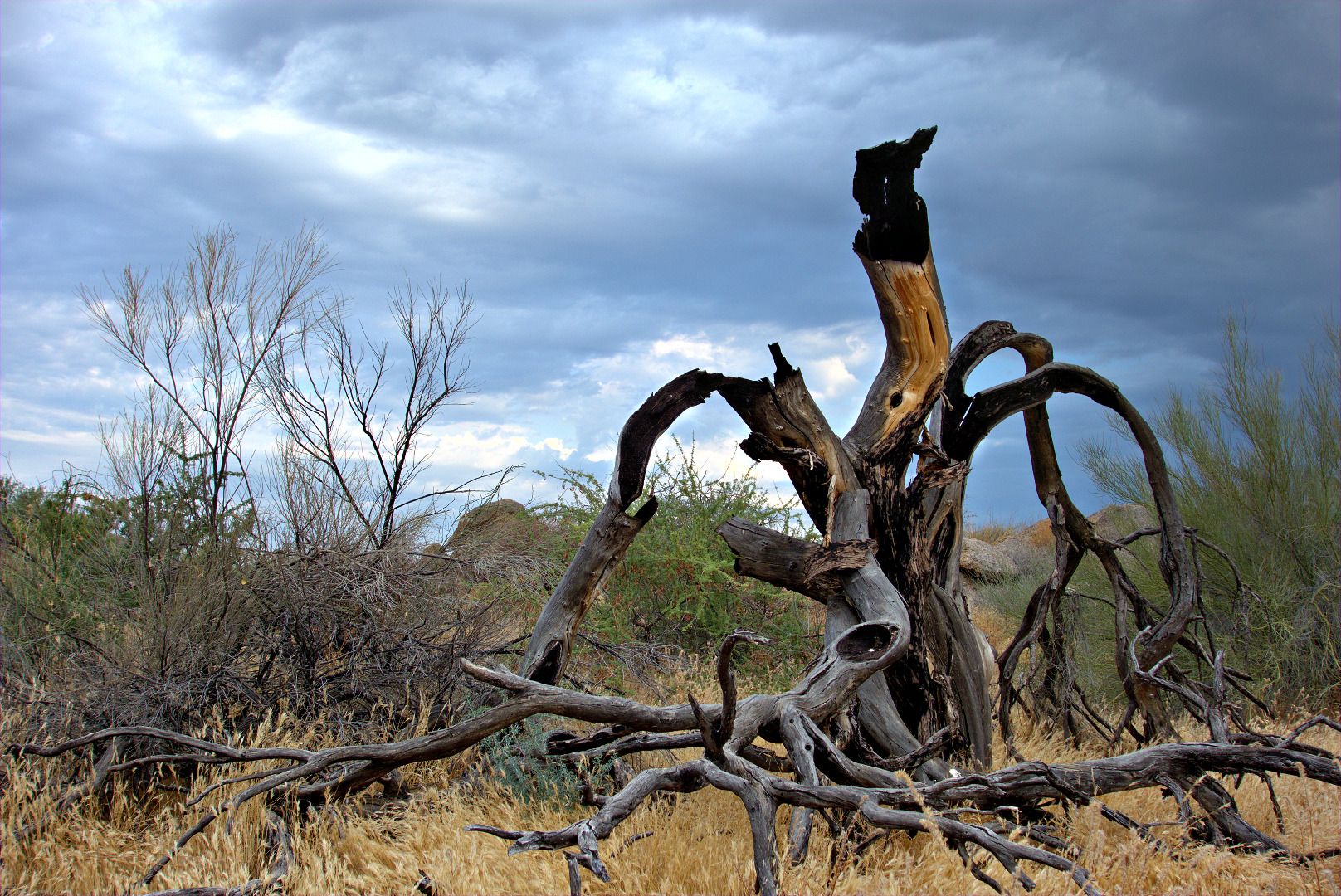
Part of a burnt tree…
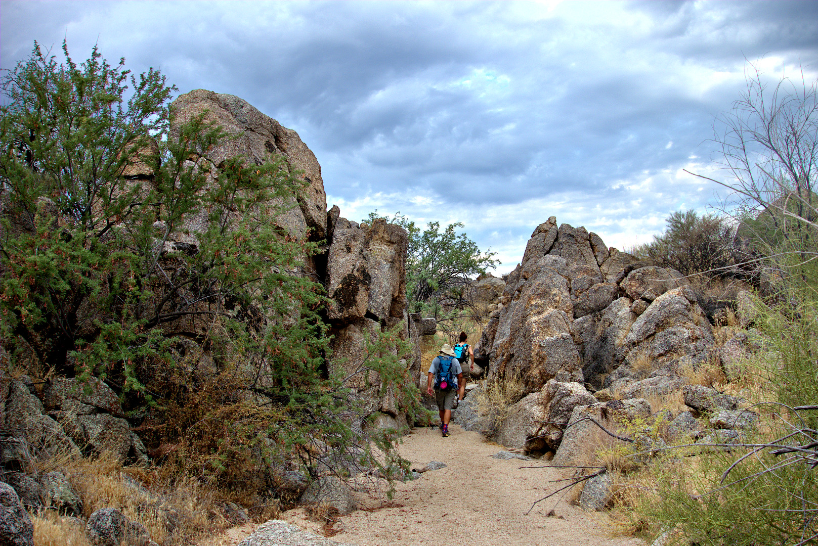
Teresa and Bob hike through another rocky section of the wash.
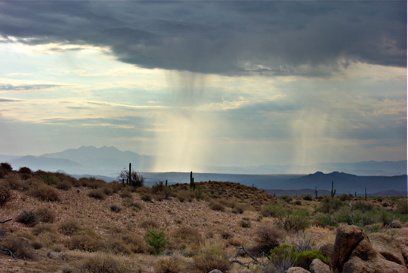
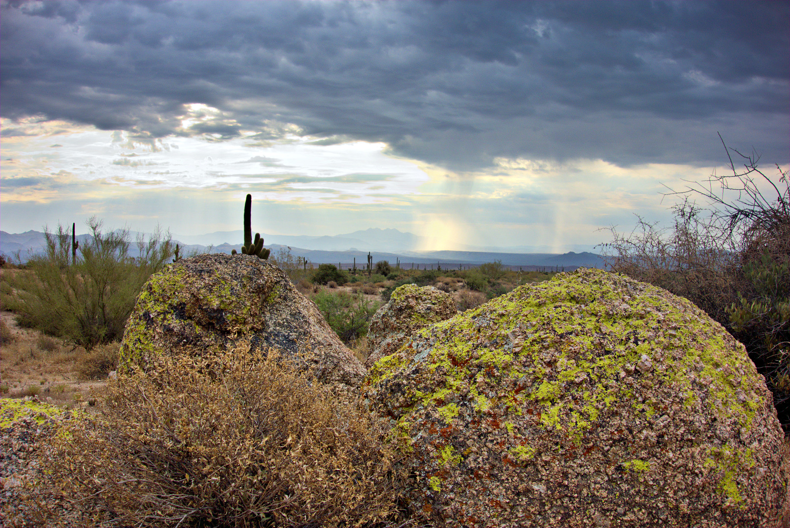
Rain showers in the distance…
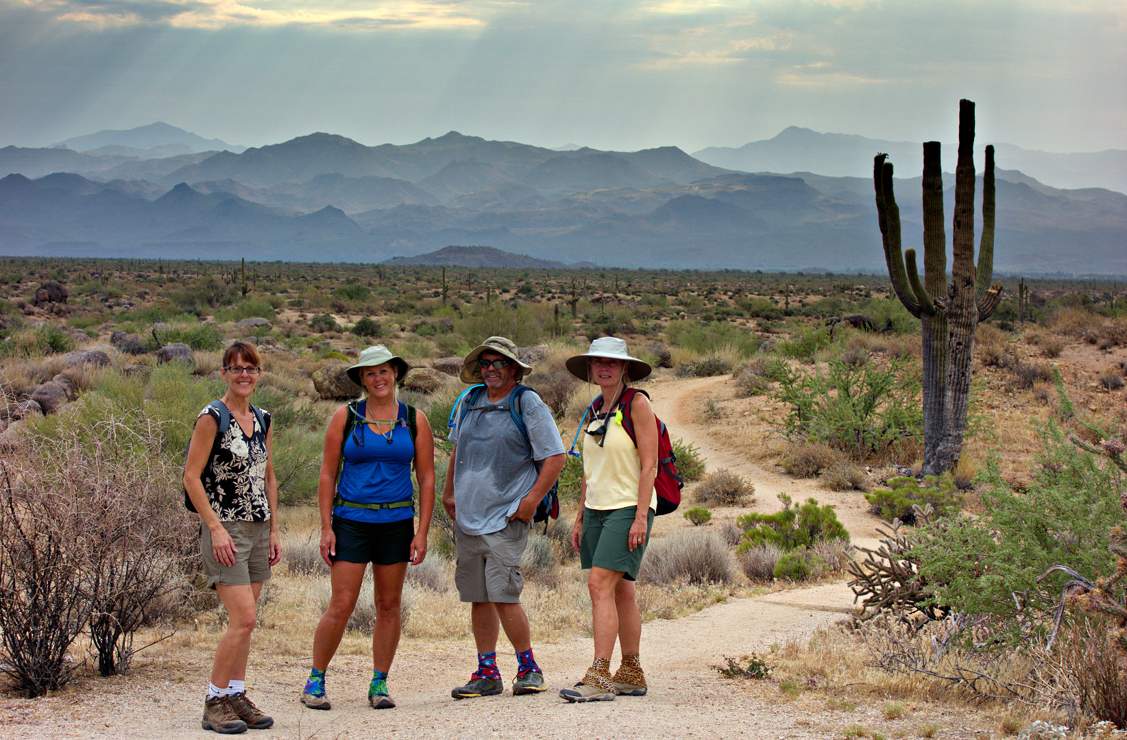
Teresa, Janet, Bob, and Linda at the top of the Bluff Trail. Janet, Bob, and Linda are wearing colorful gaiters purchased from Dirty Girl Gaiters.
Another view of rain showers from the Bluff Trail:
Another view of the Bluff Trail, with Four Peaks just visible behind some rain showers.
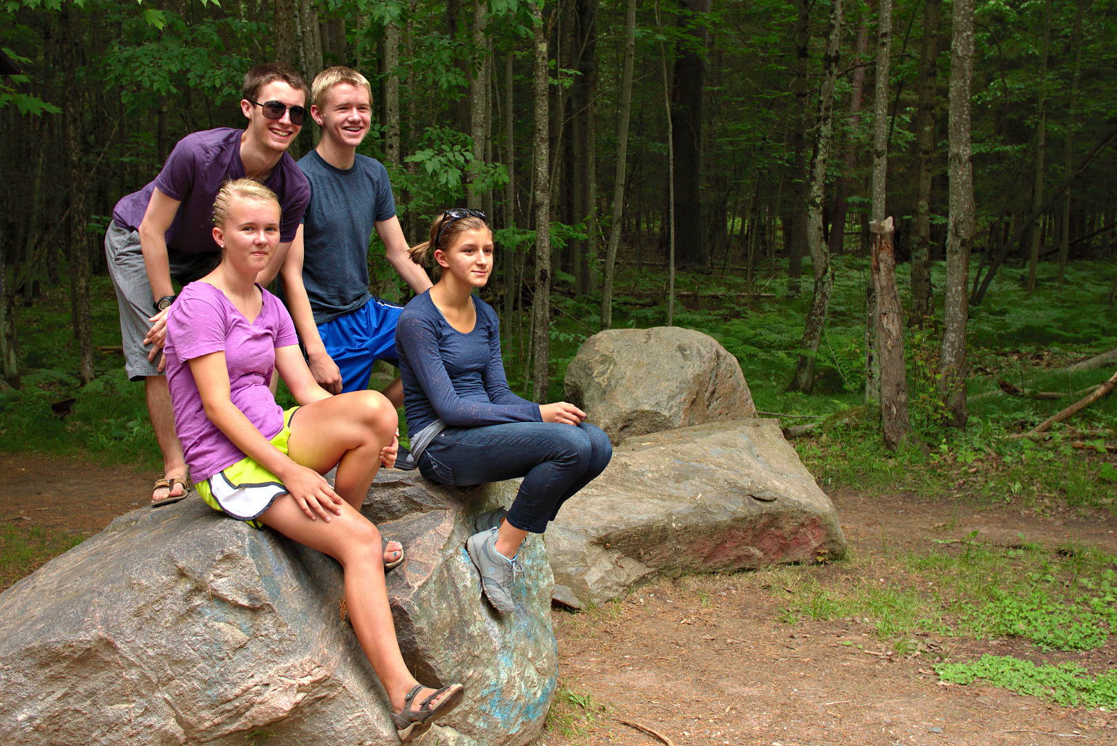
Anna, Pat, Greg, and Marie sit on a rock at the Piers Gorge trailhead.
Turbulent waters of the Menominee River: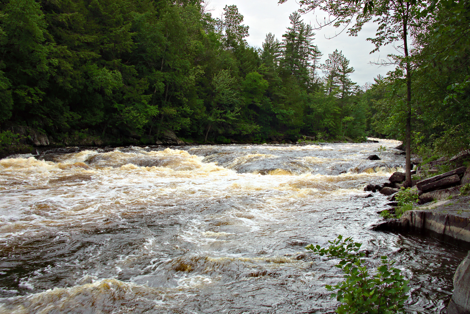
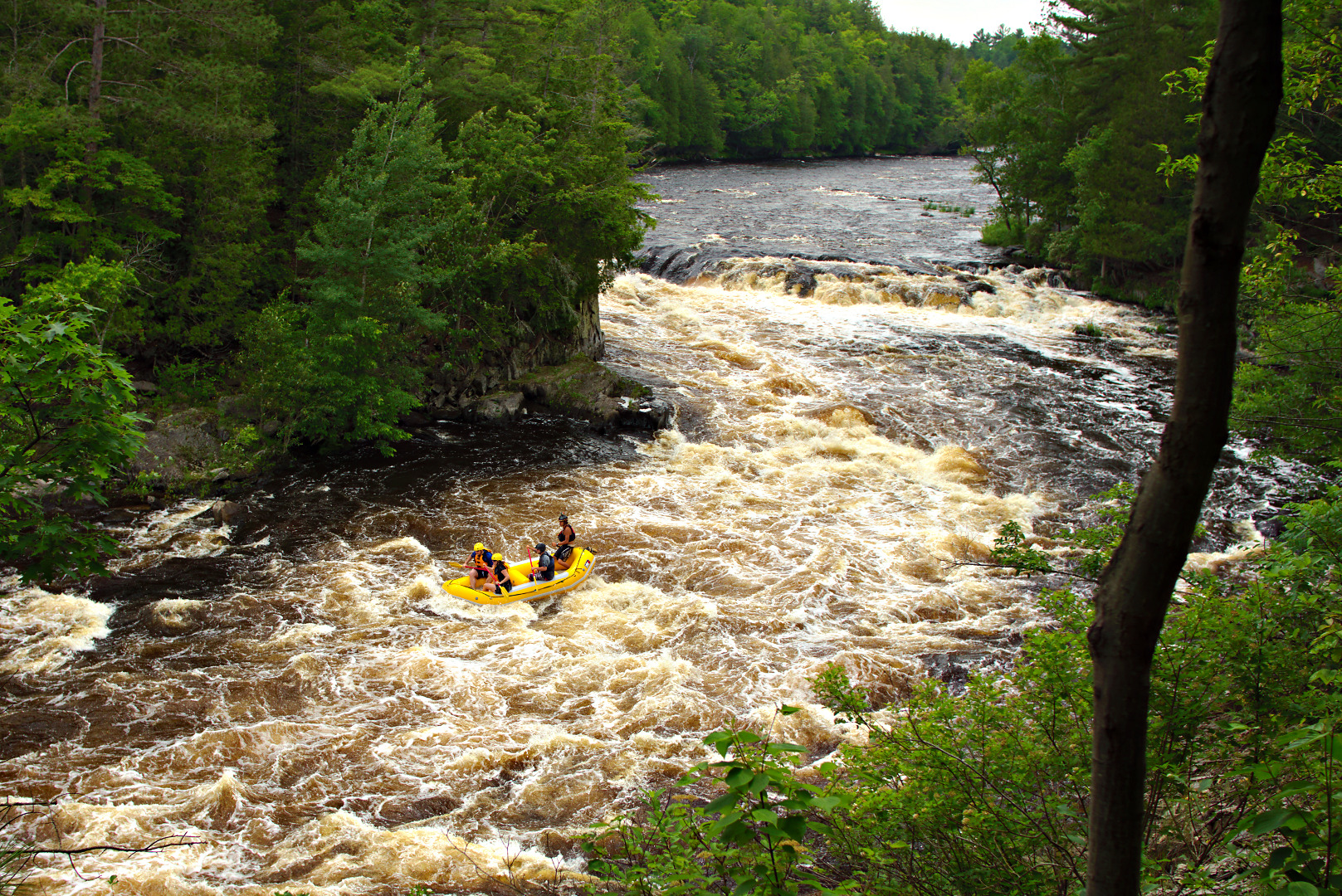
Rafters going through the rapids:
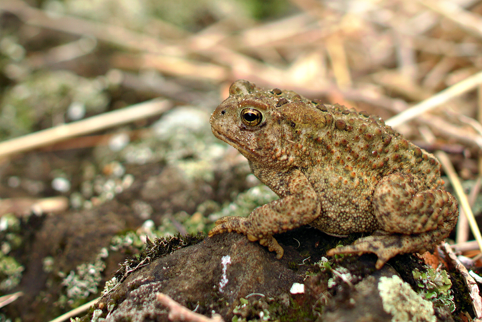
We saw this toad on the way back.
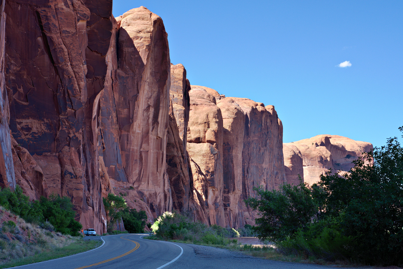
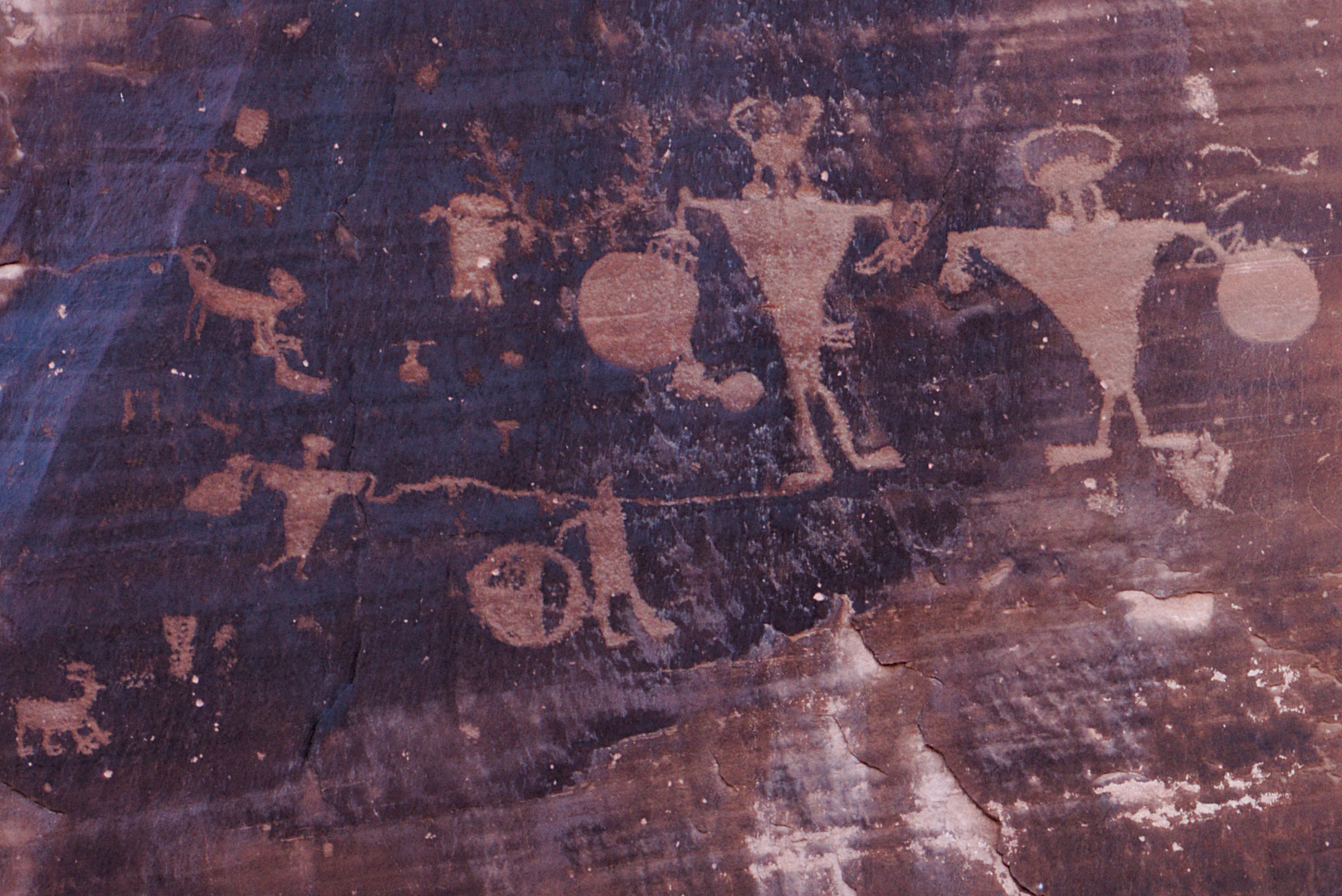
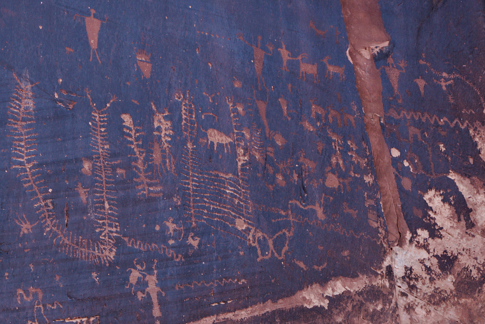
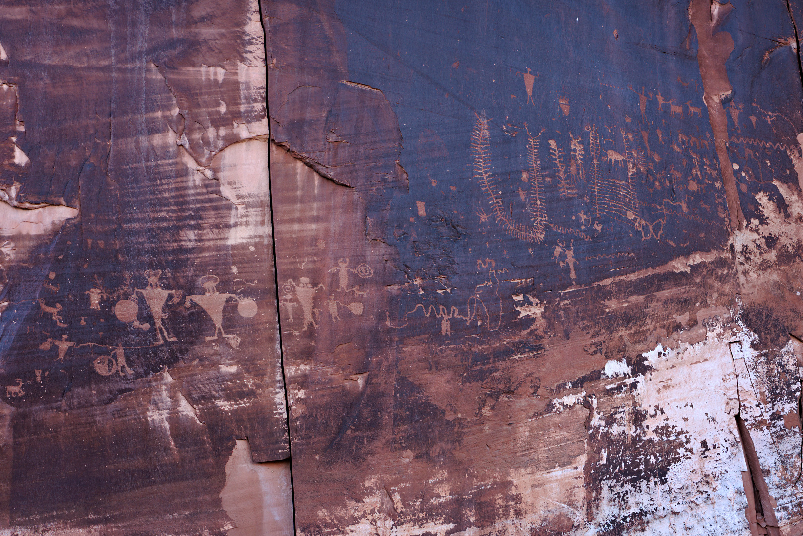
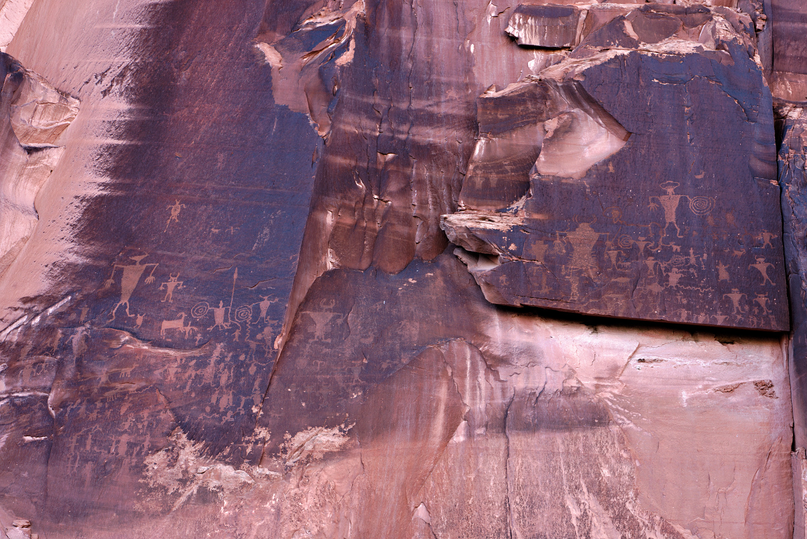
Utah State Route 279 snakes along the north bank of the Colorado river. In many places, not more than a few feet from the road are tall, nearly vertical cliffs. About 5 miles from the intersection with US 191 is a rock art site created by ancient native Americans.
This photo looks back along 279. The rock art is not visible in this photo – it’s on the walls to the left and even behind the camera.
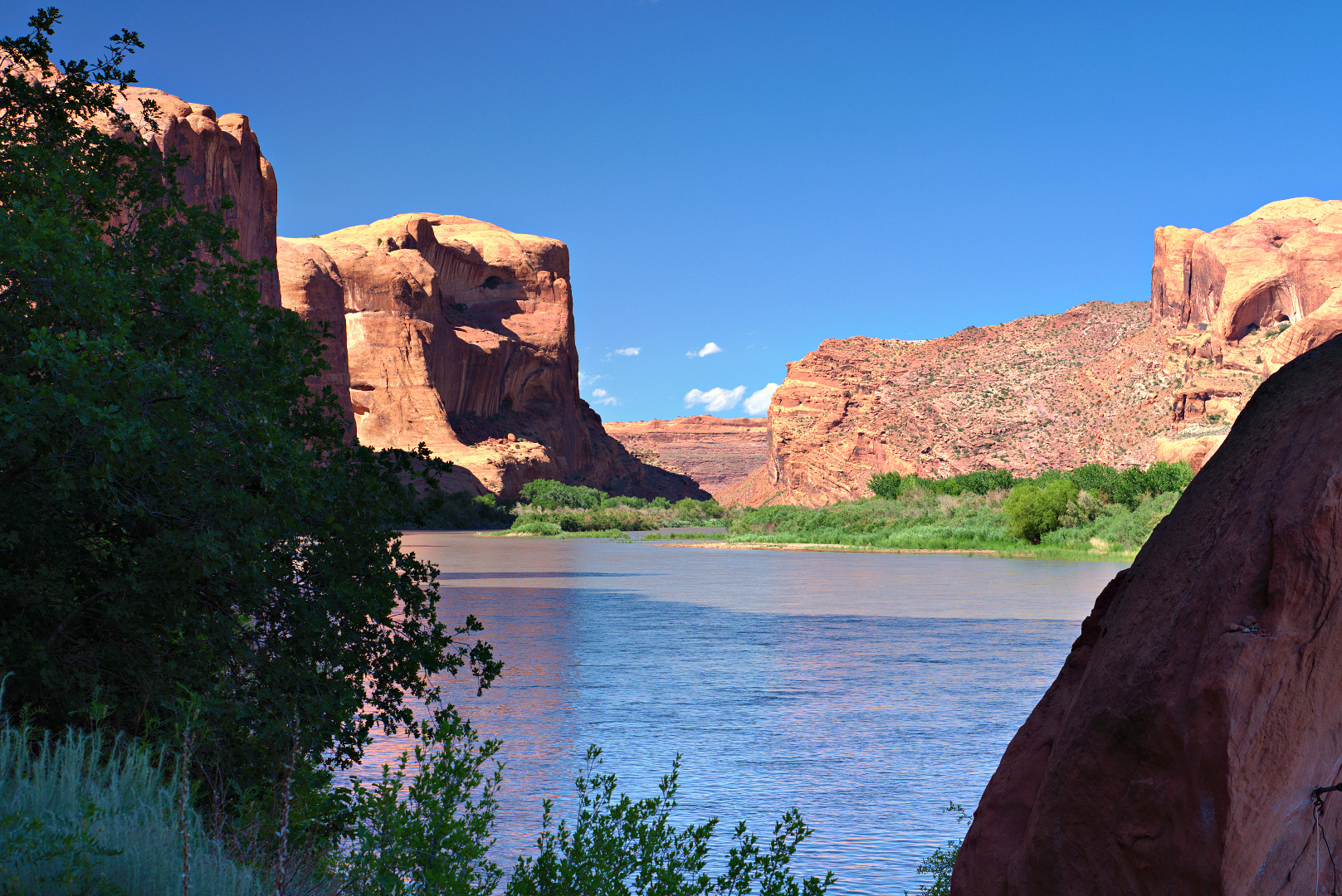
 Here is a view looking up and across the river. If you look closely, you can see part of the Moab Rim Trail on the other side of the river.
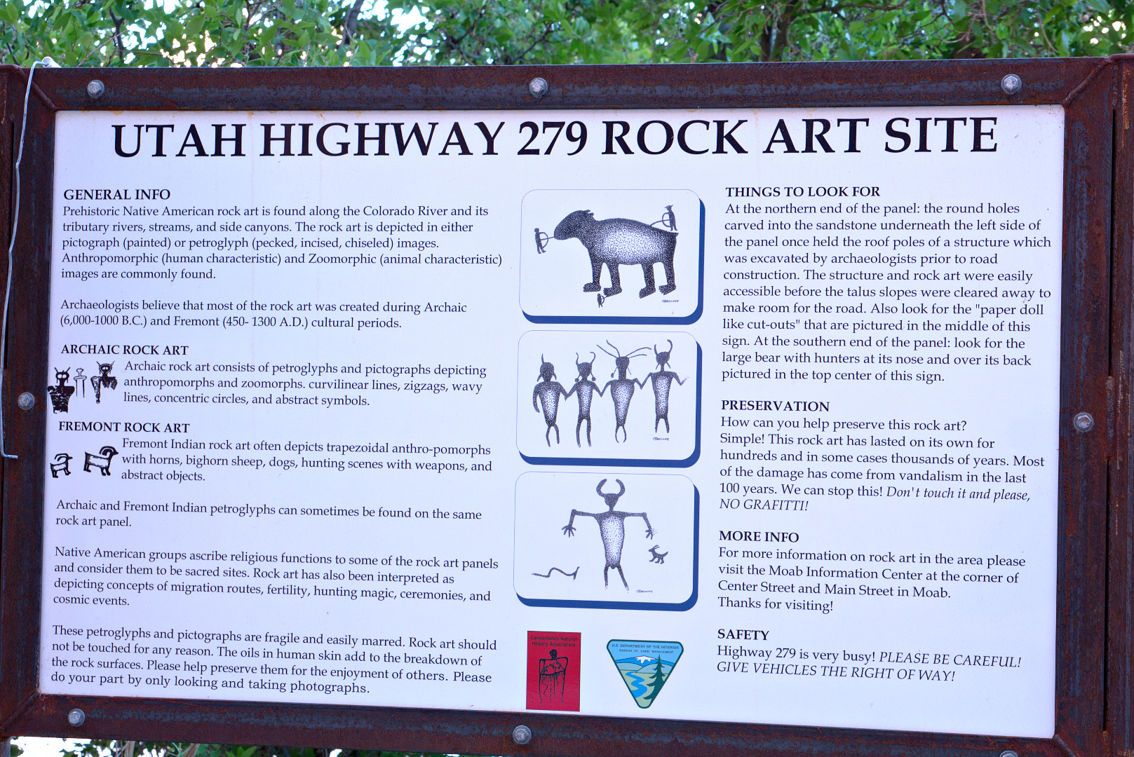
 This is the sign discussing the rock art at one of the pull outs.
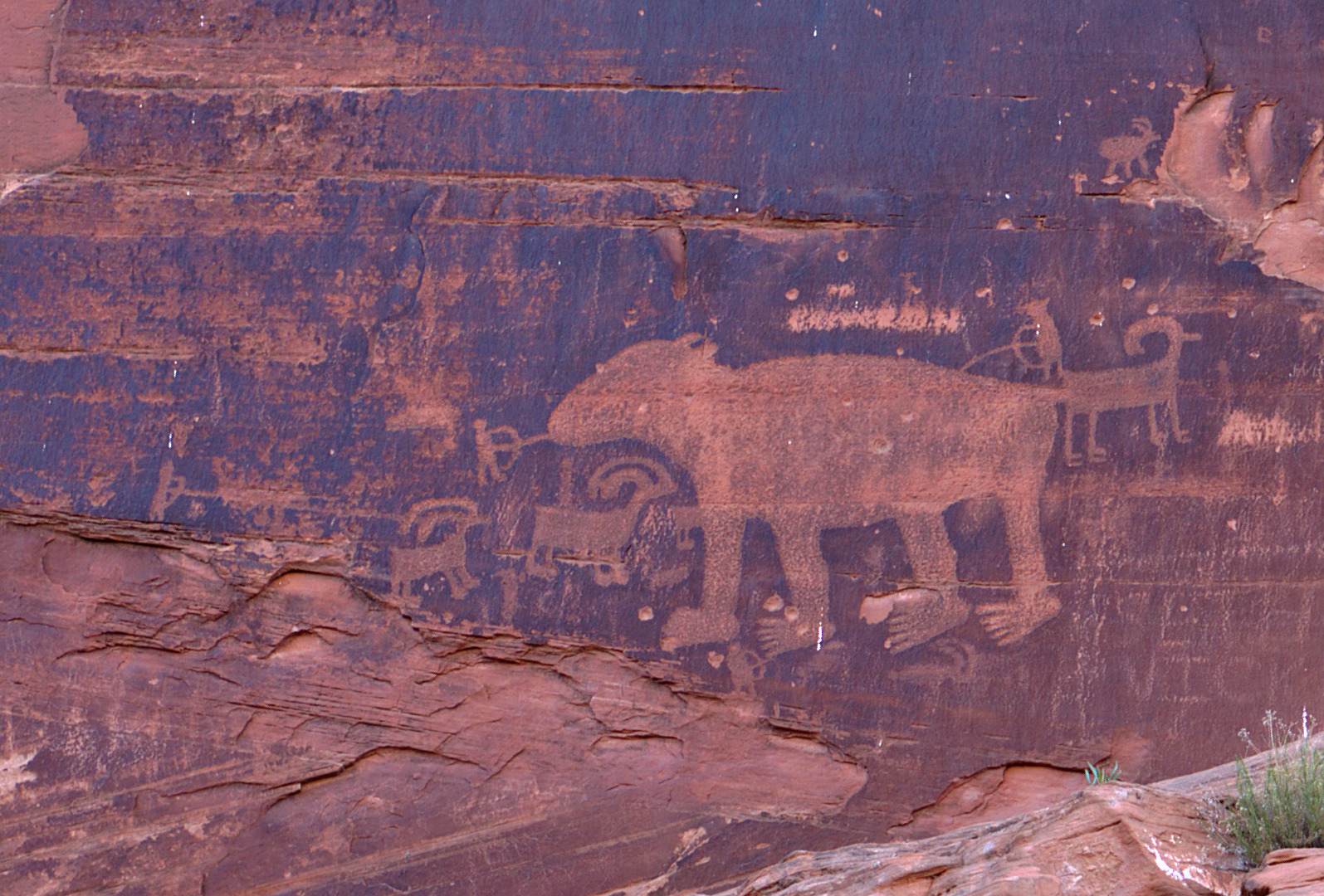
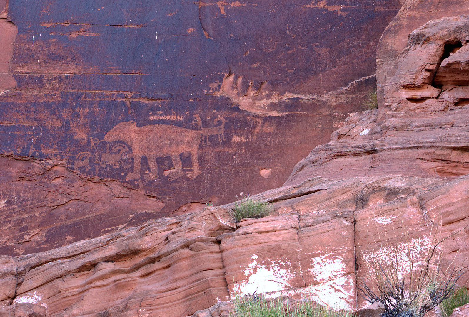
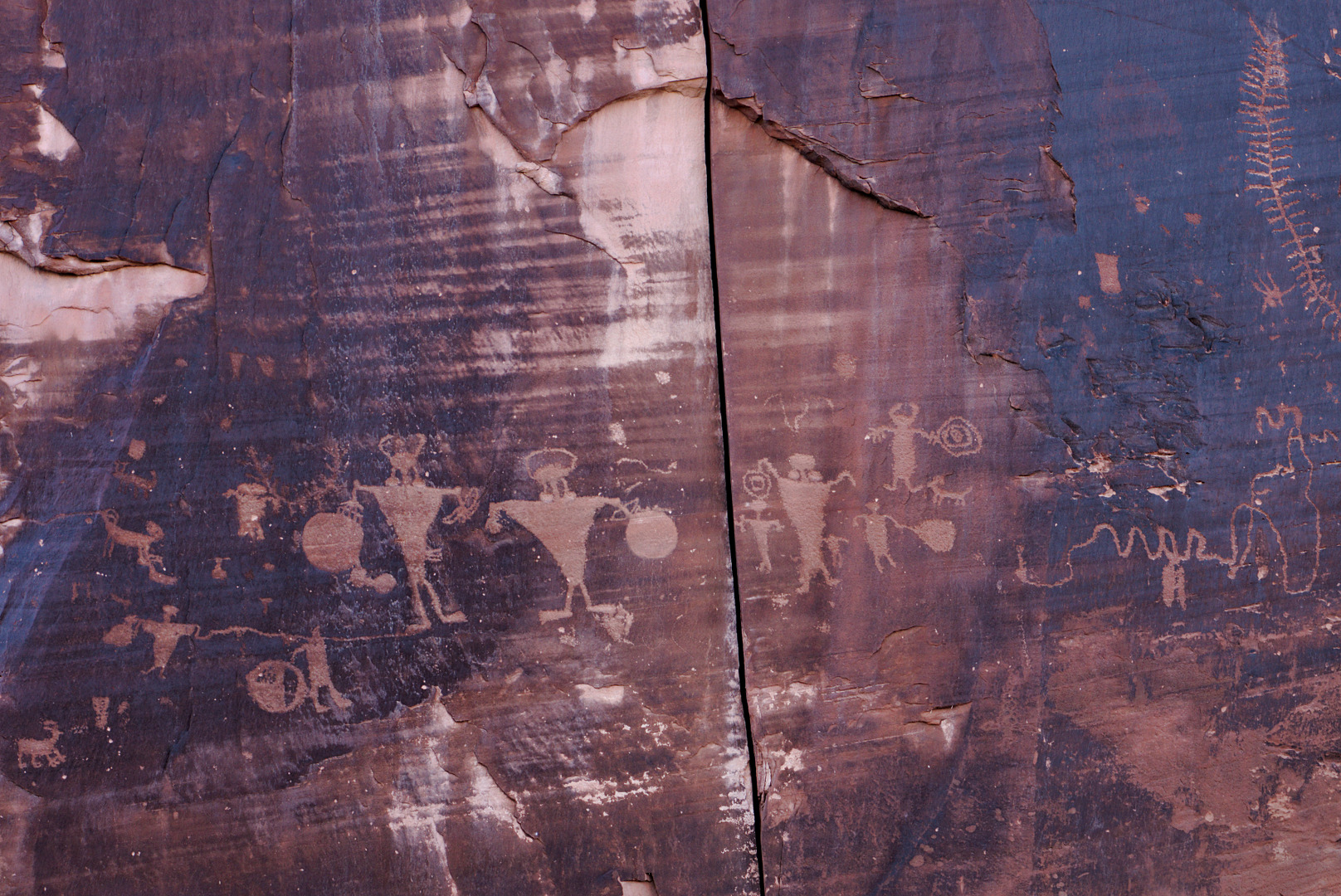
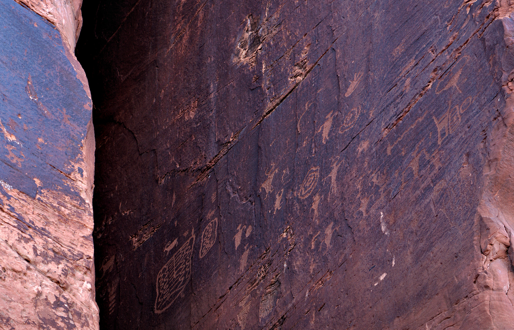
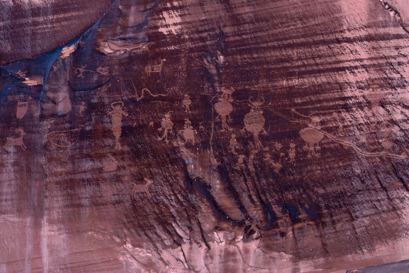
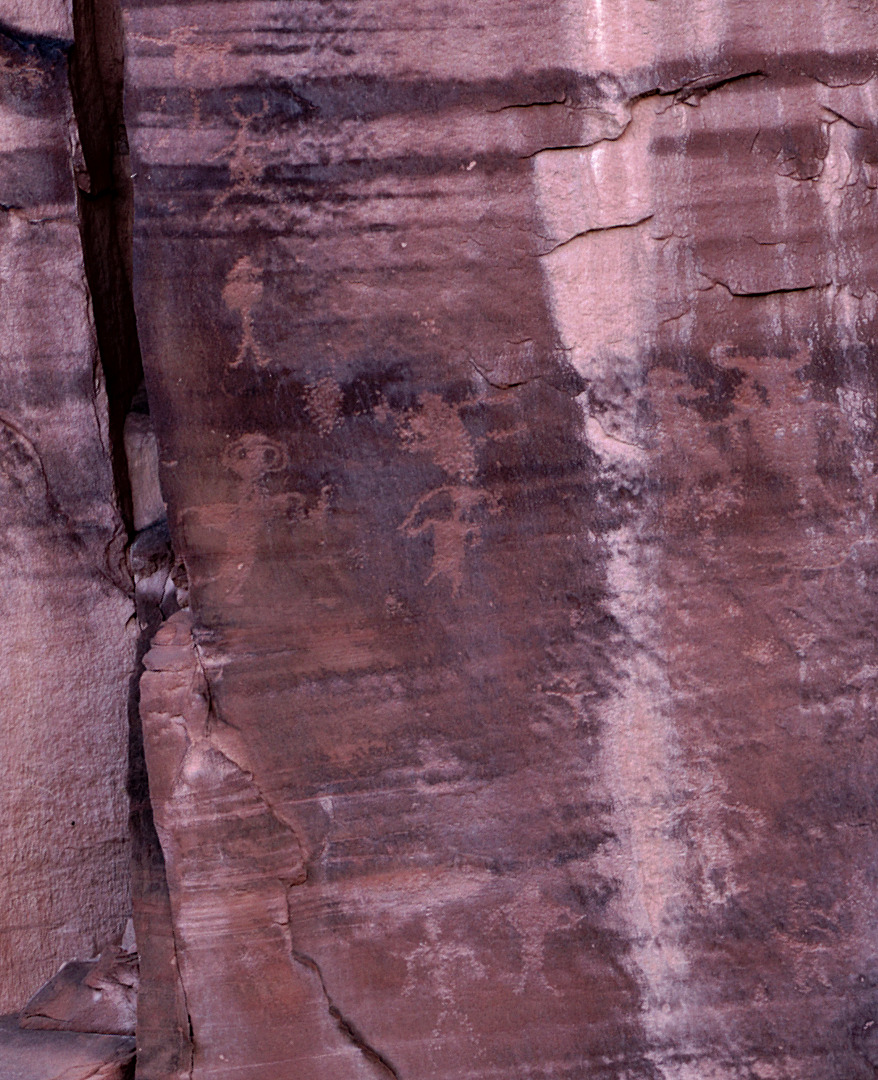
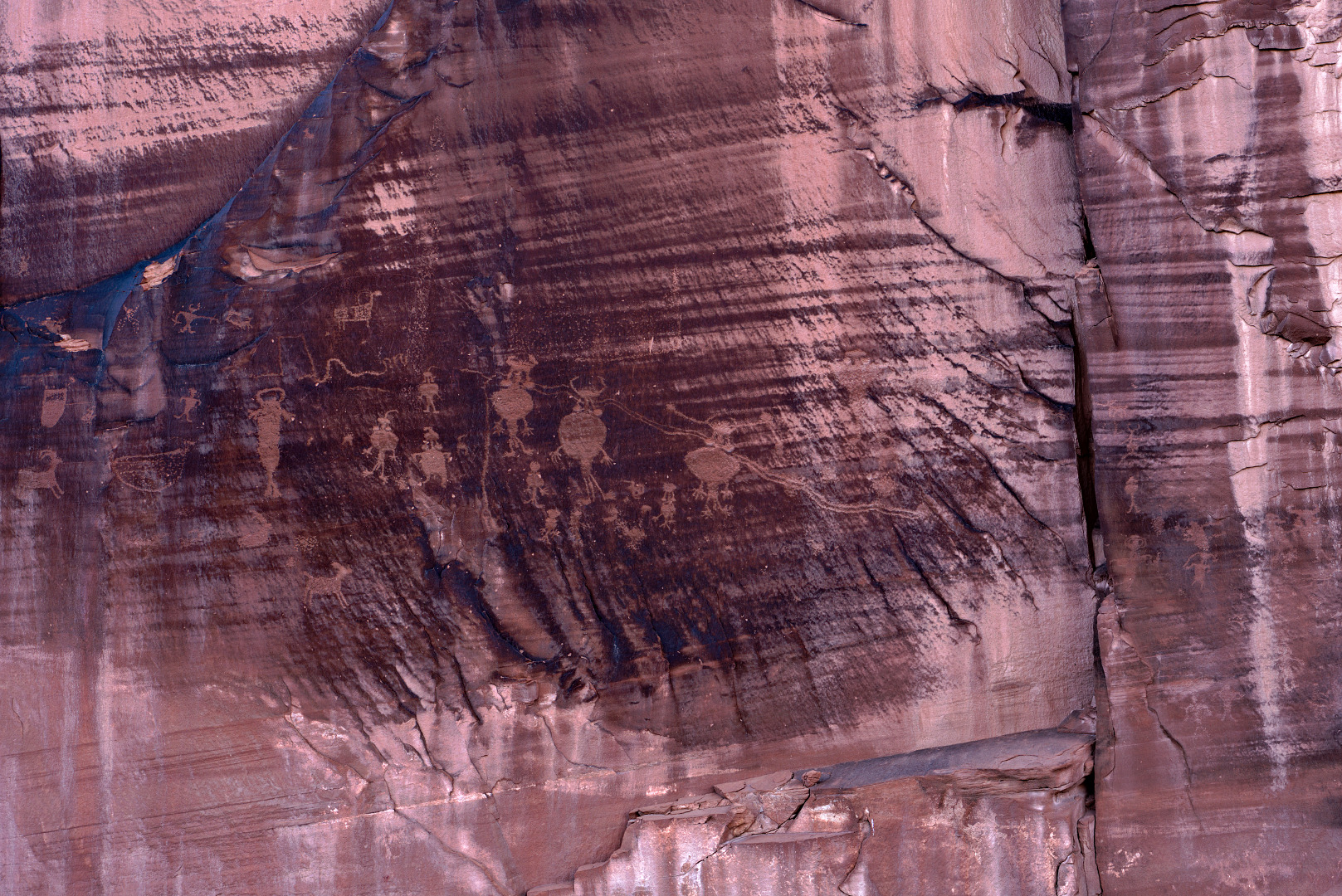
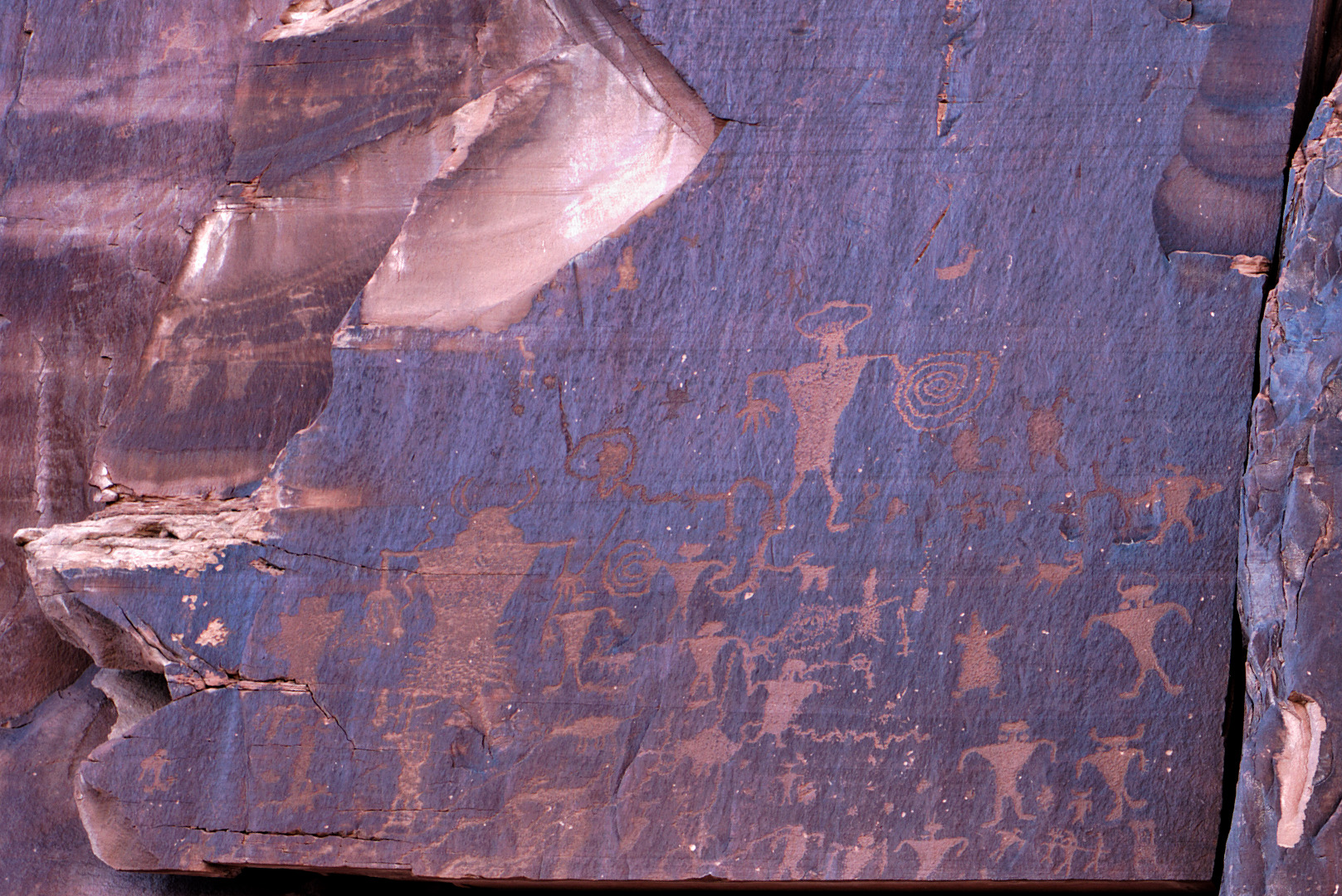
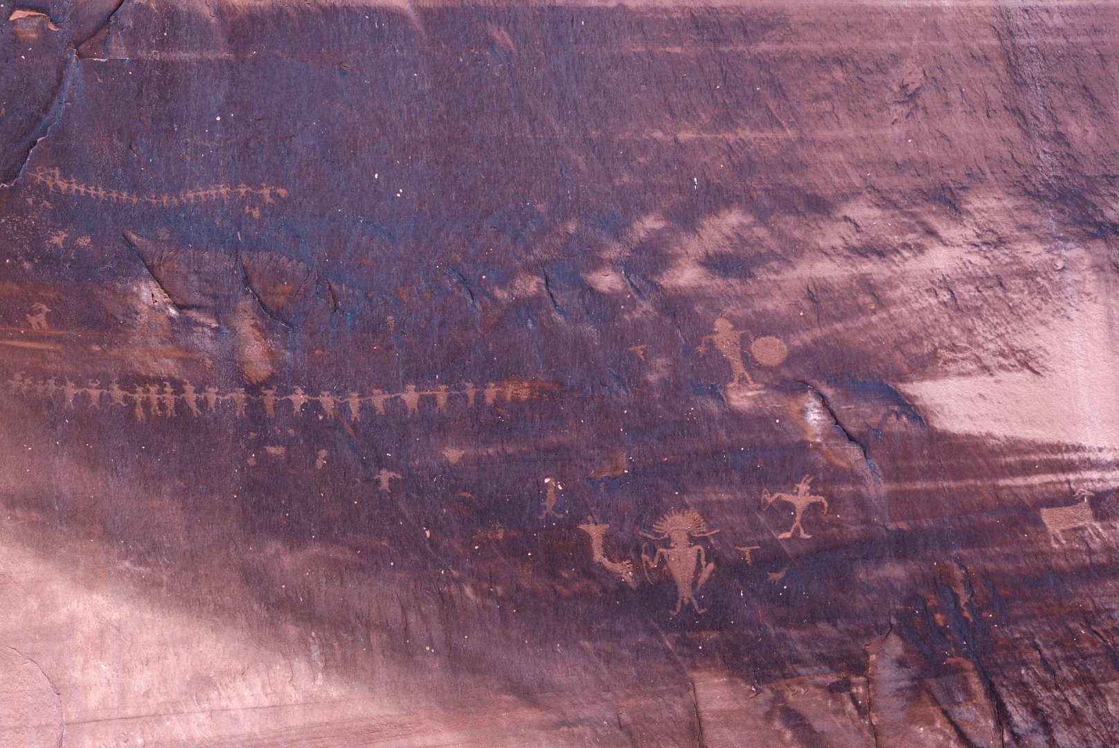
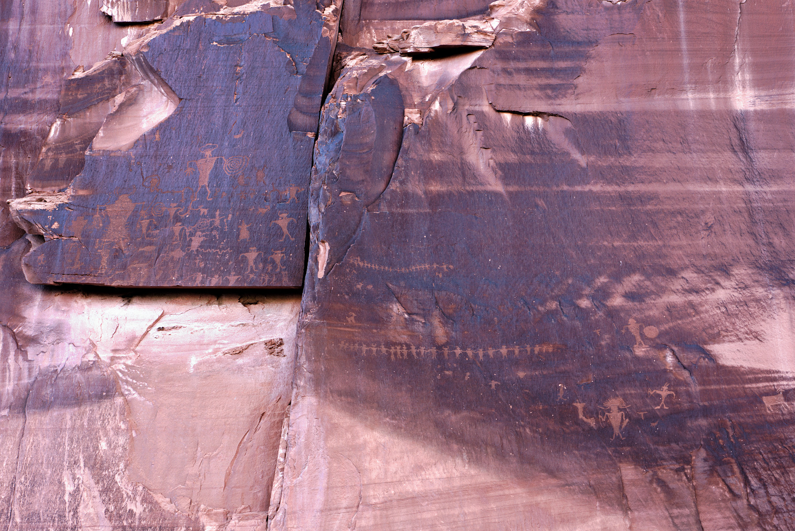
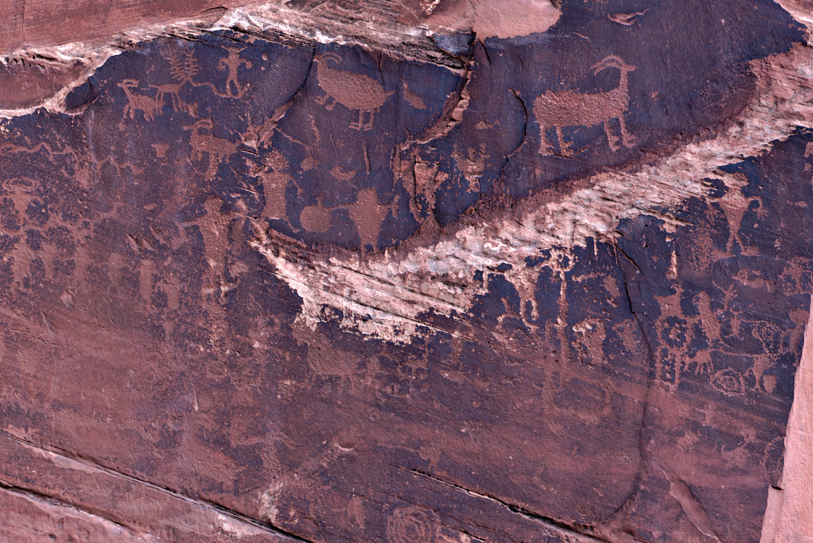
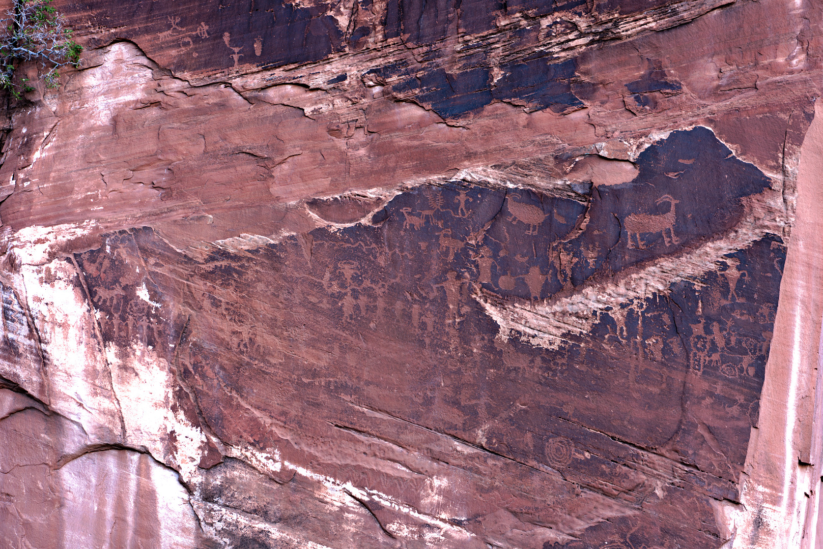
Much of the rock art is faded and difficult to see, especially when viewed in bright sunlight. It is better to visit during the afternoon when the area is in the shade. Even so, it often takes some looking to see these petroglyphs. I’ve added a lot of contrast in the photos below to make them easier to see.
Group 1:
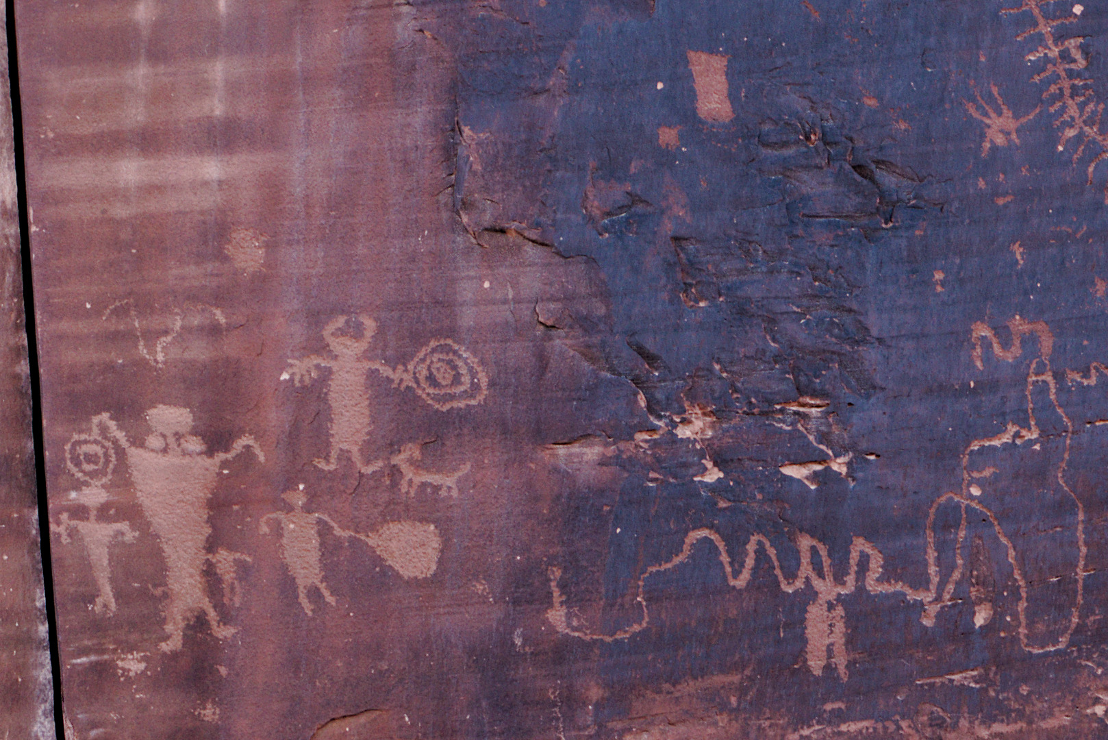
Group 2:
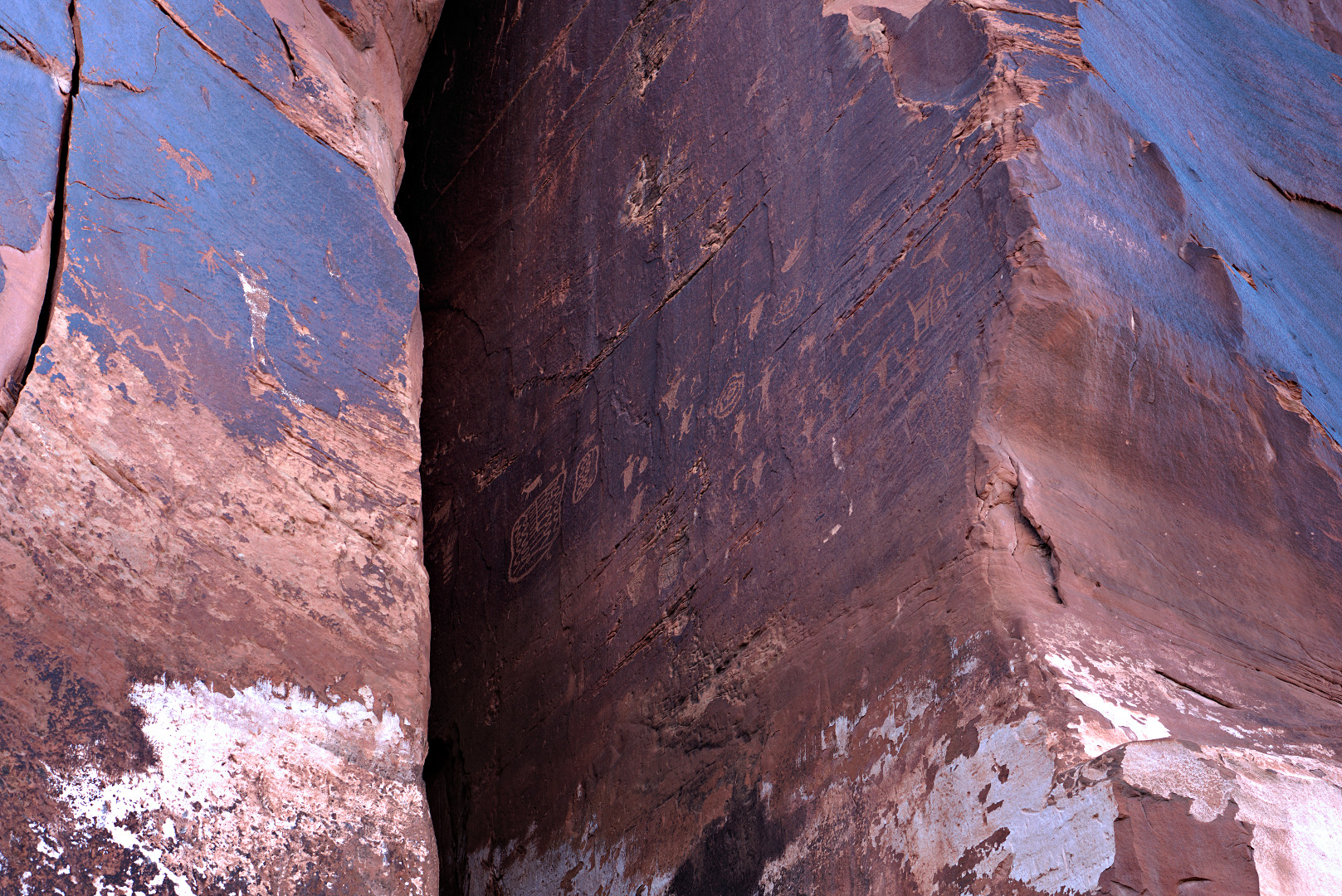
Group 3:
Group 4:
Group 5:
Group 6:
Group 7 – sadly, there was a lot of modern day graffiti in this area. I’ve cropped some of it away, but there’s some which is still visible.
I found it interesting that the artist depicted the bear’s feet as having numerous long toes.