I saw this snake on Saturday’s bike ride.
I saw this snake on Saturday’s bike ride.
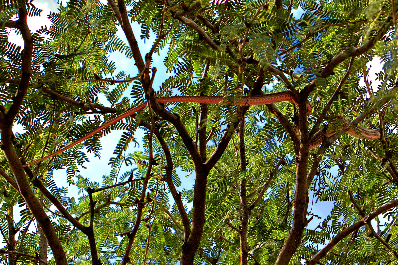
We saw this snake during our hike today. It started out on the ground, but then raced off, climbing into the tree. Bob identified it as a red racer.

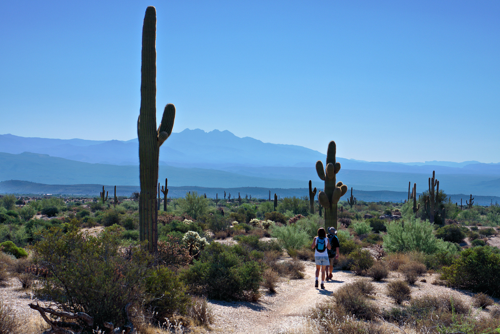
This week’s hike started at the Wagner Trailhead, though we never actually got around to hiking the Wagner Trail. Even so, we hiked 8.7 miles.
I got this photo of the sunrise before the hike started. Part of the Wagner Trail is visible in this photo.
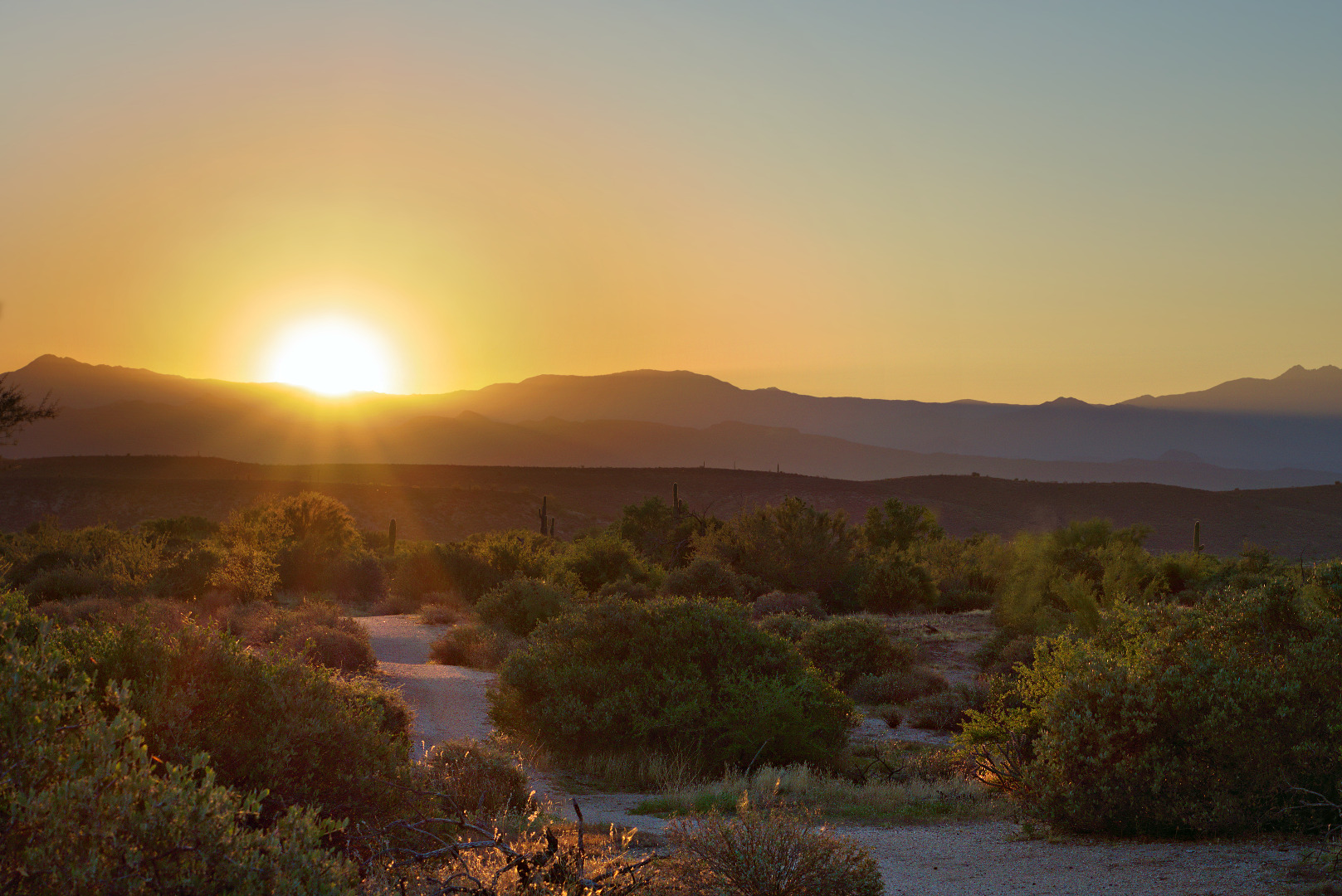
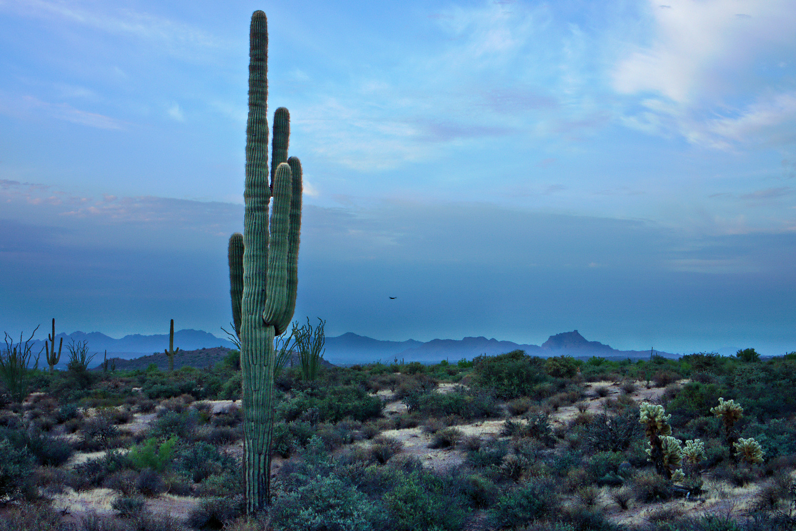
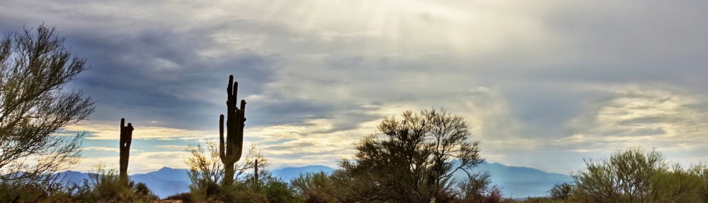
Another pre-hike photo; A good view of Red Mountain off in the distance with some interesting foliage in the foreground.

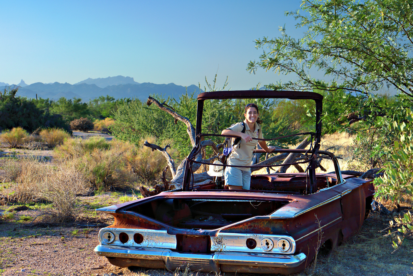
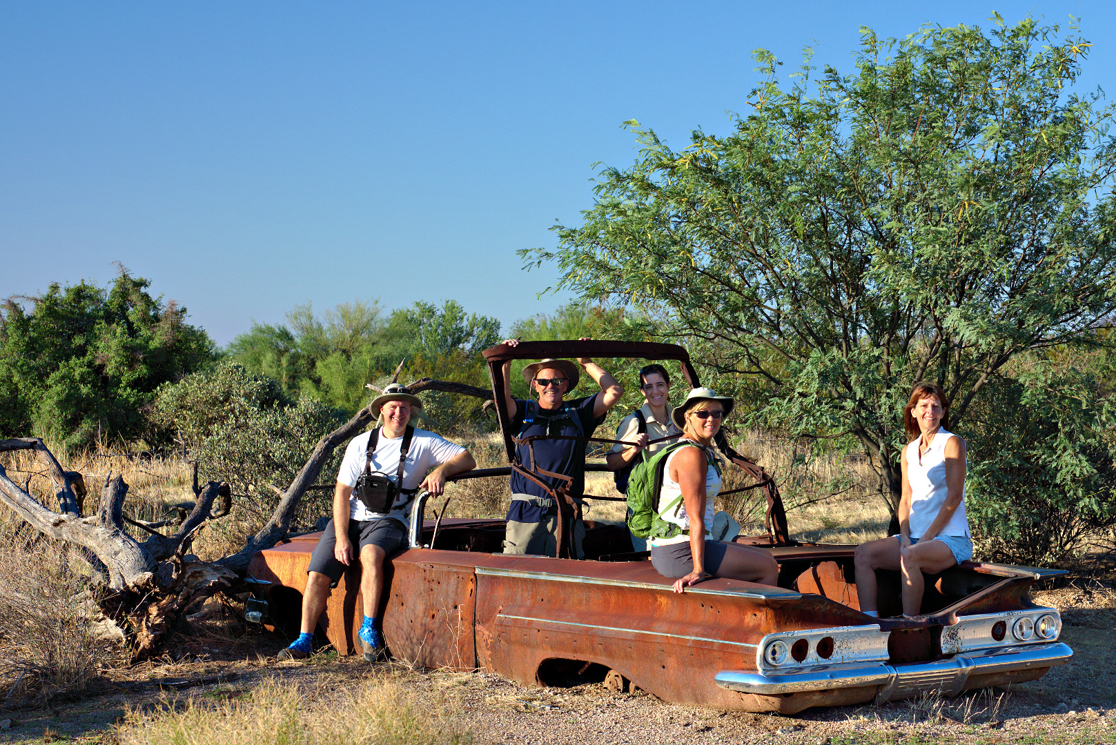
We hiked the Tortoise Trail to the Pemberton and then hiked Pemberton to Stoneman Wash. We hiked up the wash, stopping to take photos at this rusted convertible.
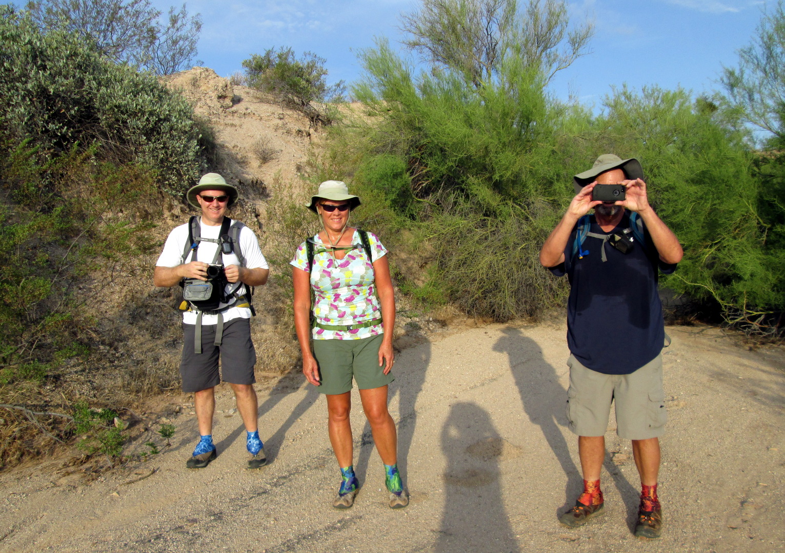
From left to right are Kevin, Bob, Amy, Janet, and Teresa.
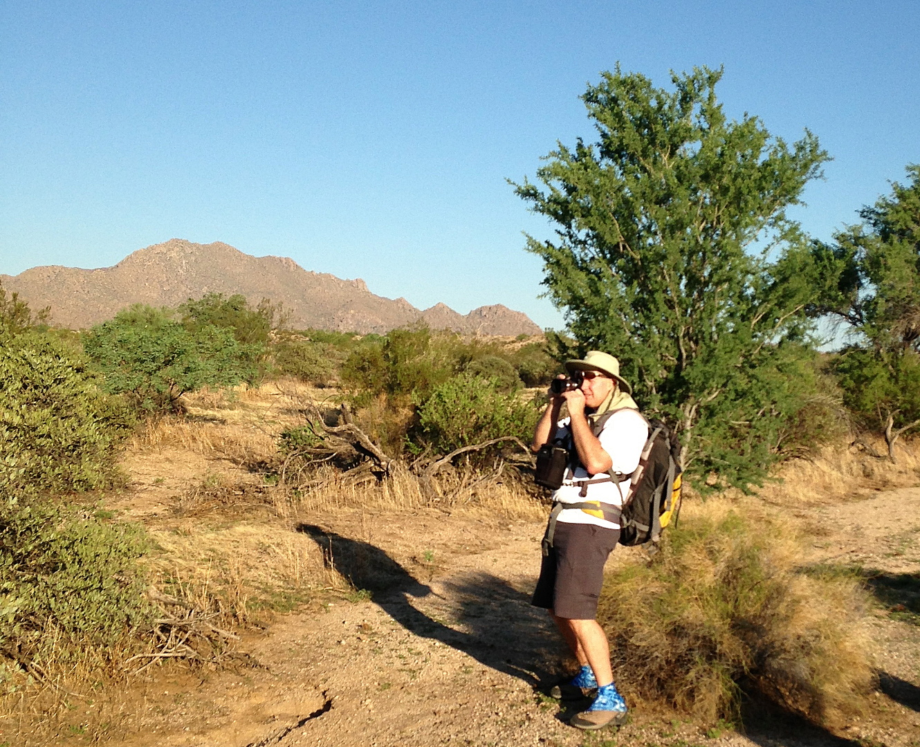
Bob took this photo of me while I was photographing the car.
A large palo verde tree in Stoneman Wash:
 We hiked up one of the feeder washes for Stoneman Wash. It eventually lead us back to the Pemberton, somewhat south of the Bluff Trail.
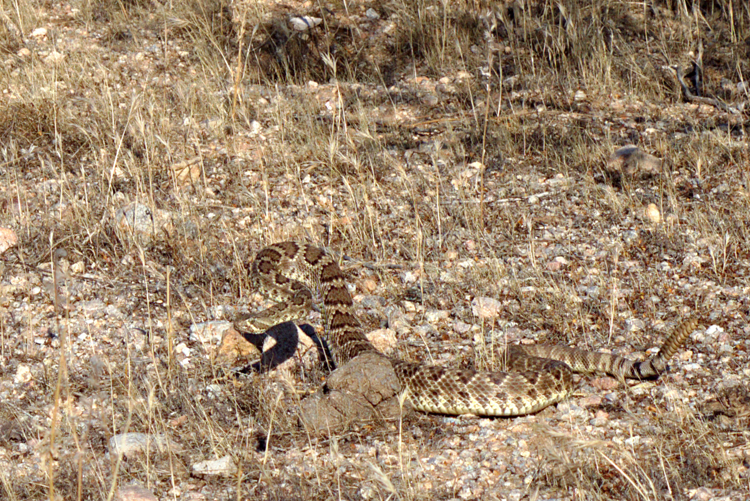
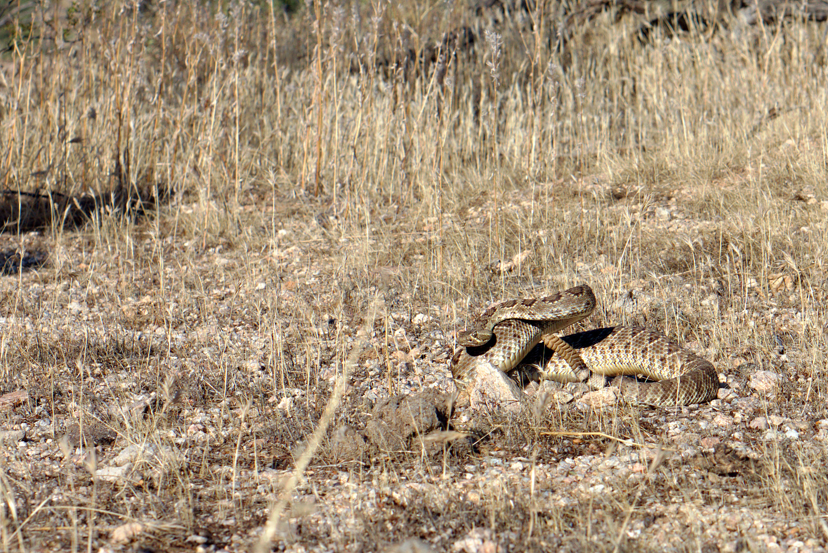
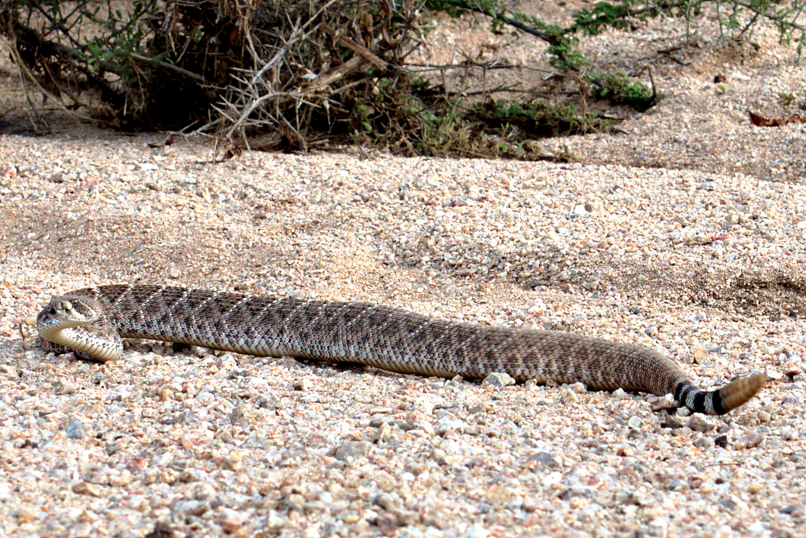
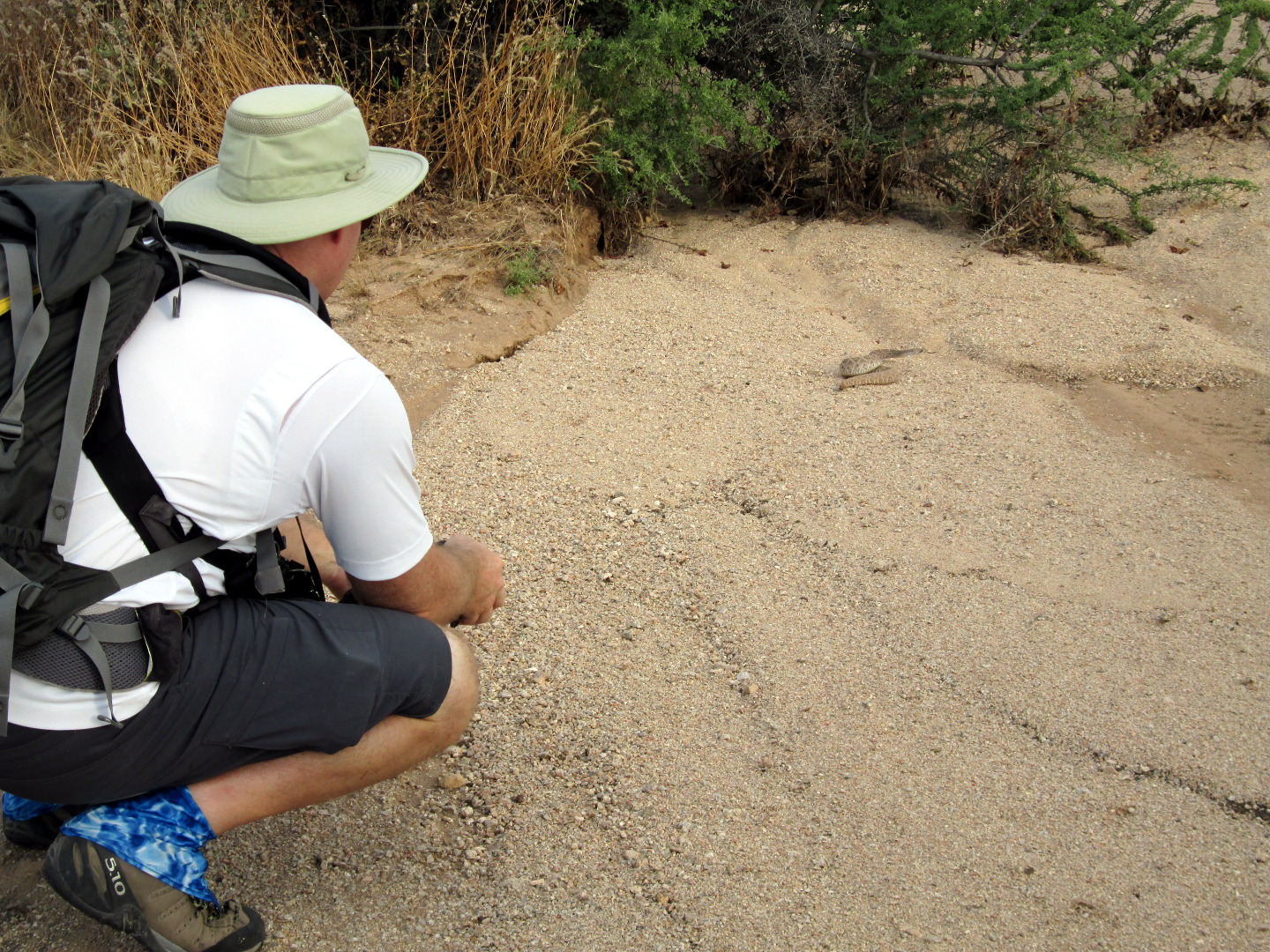
We saw this rattlesnake along the way. Ranger Amy has confirmed that it’s a Mohave rattlesnake. We saw one on last week’s hike too.
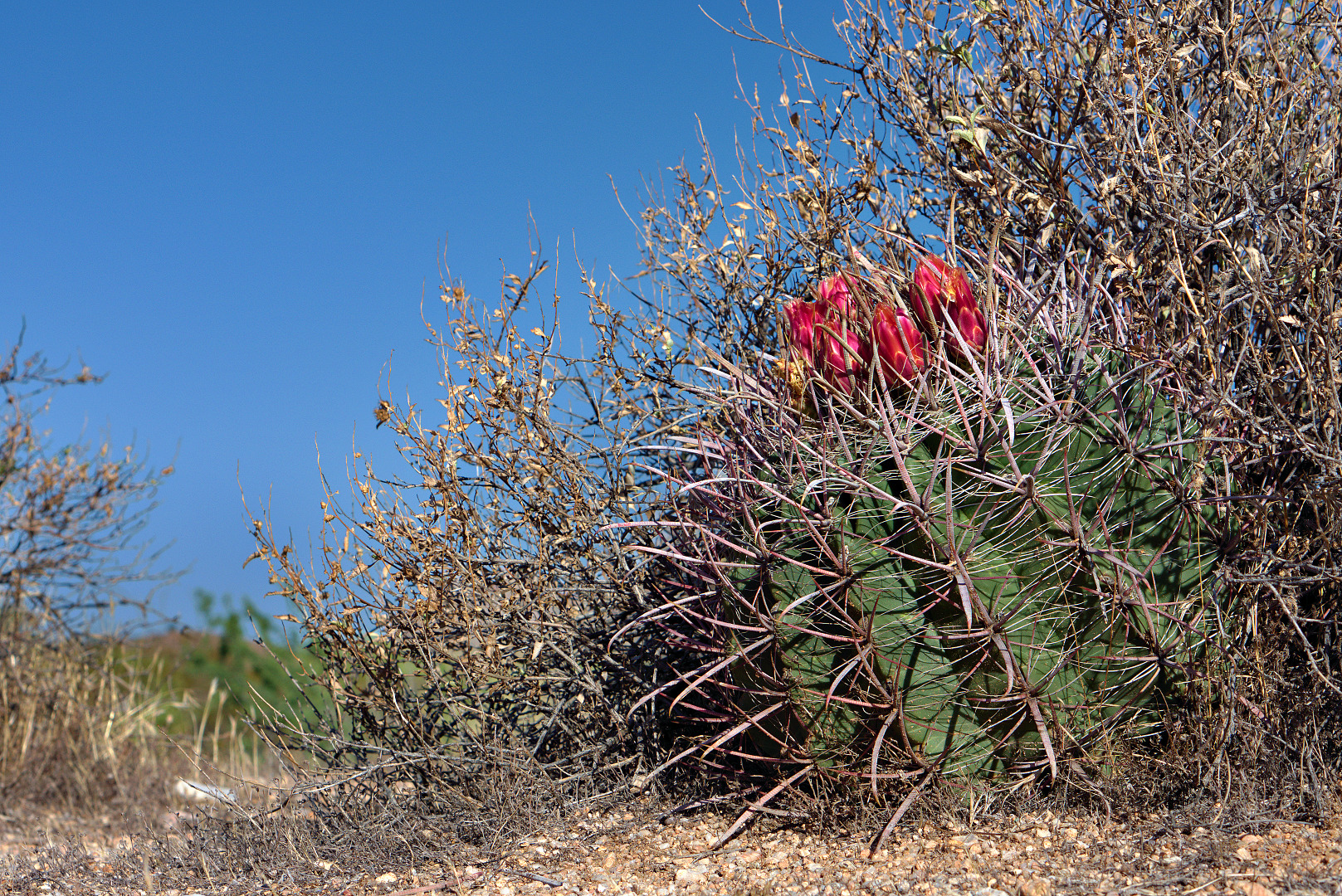
I was suprised to see a blooming barrel cactus in the area.
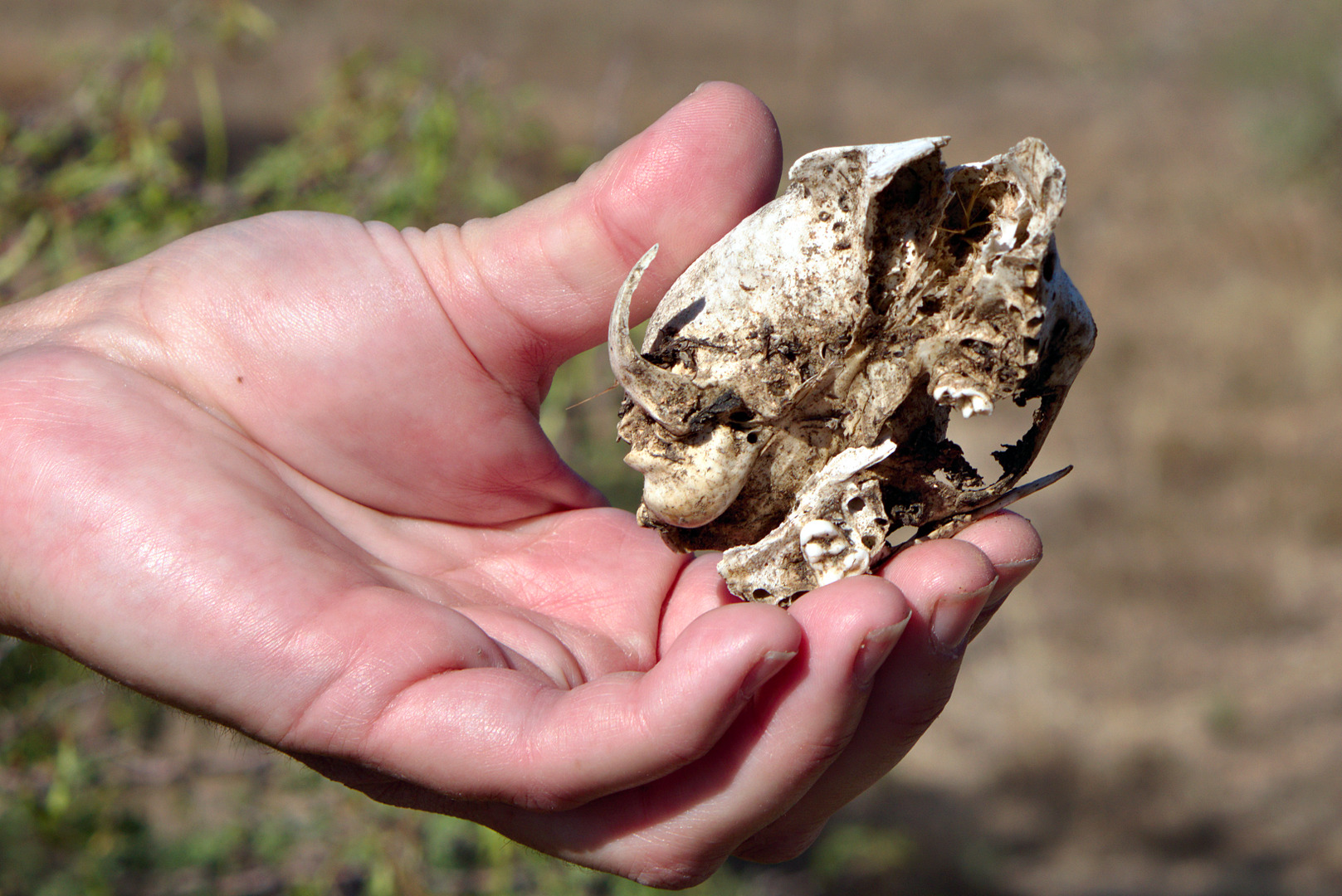
 Ranger Amy examines the skull of a small animal.
A view from the Pemberton Trail. There is a small bench just below and left of the Palo Verde on the hill. Just below and beyond the tree and bench lies the Bluff Trail. The yellow sign visible in this photo warns of a sharp turn on the Pemberton Trail.
Teresa and Bob hike down the Bluff Trail.
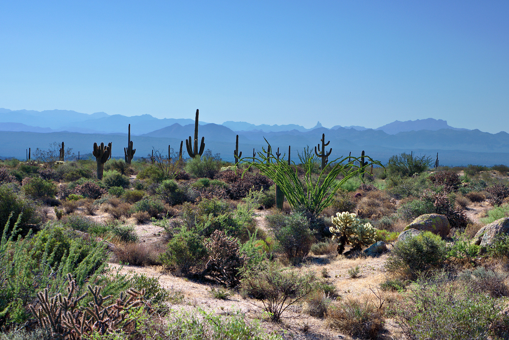
A view of Weaver’s Needle and the Flatiron far off in the distance:
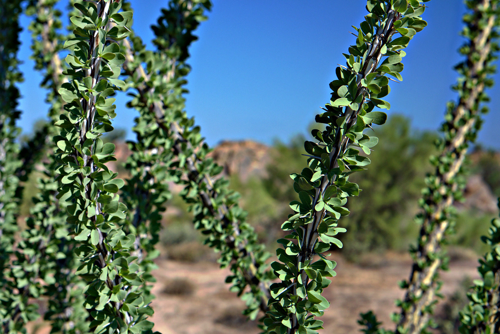
We came across a number of healthy looking ocotillos while hiking back on the Bluff Trail.
Ranger Amy spotted this horseshoe on a granite boulder.
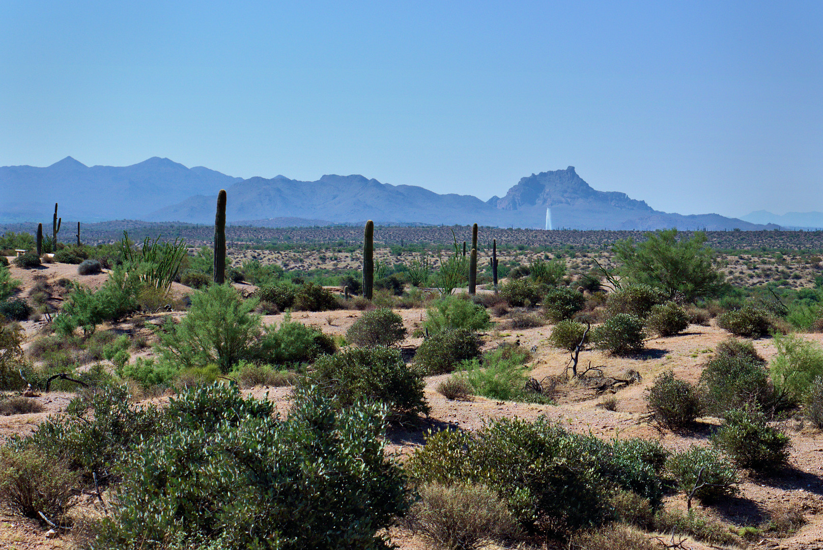
 A view of the nine o’clock fountain with Red Mountain behind it.
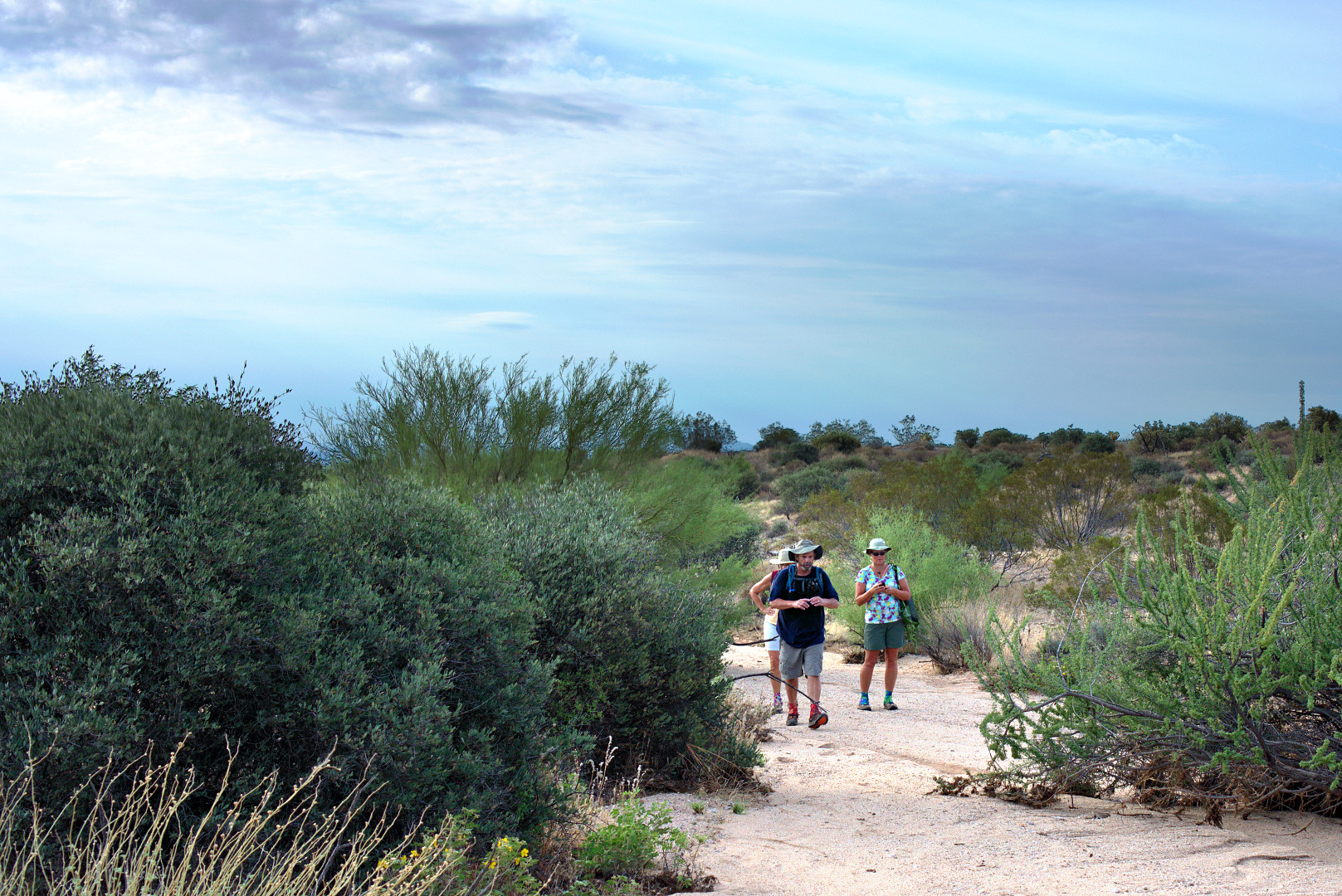
Janet, Linda, Bob, and I hiked out on the Pemberton from the Trailhead Staging Area today. We passed the site of the ranch homestead until we found a promising looking wash heading west. We hiked the wash, seeing three snakes along the way. I only got photos of two of these snakes. We returned via the Tonto Tank Trail. Total distance was 7.67 miles.
I took this photo from the road leading into the parking area while before the hike.
A photo of the sunrise, also before the hike:
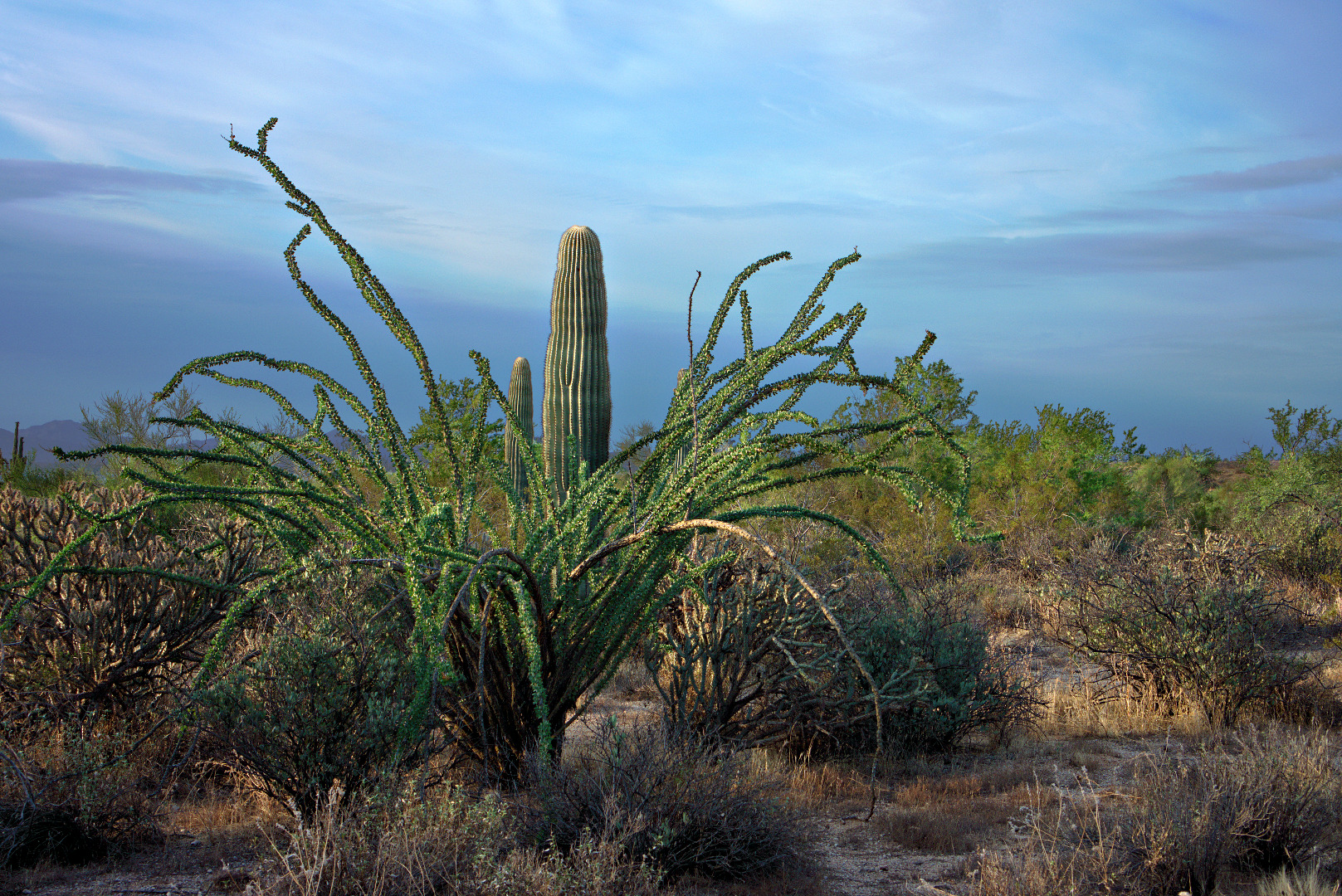
A large multi-armed saguaro in Stoneman Wash:

A view from the Pemberton, near Stoneman Wash:
This is the wash that we hiked after leaving the Pemberton. It meandered both west and north, though there were several forks we could have taken along the way which would have probably lead us to the Pemberton again.

Linda takes a photo of…
…me, Janet, and Bob:
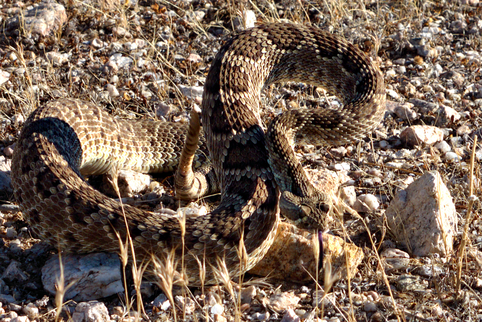
Three photos of the first snake we encountered. I believe it’s a Western Diamondback rattlesnake.


Linda took this photo of me photographing the snake:
Bob, Linda, and Janet wait for the snake to move off.
This is the second rattlesnake that we saw. Linda and Alan’s research suggests that it’s a Mohave rattlesnake. I saw one other snake, but it was not a rattlesnake; I don’t know what it was aside from being small and quick.

A view of Four Peaks from the Tonto Tank Trail:

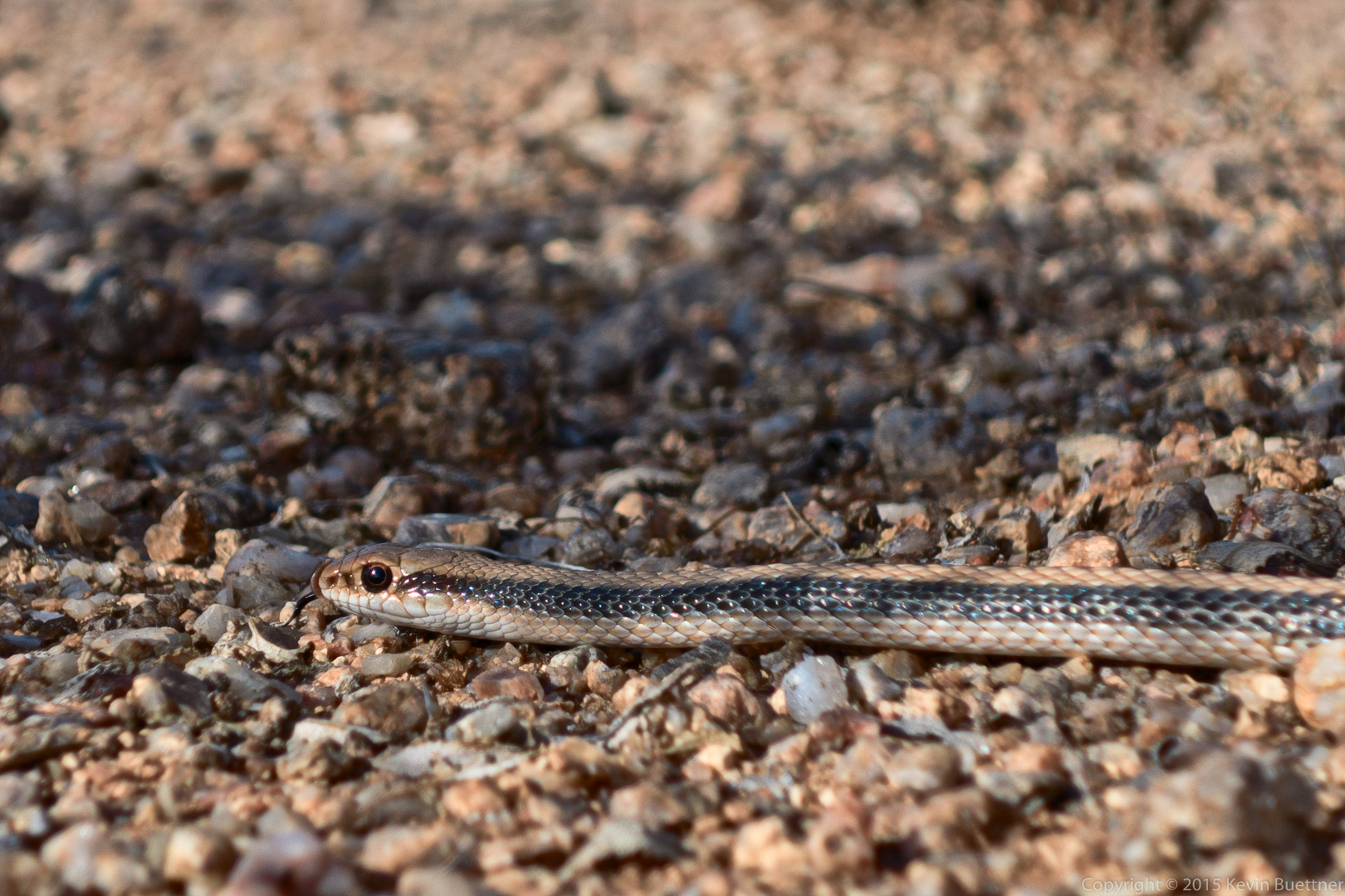
I saw two snakes while riding earlier today. These snakes were perhaps 400 yards apart, on the eastern end of the new stretch of the Pemberton. The first snake I saw was a rattlesnake, probably a Western Diamondback. Another rider told me that the second snake is a bullsnake. Amy Burnett, the ranger at McDowell Mountain Park, told me that it’s a sub-species of bullsnake called a Sonoran Gopher Snake.
Both snakes were lying across the trail sunning themselves to get warm. I had trouble getting the rattler to move. I nudged it’s tail twice with my foot before it finally deigned to raise its head. Only after nudging its tail again with a stick did it decide to take a defensive posture. Even though I was walking all around it taking photos, it stayed in the middle of the trail where it could’ve gotten run over by a bike. It moved off into the grass only after I spewed a mouthful of water at it.

This is a crop (close-up) of the above photo:

This next photo shows a better view of the rattler’s tail. Unfortunately, the head is not quite in focus.

Another crop…

I came across the Sonoran gopher snake only a short while later, probably not even a quarter of a mile from the Western Diamondback. It, too, was lying across the trail, but became quite curious about my camera! It started slithering towards me as I was frantically taking photos of it. I eventually had to move out of its way!

It was perhaps two feet away for this shot. It looks closer because I cropped away the bottom part of the image.

An even tighter crop:

Bob and I met at the Wagner Trailhead today for the Fitness Hike. Ranger Amy showed up briefly to tell us that she had a sore throat.
Textured clouds made for a brilliant sky just prior to sunrise. I’ll admit to enhancing the sky in the photo below; the real thing was colorful too, but perhaps not quite as saturated. I could easily dial it back a bit, but I happen to like this edit. Marie is usually quite critical of such things, but she likes it too.

The sun rose while we were talking to Amy. She pointed it out, so I turned around and snapped a few more photos. Here’s one of them:

Our plan was to hike out to Rock Knob. We took Wagner to Granite and the started up the wash that parallels Bluff. Just after that first little scramble up some rocks, I encountered a Western Diamondback who promptly slithered into a nearby hole. Bob and I could easily see into the hole though. Here is one of Bob’s photos of the snake:

I wasn’t very quick on the draw as I had reassigned the button for setting the flash, but for me, being able to set the metering mode quickly is more important than the flash. But I finally found the menu option for turning it on and managed to get this shot:

Bob climbed up and around the snake, avoiding its hole. We proceeded on up the wash. We crossed Pemberton, staying in the wash leading up to Rock Knob. Below is a view of Rock Knob from that wash.

As we made our way northward to go around Rock Knob, we came upon a very impressive looking saguaro. Bob and I spent perhaps ten minutes in the area taking photos of it from various angles. Here’s one with Bob standing next to it. You can get a good feel for the size of this saguaro from this shot. Note, too, that each of the large arms have arms of their own!

One of the hazards of walking in an area with lots of Teddy Bear Cholla is that, sometimes, one will stick to your shoe. I got this one out with the aid of a stick. One of the past rangers who worked at the park, Crash, told me that a pocket comb works great for removing cholla.
The blue and white gaiter I’m wearing helps to keep sand and other detritus out of my shoes. Even so, a few grains of sand managed to work it’s way into my left shoe and found it’s way down between the first and second metatarsals. I now have a small blister there.

Here is a view looking up the saguaro. If you look closely, you can see a large nest off to the left.

Here’s a view of that same saguaro with Rock Knob behind and off to the right. I think we’re looking roughly southward here.

When we got to the Preserve side of the fence, we saw a very bleached bone sitting on a rock. Here, Bob is taking a photo of it.

Here is a closer view of the bone:

An interesting looking rock…

Bob noticed this tortoise along the way. I would’ve walked by it without noticing it. Bob said that he gave it some water and it perked right up.

Some flowers, thanks to the recent rain that we’ve gotten.

Hedgehog Cacti:

A view of Rock Knob from a vantage point to the west. We’re looking east, towards the park (from the Preserve) here.

There used to be a pretty good road in the Preserve which lead back to the Rock Knob Trail. The preserve managers churned it up so that it’s impassable by most vehicles now. It was even hard walking on it. It was easier to walk in nearby washes.
Once we got back to the park boundary and crossed the fence, we took the Rock Knob Trail to Pemberton. We took the Bluff, Granite, and Wagner trails back to our vehicles. We hiked exactly ten miles today.
Marilyn, Marie, and I went to the Fountain Park late in the day today. I had hiked up the trail overlooking the fountain to try some more HDR photos. The sun had set and it was getting dark. Marilyn and Marie came up to meet me and, as we were nearing the bottom, we saw this rattlesnake slithering across the trail. I got my camera out and after fumbling the first few photos – I still had the ISO set at 100 and the exposure compensation set to -5.0 EV – I finally got a couple of shots that weren’t all black. This is the better of the two. I used the flash for this photo; I think it turned out okay anyway.

It was raining today as I drove out to the Friday Fitness Hike at McDowell Mountain Park. It was still raining when I got there. Linda had already arrived. We rolled down our windows, said hello to each other and wondered whether anyone else would show up. We didn’t have long to wait as Amy, Janet, and Bob all showed up within the next few minutes. The rain wasn’t bad, just a light drizzle.
We hiked the Wagner Trail out to Granite, where we turned right. Along the way, on Granite, I learned that the new trail which leads up to Granite Tank has been given a name; it’s now the “Delsie Trail.” Apparently Delsie was one of the matrons of the old P-Bar Ranch. Much, if not all of McDowell Mountain Park, and much of Fountain Hills too, was once part of the B-Bar Ranch.
According to the River of Time Museum, the B-Bar ranch was operated by Henry Pemberton in the early 1900s. Operation then passed to the Coles and then to Delsie’s husband Lee Barkdoll in 1935. Lee died in a train accident a short while later. Ranger Amy tells me that Delsie operated the ranch after Lee’s death, marrying Lee’s friend Dick Robbins in 1939. She had a busy life, driving kids on the ranch and the nearby reservation into a school in Scottsdale. She’d drop the kids off and then go to her job working at a cafeteria in Scottsdale. Later in the day, she’d drive the kids home, and do whatever needed to be done for the ranch. Delsie and Robbins ran the ranch until 1955.
We hiked the Delsie Trail today, taking it all the way to Granite Tank. Along the way, Amy stopped to show us a plant known as The Queen of the Night. It doesn’t look like much in the photos below, but Amy assures us that it has a very spectacular flower which only opens after dark. In the photo below, Amy is telling us about this Night-blooming Cereus.

Here is a better view of this otherwise unremarkable plant with Four Peaks off to the left.

A bit further up the Delsie Trail, Amy turned around so that she could open the Nature Center on time. It was still drizzling, but we stopped to take pictures before she turned back.


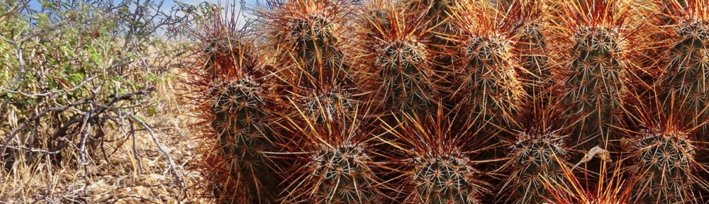
As we hiked further up the Delsie Trail, we noticed that some of the barrel cacti had bright red needles, perhaps due to the rain.

The Delsie Trail connects to the Pemberton Trail at Granite Tank. We turned left and hiked a short way to where we could see this crested saguaro:

The rain brought out a lot of color that we don’t normally see when it’s dry – which is most of the time. This photo is from a little ways further along the Pemberton.

A short while later, we came upon this “quadruple” saguaro. It’s one plant that appears to have split into four very long arms when the plant was quite young.

Bob noticed the sun starting to make its presence known and suggested that I get a photo. Bob is good at spotting these shots.

We saw this dead tree just as we came upon Stoneman Wash. We decided to hike Stoneman Wash today. If you’re going to hike this upper section of wash, the best time to do it is just after a rain because it firms up the sand. It’s still a wash, but it’s not quite as loose as normal. It can still be quite bad, however, if equestrians have been out with their horses. Janet and Linda suggested this photo.

We came across this unusual Palo Verde tree as we were hiking Stoneman Wash. I thought it odd that the tree had a dead looking spot above which were living branches.
Ranger Amy, who in turn double checked with Ranger Kevin Smith at Spur Cross, tells me that the colorful plant in front of the Palo Verde is a Turpentine Bush. We saw many of them on the hike. The rain seems to have brought out the color in them. Amy tells me that they have yellow flowers when they bloom.

Here is my attempt at photographing water droplets on a Palo Verde branch.

Linda had the idea for this shot. She took the photo too. I think it turned out very well.

Bob and I walked right past this snake, a Western Diamondback, and had trouble seeing it even when Linda and Janet were pointing right at it. I had a hard time photographing it too as I took one shot where I missed the snake completely! This shot, however, came out fairly well. Notice though how well the snake blends in with the gravel of the wash.

Here’s a 1:1 crop showing more detail:

We ended up hiking Stoneman Wash all the way to the Bluff Trail. Once we got to Bluff, we turned left and headed back on the Wagner Trail.
Large black ants were out in force today. I guess they like the moisture too. Bob had been bitten by some black ants earlier in the hike.

I got this photo just after taking a few shots of the ants. I really like the clouds in this shot.

We hiked a little over nine and half miles today in only a little over three hours.
On Saturday, the last full day of our stay in Moab, we headed out to the Sand Flats Recreation Area. We started out hiking Fins & Things, a 4×4 jeep trail. Unfortunately, I took a wrong turn along the way and we ended up taking a tour of the various campsites through which Fins & Things passes on its way back to the main road. It was very disappointing. I did, however, get this photo of a cool looking snake:

Once back at our truck after our unsuccessful attempt at hiking Fins & Things, we drove down the road to the trailhead for the Porcupine Rim Trail. We all started hiking it, but Marilyn and Marie decided to wait for me, resting under this broad tree:

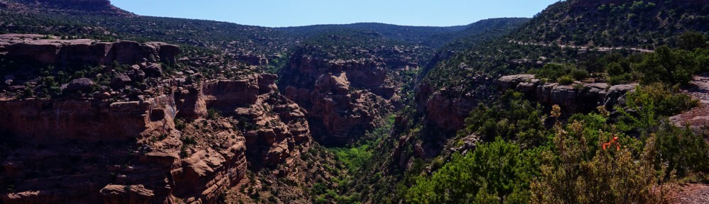
Seeing more than a glimpse of the canyon below was difficult due to all of foliage growing on the side of the trail. But, every now and then, a small clearing appeared from which I could take a photo. This is one of the better ones.

I came to a point where the trail split. I followed the path that would lead me to higher ground, thinking that the views would be better. The path I chose ended up taking me to the Kokopelli Trail. The small section of the Kokopelli Trail that I saw was navigable by passenger car, whereas the Porcupine Rim Trail definitely was not. There were indeed some interesting views from that vantage point.

Here is another view from the Kokopelli Trail. You can see some of the Trail (road) itself in this photo.

I turned around and started retracing my steps down the Porcupine Rim Trail. As I was coming back, I got a call from Marilyn who informed me that I would soon be seeing racers running the Desert R.A.T.S. (Race Across The Sand) race. This is a seven day event in which racers run/walk the 148-mile long Kokopelli Trail from Grand Junction, Colorado to Moab, Utah. Distances covered each day range from between nine and fifty miles. Here is a photo of the front runners:

I saw perhaps a dozen other racers on the way back down. When I got back to the trailhead, an aid / support station for the race had been set up and there were several more vehicles at the trailhead. It seems likely that some of the passenger cars that I saw driving down the Kokopelli Trail earlier in the day were support vehicles for the race.
Later in the day, after food and a siesta, and well after that final stage of the race had been concluded, Marilyn and I drove the truck back up the Kokopelli Trail to the Castle Valley Overlook. It turns out that, had I continued hiking up the Porcupine Rim Trail earlier in the day, I would’ve eventually ended up at the overlook.
Three mountain bikers, emerging from their ride up the Porcupine Rim Trail, got to the overlook slightly ahead of us. One of them climbed a rock for a better view:

The view of Castle Valley, just before sunset, was spectacular.
